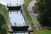
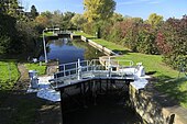
List of locks on the Unstrut
The list of locks on the Unstrut includes all existing and former locks in the course of the River Unstrut and in the canal-like branches of the river Unstrut that have been artificially created to improve navigation or for hydrological reasons. The names of locks that no longer exist are written in italics .
The Unstrut is an approximately 192 km long left tributary of the Saale and its most water-rich tributary. The catchment area is almost the entire Thuringian Basin along with part of the western and northern edge plates, parts of the southern Harz and smaller parts of the northern Thuringian Forest . In the reconstruction and renovation work on the Unstrut locks, the interests of monument protection were taken into account. The Artern and Ritteburg barrages with their locks are located on the territory of the Free State of Thuringia . The kilometers are uphill, against the direction of flow of the river.
history
The prerequisite for the start of shipping on the Unstrut in April 1795 between Bretleben (km 78.5) and the confluence with the Saale were, among other things, the construction of 12 locks between Artern (km 65.0) and Freyburg (from 1791 to 1795) km 5.2) as well as measures to expand the river (widening and deepening). The main dimensions of the locks were: gate widths between 5.52 m and 5.65 m and chamber lengths between 50.50 m and 51.50 m. The traffic of ships up to 150 t deadweight was possible. According to an announcement of December 30, 1936, the permissible ship dimensions on the Unstrut were still 5.50 m wide and 44.50 m long in the 20th century. From 1826 through the further expansion of the Saale, continuous shipping from Artern / Unstrut to Halle / Saale was possible.
Locks
| place | Name of the lock | Kilometers of waterways | Dimensions (chamber length / gate width / chamber width / drop height) | Open to traffic / year of construction / renovation / conversion | Lock picture or river picture approximate former location | registration | Coordinates (approximate location of no longer existing locks) |
|---|---|---|---|---|---|---|---|
|
|
|||||||
| Artern | Artern lock | Unstrut 61.00 | L approx. 46.00 m / W 5.20 m / W m / fall height? m | 1791 to 1793 | Canoe club Artern demand lock, contact for locks | 51 ° 21 ′ 42 "N, 11 ° 17 ′ 7" E | |
| Kalbsrieth | Ritteburg lock | Unstrut 57.50 | L approx. 46.00 m / W 5.20 m / W m / height of fall 1.40 m | 1791 to 1793, closed in 1986, renovation started in 2000, reopened in July 2002 | Registration by phone at +49 3466/322332 | 51 ° 20 ′ 52 ″ N, 11 ° 19 ′ 21 ″ E | |
| Schönewerda | Schönewerda lock | Unstrut approx. 53 | L approx. 46.00 m / W 5.20 m / W approx. 6.00 m / fall height? m | 1792 to 1794, canceled in the 1960s | 51 ° 19 ′ 17 "N, 11 ° 21 ′ 57" E | ||
| Rossleben | Lock Roßleben | Unstrut | L approx. 46.00 m / W 5.20 m | 1794, canceled in the 1960s |  |
51 ° 17 ′ 42 "N, 11 ° 25 ′ 17" E | |
| Wendelstein (Memleben) | Wendelstein lock | Unstrut 44.60 | L approx. 46.00 m / W 5.50 m / W m / fall height 1.80 m |  |
Registration by phone at +49 34672/93147 | 51 ° 16 ′ 31 ″ N, 11 ° 28 ′ 2 ″ E | |
| Nebra | Nebra lock | Unstrut approx. 37.10 | L approx. 46.00 m / W 5.50 m | 1791 to 1794, canceled |  |
51 ° 17 ′ 12 "N, 11 ° 34 ′ 41" E | |
| Querfurt OT Vitzenburg | Vitzenburg lock | Unstrut | L approx. 46.00 m / W 5.50 / height of fall (unknown) | 51 ° 17 ′ 52 "N, 11 ° 34 ′ 22" E | |||
| Karsdorf | Karsdorf lock , until 1936/37 Carsdorf | Unstrut 25.80 | L approx. 46.00 m / W 5.50 m / W m / fall height? m | Begun in 1791, inaugurated on November 16, 1793, canceled in the 1960s |  |
51 ° 16 ′ 59 ″ N, 11 ° 39 ′ 0 ″ E | |
| Laucha an der Unstrut , ( Burgscheidungen ) | Tröbsdorf lock | Unstrut 20.70 | L approx. 46.00 m / W 5.50 m / W m / fall height approx. 1.00 m | 1822, remodeling 1882/83 |  |
Registration by phone at +49 34462/20031 | 51 ° 14 ′ 53 "N, 11 ° 37 ′ 56" E |
| Laucha on the Unstrut | Laucha lock | Unstrut 13.30 | L approx. 46.00 m / W 5.20 m / W m / fall height? m | 1791 to 1794 |  |
Registration by phone at +49 34462/22902 | 51 ° 13 ′ 34 "N, 11 ° 40 ′ 38" E |
| Freyburg | Zeddenbach lock | Unstrut 6.70 | L approx. 46.00 m / W 5.20 m / W approx. 6.00 m / fall height? m | 1791 to 1794 |  |
Registration by phone at +49 34464 28095 | 51 ° 12 ′ 42 "N, 11 ° 44 ′ 37" E |
| Freyburg | Freyburg lock | Unstrut 5.20 | L 50.67 m / W 5.65 m / fall height? m | 1791 to 1795, closed in the 1960s, reopened November 27, 1995 |  |
Registration by phone at +49 34464/28095 | 51 ° 12 ′ 35 ″ N, 11 ° 46 ′ 7 ″ E |
literature
- Fritz Kühnlenz: Cities and castles on the Unstrut. Greifenverlag, 1st edition 1992, ISBN 3-7352-0293-4 or special binding - Verlagshaus Thüringen 1999, ISBN 3-89683-121-6
- Castles and palaces in Saxony-Anhalt; Edited by the Saxony-Anhalt regional group of the German Castle Association, booklets 7 & 8
- Michael Eile: Shipping on the upper Saale and Unstrut: then and now Ringelbergverlag, first edition (March 23, 2016) ISBN 3-9458-5005-3
Web links
- State Office for Flood Protection and Water Management Saxony-Anhalt (LHW) Accessibility and lock operating times in Unstrut accessed on February 22, 2019
Individual evidence
- ↑ Germany and its inhabitants: a handbook of patriotism for ..., Volume 1 by Karl Friedrich Vollrath Hoffmann, Stuttgart, 1834
- ↑ Kanu und Wanderverein Artern accessed on February 22, 2019
- ^ [1] Announcement of the closure of the Roßleben lock; Merseburg, July 15, 1841 in the Official Gazette of the Royal Government of Merseburg: 1841