List of listed objects in Mönchhof
The list of listed objects in Mönchhof contains the 15 listed , immovable objects of the community Mönchhof in Burgenland ( district Neusiedl am See ).
Monuments
| photo | monument | Location | description | Metadata |
|---|---|---|---|---|

|
Waypoint ObjectID: 6043 |
Am Kurzberg location KG: Mönchhof |
The square pillar with scale ornament and stone cross dates from the 1st half of the 18th century. It stands in the vineyards northwest of the village. |
ObjectID: 6043 Status: Notification Status of the BDA list: 2020-02-29 Name: Wegkreuz GstNr .: 3246 |

|
Light column ObjectID: 6036 |
at Bahngasse 16, KG location : Mönchhof |
A tabernacle pillar with a pyramidal helmet from 1622. |
ObjectID: 6036 Status: Notification Status of the BDA list: 2020-02-29 Name: Lichtsäule GstNr .: 1018/5 |

|
Fortifications / military structures, defense tower ObjectID: 6032 |
Hauptgasse location KG: Mönchhof |
A square tower with the inscription 1669; probably the rest of the former parish church. |
ObjectID: 6032 Status: § 2a Status of the BDA list: 2020-02-29 Name: Fortifications / military buildings, defense tower GstNr .: 17/2 |

|
Fortifications ObjectID: 6034 |
Kirchenplatz KG location : Mönchhof |
The fortification dates from the 15th and 16th centuries. It originally went further west and ran around the entire area of the church. Today it is still preserved on the south side of the church hill. The spandrel masonry with loopholes is inhomogeneous and renewed in sections. On the outside the wall is plastered and supported by inclined supports. The church square was separated by a wall running to the west in the middle of the 19th century.The wrought-iron grating of the access gate dates from 1847. |
ObjectID: 6034 Status: § 2a Status of the BDA list: 2020-02-29 Name: Fortification system GstNr .: 4 |

|
Lindtner Cross ObjectID: 6040 |
Kirchenplatz KG location : Mönchhof |
Inscription: Dedicated on the occasion of Hungary's millennial jubilee by Jakob and Anna Lindtner in 1896. |
ObjectID: 6040 Status: § 2a Status of the BDA list: 2020-02-29 Name: Lindnerkreuz GstNr .: 428/1 |

|
Catholic parish church hl. Magdalena ObjectID : 6029 |
Kirchenplatz 1 KG location : Mönchhof |
After the previous church, which was mentioned in a document in 1240, was destroyed during the Turkish War in 1683, a new baroque building was built between 1729 and 1734. The furnishings date from the construction period. The high altar was built by Elias Hügel , who was also in charge of the construction of the church. The high altar painting is the work of Martino Altomonte . |
ObjectID : 6029 Status: § 2a Status of the BDA list: 2020-02-29 Name: Catholic parish church hl. Magdalena GstNr .: 1 parish church hl. Magdalena, Mönchhof |

|
Former monastery ObjectID: 6030 |
Kirchenplatz 1 KG location : Mönchhof |
A two-story, two-winged building that was built from 1729. |
ObjectID: 6030 Status: § 2a Status of the BDA list: 2020-02-29 Name: Former monastery GstNr .: 3/1; 2 |

|
Granarium ObjectID: 6033 |
Kirchenplatz 3 KG location : Mönchhof |
The two-storey storage building with a half-hip gable dates from the 18th century. |
ObjectID: 6033 Status: § 2a Status of the BDA list: 2020-02-29 Name: Granarium GstNr .: 346/2 |

|
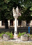
Figure shrine Holy Change ObjectID: 6041 |
Raiffeisenplatz KG location : Mönchhof |
A baroque group of stone figures on a Tuscan column. |
ObjectID: 6041 Status: § 2a Status of the BDA list: 2020-02-29 Name: Figure shrine Holy Change GstNr .: 8/5 |

|
Light column ObjectID: 6035 |
Sandhöhe location KG: Mönchhof |
A wayside shrine from the 15th century at the roundabout to Sandhöhe. A square pillar with a stone helmet and tabernacle, in which there is a small angel figure. |
ObjectID: 6035 Status: § 2a Status of the BDA list: 2020-02-29 Name: Lichtsäule GstNr .: 399/1 |

|
Cholera Chapel (Kreuzkapelle) ObjectID: 6031 |
Sandhöhe location KG: Mönchhof |
The chapel was built in 1838, the tower was added in 1861. |
ObjectID: 6031 Status: § 2a Status of the BDA list: 2020-02-29 Name: Cholerakapelle (Kreuzkapelle) GstNr .: 4324 Cholerakapelle Mönchhof |

|
Plague / Trinity Column ObjectID: 6037 |
KG location : Mönchhof |
A group of Trinitas on a square pillar with a scale ornament; dated 1714. |
ObjectID: 6037 Status: § 2a Status of the BDA list: 2020-02-29 Name: Pest- / Dreifaltigkeitssäule GstNr .: 4 |

|
Cemetery cross ObjectID: 6039 |
KG location : Mönchhof |
The stone cemetery cross with a beautiful Pietà is marked 1773. Its base shows a relief of purgatory. |
ObjectID: 6039 Status: § 2a Status of the BDA list: 2020-02-29 Name: Friedhofskreuz GstNr .: 621 |

|
Cross column ObjectID: 6042 |
KG location : Mönchhof |
The cross column on the road to Gols is marked with 1722. |
ObjectID: 6042 Status: § 2a Status of the BDA list: 2020-02-29 Name: Kreuzsäule GstNr .: 3217/1 |

|
Waypoint ObjectID: 6038 |
KG location : Mönchhof |
The wayside cross with whitewashed inscription dates from the 17th century and is located near the railway line. |
ObjectID: 6038 Status: Notification Status of the BDA list: 2020-02-29 Name: Wegkreuz GstNr .: 950/2 |
Web links
Commons : Listed objects in Mönchhof - collection of images, videos and audio files
Individual evidence
- ↑ a b Burgenland - immovable and archaeological monuments under monument protection. (PDF), ( CSV ). Federal Monuments Office , as of February 14, 2020.
- ^ Bundesdenkmalamt (editor), Andreas Lehne (editorial management): Austrian art topography. Band LIX. The art monuments of the political district of Neusiedl am See . Verlag Berger, Horn 2012, ISBN 978-3-85028-554-4 , p. 448 f .
- ↑ § 2a Monument Protection Act in the legal information system of the Republic of Austria .