List of listed objects in Pamhagen
The list of listed objects in Pamhagen contains the 6 listed , immovable objects of the municipality of Pamhagen in Burgenland ( Neusiedl am See district ).
Monuments
| photo | monument | Location | description | Metadata |
|---|---|---|---|---|

|
Hausberg Castle ObjectID: 8006 |
Burg site KG: Pamhagen |
Former fort near the Zwei Bühel. There is still a 2 to 3 meter high truncated pyramid, moat and wall. |
ObjectID: 8006 Status: Notification Status of the BDA list: 2020-02-29 Name: Hausberg Burg GstNr .: 2497/355; 2497/356; 2497/357 |

|
Turkish Tower, Bell Tower ObjectID: 6187 |
at Hauptstrasse 47, KG location : Pamhagen |
Bell tower on the main street, on the weather vane it says: "Mosco Pascha 1639". It was renovated in 1979. |
ObjectID: 6187 Status: § 2a Status of the BDA list: 2020-02-29 Name: Türkenturm , Glockenturm GstNr .: 130/2 Bell tower Pamhagen |

|
Local chapel Maria-Lourdes ObjectID: 6188 |
at Marktplatz 72, KG location : Pamhagen |
The large chapel on the outskirts of Pamhagen in the direction of Wallern was probably a church in the 17th century, which was removed after the Turkish siege in 1683. According to oral tradition, the material (version A) was used for the Turkish tower (version B) for a windmill. In 1907 the chapel was rebuilt. |
ObjectID: 6188 Status: § 2a Status of the BDA list: 2020-02-29 Name: Ortskapelle Maria-Lourdes GstNr .: 460/2 Ortskapelle Maria-Lourdes, Pamhagen |

|
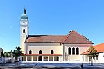
Catholic Parish Church to the Exaltation of the Cross ObjectID: 6186 |
KG location : Pamhagen |
The church is a baroque building built in 1754 with a western tower in front. Expansion in 1954/55. |
ObjectID: 6186 Status: § 2a Status of the BDA list: 2020-02-29 Name: Catholic parish church Zur Kreuzerhöhung GstNr .: 559 Holy Cross Church (Pamhagen) |

|
Crucifixion Group ObjectID: 6191 |
KG location : Pamhagen |
The crucifixion group at the cemetery stands on the wall, has classicist figures and base reliefs. These show the “Mount of Olives”, the “Flagellation of Jesus”, the “Crowning of Thorns” and the “Carrying of the Cross”. Michael Thoell created it in 1816. |
ObjectID: 6191 Status: § 2a Status of the BDA list: 2020-02-29 Name: Kreuzigungsgruppe GstNr .: 560/1 |

|
Kleinackerkapelle, Feldkapelle ObjektID: 6190 |
KG location : Pamhagen |
A small niche building from the middle of the 18th century with a curved gable. |
ObjectID: 6190 Status: Notification Status of the BDA list: 2020-02-29 Name: Kleinackerkapelle, Feldkapelle GstNr .: 2605 |
Web links
Commons : Listed objects in Pamhagen - collection of pictures, videos and audio files
Individual evidence
- ↑ a b Burgenland - immovable and archaeological monuments under monument protection. (PDF), ( CSV ). Federal Monuments Office , as of February 14, 2020.
- ↑ sey.at, accessed on February 1, 2013
- ↑ § 2a Monument Protection Act in the legal information system of the Republic of Austria .