
Pamhagen
|
Pamhagen
|
||
|---|---|---|
| coat of arms | Austria map | |
 |
|
|
| Basic data | ||
| Country: | Austria | |
| State : | Burgenland | |
| Political District : | Neusiedl am See | |
| License plate : | ND | |
| Surface: | 33.02 km² | |
| Coordinates : | 47 ° 42 ' N , 16 ° 54' E | |
| Height : | 121 m above sea level A. | |
| Residents : | 1,567 (January 1, 2020) | |
| Population density : | 47 inhabitants per km² | |
| Postal code : | 7152 | |
| Community code : | 1 07 16 | |
| NUTS region | AT112 | |
| UN / LOCODE | AT PAM | |
| Address of the municipal administration: |
Hauptstrasse 7 7152 Pamhagen |
|
| Website: | ||
| politics | ||
| Mayor : | Josef Tschida ( ÖVP ) | |
|
Municipal Council : (2017) (21 members) |
||
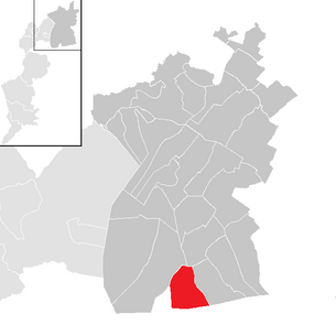
| Location of Pamhagen in the Neusiedl am See district | ||
  |
||
 Turkish tower |
||
| Source: Municipal data from Statistics Austria | ||

Pamhagen ( Hungarian Pomogy ) is a municipality with 1567 inhabitants (as of January 1, 2020) in northern Burgenland in the Neusiedl am See district in Austria .
geography
Pamhagen lies on the edge of the northern Burgenland sub-area Waasen , now also Wasen (Hungarian: Hanság ). The municipality borders on Hungary, with about half of the border running along the Einser Canal . Other districts are the holiday village Pannonia and the Pamhagen zoo.
history
The place was first mentioned in a document in 1268. In 1380 a pastor was named Johann ecclesiae de Pomog . In 1547 a ban-taiding was written ( court day ). A school is first mentioned in 1652.
The County - conscription of the year 1713 are the first indication of viticulture in Pamhagen. From 1778 to 1780 a road embankment was built through the Waasen with 14 wooden bridges from Pamhagen to Esterház (length 7.5 km) and at the end of the 19th century (1897) the Fertövideer local railway ( Neusiedler Seebahn ) was built.
A few years later, in 1909, the Pamhagen credit cooperative was founded.
It belonged like the rest of Burgenland to 1920 / 21 to Hungary (German-West Hungary). Since 1898 had to because of the Magyarization of the government in Budapest of Hungarian name Pomogy be used. Pamhagen (Pomogy) belonged to Wieselburg County (Moson Vármegye) .
After the end of the First World War , after tough negotiations, German-West Hungary was awarded to Austria in the Treaties of St. Germain and Trianon in 1919. The place has belonged to the newly founded federal state of Burgenland since 1921 (see also the history of Burgenland ).
In 1948 the “ Iron Curtain ” divided Europe, Pamhagen lost access to real estate on Hungarian territory.
After the border crossings (rail and road) to Hungary were closed in 1955, it was only possible to travel in and out of the country by train with a visa (especially Hungarian commuters). In 1990 the Neusiedler Seebahn was opened for border crossings.
For cyclists in particular, the reopening of the Pamhagen- Fertöd border crossing on a flat, short route to Hungary for non-motorized people around 1991 was a great gain. In 1995 the crossing was also opened for agricultural and forestry traffic, later also for motorized vehicles in general.

Map of Wieselburg County

Pamhagen at the end of the 19th century (recording sheet of the state survey )


Population development

Culture and sights
.JPG)
- Parish church Pamhagen : It was built from 1745 to 1754 and expanded and rebuilt in the mid-1950s.
- Türkenturm: The tower is the landmark of the place. The Turkish tower is a former bell tower from the time when the church was still outside the village.

- Lake Neusiedl
- Neusiedler See - Seewinkel National Park
- Fertő-Hanság National Park
- Pamhagen steppe animal park: The natural zoo with 50 animal species in the pristine steppe landscape in Seewinkel in Burgenland has existed since 1975, on an area of 13 hectares. It is open from March to the end of October.
politics
Municipal council
The council comprises a total of 21 members on the basis of population.
| Political party | 2017 | 2012 | 2007 | 2002 | 1997 | ||||||||||
|---|---|---|---|---|---|---|---|---|---|---|---|---|---|---|---|
| Sti. | % | M. | Sti. | % | M. | Sti. | % | M. | Sti. | % | M. | Sti. | % | M. | |
| ÖVP | 748 | 58.57 | 13 | 850 | 59.27 | 13 | 691 | 45.88 | 10 | 566 | 43.67 | 10 | 524 | 44.33 | 10 |
| SPÖ | 423 | 33.12 | 7th | 584 | 40.73 | 8th | 767 | 50.93 | 11 | 620 | 47.84 | 10 | 522 | 44.16 | 9 |
| FP A1 | 106 | 8.30 | 1 | not running | not running | not running | not running | ||||||||
| FPÖ | not running | not running | 22nd | 1.46 | 0 | 110 | 8.49 | 1 | 136 | 11.51 | 2 | ||||
| FBL | not running | not running | 26th | 1.73 | 0 | not running | not running | ||||||||
| Eligible voters | 1651 | 1852 | 1859 | 1653 | 1523 | ||||||||||
| voter turnout | 85.46% | 86.66% | 87.79% | 88.02% | 90.15% | ||||||||||
Parish council
In addition to Mayor Josef Tschida (ÖVP) and Deputy Mayor Manfred Bleich (SPÖ), the municipal board also includes the executive councilors Angelika Fleischhacker (ÖVP), Anton Kotzenmacher (ÖVP), Johann Munzenrieder (SPÖ), Johann Thell (ÖVP) and Gerhard Thüringer (ÖVP) on.
mayor
Mayor is Josef Tschida (ÖVP), who replaced Johann Munzenrieder (SPÖ) on October 7, 2012. Before Munzenrieder, Josef Wüger (SPÖ) headed the community until February 13, 2012. In the direct mayor election 2017, Tschida was confirmed in his office with 67.38% of the votes. Manfred Bleich (SPÖ) received 32.62% and became Vice Mayor.
Head of office is Manuela Kierein.
Personalities
Sons and daughters of the church
- Leopold Fleischhacker (1891–1960), farmer and politician
- Johann Sipötz (* 1941), politician ( SPÖ ), former governor of Burgenland (1987–1991)
People related to the community
- Heinz Fischer (* 1938), former Federal President, attended elementary school in Pamhagen
literature
- Section “The partner communities” in “TÜPL Bruckneudorf - 150 Years of Brucker Lager” by Petra Weiß, publisher. Stadtgemeinde Bruck an der Leitha, April 2017, p. 450/451
Web links
- 10716 - Pamhagen. Community data, Statistics Austria .
- Pamhagen steppe wildlife park
Individual evidence
- ↑ http://www.turus.net/fotostrecke/reise/ungarn/begrenzuebergang-fertoed-pamhagen- border- between-ungarn-und-oesterreich-5779.html picture border crossing Pamhagen-Fertöd, turus.net, accessed on 22. April 2014
- ↑ a b Province of Burgenland: Pamhagen 2017 election results (accessed on December 3, 2017)
- ↑ Province of Burgenland: Pamhagen 2012 election results (accessed on December 3, 2017)
- ↑ Province of Burgenland: Pamhagen 2007 election results (accessed on December 3, 2017)
- ↑ a b Province of Burgenland: Pamhagen 2002 election results (accessed on December 3, 2017)
- ↑ Parish Pamhagen: Parish council and council ( Memento of the original dated December 4, 2017 in the Internet Archive ) Info: The archive link has been inserted automatically and has not yet been checked. Please check the original and archive link according to the instructions and then remove this notice. (accessed on December 3, 2017)
- ↑ a b Municipality of Pamhagen: Mayor and Deputy Mayor ( Memento of the original from December 4, 2017 in the Internet Archive ) Info: The archive link has been inserted automatically and has not yet been checked. Please check the original and archive link according to the instructions and then remove this notice. (accessed on December 3, 2017)
- ^ Social Democratic Association of Local Authorities Burgenland: New Mayor in Pamhagen! (accessed on December 3, 2017)
- ^ Parish Pamhagen: Administration (accessed on December 3, 2017)
Andau | Apetlon | Bruckneudorf | German Jahrndorf | Edelstal | Frauenkirchen | Gattendorf | Gols | Half turn | Illmitz | Jois | Kittsee | Mönchhof | Neudorf near Parndorf | Neusiedl am See | Nickelsdorf | Pama | Pamhagen | Parndorf | Podersdorf am See | Potzneusiedl | Sankt Andrä am Zicksee | Tadten | Wallern in Burgenland | Willows by the lake | Winches on the lake | Zurndorf
Cadastral municipality: Pamhagen
Location: Pamhagen
Village: Pamhagen Group of houses: Zoo Pamhagen Weekend settlement: Feriendorf Pannonia
Counting area: Pamhagen-Zentrum | Pamhagen area