
Neusiedler Seebahn
| Neusiedler Seebahn | |||||||||||||||||||||||||||||||||||||||||||||||||||||||||||||||||||||||||||||||||||||||||||||||||||||||||||||
|---|---|---|---|---|---|---|---|---|---|---|---|---|---|---|---|---|---|---|---|---|---|---|---|---|---|---|---|---|---|---|---|---|---|---|---|---|---|---|---|---|---|---|---|---|---|---|---|---|---|---|---|---|---|---|---|---|---|---|---|---|---|---|---|---|---|---|---|---|---|---|---|---|---|---|---|---|---|---|---|---|---|---|---|---|---|---|---|---|---|---|---|---|---|---|---|---|---|---|---|---|---|---|---|---|---|---|---|---|---|
| Course book route (ÖBB) : | 700 (Vienna - Pamhagen) 731 (Vienna - Fertőszentmiklós) |
||||||||||||||||||||||||||||||||||||||||||||||||||||||||||||||||||||||||||||||||||||||||||||||||||||||||||||
| Route length: | 49 km | ||||||||||||||||||||||||||||||||||||||||||||||||||||||||||||||||||||||||||||||||||||||||||||||||||||||||||||
| Gauge : | 1435 mm ( standard gauge ) | ||||||||||||||||||||||||||||||||||||||||||||||||||||||||||||||||||||||||||||||||||||||||||||||||||||||||||||
| Route class : | D3 | ||||||||||||||||||||||||||||||||||||||||||||||||||||||||||||||||||||||||||||||||||||||||||||||||||||||||||||
| Power system : | 25 kV 50 Hz ~ | ||||||||||||||||||||||||||||||||||||||||||||||||||||||||||||||||||||||||||||||||||||||||||||||||||||||||||||
| Maximum slope : | 10 ‰ | ||||||||||||||||||||||||||||||||||||||||||||||||||||||||||||||||||||||||||||||||||||||||||||||||||||||||||||
| Minimum radius : | 300 m | ||||||||||||||||||||||||||||||||||||||||||||||||||||||||||||||||||||||||||||||||||||||||||||||||||||||||||||
| Top speed: | 120 km / h | ||||||||||||||||||||||||||||||||||||||||||||||||||||||||||||||||||||||||||||||||||||||||||||||||||||||||||||
|
|||||||||||||||||||||||||||||||||||||||||||||||||||||||||||||||||||||||||||||||||||||||||||||||||||||||||||||
The settlers Seebahn as of 19 December 1897 linking Neusiedl am See single track to standard gauge over Pamhagen with the station Fertőszentmiklós the Raab-Oedenburg-Ebenfurter railway in the Hungarian railway Győr (Raab) - Sopron (Oedenburg). Until May 26, 1979, the railway continued 56 kilometers to Celldömölk . At the time of construction, the total distance of 109 kilometers was on Hungarian territory. On January 25, 1921, 45 kilometers with Burgenland came to Austria .
owner
The owner has been the Neusiedler Seebahn GmbH since June 29, 2010 , the majority of which is owned by Burgenland and the rest of the Republic of Austria. Its predecessor was the Neusiedler Seebahn AG (NSB AG) - in Hungarian Fertővidéki Helyiérdekű Vasút (Fhév) - which had the following owners since 1997:
- Republic of Austria 48.259 percent
- Republic of Hungary 26.306 percent
- Province of Burgenland 25.435 percent
The operation performs the Raab-Oedenburg-Ebenfurter railway AG (GySEV / Raaberbahn).
Corporate purpose
In the past, the route was used more for agricultural goods transport, but today it is mainly used for passenger transport. This line connects Northern Burgenland east of Lake Neusiedl ( Seewinkel ) to the national and international rail network, which is mainly used by commuters to Vienna .
modernization
electrification
The electrification began in 2003 and was completed in sections by mid-April 2004. During these years the line was electrified with the 25 kV 50 Hz traction current system common in Hungary , with the system separation point being on the open line between the Bad Neusiedl and Neusiedl / See stations. In addition to railcars of the ROeEE , ÖBB multi-system locomotives of the series 1116 with push-pull trains as well as multi-system-capable railcar sets of the ÖBB series 4124 and 4746 are used.
Track expansion

The last renewal of the superstructure and the installation of stronger rails made it possible to increase the maximum speed on the route from 80 km / h to 120 km / h and thus significantly reduce travel times.
Train crossings
Most of the train crossings in St. Andrä take place four minutes before the usual symmetry time.
Railway stations and security
Thanks to the renewal of the safety technology, more trains can now use the route. The stations and stops have been modernized to offer passengers more comfort. Since many road crossings on the railway line are not regulated by barriers , but only by light signals or traffic signs , fatal accidents with road vehicles occur again and again. The demand for more railway barriers has not yet been given in for financial reasons.
history
- 1873: first railway plan in the Neusiedlersee region
- 1896: Issue of two railway concessions: one stretch west of the lake, one east of the lake
- December 19, 1897: The Neusiedlerseebahn goes into operation
- In the first half of the 20th century, the train was the means of transport for the agricultural goods of the surrounding country estates, which operated a number of horse-powered tugs to the railway stations of the Neusiedler Seebahn.
- until 1945: damage in World War II
- April 9, 1945: First Soviet military train on the Celldömölk - Eszterháza - Ödenburg line, repaired by the advancing Soviet troops
- June 4, 1946: Passenger train travels the Neusiedl am See - Pamhagen route again for the first time
- Spring 1947: Repair of the blown bridge over the Einser Canal, then resumption of rail traffic between Austria and Hungary
- xx then “Puszta-Express” from Eszterháza via Neusiedl am See to Vienna Ostbahnhof
- May 20, 1951: Raaberbahn AG only runs trains to Neusiedl am See (no longer to Vienna)
- May 22, 1955: cross-border passenger traffic via the Pamhagen border crossing had to be stopped
- 1950s and early 1960s: Freight traffic (mainly turnips) grew, but passenger transport fell sharply
- xx steady shift of passenger traffic from rail to road
- May 26, 1979: the Hungarian government stops all rail traffic in the Celldömölk - Fertöszentmiklós section
- xx Continuation of the Schnellbahn from Vienna to Neusiedl am See - important connection
- 1980–1994: Expansion in the Austrian section through the Neusiedler Seebahn: stronger tracks, higher speed, securing of crossings, loudspeakers in all train stations (control centrally from Pamhagen). Hope for an increased volume of goods from the warehouses located along the route.
- September 1, 1988: Inclusion of the line in the Verkehrsverbund Ost-Region
- May 27, 1990: Opening of the borders with Hungary, therefore resumption of public transport via the Pamhagen border crossing (previously only journeys with (commuter) visas were allowed)
- April 5, 1991 (General, Street): Agreement between the Austrian Federal Government and the Government of the Republic of Hungary on the construction of new border crossings at the common national border
- xx street: opening for pedestrians and bicycles
- October 1, 1995 (road): Extension of the scope of use to cross-border agricultural and forestry management traffic
- xx street: opening for motor vehicle traffic
- 2003: Change of ownership from 70 percent (Hungarian) Raaberbahn AG to 25 percent Republic of Austria and (majority) Province of Burgenland
- April 24, 2004: Commissioning of the now fully electrified line from Neusiedl am See via Pamhagen to Fertőszentmiklós (25 kV, 50 Hz)
- April 30, 2004 (road): Border opening for general road traffic
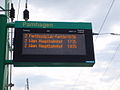
- 2003–2008: Modernization of the route: platforms, section-wise reconstruction for 120 km / h, passenger information system (2008)
- End of 2007: Hungary's accession to the Schengen system takes effect, all border controls at the border between Hungary and Austria are dropped
- June 29, 2010: Registration in the commercial register of Neusiedler Seebahn GmbH (Burgenland (majority owner) + Republic of Austria) as the successor to Neusiedler Seebahn AG
- planned until 2014: security systems at crossings, route cables, further modifications
- August 4, 2014: The "Mönchhof stop" station was closed due to insufficient utilization
gallery

End of the Neusiedler Seebahn near Celldömölk (2012)

Fertőszentmiklós

Pamhagen before the renovation

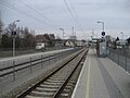
Pamhagen today
Pamhagen

Pamhagen memorial plaque
Bad Neusiedl am See


literature
- Ludwig Zwickl, GySEV - the Raaberbahn, operating history of the Austrian lines, bahnmedien.at, 2011, ISBN 978-3-9502648-5-2 .
Web links
- Current timetable of the Raab-Oedenburg-Ebenfurter Eisenbahn
- Homepage of the Raaberbahn AG
Remarks
- ↑ a b Opened as a 109 kilometer long local railway Kis-Czell - Pandorf , which connected to the Hungarian state railway company in the Parndorf station . - See: Economic communications. (...) A local train. In: Linzer Volksblatt , No. 292/1897, December 22, 1897, p. 5, bottom center. (Online at ANNO ). .
Individual evidence
- ↑ The origin ( Memento of the original from September 6, 2014 in the Internet Archive ) Info: The archive link was inserted automatically and has not yet been checked. Please check the original and archive link according to the instructions and then remove this notice. . In: neusiedlerseebahn.at , accessed on December 1, 2012.
- ↑ Railway Atlas Austria, Schweers + Wall, 2010, p. 37
-
^ Johann Witz: The agricultural railways in the Seewinkel (horse tram Albrechtsfeld). In: Railway. ISSN 0013-2756 ZDB -ID 162227-4 . Born in 1968, issue 12, pp. 220–221 (about twelve kilometers, from St. Andrä near Frauenkirchen to today's Albertkazmerpuszta in Hungary, built after the First World War, discontinued in 1956).
Johann Witz: The field railway in Wallern. In: Railway. Born in 1969, issue 6, pp. 95–96 (approx. 1916 to 1945).
Hans Witz: The Agricultural Railway Frauenkirchen. In: Railway. Born in 1972, issue 1, p. 6 (after World War I until around 1956).
Johann Witz: The field railway in Pamhagen. In: Railway. Born in 1971, issue 7, p. 101 (1912 to approx. 1945, 60 cm gauge, horse and diesel operation, approx. 6–8 km to the Apetloner Meierhof). - ↑ http://www.ris.bka.gv.at/Dokument.wxe?Abfrage=Bundesnormen&Dokumentnummer=NOR12065329 border crossing Pamhagen-Fertöd - expansion of the scope of use, www.ris.bka.gv.at, accessed on April 22, 2014