Littlefield, Arizona
| Littlefield | |
|---|---|
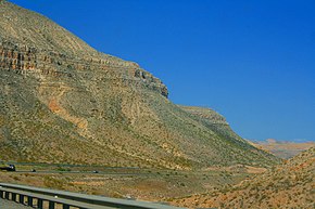
 Interstate 15 , in the Littlefield , Mohave County area |
|
| Location in Arizona | |
| Basic data | |
| Foundation : | 1865 |
| State : | United States |
| State : | Arizona |
| County : | Mohave County |
| Coordinates : | 36 ° 54 ′ N , 113 ° 56 ′ W |
| Time zone : | Mountain Standard Time ( UTC − 7 ) |
| Residents : | 308 (as of 2010) |
| Population density : | 9.9 inhabitants per km 2 |
| Area : | 30.98 km 2 (approx. 12 mi 2 ) |
| Height : | 562 m |
| Postal code : | 86432 |
| FIPS : | 04-41470 |
| GNIS ID : | 7237 |
Littlefield is an unincorporated community in Mohave County in the northwest of the US state Arizona . In 2010, 308 people lived there. The settlement is located on Interstate 15 and the Virgin River in the extreme northwest of the sparsely populated and rugged so-called Arizona Strip . The rest of Arizona can only be reached by road via Nevada or Utah .
The site was founded in 1865 as Beaver Dam by members of the Church of Jesus Christ of Latter-day Saints ( Mormons ) from St. George , Utah, as the first Mormon settlement in Arizona.
Despite its small size, Littlefield is the center of the remote region and maintains regional facilities, so there is an elementary school , a middle school and a high school .
Web links
Commons : Littlefield (Arizona) - Collection of pictures, videos, and audio files
Individual evidence
- ↑ Littlefield, Arizona (AZ) profiles: population, maps, real estate, averages, homes, statistics, relocation, travel, jobs, hospitals, schools, crime, moving, houses, news, sex offenders. In: www.city-data.com. Retrieved August 10, 2016 .
- ^ Andrew Jenson, Encyclopedic history of the Church of Jesus Christ of latter-day saints , Salt Lake City, Deseret News Press, 1941, 437
