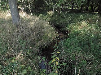
Litzenbach
| Litzenbach | ||
| Data | ||
| Water code | DE : 5872382 | |
| location | Potsdam-Mittelmark district , Brandenburg , Germany | |
| River system | Elbe | |
| Drain over | Strepenbach → Buckau → Havel → Elbe → North Sea | |
| source | south of Steinberg 52 ° 14 ′ 43 " N , 12 ° 21 ′ 37" E |
|
| muzzle | Northwest of Glienecke in the Strepenbach Coordinates: 52 ° 17 ′ 16 ″ N , 12 ° 21 ′ 57 ″ E 52 ° 17 ′ 16 ″ N , 12 ° 21 ′ 57 ″ E
|
|
| length | 6.8 km | |
| Catchment area | 11.87 km² | |
| Communities | Buckau Valley | |
The Litzenbach rises in northern Hohen Fläming between the villages of Steinberg and Buckau in the Buckautal community . It drains north to the Strepenbach and over this to Buckau and finally to the Havel . It is the only tributary of the Strepenbach and flows to it from the left.
course
The more than six and a half kilometer long, largely natural Fläming River rises on the northern slope of the Hohe Fläming, east of the Petz Mountain. From there, the stream initially flows in a north-westerly direction through a boggy wetland. To the west of Steinberg, the Litzenbach crosses under the Bundesautobahn 2 and turns to the north or northeast. On the way, the Litzenbach takes in the water of some ditches or rivers. About a kilometer before its mouth there is a small connecting ditch directly to Buckau. To the northwest of Glienecke , the Litzenbach joins the much smaller and shorter Strepenbach about thirty meters before the Buckau.
Protected areas
In the course of the Riembach flows through a large number of protected areas. The area south of the Federal Highway 2 is for example in High Fläming Nature Park and conservation area High Fläming - Belziger Landschaftswiesen. In addition, the brook is designated in the FFH area Buckau and tributaries. To the north-west of Steinberg there is a protected part of the landscape , the Lehmkuten Bücknitz. Some areas of the stream are declared as protected biotopes .
Individual evidence
- ↑ River directory gewnet25 (Version 4.0, April 24, 2014) from the Ministry for Rural Development, Environment and Agriculture of the State of Brandenburg, accessed on May 4, 2015.
- ↑ http://metaver.de/kartendienste
- ↑ State of Brandenburg biodiversity in the Flämingfließen ( memento of the original from July 14, 2014 in the Internet Archive ) Info: The archive link was inserted automatically and has not yet been checked. Please check the original and archive link according to the instructions and then remove this notice. . Accessed June 8, 2014.
- ^ Partial sheet Southwest Protected Areas. In: Landkreis Potsdam-Mittelmark landscape framework plan. Office for Environmental and Landscape Planning, archived from the original on August 7, 2011 ; Retrieved June 7, 2014 .
