Liwonde
| Liwonde | ||
|---|---|---|
|
|
||
| Coordinates | 15 ° 4 ′ S , 35 ° 14 ′ E | |
| Basic data | ||
| Country | Malawi | |
| Southern region | ||
| ISO 3166-2 | MW-S | |
| height | 560 m | |
| Residents | 36,421 (2018) | |
Liwonde is a city of 36,421 inhabitants (2018 census) in Malawi . It is located at 560 meters above sea level on the Shire River at the foot of the northern end of the Shire highlands and near a national park . This extends from the Nkaya - Nayuchi route of the Malawian Railway in the south along the Shire River to the north to Lake Malombes .
The city has a 1,000 m airfield, elementary and secondary schools, a 100-bed hospital, post office and petrol station.
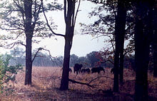
The Liwonde National Park consists of bush and tree savannahs as well as extensive swampy floodplains on the meandering river and an overgrown bank on the lake. In the park there are simple round huts for overnight stays with self-catering. Recently there is the Mvuu Wilderness Lodge for upscale tourism. Numerous species of birds and gazelle , zebras , elephants , lions , leopards , cheetahs , crocodiles , hippos and warthogs can be seen . The park - officially a protected area - is very elongated. The Shire River forms a marshland in the park . Liwonde National Park is a haven for animals in the dry season , as the Shire has water all year round. In the rainy season, many of the animals migrate to Mozambique .
In addition to Liwonde National Park, there is the Liwonde Hills Forest Reserve bird sanctuary .
Web links
- Njobvu Cultural Village, close to Liwonde NP (English)
- Report from the Liwonde National Park (English)
- Photo Gallery Mvuu Lodge and Liwonde National Park ( Memento of 13 March 2007 at the Internet Archive (English))
- BirdLife International: Liwonde Hills Forest Reserve. (English)
Individual evidence
- ↑ City Population: Population figures of the cities in Malawi 1977 to 2018 (English), accessed on September 22, 2019

