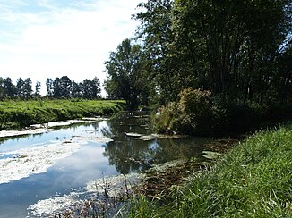
Lohamer Trench
|
Lohamer Graben Saßgraben |
||
|
Lohamer Graben at the Sulzbach pumping station |
||
| Data | ||
| Water code | DE : 159522 | |
| location | Bavaria | |
| River system | Danube | |
| Drain over | Schwarzach → Danube → Black Sea | |
| source | at Loham 48 ° 50 ′ 26 ″ N , 12 ° 48 ′ 20 ″ E |
|
| Source height | 312 m above sea level NHN | |
| muzzle | near Mariaposching in the Danube Coordinates: 48 ° 51 ′ 3 " N , 12 ° 50 ′ 31" E 48 ° 51 ′ 3 " N , 12 ° 50 ′ 31" E |
|
| Mouth height | 312 m above sea level NHN | |
| Height difference | 0 m | |
| Bottom slope | 0 ‰ | |
| length | 3.1 km | |
| Catchment area | 18.161 km² | |
| Left tributaries | Rift | |
| Communities | Mariaposching | |
The Lohamer Graben , also called Saßgraben, is a right tributary of the Schwarzach in the Straubing-Bogen district in Lower Bavaria and a third-order body of water.
course
It arises from the confluence of Schardengraben and Lohgraben on the southeastern outskirts of Loham in the municipality of Mariaposching and flows mainly in an easterly direction without touching any other places. At the Sulzbach pumping station it flows into the Schwarzach, which is heavily diked here.
Web links
Commons : Lohamer Graben - Collection of images, videos and audio files
- Profile map of the river water body - Kinsach and others. (PDF; 883 kB) Bavarian State Office for the Environment, accessed on April 29, 2014 .
Individual evidence
- ↑ a b List of brook and river areas in Bavaria - Naab to Isar river area, page 127 of the Bavarian State Office for the Environment, as of 2016 (PDF; 2.8 MB)


