Lower Buckhorn Lake
| Lower Buckhorn Lake | |||||||||||
|---|---|---|---|---|---|---|---|---|---|---|---|
| A small bay on Lower Buckhorn Lake | |||||||||||
|
|||||||||||
|
|
|||||||||||
| Coordinates | 44 ° 33 ′ 0 ″ N , 78 ° 15 ′ 30 ″ W | ||||||||||
| Data on the structure | |||||||||||
| Data on the reservoir | |||||||||||
| Altitude (at congestion destination ) | 242 m | ||||||||||
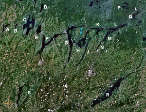
| Kawartha Lakes with Lower Buckhorn Lake (Letter "K") | |||||||||||
Lower Buckhorn Lake is a lake in the Canadian province of Ontario .
The lake is located in the area of the townships Smith-Ennismore-Lakefield and Galway-Cavendish and Harvey in Peterborough County .
Lower Buckhorn Lake belongs to the Kawartha Lakes group of lakes .
There are a number of small islets in the lake. The southern area of the lake is formed by a large bay, Deer Bay .
Lower Buckhorn Lake forms part of the Trent-Severn Waterway .
The main inflow is the lock 31 at Buckhorn , via which the water from Buckhorn Lake to the west flows in. Another tributary is the Mississagua River , which drains Mississagua Lake to the north and flows northeast of Buckhorn into Lower Buckhorn Lake.
In the east, Lower Buckhorn Lake is separated from neighboring Lovesick Lake by Wolf Island in the north and Millage Island in the south. In between is the lock 30, which compensates for a height difference of 1.1 m to the lower Lovesick Lake.
Wolf Island Provincial Park is located on Wolf Island .


