
Luboczanka
|
Luboczanka Leśnica |
||
|
|
||
| Data | ||
| location | Łódź Voivodeship , Poland | |
| River system | Vistula | |
| Drain over | Pilica → Vistula → Baltic Sea | |
| source | in Wielka Wola (Czerniewice) 51 ° 37 ′ 48 ″ N , 20 ° 10 ′ 24 ″ E |
|
| Source height | approx. 177 m | |
| muzzle | at Lubocz (Rzeczyca) in the Pilica coordinates: 51 ° 36 ′ 39 " N , 20 ° 25 ′ 29" E 51 ° 36 ′ 39 " N , 20 ° 25 ′ 29" E |
|
| Mouth height | approx. 133 m | |
| Height difference | approx. 44 m | |
| Bottom slope | approx. 2.1 ‰ | |
| length | 21.4 km | |
| Communities | Czerniewice , Rzeczyca (Powiat Tomaszowski) | |
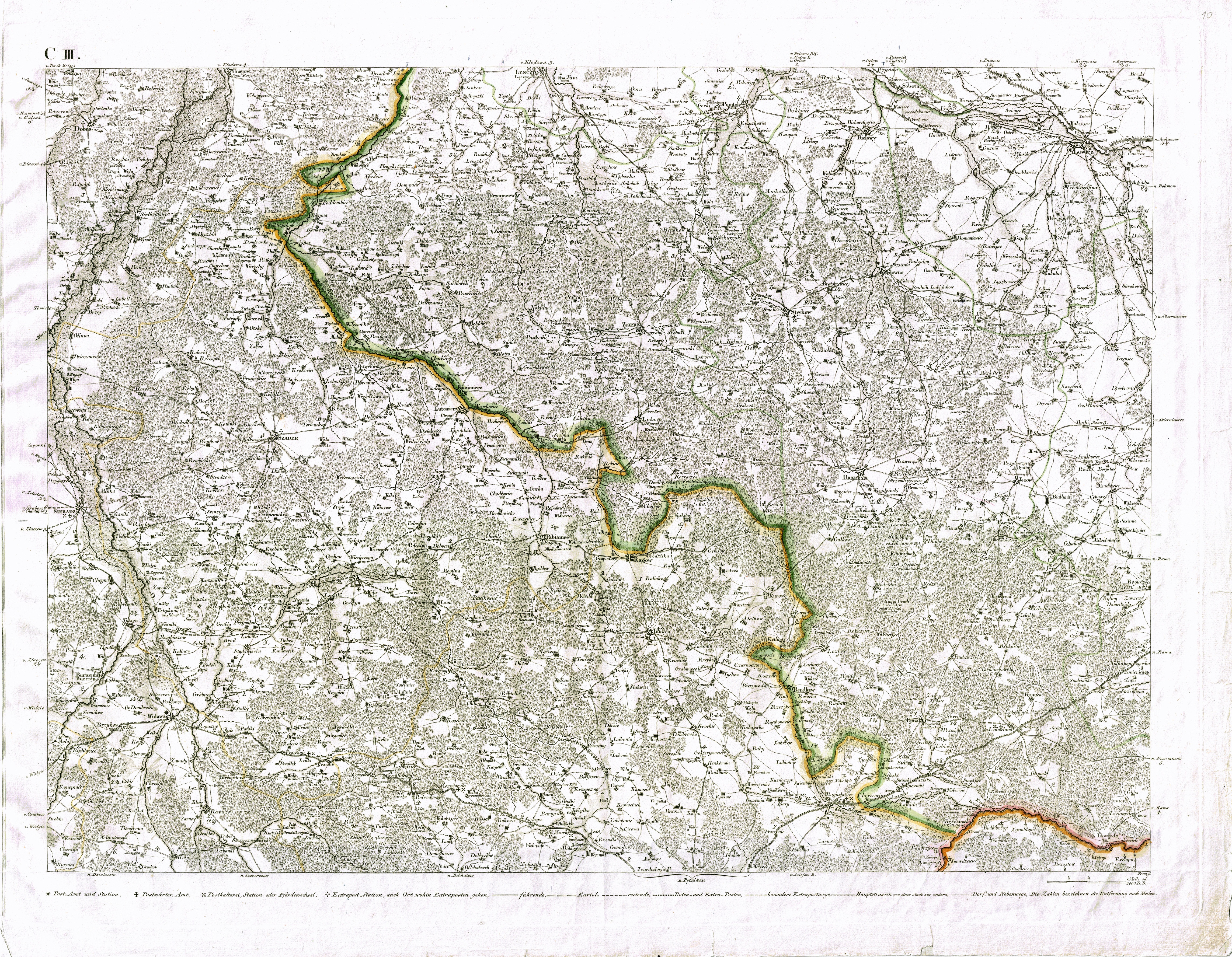
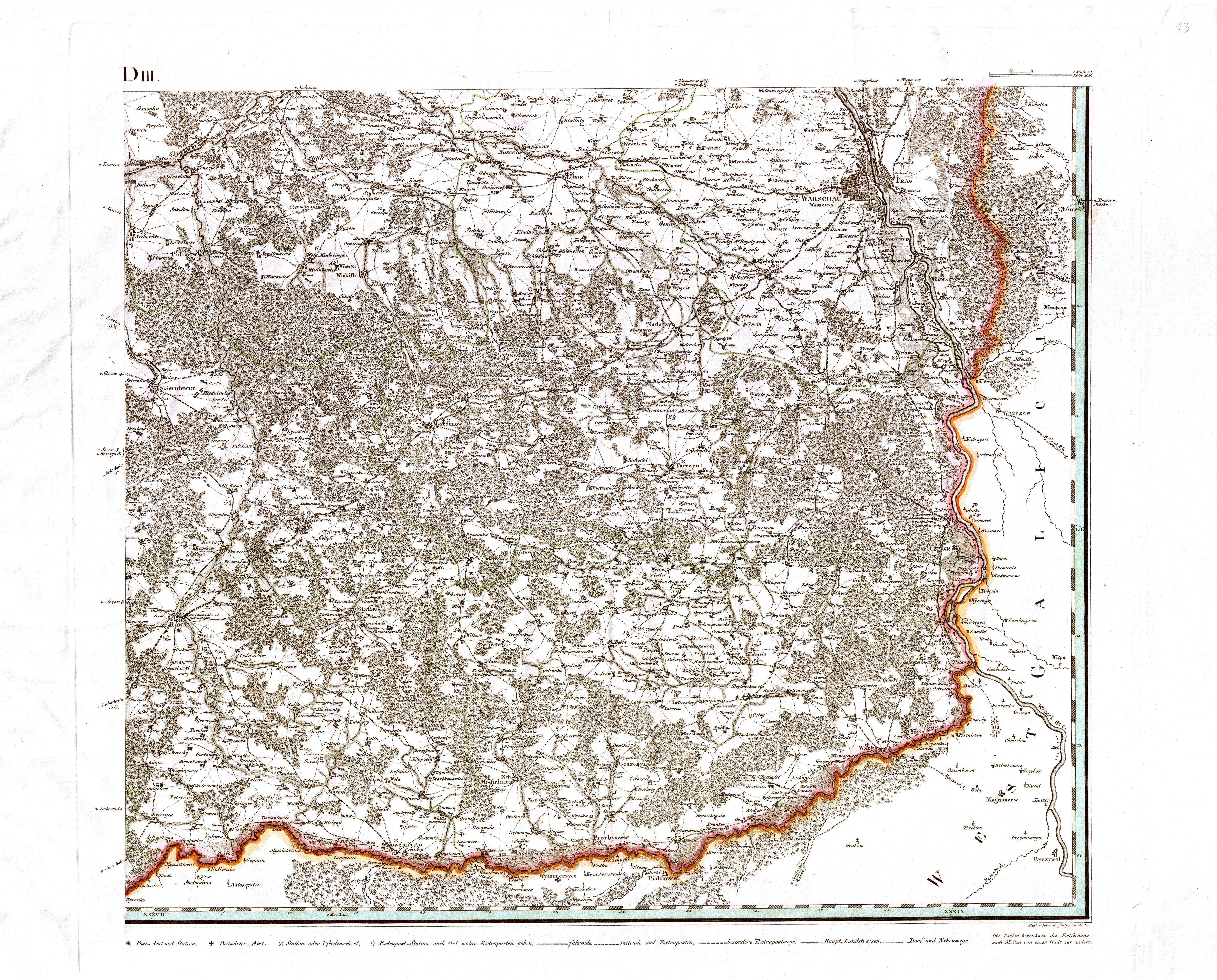
The Luboczanka (formerly Leśnica ) is a small river in the Łódź Voivodeship in central Poland . It has a length of 21.4 kilometers and is a left-hand tributary of the Pilica . The Luboczanka rises in the village of Wielka Wola (Czerniewice) and flows into the Pilica 2 km southeast of the eponymous village of Lubocz (Rzeczyca) .
The Luboczanka flows through largely arable flat areas with little gradient and therefore sometimes meanders strongly. Except for the first 2 km, its bank area is almost entirely made up of trees and bushes. The villages of Annów, Mała Wola, Dzielnica, Brzozów , Kanica, Wiechnowice, Bartoszówka and Bobrowiec lie along its course between Wielka Wola and Lubocz. Of all these villages, only Wielka Wola and Lubocz extend on both sides of the Luboczanka. As far as Dzielnice it flows through the area of the municipality of Czerniewice , from Brzozów to the confluence of the municipality of Rzeczyca , both located in the Tomaszów district (Powiat) . In the estuary was in the 1970s for better connection between Warsaw and Krakow the quick route Central Railway highway built. It crosses both the Luboczanka 800 m before its mouth and the Pilica 1.4 km further south.
In the Geographical Lexicon of the Kingdom of Poland from 1884, the Luboczanka is listed under its previous name Leśnica . In the entry Leśnica the encyclopedia states that this river flowing into the Pilica in " Old Poland " (until 1795) formed the border between the former voivodships Łęczyca and Rawa and that it was "probably" (Polish: prawdopodobnie ) around the river that flows into the Pilica from the left between Inowłódz and Nowe Miasto . (Inowłódz is 17 km southwest of the estuary, Nowe Miasto 10 km east.) Despite the slight gradient, there were already several mills along the river by 1800.
literature
- Jerzy Duma: names of waters in the right-hand tributary area of the Vistula between Pilica and Brda (Nazwy wodne w zlewisku lewych dopływów Wisły od Pilicy po ujście Brdy) , Hydronymia Europaea Volume 14, Franz Steiner Verlag, Stuttgart 1999, ISBN 978-3-515-07556-5 , P. 45.
Web links
- Map with Luboczanka on the website of the municipality of Rzeczyca
- Historical map by David Gilly (1802/03) with headwaters in “Gr. Wola "at Mapywig.org (1 mile from the right and 2 miles from the bottom of the map)
- Historical map by David Gilly (1802/03) with course from Kanice to the mouth at Mapywig.org (on the left edge of the map below)
Individual evidence
- ↑ Google Maps. Retrieved October 29, 2019 .
- ↑ Google Maps. Retrieved October 29, 2019 .
- ^ Słownik geograficzny Królestwa Polskiego i innych krajów słowiańskich . tape 5 . Warszawa 1884, p. 159 ( digitized version ).