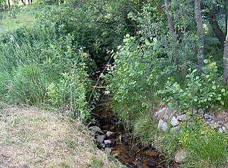
Mühlbach (Bavarian Schwarzach)
| Mühlbach | ||
|
Mühlbach, about 200 m west of its mouth |
||
| Data | ||
| Water code | DE : 146214 | |
| location | Upper Palatinate Forest | |
| River system | Danube | |
| Drain over | Bavarian Schwarzach → Schwarzach (Naab) → Naab → Danube → Black Sea | |
| source | southeast of Stadlern 49 ° 30 ′ 0 ″ N , 12 ° 37 ′ 39 ″ E |
|
| Source height | approx. 600 m | |
| muzzle | north of Schwarzach in the Bavarian Schwarzach Coordinates: 49 ° 29 ′ 51 ″ N , 12 ° 38 ′ 28 ″ E 49 ° 29 ′ 51 ″ N , 12 ° 38 ′ 28 ″ E |
|
| Mouth height | approx. 563 m | |
| Height difference | approx. 37 m | |
| Bottom slope | approx. 28 ‰ | |
| length | 1.3 km | |
| Catchment area | 3.41 km² | |
| Communities | Stadlers | |
The Mühlbach is a 1.3 km long right tributary of the Bavarian Schwarzach in the Upper Palatinate in Bavaria .
course
The Mühlbach rises at a height of 600 m on the slope that drops from Stadlern into the Schwarzachtal. It flows about 430 m to the east. Then he turns to the southeast. After another 480 m it swings to the east again. He crosses under the road that connects Waldhäuser with Schwarzach . About 330 m north of Schwarzach it flows into the Bavarian Schwarzach.
Tributaries
Only in its upper course does the Mühlbach absorb a few small, nameless rivulets from the left.
Individual evidence
- ↑ a b c d course and catchment area of the Mühlbach
- ↑ a b Length and catchment area according to: List of brook and river areas in Bavaria - Naab river area, page 116 of the Bavarian State Office for the Environment, as of 2016 (PDF; 4.0 MB)
- ↑ Fritsch hiking map of the Upper Bavarian Forest, nature park , scale 1: 50,000
Web links
Commons : Mühlbach - Collection of images, videos and audio files
