Magistralinis kelias A4
| Magistralinis kelias A4 in Lithuania | |

|
|
| map | |
| Basic data | |
| Operator: | Lietuvos automobilių kelių direkcija |
| Start of the street: | Vilnius ( 54 ° 39 ′ N , 25 ° 11 ′ E ) |
| End of street: | Border with Belarus ( 53 ° 57 ′ N , 23 ° 58 ′ E ) |
| Overall length: | 134.46 km |
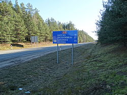
| The road at Merkinė (2009) | |
The A4 is a trunk road in Lithuania . For the most part, it is not part of a European route (in Vilnius, European route 28 for short ).
course
The road leads from the capital Vilnius over the junction of the westward Magistralinis kelias A16 in a south-westerly direction to the border with Belarus south of Druskininkai at the Pryvalki / Raigardas transition. On the Belarus side, the highway forms P42 continued in the city of Hrodna (Grodno).
The length of the road is around 134 km.
Web links
Commons : Greitkelis A4 - collection of images, videos and audio files

