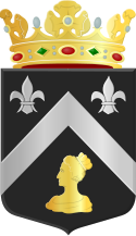
Mariekerke
 flag |
 coat of arms |
| province |
|
| local community |
|
|
Area - land - water |
34.8 km 2 34.68 km 2 0.12 km 2 |
| Residents | 4,180 (Jan 1, 1996) |
| Coordinates | 51 ° 31 ' N , 3 ° 32' E |
| prefix | 0118 |
| Postcodes | 4333-4334, 4337, 4353, 4356-4357, 4361, 4363-4365, 4371, 4373-4374, 4388 |
Mariekerke was a municipality in the Dutch province of Zeeland . It was formed on July 1, 1966 by the merger of the three municipalities Aierterkerke , Grijpskerke and Meliskerke . The seat of the administration was in Meliskerke. On January 1, 1997, it was merged with Domburg , Valkenisse , Westkapelle and Veere to form the new municipality of Veere . A year earlier Mariekerke had 4,180 inhabitants on 34.8 km².
Sons and daughters
- Joseph Augustin Hagendorens (1894–1976), Roman Catholic religious, Bishop of Tshumbe
Web links
Commons : Mariekerke - collection of images, videos and audio files
Individual evidence
- ↑ a b Regionale kerncijfers Nederland Centraal Bureau voor de Statistiek , accessed on April 13, 2018 (Dutch)
- ^ Ad van der Meer, Onno Boonstra: Repertorium van Nederlandse gemeenten 1812-2011 . Data Archiving and Networked Services, The Hague 2011, p. 127 ( PDF file; 8.9 MB ).