Mērsrags
| Mērsrags ( German : Margraves) | ||
|---|---|---|
 |
|
|
| Basic data | ||
| State : |
|
|
| Landscape: | Courland ( Latvian : Kurzeme ) | |
| Administrative district : | Mērsraga novads | |
| Coordinates : | 57 ° 20 ' N , 23 ° 8' E | |
| Residents : | 1,532 (Jun 3, 2015) | |
| Area : | ||
| Population density : | ||
| Height : | 4 m | |
| Website: | www.mersrags.lv | |
| Post Code: | ||
| ISO code: | ||
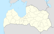
Mērsrags (German: Margraves ) is a place in western Latvia , on the coast of the Bay of Riga .
Location
Mērsrags is located on a prominent rocky promontory on the otherwise equalization coast of the Gulf of Riga. The name Mērsrags (Latvian: rags = horn, cape) is derived from this.
In Mērsrags, the Mērsrags Canal, dug in 1842, the outflow of Lake Engure , flows into the sea. The area around Mērsrags is part of the Engure Lake Nature Park, the banks of which are an important breeding ground for rare bird species.
history
Mērsrags is first mentioned in a document in the 15th century (1469 and 1495). The village developed into a fishing village. The church was built in 1700. A larger, wooden church was consecrated in 1809.
Since the 19th century, the port of Mērsrags has been used for timber exports, among other things. In 1875 a lighthouse (Mērsraga bāka) was put into operation, the beacon optics of which had been made in France. It was destroyed in the First World War and rebuilt in its current form in 1922.
In the 20th century, a fish processing industry emerged in Mērsrags. Inshore fishing is still practiced from Mērsrags to this day.
From 2008, the municipalities of Mērsrags and Roja formed a joint administrative unit before the municipal council decided in 2010 to form its own “novads”.
literature
- Hans Feldmann , Heinz von zur Mühlen (ed.): Baltic historical local dictionary, part 2: Latvia (southern Livonia and Courland). Böhlau, Cologne 1990, ISBN 3-412-06889-6 , p. 379.
- Sigurds Rusmanis, Ivars Vīks: Kurzeme . Izdevniecība Latvijas Enciklopēdija, Riga 1993, ISBN 5-89960-030-6 , pp. 180-181.
- Astrīda Iltnere (ed.): Latvijas Pagasti, Enciklopēdija. Preses Nams, Riga 2002, ISBN 9984-00-436-8 .
Footnotes
- ↑ a b Hans Feldmann, Heinz von zur Mühlen (ed.): Baltic historical local lexicon, part 2: Latvia (southern Livland and Courland). Böhlau, Cologne 1990, ISBN 3-412-06889-6 , p. 379.
