
Mathesberg
| Mathesberg | ||
|---|---|---|
 Mathesberg from the northeast |
||
| height | 831.8 m above sea level NHN | |
| location | East Hesse ( Germany ) | |
| Mountains | Rhön | |
| Coordinates | 50 ° 29 '15 " N , 9 ° 58' 43" E | |
|
||

The Mathesberg is 831.8 m above sea level. NHN high elevation of the Rhön in Hesse ( Germany ).
Geographical location
The Mathesberg is located within the "Hohen Rhön" southwest of the Ehrenberg district and climatic health resort Wüstensachsen in the Fulda district .
Mountain description
The Mathesberg borders the Rotes Moor nature reserve , its mountain meadows are ideal locations for numerous orchids. The summit of the Mathesberg is not accessed by paths. The extra tour of the Red Moor of the Hochrhöner and two local circular hiking trails lead with identical routes in this area over the south, west and north slopes of the Mathesberg. The Mathesberg is not very forested. Because there are higher mountains all around it, the view options are limited to the surrounding area. The extending from Mathesberg south ridge is characterized by pastures, old Hutebuchen and a stone run .

Hutebuche on the Mathesberg
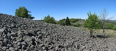
Dump
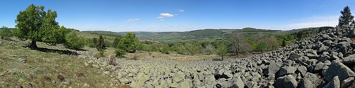
View of the Ulstertal


