Medora (Indiana)
| Medora | ||
|---|---|---|
|
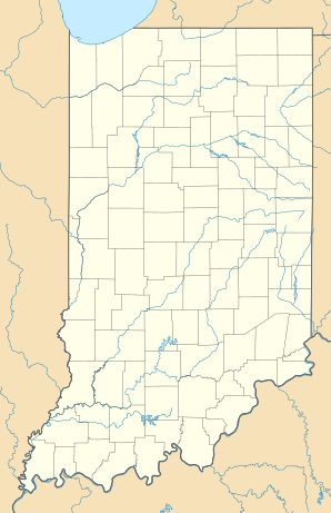
Location in Indiana
|
||
| Basic data | ||
| State : | United States | |
| State : | Indiana | |
| County : | Jackson County | |
| Coordinates : | 38 ° 49 ′ N , 86 ° 10 ′ W | |
| Time zone : | Eastern ( UTC − 5 / −4 ) | |
| Residents : | 565 (status: 2000) | |
| Population density : | 706.3 inhabitants per km 2 | |
| Area : | 0.8 km 2 (approx. 0 mi 2 ) of which 0.8 km 2 (approx. 0 mi 2 ) is land |
|
| Height : | 161 m | |
| Postal code : | 47260 | |
| Area code : | +1 812 | |
| FIPS : | 18-48240 | |
| GNIS ID : | 0438962 | |
Medora is a small town in southern Indiana , United States , about 70 km south of Indianapolis .
The population was 556 in 2004. The closest cities are Brownstown and Seymour which are in the same county. Since the closure of some factories and thus the loss of jobs, the number of residents has steadily decreased over the past 10 years. The region's flat and fertile land is used for agriculture, which is the main source of income. Medora was once a small town that was created and lived by the freight transport of the adjacent railway. The East Fork White River , which also flows through Indianapolis, flows through the small town . Medora is located in Jackson County . Over 99% of the population is white, as is mostly the case in the American countryside. The city is known because the second largest covered wooden bridge in the USA is nearby, but it is no longer used. There is a school in the city as well as numerous churches. Medora JR / High School is one of the smallest public schools in Indiana and has just 120 students. Basketball, volleyball and athletics are offered there for the students. The school building was restored in 1988 and partially rebuilt.
history
Historical objects
- To the southeast of Medora is the historic Medora Covered Bridge .
sons and daughters of the town
- Cal Collins (1933-2001), jazz guitarist
