Medvědí hory (Rybník nad Radbuzou)
| Medvědí hory | ||
|---|---|---|
|
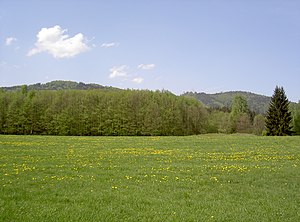
Medvědí hory - Amber Ridge from the southeast, left: Big rock, right: Eisenberg |
||
| height | 792 m nm | |
| location | Plzeňský kraj , Czech Republic | |
| Mountains | Upper Palatinate Forest | |
| Coordinates | 49 ° 31 '22 " N , 12 ° 39' 11" E | |
|
|
||
The Bernsteiner Ridge (Czech: Medvědí hory ) is a mountain ridge of the central Upper Palatinate Forest . It is located in the Okres Domažlice and extends in a north-south direction along the German-Czech border. In the west it is bounded by the valley of the Bavarian Schwarzach , in the east by the Radbuzatal . In the north it extends to the valley of the Mostecký potok (German: Glöcklbach) and in the south to the 600 m high pass between Schwarzach and Rybník nad Radbuzou (German: Waier). The Bernsteiner Ridge is formed from the 790 m high Eisenberg in the north and the 792 m high Großer Fels in the south.
The towns of Mostek (German: Schwanenbrückl) and Rybník nad Radbuzou (German: Waier) are on the east side of the Bernsteiner Ridge, while the towns of Waldhäuser and Schwarzach are on its west side .
The good, paved road from Schwarzach to Rybnik is only free for pedestrians and cyclists, but closed to car traffic. Another 810 m high pass is located in the north between Glöckelberg (Malý Zvon) and Eisenberg.
supporting documents
- ↑ Josef Bernklau: The floor shape. In: Franz Liebl, Heimatkreis Bischofteinitz (Hrsg.): Our Heimatkreis Bischofteinitz. Brönner & Daentler KG, Eichstätt 1967, p. 10.
- ↑ https://geoportal.bayern.de/bayernatlas/index.html?bgLayer=tk&zoom=9&lang=de&topic=ba&layers=e528a2a8-44e7-46e9-9069-1a8295b113b5&layers_visibility=false&E=4547c7048

