
Merheimer Heide


The Merheimer Heide on the right bank of the Rhine is a local recreation area in Cologne , the layout of which goes back to plans by Fritz Schumacher . These envisaged creating an outer green belt that encompasses the city . The green areas of the Merheimer Heide touch or extend over the districts of Buchheim , Holweide , Merheim and Höhenberg . The original size of 150 hectares in the eastern area was greatly reduced by the construction of residential buildings and the motorway .
founding
Considerations of creating a recreational area for the population, based on the outer green belt on the left bank of the Rhine, connecting the eastern parts of the city, did not materialize until the second half of the 1920s. On December 29, 1927, the city council decided to create a landscape park from the former Prussian parade ground , the Merheimer Heide . They commissioned the municipal gardening technician and construction director Theodor Nussbaum with the planning and had the proposed site prepared by “emergency workers”. Initially, allotments were primarily created . In 1929, the three-year work on the park began.
concept

After a press report, details and objectives of the project were explained to the population:
“The facility is 150 hectares in size and is planned as a modern public park. This includes those facilities that not only serve the enjoyment of nature and pure tranquility, like the conventional parks of the last century ..., but facilities that are made available to the population to a much greater extent. During the planning, the diverse needs of the residential areas on the right bank of the Rhine were taken into account. A total of 17 soccer fields, 5 running tracks and 21 tennis courts are planned for the sports clubs. "
Allotment gardens were intended to frame the grounds in the northwest and northeast, and additional areas were intended as grassland and playgrounds. The area of an exploited gravel pit should be turned into a pond with an associated coffee house. Theodor Nußbaum also planned a light and air bath (based on the model of Fritz Encke's "FreiLuGa" at the intermediate plant V b in Cologne-Müngersdorf ) on the site of the former fortress , which was to be built next to a country-style restaurant to be built.
Todays situation
The greater part of the Merheimer Heide park extends west of the A3 / 4 between the tram route of line 1 in the south and Frankfurter Strasse in the west. The north end (Schlagbaumsweg) of the system extends beyond the Köln-Ost motorway junction . The areas east of the motorway can be reached on foot via a bridge south of the cross.
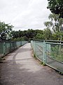
Bridge over the B55a between the north and south of the park

Inland area south part

Northern part of the riding area

Riding area with practice course in the north part


Northern part
A riding club (Ländlicher Reiterverein e.V. Cologne) is based on the site (area of the former Prussian intermediate plant X c .) With small grove-like oak and beech forests as well as some strips of bushes . It is surrounded by wide meadows with a hunting route for event riding. As in the southern part, these systems are crossed by mostly straight paths.
Southern part
The elongated inner area of almost open meadow terrain is affected by heavy traffic noise despite a strip of bush planted along the lower motorway. The wide meadows, criss-crossed by paths, are adjoined by narrow strips of forest interspersed with older trees on the entire west side. There are beeches and oaks that dominate the entire park, as well as ash , poplar and birch, as well as occasional conifers .

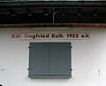
DJK Siegfried Kalk, club facility
detail

TuS Cologne rrh. 1874


In the forest area in front of the meadow, which extends to Frankfurter Straße, there are a number of sports facilities of different disciplines : tennis courts , a shooting club or football clubs . There are simple ash pitches where the fans only have standing room, but there are also stadiums with a covered grandstand , seats and club facilities with restaurants. The Merheimer Heide green area with all its possible uses is easily accessible from all sides by public transport in the city. For dog owners there is a generous free running area where the dogs can run without a leash. In the rest of the Merheimer Heide, leash is mandatory.
literature
- Joachim Bauer and Carmen Kohls: Cologne under French and Prussian rule . In: Werner Adams and Joachim Bauer (eds.): From the Botanical Garden to the Big City Green - 200 Years of Cologne Green (Stadtspuren - Denkmäler in Köln, Volume 30) Bachem Verlag, Cologne 2001, ISBN 3-7616-1460-8 .
Individual evidence
- ^ Henriette Meynen: Merheimer Heide . In: Joachim Bauer, Carmen Kohls: Cologne under French and Prussian rule . In: Werner Adams, Joachim Bauer (eds.): From the Botanical Garden to the Big City Green - 200 Years of Cologne Green ( Stadtspuren - Monuments in Cologne , Volume 30). P. 159
- ^ Henriette Meynen: Merheimer Heide. In: Werner Adams, Joachim Bauer (Hrsg.): From the botanical garden to urban green - 200 years of Cologne green . ( Stadtspuren. Monuments in Cologne , Volume 30). Bachem Verlag, Cologne 2001, ISBN 3-7616-1460-8 , p. 159
- ↑ On the trail of Prussian Cologne on the right bank of the Rhine . City Cologne; Retrieved August 18, 2008
Coordinates: 50 ° 56 ′ 51.4 ″ N , 7 ° 1 ′ 51 ″ E