
Fortress ring Cologne

The city of Cologne was surrounded by a double fortress ring under Prussian administration (since 1815 ) . It had to be demolished after 1919 due to the Treaty of Versailles . Together with the Roman city wall, the medieval city wall , the inner and outer Prussian fortification belt, there are remains of four fortification systems in Cologne .
Prussian extensions to the medieval city wall
- 1816–1819: Battery tower north of the Bayenturm;
- 1821–1825: Wall on the Rhine side expanded;
- 1816–1854: Expansion and reconstruction of the medieval fortifications (cf. also fortifications on the banks of the Rhine);
- 1850–1860: Demolition of the city wall on the Rhine side;
- 1883-1885; Breaking off the middle section; 1886: demolition of the southern section;
- 1886ff .: demolition of the northern section;
- 1870–1914: Expansion of the fortification ring under Prussia
- 1880s onwards: The ring road in Neustadt is built on the bastions
- 1882–1891: Construction of the wall on the left bank of the Rhine around the Neustadt, including some forts of the inner fortress belt (Fort I, IX, X, XI)
- after 1918 (until 1925?): grinding of the Prussian fortifications
- today: on the land side no Prussian, but only medieval components: Bottmühle, Severinstor, Ulrepforte, piece of wall on Sachsenring, Hahnentor, piece of wall on Hansaring, Eigelsteintor.
Extension structures
In response to the threat posed by the explosive shell , concrete , reinforced concrete and steel armor were used in the fortress construction. Therefore, between 1905 and 1914, a number of concrete shelters were built in front of the actual outer fortress ring . As a result, the number of works on the outer fortress ring rose to 177 plants. The works of the inner fortress ring were still occupied until the end of the First World War .

Floor plan of an intermediate plant
Elements of a fort (simplified representation)


Crew and armament
It was planned to occupy the Cologne fortress in wartime with 50,000 soldiers and 6,000 horses. The works were equipped with a total of 450 guns from 3.7 cm to 21.0 cm. There were also 120 stationary and 280 mobile headlights .
Grinding and redesign of the fortress rings
Due to the provisions of the Treaty of Versailles , Germany had to remove all fortifications on both sides of the Rhine. It is thanks to the Mayor of Cologne at the time, Konrad Adenauer , that various fortifications have nevertheless been preserved and that the fortress paleons were redesigned from 1924 as part of job creation measures to create the Cologne green belt . Back then, Cologne became the proverbial city in the country . The trenches of the forts were mostly filled in, but the structures of the throat remained freely accessible.
The fortress ring Cologne today

The military ring road, which connects the forts of the outer ring on the left bank of the Rhine, is one of the many heavily used ring roads around Cologne. For most of its course it leads through a park-like landscape. In the Inner Ring Rayon, the Inner Kanalstrasse , Universitätsstrasse, Weißhausstrasse ring road runs through a lot of greenery.
Street names on the right bank of the Rhine also indicate the military ring: Porzer Ringstrasse, Gremberger Ring, Vingster Ring, Höhenberger Ring, Buchheimer Ring, Herler Ring, Mülheimer Ring, Neurather Ring, Höhenhauser Ring, Stammheimer Ring ( Cologne-Stammheim ) section (Fort XII with intermediate work XV).
The forts themselves are in different conditions. Some of them are used by clubs, others are walled up and serve as refuges for bats.
War powder magazines
War powder magazine No. 1 on Karl-Korn-Strasse, near Bottmühle, built May 25, 1818 to October 1819; In 1881 passed into municipal ownership; now part of the Stollwercksiedlung; no more traces visible.
War powder magazine No. 2 Karthuserwall 40, near the street on Trutzenberg; Built 1838–1841; 1904–1907 construction of the Kaiserin Augusta School and, after its destruction in the Second World War, 1955/56 construction of the Humboldt Gymnasium; no more traces visible.
War powder magazine No. 3 Mauritiuswall / Schaevenstrasse, built 23 July 1821 to the end of December 1824; In 1881 passed into municipal ownership; no traces visible.
War powder magazine No. 4 Gereonswall 57 / Kyotostraße, built in 1834; In 1881 passed into municipal ownership; 1956–1958 construction of a primary and secondary school on the site; no more traces visible.
War powder magazine No. 5 Gereonswall / Vogteistraße, built in 1828/29; In 1881 passed into municipal ownership; no more traces visible.
War powder magazine No. 6 Thürmchenswall 48–54, between Domstrasse and Unter Kahlenhausen; Built in 1828/29; In 1881 passed into municipal ownership; 1909–1911 construction of the Dreikönigengymnasium on the site; 1948–1950 after destruction in World War II, rebuilding of the school, since 1977 the music college here ; no more traces visible.
War powder magazine Deutz Schaurtestrasse 1828/29: built; Passed into municipal ownership around 1907, construction of the Deutz grammar school; no more traces visible.
Walling around Deutz
Erected 1818–1822; from 1907ff. Cancellation; no traces visible, only the street layout (Kasemattenstrasse, Graf-Geßler-Strasse, Reischplatz, Helenenwallstrasse) as the course of the former Wallstrasse and the basalt-stone hill in Kasemattenstrasse still remind of this.
Rhine bank fortification
Caponier Elsa-Brändström-Strasse; built around 1891; In 1907 passed into municipal ownership; today: vacancy.
Caponier, now commonly known as bastion; Konrad-Adenauer-Ufer 80; built around 1891; In 1907 passed into municipal ownership; from 1891 to 1924 accessible via a staircase as a viewing platform; 1924 expansion as a restoration based on a design by Wilhelm Riphahn; reconstruction after war damage in 1958; 1977 renovation; today restaurant business; received: Caponiers with restaurant structure.
Malakoffturm Holzmarkt, built around 1853; Design: Karl Schnitzler with Bernhard Wilhelm Harperath ; 1855 naming Malakoffturm; reused around 1898 as a machine house for the swing bridge in the Rheinauhafen ; today: use, among other things, as a club building.
Caponier, Agrippina shipyard, built around 1891; Increased in 1937 and used by the water police until 1998; from 1998 private use.
Kehlmauer, between Siegburger Strasse and Deutzer Werft; Built 1818–1826; 1970ff. partially laid down; Today preserved section from Benjaminstraße to Helenenwallstraße, rear floor level raised, southern section on the Rhine side concreted in 2008/09.
The inner fortress ring
After the city was liberated by Prussian troops on January 15, 1814 and fell to Prussia at the Congress of Vienna , King Friedrich Wilhelm III decided on March 11, 1815 . that the Rhine line should be reinforced by forts. In 1816 began under the overall direction of Major General Gustav von Rauch , the Inspector General of all the Prussian fortresses, and according to the plans of the Prussian military architect Ernst Ludwig von Aster with the construction of eleven modern forts and seven lunettes to the left on the side of the Rhine lies City (the forts with the even numbers, i.e. 2, 4, 6, 8, 10 and all smaller plants and powder magazines). Structurally, these forts were symmetrical, high-rise brick buildings with strong plinths and corner blocks. Deutz on the right bank of the Rhine , at that time still an independent town, was integrated into this ring (three forts and two lunettes).
On September 9, 1825, King Friedrich Wilhelm III visited. the city to baptize the five new forts and deliver them to their destination. They were given the names Rheinschanze (later Fort 1), Grand Prince Nikolaus (Fort 2), Hereditary Grand Duke Paul of Mecklenburg (Fort 4), Prince Friedrich of the Netherlands (Fort 6), Prince Heinrich of Prussia (Fort 8) and Prince Wilhelm of Prussia (Fort 10). The Riehler Schanze was built between 1834 and 1835 (later Fort 11). Between 1841 and 1847 the forts with the odd numbers were built. These forts were no longer given names, but were simply numbered consecutively. The forts 12 to 14 on the right bank of the Rhine, which were located close to the city wall, were built between 1857 and 1863.
The extensive construction project was completed in 1863. It was the most modern fortress ring in Europe at that time. The Fortress Cologne was in the German Reich 42.5 km in circumference and 182 individual works, the biggest fortress. The forts were essentially made of bricks. They were numbered with Roman numerals .
Inner fortress ring on the left bank of the Rhine
Fort I, named from the 1880s to Fort Hereditary Grand Duke Paul von Mecklenburg, Oberländer Wall 1; Built in 1830 and called Rheinschanze by the king, converted into Fort I from 1841–1847; Design: Heinrich Ferdinand Schuberth with changes by Ernst Ludwig von Aster and Carl Ferdinand Busse ; 1882–1891 included in the inner wall; 1911 abandoned as a fortress; 1914–1916 design of the Friedenspark gardens by Fritz Encke ; 1919ff. Use as the cafeteria of the University of Cologne ; 1926: Installation of the war memorial based on the design by Otto Scheib and the crowning eagle sculpture by Georg Grasegger ; 1939–1945 air defense position on the roof of the Reduit; in the post-war period branch of the Cologne tax office; 1971 Partial use by the municipal garden department; today: Youth Center Cologne e. V .; Preserved: core work with war memorial structure, altered flank wall towards the Rhine, flank ditch and faced ditch towards the Rhine, caponiers towards the Rhine, the entire area in the basic horticultural structure by Encke, but without the flowers he designed at the time.
Fort II, Grand Prince Nicholas of Russia, Bischofsweg / Marktstrasse / Am Toten Juden, built November 11, 1816 to December 1821; Draft: Oberbaudeputation in Berlin chaired by Schinkel, carried out by Major vom Platze Jachnuk and building inspectors Elsner and Buschius; 1860s: accommodation of 252 soldiers; Abandoned as a fortress at the end of the 1880s, the only detached fort located outside the new inner wall; Demolition and construction of the wholesale market in the mid-1930s; no more traces visible.
Fort III, Bonner Wall 108–110, built 1843–1847; Design: Heinrich Ferdinand Schuberth with changes by von Aster and Busse; 1860 accommodation for 178 soldiers; Established as a fortress prison in 1882/85; 1960s demolition; no more traces visible.
Fort IV, Hereditary Grand Duke Paul of Mecklenburg, Eifelstrasse, in the Volksgarten; Built 1822-1825; Design: Oberbaudeputation in Berlin chaired by Schinkel, carried out by Jachnik, Elsner and Buschius; 1887–1889 converted into the first green fort in Cologne in the sense of romanticism as part of the ruins in the park, stair towers added; Design: Adolf Kowallek ; Use by the restaurant, occasionally with a soda bar; 1930 Association office of the branch of the Red Cross, one tenant; 1939: Association office of the branch of the Red Cross and central warehouse of the city administration office 824 (horticulture); after 1945: depot of the garden or green space office; since 1983 artist studios; Preserved: core works, envelope gates, south-eastern flank ditch with Eskarpen and Kontereskarpen walls.
Fort V, Zülpicher Straße 41, built 1843–1847; Design: Heinrich Ferdinand Schuberth with changes by von Aster and Busse; abandoned as a fortress towards the end of the 1880s; in municipal ownership by 1886 at the latest; 1886–1888 Reduit as the administrative building and laboratory of the Augusta hospital planned by the city master builder Stübben, provided with a single-storey roof structure and other parts razed for the construction of the other buildings of the Augusta hospital; At the end of 1934, the first rooms in the Academica canteen for the newly built university with 700 meals a day; 1935/36 Chemical Institute of the University, since October 30, 1944 open ruins after a bomb attack; 1945ff. University building; today: rooms of the Geographical Institute; 2002–2004 renovation and renewed roof construction; received: core plant.
Fort VI, Prince Friedrich of the Netherlands, Aachener Strasse, construction period December 30, 1818 to the end of 1823. Fort VI of the inner Prussian fortress belt of the city of Cologne, completed in 1823, was named Prince Friedrich of the Netherlands . It was built south of Aachener Strasse in place of the previous lunette No. 8 at the end of 1823. Responsible for the design and management was the Oberbaudeputation in Berlin under the chairmanship of Schinkel , the execution was carried out by Major Jachnik, Building Inspector Elsner and Buschius. The complex was probably demolished in the late 1880s and left no traces.
Fort VII, south of Venloer Straße , 1841–1846: built, design: Heinrich Ferdinand Schuberth with changes to Aster and Busse; Abandoned as a fortress at the end of the 1880s; around 1912 demolished in the course of building the railway systems; today: no traces visible.
Fort VIII, Prince Heinrich of Prussia, built on the site of the former Gereonsgüterbahnhof, May 20, 1822–1825; Design: Oberbaudeputation in Berlin; Abandoned as a fortress at the end of the 1880s; around 1912 demolished in the course of the construction of the railway systems; today: no traces visible.
Fort IX, renamed Prince Frederick of the Netherlands according to the Highest Cabinet Order of October 29, 1888 , east of Escher Strasse, built in 1843–1847 in place of Peace Powder Magazine 6; Design: Heinrich Ferdinand Schuberth with changes by Ernst Ludwig von Aster and Carl Ferdinand Busse; Included in the inner wall at the end of the 1880s; 1912: an apartment, warehouse and stable; around 1912/13: demolition in the course of the construction of the railway systems; no traces visible today.
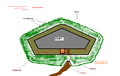
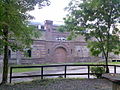
Fort X, Prince Wilhelm of Prussia , Neusser Wall 33, built October 4, 1819–1825; Design: Oberbaudeputation in Berlin, carried out by Jaschnik, Elsner and Buschius; Included in the inner wall at the end of the 1880s; 1912: apartments; 1914: Design for a green fort by Fritz Encke; 1919/20 execution of the gardens with rose garden on the wall; 1930 in the reduit office of the municipal gardening authority, five or six tenants, including one gardener; 1939: Comradeship House of the SS ; after 1945: emergency accommodation; 1972 (according to the Rheinischer Zeitung) used by four families, council blowers, rabbit breeders' association, scouts, camp of the city of Cologne, green space office; 1978: eight tenants; today: clubs, one tenant (caretaker); Preserved today: core works, encircling with casemates, flank and faced trenches with escarp and countercarp walls and mine galleries.
Location: 50 ° 57 ′ 27.8 ″ N , 6 ° 57 ′ 41.6 ″ E

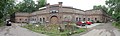
Fort X courtyard
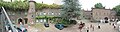
Inner courtyard panorama

Rose garden on Fort X, view from the pavilion


Fort XI, according to the highest cabinet order of October 29, 1888, renamed Prince Heinrich of Prussia, Niederländer Ufer; 1834/35: built as Riehler Schanze; 1843–1847: New building as a fort based on a design by Heinrich Ferdinand Schuberth with changes by Ernst Ludwig von Aster and Carl Ferdinand Busse; End of the 1880s: inclusion in the inner wall; around 1912: partial demolition; Second World War: emergency hospital; since the 1950s: on the site: youth hostel; since 1997: sculpture park ; today: no traces visible.
Inner fortress ring on the right bank of the Rhine
Fort XV, Rheinpark, former name Fort XII; 1845/46: built as a lunette on the Rhine; 1857: the bezel was broken off; 1858/59: Construction of the fort in place of the lunette according to the design by Heinrich Ferdinand Schuberth with changes by Ernst Ludwig von Aster and Carl Ferdinand Busse; 1913/14: Demolition of the redoubt, ditch, walling largely preserved and establishment of a restaurant for the German Werkbundausstellung based on the design by Wilhelm Kreis and the associated green design based on the design by Fritz Encke; Second World War: partially destroyed; 1956/57: Walling partially leveled or earthfill also shifted as well as construction of a park café on the eastern Kaponiere for the Federal Horticultural Show according to the design by Rambald von Steinbüchel-Rheinwall as well as wall and ditch changes with green design according to the design by Günther Schulze and Joachim Winkler; today: received: hints of a moat and wall divider.
Fort XIV, Deutz-Mülheimer Strasse, former name Fort XIII; Built 1857–1859 in place of the earlier bezel 8, design: Heinrich Ferdinand Schuberth with changes by Ernst Ludwig von Aster and Carl Ferdinand Busse; demolished around 1910 and set up a parcel post office on the site; from around 2000: Lufthansa design center, hotel and administration building; today: no traces visible.
Fort XIII, Fort Rauch, Siegburger Strasse, former name Fort XV; 1861–1863: created through the rebuilding of the bezel on Windmühlenberg in 1855; before the First World War: artillery depot; 1930: five tenants, one warehouse, five businesses; 1939: five tenants, two warehouses, seven businesses; 1951: 17 tenants, five companies, sports club Deutz 05; around 1958/59: demolished, today: preserved: a caponier in the basement of a Strabag building.
Lünetten on the left bank of the Rhine
Lünen 1, on Alteburger Straße and on the site of today's Maternus Church; Built in 1820/21 as a peace powder magazine; 1832 rebuilt as a bezel; today: no traces visible in the terrain.
Bezel 2, Zugweg / Rolandstraße and on the grounds of the cath. Primary school; Built in 1820/21 as a peace powder magazine; Converted into a bezel in 1832; today: no traces visible in the terrain.
Lunen 3, Volksgartenstraße, in Volksgarten, south of the intersection Volksgartenstraße / Kleingedankstraße; Built in 1818/19 as a peace powder magazine; 1831/32 converted to a bezel; 1887–1889 redesigned or integrated into the Volksgarten based on a design by Adolf Kowallek; At the end of the 1880s, it was converted into the garden director's apartment (Kowallek and later Encke). 1929 Office of the municipal garden district 1, association office of the branch of the Red Cross, two tenants, one of them a gardener; 1939: Office of the municipal garden district, one or two tenants, including one gardener; after 1945: gutting and a new roof, used by the Green Space Office for the wintering of potted plants, hence the name orangery ; 1978 :: Restaurant, two tenants, including one gardener; from 1991 as rehearsal room of the Healing Theater in winter; from 2000: used as a theater house all year round; today: the storage building / reduit of the lunette still preserved in the basement, as well as remnants of the wall with three casemates.
Bezel 4, on the Lindenstrasse / Roonstrasse intersection; Built in 1818/19 as a peace powder magazine; 1832: rebuilt as a bezel, no traces visible.
former bezel 5, on Krefelder Wall / Krefelder Strasse; Built in 1821 as a peace powder magazine; 1841: replaced by the construction of Fort IX, no traces visible.
Bezel 5, on Neue Maastrichter Straße on Brussels Street; Built in 1818/19 as a peace powder magazine, no traces visible.
Bezel 6, in the Gladbacher building block, Gilbachstrasse and Spichernstrasse; 1841: built, no traces visible.
Bezel 7, on the Hülchrather / Weißenburgstrasse intersection; 1818/19: built as a peace powder magazine; 1832: rebuilt as a bezel, no traces visible.
Lunettes on the right bank of the Rhine
Lunen 1, Am Judenfriedhof, today Deutzer Stadtgarten, former name Lunen IX; Built in 1855 as a defensible peace powder magazine called Am Judenfriedhof ; 1859–1864 converted to a bezel; 1919/20: transformed into a green fort , design: Fritz Encke, used as a restaurant; after 1967: building destroyed due to building moisture; today: in the green area the ground plan and outline are still roughly legible.
Lunette 2, east of the old building of the Eduardus hospital, former name lunette IX; 1828/29: built as a defensible peace powder magazine; 1832/33: converted to a bezel; End of the 1990s: removal of the last traces of the terrain; today: Extension of the Eduardus Hospital.
Inner city wall
Built 1882–1891 (middle section from September 1882ff., Southern section from 1883ff., Northern section from 1886), demolished 1911–1972.
Front I, Elsa-Brandstöm-Strasse, Neusser Wall; 1886–1890: built; today: no longer visible.
Front II, Neusser Wall, Krefelder Wall; 1886–1890: built; today: no longer visible.
Front III, Gladbacher Wall, Media Park; 1882–1887: built today available: caponier on Gladbacher Wall.
Front IV, Gladbacher Strasse; 1882–1887: built; today: no longer visible.
Front V, Venloer Wall, Ludolf-Camphausen-Strasse; 1882–1887: built; no longer visible today.
Front VI, Schmalbeinstrasse, inner green belt in the area of the former Lindenwall, west parallel to Moltkestrasse and Lützowstrasse; 1882–1887: built; today: no longer visible.
Front VII, Zülpicher Wall and university grounds; 1882–1887: built; today: no longer visible.
Front VIII, Luxemburger Wall, Eifelwall; 1882–1887: built; today: no longer visible, Mittelkavalier VIII demolished in 1959
Front IX, Vorgebirgstraße, Bonner Wall; 1883–1888: built; 1972: Kavalier removed as the last section, only part of the counter-karpen wall between the tracks was preserved.
Front X, Bonner Wall, Alteburger Wall; 1883–1888: built; after the Second World War: dragged.
Front XI, Alteburger Wall, Oberländer Wall; 1883–1888: built; today: no longer visible.
The outer fortress ring

The development of siege guns with ever increasing ranges, the development of the Cologne suburbs such as Cologne-Ehrenfeld , which also developed towards the fortress ring, forced the construction of another fortress ring with a diameter of 16 kilometers after the war of 1870/1871. This time too, large parts of the city on the right side of the Rhine were enclosed in the fortifications. The fortress ring consisted of 12 main works and a total of 23 intermediate works that were inserted between the main works. This fortress ring was completed in 1880, but it was considered obsolete by 1886. The reason for this lay in the introduction of explosive shells with time fuses , which, when hit, dug deep into the ground and only then exploded. The combination of bricks and earth walls offered no protection against such a threat.
The main works again received Roman numerals for identification, the intermediate works received the same number as their associated main work and the lowercase letters a, b or c to distinguish them. In addition, the city-side facades of the facilities were designed slightly differently in order to make it easier for the stationed soldiers to identify their fortress. The individual forts were connected to one another on the left bank of the Rhine by the military ring road, which is still of considerable importance for the city today.

Outer fortress ring on the left bank of the Rhine
Fort I, (Niehl), Bremerhavener Strasse, on the current Ford site; 1874–1877: built; 1922/23: looped; today: no traces visible in the terrain.
Location (estimated): 51 ° 0 ′ 8.4 ″ N , 6 ° 57 ′ 30.1 ″ E
Zwischenwerk Ib, (Niehl), Bremerhavener Strasse; north of the intersection of Neusser Straße / Militärring; 1876/77: built; Dragged in 1921; 1926: the company von Glanzstoff-Courtaulds was established on the site ; today: very minor bumps visible as traces on the edge of the area.
Zwischenwerk IIa, (Niehl / Longerich), east of Bergheimer Weg, north of the military ring and south of the barracks area; 1876/77: built; 1920/21: partially razed, preservation of the Kehl barracks with developed sports rooms as well as the flank and throat ditch with ditch retaining walls; 1923: Design of the green design with sports and public meadow by Fritz Encke; 1926, 1929: Annex to the draft revised by Theodor Nussbaum ; 1930: a tenant (gardener) in the Kehlkaserne; 1939: Home of the Hitler Youth ; during the Second World War: POW camp, one tenant; 1951: 17 tenants, two of them gardeners; 1961: five tenants and garden authority accommodation, demolished after 1964; today: no traces visible in the terrain.
Fort II, (Longerich), Militärringstrasse 341, between Bergheimer Weg and Heimersdorfer Strasse; northwest of the intersection of Bergheimer Weg and military ring; 1874–1877: built; October 1921: partly dragged; 1923: Planning as a recreation site with Volkswiese while preserving the Kehl barracks and the Kehl and flank ditches with retaining walls according to a design by Fritz Encke (according to Encke memorandum, p. 48: The rooms of Fort II, which have not yet been developed for the time being, in which until now only one apartment and a gym would then be used as accommodation for youth clubs. ); 1927–1933: Service room of the Evangelical Congregation Nippes; 1930: at the same time the gymnasium of the municipal elementary school, a tenant (gardener); 1933: Reich Labor Service; 1939: a tenant; during the Second World War: POW camps; from 1945: assembly camp for bombed out Cologne residents; 1951: 14 tenants; 1966: demolition; today: Traces of the former terrain are still faintly recognizable.
Location (estimated): 51 ° 0 ′ 6.7 ″ N , 6 ° 54 ′ 32.5 ″ E
Zwischenwerk IIb, (Longerich), between Lindweiler Weg and Escher Straße: northwest of the intersection of Lindweiler Weg and the military ring; 1876–1878: built; 1920/21: partly dragged; 1923: Conversion to a sports facility (one soccer, one hockey and two ball pitches); 1926: Sports facility completed; 1961: Kehlkaserne no longer exists; today: traces of the Kehl barracks visible in the elevation.
Fort III, (Ossendorf), north of the Nüssenberger Hof; north of the intersection of Nüssenberger Weg and Militärringstrasse, October 1874–1876: built; 1920/21: partly razed, that means preservation of the valley barracks as well as the valley and flank ditches with retaining walls; 1923: Designing a recreation center with a popular area, designed by Fritz Encke, according to memorandum of Encke, p 50 are, for the time being not to expand the spaces of Kehl barracks preserved, but to secure only against non-Called penetration ; 1931: Theodor Nussbaum's redesign; 1932/33: completion of the green area; 1965: two tenants; End of 1965: demolition for training purposes by the pioneers of the Bundeswehr; today: traces of the former site formation and remains of masonry lying around visible.
Estimated location: 50 ° 59 ′ 12.8 ″ N , 6 ° 51 ′ 41.3 ″ E
Zwischenwerk IIIb, (Ossendorf), south of the Nüssenberger Hof; 1875–1877: built; 1920–1921: partial preservation of the Kehlkaserne and the Kehlgrabenmauer; 1923: Redesign of the green design while retaining the glacis planting by Fritz Encke; 1925: Opening of the Day Forest School II with outdoor classrooms; 1930: Municipal forest school, one tenant (teacher); 1951ff .: Municipal forest school Nüssenbergerbusch, a tenant (caretaker); 1973: one tenant, club rooms; 1991: Boklemünder Musik- und Trumpetercorps, Bocklemünder Musikcorps, rock music group of falcons and music group of radio amateurs; Today: Club rooms for radio amateurs and clubhouse with lecture and exhibition casemates of the Arbeitsgemeinschaft Fortress Köln eV , preserved: Kehlkaserne, southern section of the Kehlgraben recognizable, flank ditch in a different shape.
Location:

Intermediate plant III B

Zwischenwerk III b Panorama


Intermediate plant IVa, (Bocklemünd), north of the Mühlenweg confluence; 1875–1877: built; 1920–1921: partially razed, but in a document from the 1920s, HstAK 902/168/1: complete destruction. Leveling and construction of sports facilities, sports areas based on a design by Fritz Encke around 1923; around 1965: razing; today small remains of the shoulder ditches are visible in the area.
Fort IV, (Bocklemünd), Freimersdorfer Weg; March 1874–1876: built; 1921/22: partially razed, according to a document from the 1920s, HstAK 902/168/1: preservation of the Kehlkaserne, conversion of the rubble fields into a sports facility; Encke, memorandum, p. 51: The majority of the rooms in the barracks are designed as changing rooms for those who do sports, the others as a gym and as rooms for the needs of the children's air bath, as well as an apartment for supervisors ; 1923: Redesign: Fritz Encke; 1924/25: Execution: Sports facility of the Post Sports Club, municipal horticultural and open-air school, municipal horticultural administration district 5, two tenants, one of them a gardener; 1939: Postsportverein e. V., Municipal Horticultural Administration District 5, one tenant (administrator); 1939–1945: on the former ground floor: air defense center for the greater Cologne area, upper floor: accommodation for the crews and officers of the air defense center; after 1945: emergency accommodation; 1951 Postsportverein Köln, four tenants; before 1960: also poultry farming; 1961: mushroom growing, one tenant, two carpenters; 1965: Sports facilities of the Postsportverein Köln eV, six tenants; 1978: Sports field of the Postsportverein Köln eV, two tenants (one of them a club attendant); 1980s-2008 club rooms of the Telekom- und Postsportgemeinschaft eV as well as other club rooms, storage rooms and workshops of the city of Cologne; today: club rooms, locksmith's shop; Preserved today: Kehl barracks, approaches to the flank ditches and ramparts, access bridge and path.
Location: 50 ° 58 ′ 16.7 ″ N , 6 ° 51 ′ 40.5 ″ E
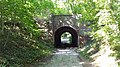
Fort IV on the Cologne-Venlo railway line

Fort IV, view of the partially filled in throat ditch
Fort IV panorama


Zwischenwerk IVb, (Vogelsang), Belvederestrasse, east of the Max Planck Institute; 1875–1877: built, according to a document from the 1920s, HstAK 902/168/1: preservation of the valley barracks as well as the flanks and valley trenches with trench retaining walls, construction of a recreation area with a grassland; Encke, memorandum p. 52: The rooms of the barracks are not developed, but only secured against intrusion. ; 1923: Redesign plan: Fritz Encke; around 1923: completion; around 1962: elimination; today: slight traces of the valley and flank ditches and walls recognizable in the terrain.
Zwischenwerk Va, (Müngersdorf), Belvederestrasse 151, north of the Belvedere building; 1875–1877: built; 1920/21: partially razed, initially planned according to HstAK file 36/1, to expand Kehlkaserne by means of emergency work into a dairy farm with a dairy, according to a document from the 1920s, HstAK 902/168/1: Preservation of Kehlkaserne as well as the flank and Throat ditches with trench retaining walls, construction of a recreation area with a grassland; 12924 forest school created and opened in 1925; 1927/28: expanded to include a playground, gymnastics and sports field and sand basin based on the design by Theodor Nussbaum; 1939: Municipal Horticultural Open Air School; 1951: three tenants, including one gardener; 1965: Municipal outdoor and gardening school, a tenant (gardener); 1978: Municipal Open Air and Gardening School; today: open-air and garden school (Freiluga), remarkable: teaching and rock garden, preserved: throat barracks and flank ditches still recognizable at the throat points.
Location (estimated): 50 ° 56 ′ 55.8 ″ N , 6 ° 52 ′ 7.2 ″ E
Fort V, (Müngersdorf), east of Robert-Blitzer-Weg (?) And west of Eschenallee; January 1874–1876: built; 1921–1922: partially razed, according to a document from the 1920s: preservation of the valley barracks and the valley and flank ditches with retaining walls, conversion of the plant as a recreation area with a grassland; on this Encke memorandum, page 54: Fort V, which is still used as a prison, is to accommodate a recreational facility for Müngersdorf ; 1923: Redesign: Fritz Encke: Recreation center with meadow and sports areas; 1930: Design: Theodor Nussbaum as a green fort with a sports facility; 1939–1945: Collection camp for Cologne Jews before they were transported to the extermination camps; around 1962: demolition; today: slight traces of the Kehl barracks in the terrain modeling and in the vegetation.
Location: ?
Zwischenwerk Vb, (Müngersdorf), stadium area between swimming and riding arena; 1875–1877: built; 1921: partially razed, according to a document from the 1920s, HstAK 902/168/1: preservation of the Kehlkaserne and installation of an air and light bath; 1923: Design: Fritz Encke; after 1945: student dormitory; around 1970: demolition; today: no traces in the area.
Zwischenwerk VIa, (Lindenthal), north of Dürener Strasse, near Heinrich-Stevens-Weg; 1875–1887: built; 1921: partially razed, according to a document from the 1920s, HstAK 902/168/1: preservation of the Kehlkaserne, conversion of the rubble fields into sports fields; 1923: Design: Fritz Encke: Sports facility, playground; until 1958: emergency accommodation; around 1959: demolition; no traces in the area today.
Fort VI, (Lindenthal), north of Gleuler Strasse; 1873–1876: built, used by 9th foot artillery regiment; 1921: partially razed, according to a document from the 1920s, HstAK 902/168/1: Planning: preservation of the Kehl barracks and the moat retaining wall, establishment of a day forest school; Encke's memorandum (p. 59): In the barracks only 2 apartments have been built for the time being. After completion of the 10 sports fields planned here, additional rooms will be prepared for half of them. The rest will be used for the needs of the Volkswiese. ; 1923: Design: Fritz Encke; Ornamental garden on the Kehlkaserne and rock garden in the northern moat, Volkswiese; 1923 and 1927: Execution: 1930: two tenants (gardeners); 1939: two tenants, including one gardener; Second World War: emergency shelters, three-story beds; 1951 17 tenants; 1965: eleven tenants; 1971: Use by the Green Spaces Office and three sports clubs; since the late 1970s: rock groups, visual artists; Green space office; 1979: Superstructures on the Kehlkaserne; 2000: Renovation work in the rock garden by the Rhenish Association for Monument Preservation and Landscape Protection with the Hildegard-von-Bingen-Gymnasium; today: preserved: Kehlkaserne, northern flank and throat ditch in a different shape, position of the faces recognizable by tree vegetation.
Location: 50 ° 54 ′ 52.5 ″ N , 6 ° 53 ′ 28.8 ″ E
Intermediate plant VIb, (Sülz), near Berrenrather Straße; 1875–1877: built; 1921: partially razed, according to a document from the 1920s, HstAK 902/168/1: preservation of the Kehlkaserne, conversion of the rubble fields into sports fields; 1923: Design by Fritz Encke as a "green fort" with sports facilities and a meadow; 1923–1927: execution; 1930: Workers' sports club Frischauf Sülz 03, a tenant; 1930s: according to newspaper report, Reich Labor Service; 1939: Spielverein Sülz 07, two tenants, one of them a gardener; 1948: Sülz 07 merges with the Kölner Ballspielclub to form 1. FC Köln; 1951: restaurant; 1953: start of renovation work; 1965: Clubhouse of 1. FC Cologne; today: 1. FC Köln sports facilities: Geisbockheim, heavily rebuilt; today: Parts of the Kehlkaserne preserved in the basement of the clubhouse.
Intermediate plant VIIa (Klettenberg), south of the intersection of Luxemburger Straße / Militärring; 1876–1878: built; 1921: partially razed, according to a document from the 1920s HstAK 902/168/1: preservation of the Kehlkaserne, conversion of the rubble fields into sports fields; Encke memorandum (p. 61): Following the work, a sports field group; 1923: Design: Fritz Encke; 1930: Cologne Ball Game Club; 1930s: according to witness report: Reichsarbeiterdienst; 1939: Kölner Ballspielclub e. V., restaurant, two tenants; 1951: three tenants; 1961: destroyed according to a document from the city curator; today: no traces in the area.
Fort VII (folding rule), east of the federal railway line to Trier; March 1874–1877: built, used by the 9th foot artillery regiment, according to a document from the 1920s, HstAK 902/168/1: preservation of the Kehlkaserne; Conversion of the rubble fields into a sports facility; 1923: Fritz Encke redesigned the green fort with a sports facility; around 1926: construction of allotment gardens; 1930: Borussia football club, St. Bruno bachelor club; 1939: shooting range, three tenants; Second World War: flak positions, accommodation of foreign forced laborers; 1943/44: air raid shelter; after 1945: storage rooms, wood shop, car recycling, small engine repair service, electrical workshop; 1951: 21 tenants; 1965: 19 tenants; 1978: 14 tenants; 1980s ff .: various commercial enterprises (cf. after 1945); 1999ff .: planning of a hotel complex with wellness facilities based on the reconstruction of all parts of the fort; today vacancy (owned by the Federal Railroad); Preserved today: Kehlkaserne, flank walls visible in small traces.
Location: 50 ° 53 ′ 44.2 ″ N , 6 ° 55 ′ 30.4 ″ E
Fort VII in folding rule

Zwischenwerk VIIb (folding rule), near Brühler Strasse, west of Leichweg and south of Militärringstrasse; 1876–1878: built; 1921: partially razed, according to a document from the 1920s, HstAK 902/168/1: complete destruction. Leveling and construction of a recreational facility; 1923: Design by Fritz Encke: Recreation facility with playground; today: slight traces of the flank ditches can be seen.
Intermediate plant VIIIa (Raderthal), east of Hitzelerstraße; 1876–1878: built; 1921 partially razed, according to a document from the 1920s, preservation of the Kehl barracks, conversion of the rubble fields into sports fields; 1923: Redesign by Fritz Encke: green fort with sports facility: 1930: Kölner Spielverein Victoria eV, a tenant (groundskeeper); around 1960: blown up; today: no traces in the area.
Fort VIII (Marienburg), west of the Schillingsrotter Weg; 1875–1878: built, used by 7th foot artillery regiment; 1922: partially razed, according to a document from the 1920s: People's and playground, air and light bath for children; Encke memorandum (p. 64): The high Fort VIII [...] steep glacis sloping down to the golf course. Fort VIII is supposed to be a recreation facility ; 1923–1925: execution; 1927/28: revised design by Theodor Nussbaum: free, air and garden school; after 1945: bomb depot of the ordnance disposal service; 1951: 18 tenants; around 1975: overgrounding of the Kehlkaserne; today: golf course, traces of the throat ditch and the eastern flank ditch recognizable in the terrain.
Intermediate plant VIIIb (Marienburg), northeast of Konrad-Adenauer-Strasse; 1876–1878: built, minor razing work, according to Encke's memorandum (p. 65): >> If the type of blasting allows, the impression of the old fortification should be preserved as far as possible. ... This place is the right place for a small restaurant. Adenauer planned a restoration facility for the recreation facility here; around 1926: horticultural design by Fritz Encke; 1927: Execution with changes by Theodor Nussbaum, post-war use by the Green Space Office; since 1985: sculpture park in the outdoor areas; otherwise today: Cologne Fortress Museum (CRIFA); the best preserved work in the outer fortification belt, only the caponiers at the shoulder points have been dragged, on and on the throat caponier is the staircase built in the 1920s, roof garden-like ornamental garden on the ground level newly terraced in 1927 above the intermediate work with its preserved walled border Facing and front trenches.
Location: 50 ° 53 ′ 56 ″ N , 6 ° 58 ′ 57 ″ E

Access to the park and the fortress museum
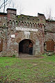
Portal of the intermediate plant VIII B

Intermediate plant VIII B in Cologne-Marienburg

Inside of the intermediate plant VIII B

Intermediate plant VIII B


The Müngersdorfer Fort in the time of National Socialism
.jpg)
.jpg)
During the National Socialist dictatorship, the area of Fort V, located on the outer ring and previously serving as a garrison prison, was used as a collection camp for the Jews living in the city , in order to subsequently deport them to the ghettos and extermination camps.
More detailed investigations in Cologne-Müngersdorf showed that the people were housed in barracks on the sports field area adjacent to the fort and in the area of today's allotment gardens, but not in the Kehlkaserne itself. This was partly used by the Wehrmacht as a material store, later it served the Müngersdorf population also as an air raid shelter . The fort was eliminated in the 1960s; today only a small plaque with the following content reminds us of this:
- In memory of the dead and as a reminder for the living
- During the Second World War, the so-called Müngersdorf Jewish camp was located in the former Fort V and the adjacent area. The Jews expelled from their houses and apartments were concentrated here and transported to the Nazi extermination camps.
- Cologne City Council 1981
Outer fortress ring on the right bank of the Rhine
Intermediate plant IXa (Westhoven), Westhovener Aue , south of Kölner Strasse; 1877–1878: built; Partially razed in 1922; 1951–1995 located in the middle of the Belgian military area and used as a storage room and coal cellar; 2004: planning for a recreation facility; 2008: Closure by sealing; today: vacant, preserved: Kehlkaserne, northern Kehlgraben roughly recognizable.
Location: 50 ° 54 ′ 6.4 ″ N , 7 ° 0 ′ 18.5 ″ E

Walled-up facade of the intermediate plant IXa

Fort IX (Westhoven), east of Gremberger Ring and north of Kölner Strasse; 1877–1880: built; 1922: partly dragged; 1932: Voluntary labor service; 1936–1945 renamed Camp Hitler; 1933ff .: Reich Labor Service; from 1935: part of the mudra barracks for the Westhovener Pioneer Battalion 26; 1951–1955: Part of the Belgian military area and used as a horse stable, club room for the Belgian pistol shooters and the Belgian alpine club; 1955: horse stable; since 2000: vacant, preserved today: Kehlkaserne, log house, Kehlgraben, northeastern flank ditch, flank ramparts and access path recognizable.
Location: 50 ° 54 ′ 35.7 ″ N , 7 ° 1 ′ 17.6 ″ E
Intermediate plant IXb (Gremberg), northeast of the Gremberg motorway junction in the Gremberg grove; 1877–1879: built; 1922: partly dragged; 1961: a tenant, a business enterprise; 2008: Closure by bricking up the facade openings; today: vacant, preserved: Kehlkaserne, ramparts and ditches.
Location: 50 ° 55 ′ 11.2 ″ N , 7 ° 1 ′ 36.7 ″ E
Intermediate plant Xa (Vingst), east of the Vingster Ring, north of the Hardtgebuschweg; 1877–1879: built; 1922: partly dragged; 1923: Redesign: Fritz Encke: Open-air and garden school; 1926/27: execution; 1951: nine tenants; around 1956: demolition; Today: Buildings no longer visible, preserved: slight traces of the flank ditches and ramparts in the area of the shoulder points as terrain modeling and recognizable in the routing.
Fort X (Höhenberg), east of Frankfurter Strasse, south of Nohlenweg; 1877–1880: built; 1922: partly dragged; 1923: Redesign: Fritz Encke: green fort with meadow; 1927/28: execution; Second World War: main command post for air raid units; Post-war period: emergency shelters; around 1970: used by the gardening office and the civil protection office; since about the mid-1980s: clubs, preserved today: valley ditch wall, flank ditches, parts of the flank walls, access path, route layout traces the former floor plan.
Location: 50 ° 56 ′ 18 ″ N , 7 ° 2 ′ 8.5 ″ E

Kehlkaserne Fort X. The missing ornamental band in the second segment to the right of the gate shows where the Kehlkoffer used to be.

Old floor plan projected onto a current map. Only the area marked in red is available today, without the throat trunk protruding into the throat.

Intermediate plant Xb (Höhenberg), Merheimer Heide; 1877–1879: built; in the 1920s: destroyed; today: no more traces visible.
Intermediate plant Xc (Buchheim), south of the Schlagbaumwerges, west of the motorway; 1877–1879: built; 1922: partly dragged; 1948ff .: horse stable of the Cologne breeding, riding and driving association, lounges, carpenter's workshop; 1966: partial blast; today: sanitary facilities of the adjacent football club, preserved: small section of the Kehlkaserne.
Location: 50 ° 57 ′ 20.1 ″ N , 7 ° 1 ′ 56.7 ″ E
Intermediate plant XIa (Buchheim), Herler Ring 176, north of Gauweg, west of the autobahn; 1877–1879: built; 1922: partly dragged; 1923: Fritz Encke's redesign plan for a “green fort” with a sports facility; 1923–1925: Execution, in the 1920s: extension to the Kehlkaserne (restaurant building); since 1924: Turngau in Cologne; since 1927: Mülheimer Turnverein (MTV); 1939: Turnerheim of the Mülheim corporation 1850, restaurant; during the Second World War: auxiliary police; from 1949: MTV; 1951: restaurant, 16 tenants, including two gardeners; 1965: ten tenants; 1978: restaurant; September 13, 2011: restaurant closed; Preserved today: Kehlkaserne, rear exposed, extension from the 1920s, traces of the flank ditches with adjacent ramparts on both sides of the sports fields.
Fort XI (Buchheim), formerly Mülheimer Ring 151, east of Mülheimer Ring, north of Piccoloministraße; 1877–1880: built, used by the 7th Company of Infantry Regiment 16 (Hacketäuer); 1922: partly dragged; 1923: Redesign by Fritz Encke as a recreational facility with a meadow; 1926–1931: execution; 1939: Light, air and sunbathing, one tenant; 1951: 51 tenants; around 1960: Garden Department, a sports club; Late 1970s: Boy Scout Home; Preserved today: Kehlkaserne, log house, Kehlgrabenmauer, flank ditches without wall as well as parts of the ramparts, the original fortress ground plan recognizable in the green design and route.
Location: 50 ° 58 ′ 18.4 ″ N , 7 ° 1 ′ 33.3 ″ E
Intermediate plant XIb (Mülheim), Cottbuser Strasse, south of Berliner Strasse, west of the Autobahn; 1877–1879: built; 1922: partly dragged; 1923: Fritz Encke's redesign plan as a recreational facility; 1927: execution; since 1969: Holweide music train; Today: Club rooms of the youth, music and fanfare corps Holweide, garden department, preserved: Kehlkaserne, flank and front ditch and ramparts as ornamental systems at a different elevation.
Location: 50 ° 58 ′ 39.8 ″ N , 7 ° 1 ′ 19.2 ″ E
Zwischenwerk XIIa ( Brother Klaus settlement ), Walliser Weg; 1877–1879: built; 1922: partially razed, redesign by Fritz Encke as "light and air bath"; 1926–1929: execution; Post-war period: emergency shelters; during the construction period of the Bruder Klaus settlement: warehouse, meeting place and apartments; 1961: removed in the course of redesigning the Bruder-Klaus-Siedlung; today: flank ditches and ramparts in parts can be seen in vague outlines.
Fort XII (Stammheim), west of Düsseldorfer Straße, north of Stammheimer Ring, Stammheimer Häuschen; 1877–1880: built, used by the 6th Company of Infantry Regiment 16 (Hacketäuer); 1922: partly dragged; 1923: Fritz Encke's redesign plan as an air and light bath ; 1927–1929: execution; Post-war period: emergency shelters; 1961 and 1966: 15 apartments; 1978/77: overgrounding of the Kehlkaserne; today: green area with traces of flank ditches and ramparts, throat ditch and fort inner courtyard recognizable in terrain formation.
Location: 50 ° 59 ′ 33 ″ N , 6 ° 59 ′ 46.2 ″ E
Intermediate plant XIIb (Stammheim), Stammheimer Deichweg; 1877–1878: built; 1922: partly dragged; 1923: Fritz Encke's redesign plan as an air bath; around 1959: eliminated; no traces visible in the area today.
Interfield structures
Infantry bases, 24 plants on both sides of the Rhine; 1887–1891, 1907–1913, at the beginning of the First World War. built; first half of the 1920s: razing; Preserved: remarkable remains of rubble with partially preserved interiors: Plant 16: Quantityich Infantry Base, Plant A81; Infantry base Stammheim 2 and the rubble stones integrated into the forest botanical garden in a hollow of Plant 82: Infantry base Hermannshof.
Infantry rooms, 28 plants on both sides of the Rhine; 1887–1891: built; 1907–1913, at the beginning of the First World War, first half of the 1920s: razing; Preserved: remarkable remains of rubble with partially preserved interiors: Plant A54 or 55 built at the beginning of the First World War.
Artillery shelters, 26 works on both sides of the Rhine; 1887–1891: built; 1907–1913, at the beginning of the First World War, first half of the 1920s: razed, no longer visible.
Ammunition rooms, 26 plants on both sides of the Rhine; 1887–1891: built; 1907–1913, at the beginning of the First World War, first half of the 1920s: razing, preserved: remarkable remains of rubble with partially preserved interior of Plant 65: Komar ammunition room.
Watchtowers, three works, on the left bank of the Rhine; 1907–1914: built, first half of the 1920s: razed, no longer visible.
Trenching, six works, left bank of the Rhine, beginning of the First World War: built; 1921: grinding, no longer visible.
Flanking batteries, 15 plants, on both sides of the Rhine, beginning of the First World War: built, first half of the 1920s: razed, no longer visible.
Advance painting, twelve plants, left bank of the Rhine, beginning of the First World War: built; 1921: grinding, no longer visible.
Activities and initiatives
- Cologne Research - Institute of Fortification Architecture (CRIFA)
Since the mid-1990s, Cologne's fortresses from the Prussian era have been researched and documented. As a spin-off, the intermediate plant VIII b was prepared as a Cologne museum fortress from 2003 and outsourced as an independent association Kölner Festungsmuseum eV . The most well-known publicity measure of local history as well as the promotion of tourism is the day of the forts, which is held annually with the support of the Cologne city administration.
- Day of the forts
The now international fort day has been held annually since 2003. Similar to the day of the open monument , interested parties have the opportunity to visit all forts on this day free of charge as part of guided tours. The forts are brought into the consciousness of the population and history can be experienced. The focus is on the architecture and the city's history, less on the military and weapons. The organizer is CRIFA in cooperation with the Cologne Fortress Museum and the individual cities.
- Fortis Colonia
The Cologne association Fortis Colonia takes care of the preservation of the remains of Cologne's city fortifications from the Romans to the Prussians. The aim of the association is to bring this historical legacy back into the consciousness of the population and to ensure that it is preserved and used sensibly.
- Cologne Fortress Museum
The Cologne Fortress Museum, founded in 2004, is located in the Marienburg district of Cologne , in the former intermediate plant VIIIb. The museum offers public tours twice a month.
See also
literature
- Andreas Kupka: Archeology North-South Stadtbahn Cologne. “The city to adorn and defy”: late medieval and modern fortifications in the south of Cologne. Administration of the Museums of the City of Cologne, Cologne 2006.
- A green area with history. Fortifications and outer green belt in Cologne. Festschrift for Konrad Adenauer. Edited by Fortis Colonia (= Fortis Colonia series of publications No. 2), Cologne 2015. ISBN 978-3-9817714-1-1
- Henriette Meynen: The Prussian fortress Cologne. (= Rheinische Kunststätten issue 452). Rhenish Association for Monument Preservation and Landscape Protection , Cologne 2000, ISBN 3-88094-863-1
- Henriette Meynen and others: fortress city Cologne - the bulwark in the west. Emons, Cologne 2010, ISBN 978-3-89705-780-7 .
- Georg Ruppert: fortress under the city. Spiegel-Online (einestages.de) 2008. Article
- Robert Schwienbacher: Fortress Cöln - The outer fortress belt. Cheeky 2002.
- Robert Schwienbacher: Inventory of the Prussian fortress Cologne . Volume 1 and 2, Cologne 2010.
- Uwe Zinnow: Working group fortress Cologne e. V. - The history of the Cologne fortress belt in the Bocklemünd area. Huerth 2006.
media
- Frank Beumer: Fortress Cologne. DVD. CRIFA, 2004.
- Rheinhard Zeese: 1900 years of fortified Cologne. CD. LEB, Brühl 2006.
- Uwe Zinnow: Casemates for Cologne. DVD, (Working Group for Fortress Cologne e.V.) Center TV Cologne, 2006.
Web links
You can also find more photos for the individual districts below
- Annual Fort Day under the patronage of the City of Cologne
- Working group fortress Cologne
- Specialist page of the bunker pecking about the fortress city of Cologne
- Cologne Research - Institute for Fortress Architecture (CRIFA)
- Cologne Fortress Museum
- Fortis-Colonia
- Fort IX on Fort Open Day 2004
- Images & memorial plaques - Peace Park Cologne, Fort I - Hereditary Grand Duke Paul of Mecklenburg
Individual evidence
- ↑ https://fortis-colonia.de/stadtbefestigungen/chronologie.html
- ↑ Henriette Meynen: Catalog of fortress structures with subsequent uses , section Innerer Festungsgürte, p. 495 f
- ↑ Alexander Hess: Effects of the new town wall and the rayon in Sülz / Lindenthal on the urban structure. In: Fortis Das Magazin 2015/16, p. 152/153, published by Fortis Colonia, Cologne 2016.
- ^ Entry by Christoph Boddenberg on Fort VII of the outer Prussian fortress belt in the " KuLaDig " database of the Rhineland Regional Council
- ↑ a b HstAK 902/168/1
- ↑ Ayhan Demirci: Nazis, mines, phantom corpses: Lord of the forts leads through Cologne's horror fortress. May 31, 2018, accessed on July 28, 2019 (German).
- ↑ museum.de (ed.): Cologne Fort Museum . ( museum.de [accessed on November 5, 2018]).