
City wall Cologne
The city wall of Cologne was a fortification built in several phases over centuries. The first was created between the late 1st and 3rd centuries for the square " Colonia Claudia Ara Agrippinensium " of the Romans. A more spacious, semicircular fortification line was created in the Middle Ages. The last expansion was the fortress ring from the Prussian era from 1815, while the medieval wall was laid down from 1881 with the exception of small remains.

Roman city wall
The chronology and building history of the first ancient Cologne city fortifications are uncertain. Tacitus mentions fortifications for the 1st century. The design and extent of these systems are not known. After archaeological excavations in 2008, the shuttering boards of the concrete foundation on the east side were dendrochronologically dated to 89 AD .
Considerable parts of a multi-phase Roman stone wall are still preserved today , which on the Rhine side dates back to the 1st century, but important parts probably not until the 2nd / 3rd century. Century has been completed or modified.
The later erased inscription of Emperors Valerianus and Gallienus (253–260 (?) And 253–268) on the arch of the north gate west of today's Cologne Cathedral (now in the Roman-Germanic Museum ) indicates a construction phase in the 3rd century .
The architectural decorations of the so-called Roman tower in the north-western corner of the city should, in any case, also belong to the 3rd century in its upper area.
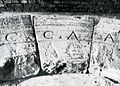
Inscription above the north gate of the CCAA

Rebuilt side passage of the Roman north gate

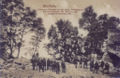
Remains of the Roman city wall (north side)

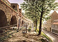
Roman south wall, Mühlenbach


Written research on sources and archaeological preservation of monuments
The extensive soil investigations that were carried out on the occasion of a planned new sewer network in Cologne from the 1880s and completed in 1890 provided science with a number of new findings about the city's Roman past. The careful investigations, which also included the first town fortifications, were carried out under the direction of the engineer and later town planning officer Carl Steueragel (1848-1919) and his colleague Rudolf Schultze (1854-1935), who then advanced to Bonn town builder, and in 1895 Bonn yearbooks published. In addition to the writings of Stephan Brölmann , Ennens , Keussen and other researchers, Clemen referred in his publication on Roman Cologne above all to the research results of Schultze and Steuerungagel, which are still the basis of archaeological conservation in Cologne today.
Side lengths and course of the wall

The Roman city wall, as a structure equipped with gates and towers, enclosed an irregular quadrangle that adapted to the natural terrain and approximated the shape of a square.
The respective side lengths and the course of the wall with the location information in Paul Clemen from 1906:
- West wall with 1179.90 m
Starting at the street “Alte Mauer am Bach” in a slight curve behind the eastern row of houses on Mauritiussteinweg, then across the west side of Clemensstraße, further across “Am Laach” and along the choir apse of St. Aposteln , further through Gertrudenstraße and in the arch behind the eastern houses of St. Apern Straße to the Römerturm.
- North wall with 948.90 m
From the Römerturm in a straight direction east to the tower on the Berlich street, from there slightly north along the north side of the castle wall, at the end of it crossed the Domkloster street and ran under the northern side wall of the cathedral to Pillar IV of the railway viaduct .
- East wall with 881.70 m
The east wall ran in a straight line from Pillar IV on Trankgasse in a southerly direction, east along the street “Unter Taschenmacher”, Bürgerstraße and Judengasse , there under the town hall to the confluence of the street “Obenmarspforten”, then a little east along the east side Martinstrasse ("bovenmauren") until shortly before the eastern end of the street Mühlenbach.
- South wall with 903.30 m
The south wall ran westwards along the Duffesbach coming from Hürth below the northern row of houses on the streets Mühlen- and Blaubach and behind the Bachemstraße further west, on the south side of the street "Alte Mauer am Bach" to the corner tower on the street Greekspforte.
Towers and gates of the Roman wall
.jpg)
According to the state of knowledge of research at the beginning of the 20th century, the 19 towers found on the three sides of the Roman wall were described in Paul Clemens' published work "The Roman Cologne". The buildings that were generally used as defense towers in Roman times (also mentioned as rondels) still had this function in the early Middle Ages and were referred to in Cologne as " wichus or wighus " (propugnaculum), or battle house. With the expansion of the city, the towers lost their original protective function and were henceforth used for all possible purposes. They served mills as a substructure, were latrines , small monastic dwellings, also served as chapels or were converted for residential purposes.
- Towers and gates on the north side
- The corner tower on the northeast side was located at the choir of the later cathedral (west of the collegiate church of St. Maria ad gradus, which was laid down in 1817 ) opposite the Trankgasse. It was mentioned for the first time in 1247 and again in 1261 as the library of the cathedral monastery and was partly preserved above ground in the 1850s. Only when the chapter hall was built did the remaining masonry disappear.
- The next tower stood between the 2nd and 3rd pillars of the buttress on the north side of the cathedral longhouse , the foundation of which later resulted in the destruction of its southern half. The remaining tower was still preserved at the beginning of the 20th century at a low height above the ground.
- West of the north gate, the "Porta clericorum" or also called Pfaffenpforte , the wall led to the first tower on the castle wall, on which a windmill was mentioned in the 12th century . Around 1300 it had apparently lost this function and was called "dat rode Wichus", whose new use, according to the Niederich shrine , was specified as "ab hospitali St. Andreae". In 1324 the tower appeared in general as the main building of the cathedral or "to the old cathedral" (after the Hildebold cathedral ). The tower stood the test of time and was converted into a residential building at the beginning of the 20th century. At that time, it protruded halfway into the street and was still 4.70 m high above its base on the field side.
- The tower behind the houses at Komödienstraße 69 and 71 was also known as the “Roitwichus” or “roede wichuss” in the 13th century. It can still be recognized as a tower on Arnold Mercator's city map , was designated as dilapidated in 1581 (Kolumba Berlici shrine book) and was soon laid down at ground level. In May 1904, when a number of houses on the castle wall and Komödienstraße were demolished, remnants of the old Roman fortifications were almost completely removed. The restored stump of the "Lysolph Tower" named after a resident and pieces of wall along the southern side of the road towards Trankgasse have been preserved to this day.
- The gate tower on Appellhofplatz is considered to be the early side gate of the north gate, which may have opened a street in the direction of today's Subbelrather Straße. The building lost its importance as a gate at the end of Roman times. It was designated as "Aldenwichus" in 1292 and was owned by Heinrich vom Cusin at the beginning of the 14th century, who designated it in 1316 to accommodate two beguines . From this first “cell” in the tower, the monastery of the cell was built in 1334, which was laid down around 1828 during the construction of the justice building that is still preserved today.
- The tower behind the later Hauptwache (today's Cologne City Museum ) was designated in 1246 as the “propugnaculum Judeorum” or “Judenwichhus”. The name referred to the neighboring Judenpforte, built in 1106 and assigned to the residents of Cologne's Jewish quarter for defense. The tower was also in 1331 for the hermitage of nuns and later part monastery , whose arising already from an earlier chapel to St. Vincent and St. Mary of Egypt was in the tower. After the abolition of the monastery in 1808, the tower came into private ownership and was bought by the military authorities in 1837, which then laid it down. The remains of the tower were later found by Rudolf Schultze and Carl Steuerungagel, who examined and documented them.
- The tower at Berlich that before 1265 by Count William of Holland the Richolf Parfuse was given in fief, was in 1265 in possession of the Counts of Jülich . Since 1304 it has been the eastern tower of the Poor Clare Monastery of St. Clara and after its abolition has been in changing private ownership since 1806. Even Fox described him as "almost in all its original form" and noted its demolition in the 1840s, which took place for the widening of the road Berlich.
- Today's Römerturm, formerly the north-west tower of the city, was also called "Clarenturm" in the Middle Ages, because like the previous one it belonged to the wall of the Klarenkloster. Like the tower "ab hospitali St. Andreae", it was used as a latrine until it was abolished and since 1806 has been in changing private ownership. In 1833 it was given a structure that did not correspond to the historical circumstances and in 1873 the city of Cologne bought it for 19,000 thalers . The tower, which was saved from the planned laying down, was restored and is the only surviving “Roman tower” in the city today.


Tower in the northeast corner

North gate and easternmost tower of the castle wall

Middle towers of the castle wall

Northwest tower after Justus Vinckenboon around 1660–70


- Towers and gates on the west side


- The defense tower adjoining the north-western corner tower in a south-westerly direction is the so-called Helenenturm at the western end of the street of the same name, which is still preserved today as a half tower.
- Like the Helenenturm, the next tower on St.-Apern-Straße (in the Middle Ages "Hinder Sankt Claren") (the latter no longer preserved) was heavily built over and fell into disrepair, so that both structures only appeared in the last decades of the 19th century their exposure became known. The wall now led to the "porta honoris", the oldest honor gate (the "old or middle honor gate" was later located at the height of Brinkgasse and Ehrenstrasse), on which the Breite Strasse , the Gertrudenstrasse and Apostelnstrasse, as well as the Ehrenstrasse with the St .-Apern-Strasse converged. According to Keussen, Ehrenstraße was the namesake of the honor gate and the later honor gate. In his remarks, he criticizes the occasionally misunderstood designation "erea porta" (bronze or arch gate) as an inept Latinization of the German name for the gate.
- The Roman tower at the end of Breite Straße no longer appeared on Mercator's drawing from 1570/71, but an entry in the shrine suggests that it became a mill. A house at this location was named "zu der Windmullen" in 1588.
- The defensive tower of the wall following in Gertrudenstrasse 7 is said to have been in ruins as early as the 16th century , but was still four to five meters above street level in 1895 and was soon laid down. Hereafter, the Wall campaign was followed by the second Roman gate of the west side, just a few meters south of the choir of the later Apostelkirche west gate . The fact that the previous building of today's Hahnentorburg was still in use in the 10th century resulted from a depiction of the later Archbishop of Trier Ruotger . He reported on a funeral procession of Archbishop Brun , who died in Reims in 965 , who probably entered the city gate in Cologne, coming via the medieval “Antorfer Straße” (now Aachener Straße) near Mercator.
- The tower in Laach 5a still appears in full size on Mercator's cityscape and was also described as well-preserved in Brölman's writings from the beginning of the 17th century. It was laid down in the summer of 1874 without the building being documented in any way.
- The next tower was on the site of vineyards (a dowry from Brölman's wife) of the Brölman property at Mauritiussteinweg 36. It was, similar to a tower on the south wall used in the same way by his contemporary Hermann von Weinsberg , around the turn of the 17th century became the place of study for researchers. The tower was laid down at an unknown time; its remains were rediscovered in 1880 at a depth of 2 m below the garden terrain. This tower was followed by a southwestern gate in the further course of the wall, which was located roughly at the corner of Clemensstrasse and Bobstrasse today. At this gate, now called began Roman road Trier-Cologne designated highway, the direct way in today's flight of well-known since the early Middle Ages suburban streets Huhnsgasse, Weyerstraße and Zülpicher road, now the Luxembourg road took its way as a highway. The southwest gate at the confluence with the old "Steinweg" lost its former function when the land opposite it was built upon by the foundation of a new monastery by the Benedictines of St. Pantaleon (later the construction of the church of St. Mauritius adjacent to the monastery ) and blocked the way. The ancient gate found its replacement as an entrance and exit to the southwest town in the new Greek gate , which was probably broken in the 10th or 11th century and which now took on these tasks. The existence of the ancient gate, its location and its importance as the beginning of a Roman highway are documented by excavations at the end of the 19th century, as well as a Roman milestone recovered in 1903 on the Luxemburger-Höhe Greinstraße, which referred to this gate with its inscription. At today's corner of Hohe Pforte and Mühlenbach was the south gate of the same name, where the military road from Mainz to Xanten reached the city and ran through it as “ cardo maximus ” north to the Pfaffenpforte.
- The tower on the south-west corner of the city next to the Greek gate, which was built later, was called a roundabout next to the gate in the Middle Ages. As early as the middle of the 19th century, the remains of the tower were only about 3 m above the ground, which has been preserved to this day. Its western half was laid down at the “Greek Gate” 8 when the house was built. The remains of the tower, which were included in the buildings there until the destruction of the Second World War, are free today.
Further development
Possibly very early and not only in the 10th century, as is often mentioned in older historical research, the 25 hectare area of the former Rhine island, on which the Martinsviertel extends today, was acquired through the construction of ramparts and moats on the north and south side into the urban area. The former arm of the Rhine in the area of today's Heumarkt / Altermarkt silted up in the 2nd / 3rd Century and was then replenished. These results have been secured since the excavations in the area of the Philharmonie and most recently from 1996 to 1998 on the hay market.
The construction sections of the Roman city wall of Cologne are a research field of Rhenish archeology to be worked on.
In autumn 2017, a support association for the restoration of the Roman city wall was founded.
Medieval fortifications
1. City expansion from 950
The 25- hectare area of the former Rhine island, on which the Martinsviertel extends today, was probably built-up suburban area even before 950 . That already in the 2nd century silted area was in the Carolingian period between the Roman wall and a barrier island in the Rhine secured by embankments and hedged against the current through quays. In the period around 800, the first extensive and permanent development was built on this site.
It was not until around 950/60 that the eastern Roman wall, which had already had breakthroughs in some places, became obsolete as a protective wall, as the north and south flanks of the city wall towards the Rhine were fortified with ramparts and ditches. On the south side of the city the brook coming from the slope of the Ville flows into the Rhine. Its final course, the Filzengraben, is a street that still exists today, which sources in 948 referred to as an expanded city moat. This southern moat ended on the Rhine at a built bulwark, which at that time had one of the main towers of the city. The fortification was in 1156/57 with all accessories in the possession of the Limburg monastery of St. Troud , which was also responsible for the defense of this section on the bank. In 1171 the tower was rebuilt from the foundation walls by the order due to dilapidation and in 1177 it came to Heinrich Saphir as a fief , whereupon the tower was named Saphirturm. Later the tower was given to Hildeger and Heinrich Hardefust and inherited. Remnants of the building were preserved before the Second World War and were given as barrel vaults made of brick under the building on the "Rheinberg" 3 property, the "Duhr wine wholesaler". The basement had the dimensions of 8.30 x 7.10 meters, the walls of basalt stone masonry, which probably came from the time of construction. When the tower was later located to the west behind the then built Rhine wall, it had lost its initial importance as a fortification.
The northern extension of the Roman wall was formed by the protective ditch facing the Rhine next to Trankgasse. This could be seen from a shrine book entry from the end of the 12th century, according to which there was a bridge "secus Rhenum" next to the provost office of St. Maria ad Gradus located there. To further protect this section, there was a wall on the north side of the trench. This was attested by a further entry in the shrine files from 1163, which contained a house “domus in wallo iuxta s. Lupum ”. The tower , which stands as a counterpart to the southern Saphirturm at the end of Trankgasse, was probably a predecessor of the building later known as the Frankenturm .
The connection of the Rhine suburb (25 ha, Heumarkt, Alter Markt, Martinsinsel) to the Römerquadrat enlarged the urban area to 122 ha. A new Rhine wall did not yet exist.
2. City expansion from 1106 to 1141
In 1106 a second city expansion was made due to the strong population increase. It took place at the request (or pressure) of Emperor Heinrich , who had abdicated in December 1105, and brought about the inclusion of unprotected suburban settlements through new forward fortifications. These now also included the settlements with the southern Oversburg , some smaller areas of the western suburb and the Niederich area adjoining north of the city .
With this measure, which was carried out against the will of Archbishop Friedrich and against that of Henry V's allied son and successor, Heinrich V , about twelve new gateways were built in the expanded walls, through the old gates of the Roman wall (with With the exception of the Greek gate) lost their original meaning as external gates. The defense of the new fortifications consisted of earth walls, trenches and reinforcing palisades with integrated gates and towers ("vallo turribusque" according to Emperor Heinrich's request), which had been equipped with wooden battlements on the city side . Parts of the old wall (creeks, Mauritiussteinweg, Benesispfuhl (iuxta fossatum antiqui muri), at Kattenbug and wall remnants made of tuff stone in Eintrachtstraße and at Maria Ablass Platz are occupied) and wall sections of the church immunities were integrated in them. The newly fortified walling was transferred to the areas involved in the respective parishes in defense sections , which, in addition to the received communal rights, also had to take on the duties and burdens of military service in their section areas. The organization of the respective areas, such as the collection of taxes specifically set for the new fortifications, the raising of the guards and their division of duties, as well as the construction and maintenance of the facilities in their sections, was the responsibility of the respective officials of the districts. The new structures of the citizenship, which at this time frequently changed their political partisanship (depending on their interests, sometimes on the side of the emperor or on the side of the archbishop), already proved themselves during the following sieges of the city. So in the year 1114 against Heinrich V and in 1138/39 against the archbishop and city lord Arnold von Cologne himself. In 1164 Count Palatine Konrad threatened the city, but broke off his plan to take the city due to Cologne's defensiveness - all such attempts remained until End of the imperial city unsuccessful.
- Northwest area
By including the suburb of Niederich in the north of the city center, the city expanded by around 52 hectares . The previous separation of Niederich by extending the protective trench of Trankgasse that ended at the north gate, which had already secured the inclusion of the Rhine suburb on its north side, was now dispensable.
The collegiate churches St. Ursula , St. Kunibert and St. Andreas were located in the extension area , whereby the church of St. Andreas with its original name St. Matthaeus in fossa ("St. Matthäus am Graben") already indicated the local conditions.

In addition to these new districts, the St. Laurenz district also secured one of the advanced fortification sections in the lower, north-western area close to the city . In 1106 the council assigned the community living there in Cologne's Jewish quarter the security and maintenance of the new city gate located next to their residential area and named it after them Judenpforte (access to Komödienstraße). The section “Ipperwaldgraben” (today's Kattenbug) and the Würfelpforte (on Gereonstraße) were given to the Christian population of the St. Laurenz district for defense. This gate, laid down in 1872, was first named (1163/68) as "porta S. Gereonis", then as "Wurpilporze" (1238) and later as "porta tesserarum" (1331). From the "Würfelpforte", which was the entrance and exit of the street "Unter Sachsenhausen", the wall continued north through the "Alte Graben" (today's Cardinal Frings - Eintrachtstraße) to the old Eigelsteintor. There it crossed the Eigelstein street and led through "Unter Kahlenhausen" to the immunity of St. Kunibert on the banks of the Rhine.
- Southwest area

With the suburb of Oversburg in the south, the city expanded by 34 hectares. Here, the line of fortifications shifted to the south by about the same length of the bank on the Rhine as it was changed downstream on the north side of the city.
The collegiate church of St. Georg and the parish churches of St. Jakob , St. Jan and St. Maria in Lyskirchen were located in this area of expansion, and their parish and parish district boundaries also corresponded to the new fortification lines of the south-western expansion.
Beginning with a Rhine gate (Nahe or Neckel gate), the rampart and ditch were expanded through two natural depressions. The Katharinengraben up to the new St. Johannispforte (also Katharinenpforte), a gate with two arches and in Wallraf's view only demolished in 1782 on Severinstraße and further to the northwest through the Perlengraben to the Weißfrauenpforte (also Pantaleons- or Bachpforte) on the Blaubach . The old stream gate, also arched by two arches, burned down in 1244 and was renewed. The 1300 the monastery of the "White Women" on revocation surrendered gate is on the map of Mercator (1571) and of Hogenberg (1572) clearly visible. In 1584 it was described in the sources as dilapidated and was later restored. Similar to the Pfaffenpforte, there was a relief with a pair of lions above the arches .
- Middle, western area
"Westerich" or "Westenich" in the west (15 ha with St. Aposteln immunity; today "Alte Wallgasse" and "Am Rinkenpfuhl"); the urban area grew to 223 hectares. The previous fortifications were strengthened and several city gates were added: two gates in the Niederich area - the old Eigelstein gate and a gate west of St. Mathias; two gates in the west - old Ehrentor and Schaafentor; two gates in the south (Oversburg) - a gate to St.Pantaleon and old Severinstor (south gate).
This expansion of the city left the monasteries and monasteries of St. Gereon in the north-west, St. Mauritius in the west, St. Pantaleon in the south-west and St. Severin in the south with their artisan quarters outside the new city wall.
3. City expansion from 1180 to 1259
Construction work began in 1180 to enlarge the settlement area to 401 hectares. The previous wall secured the city in a semicircle against the hinterland. It was not until 1191 that the citizens began to build the city wall on the piled-up rampart and completed this work around 1259. At the beginning of the 13th century, the city began to be secured on the Rhine side by building a Rhine wall equipped with fortified gates and towers .
Fortification of the banks of the Rhine

The Rhine Wall was a building from the 13th century. According to Keussen's surveys, there was previously only a small wall between the Saphirturm and the Rheingasse gate. This is evidenced by all the early shrine maps that recorded the development of the Rhine suburb of the 12th century. You mention houses on the Rhine or on the bank and often mention the “shipyard” in front of them. Insofar as houses were mentioned in these documents that were designated as being on or next to the city wall, they documented their location on the Roman east wall or the remains of it.

Securing the Rhine side

With the obtained privileges of stacking and customs rights , the city's interest in a comprehensive safeguarding of the bank area in front of the core city, on which the market districts stretched between Butter, Thurn and Holzmarkt, increased.
This fortification was gradually built between the “Ark” river heads of the Kuniberts and Bayenturm towers that protruded into the Rhine . It developed into a coherent complex equipped with gates and towers, some of which were connected in its sections via battlements on the walls. Almost every one of the streets and alleys that led to it had a gate, or at least a small gate, and not only differed in this way from the circular wall on the field side, which was built much more uniformly in its building structure. For the year 1470, 26 different gates were specified in the Rhine wall, of which the larger structures have been well documented since the first, almost realistic panoramas made from 1531 onwards .
The city took a precautionary measure with the wall on the Rhine, which was also built on the field side, but behaved quite carelessly with this protection until the 15th century. So it was allowed that the wall was built over in many places with Wiech houses for private purposes by building oriels and even summer houses on or above it . The building permits were, however, linked to the proviso that the buildings had to be available to the city in the event of a defense. The same applied to the real estate on or in the Rhine Wall leased or sold by the city itself , such as the "Hasenpforte" on Thurnmarkt that it sold. In the 15th century, stricter standards were applied and steps were taken against the conditions and excesses on the Rhine Wall.
Woensam's overall view of the cityscape seen by Deutz , however, illustrates a standardization of the wall that occurred at that time through renovations, from which it was concluded that restorations had taken place. However, the only early source for this is the Utrecht Arnoldus Buchelius (1565–1641), who stated that the Rhine wall was renewed in 1461. Johann Koelhoff the Younger reports on a later redesign of the wall on the Rhine side in his “Little Chronicle of 1528” and the historiographer Aegidius Gelenius , who both stated the year 1497 for this work and described a crenellated wall at that time. As with the curtain wall on the field side, the Rhine wall had pillars and arches to stabilize it. Its towers, which were semicircular towards the river, were rectangular on the city side and so offered large spaces inside. During the construction of the “great city wall”, the city had to levy a special tax to finance the building, but fines were used with regard to the Rhine wall that usurers had been charged with .
After completing the massive fortifications, Cologne was now the most powerful fortress city north of the Alps (larger than that of Paris with 40 towers and 14 gates, completed in 1215), cf. roman city wall . The wall had a total length of approx. 9 km with 12 archways and 52 defense towers. In addition there was the city wall on the Rhine side with more than twenty gates and smaller gates integrated into the wall and some of the towers.
Ending Middle Ages

In 1376 the Cologne Chronicle mentioned an attack on the city by firearms and called in this context "fire arrows". The city's expenditure book also noted an item for the same year that was incurred for the production of “Donnerbüchsen”. In 1386, under the municipal rent master Constantin von Lyskirchen , a second outer ditch was placed in front of the moat that had previously accompanied the city wall, which was equipped with hedges and which Koelhoff's chronicle described as "a useful buwe". At around the same time, the construction of outer kennels began for the main archways , as such systems were subsequently mentioned. In 1403 the Eigelstein Gate was reinforced and in 1407 the Dreikönigenpforte in the Rhine wall was walled up. In 1418 the council commissioned the fireworker Goedekin Volger, known as "Fynzink", who knew how to build ramparts and bulwarks, to instruct the carpenters to equip the fortifications with protective screens to protect against large cans . This kind of protection was offered by the ramparts of the Salzgassen- and small Fischpforte to their defenders during a feud with the Archbishop of Cologne. After a partial renovation of the city wall had been carried out in 1421, the council hired four workers permanently in the summer of 1430, who had to repair the masonry permanently with their Truyffeln (an expression still used in the Rhineland today). The hag of the outer moat was mentioned in 1438 and the first major bulwarks were named by the town's “watch order” in 1446, the facilities in front of the Weyer and Hahnentor gates. In 1469 the bulwark in front of the Severinstor followed, whereby 5000 guilders were approved by the council for this measure and other matters relating to the fortifications . In the same year the previous "town stone mason " Johann died and was replaced by Johann Burst, also a master stonemason . In 1476 it was ordered that the unauthorized chopped down "Haagen und Hecken" of the outer moat were to be replanted and reinforced with stackets . The reason for all these measures was the political situation of the 1470s, which culminated in the Cologne collegiate feud .
Under the impression of these events, the council decided in 1476 to commission the city workers "at St. Severinsportz" to build a parapet of the same material on their stone bulwark , which should be 4 feet thick and 5 feet high. In addition, the system should be provided with roof and windows and the stone wing of the bulwark should be extended to the outermost gate.
Furthermore, the workmen were instructed generally "Bussenlücher" ( loopholes to repair) of the towers to create a stone bulwark advice of GunMaster at the Pantaleon gate, to build on the bulwark of the Rooster gate "within front of goal" a vault, "it is go to the defense and set up a cannon ”, to build an outer gate there and to guide the road over the ditch like at the Eigelstein and Severin Gate. At the Friesenpforte a small stone bulwark should be built in the outer moat and the Gereonspforte should receive a "self-defense" for both moats in the inner moat, as well as a stone bulwark with two wing structures on the outer one. Ultimately, the Eigelsteintor should also receive an additional outer ditch with which the bulwark should be moved, which like the bulwark in front of "Bayen" should be fortified with willows.
The work then carried out on behalf of the council to strengthen the city fortifications were not accepted without resistance. In 1479, units of Kurkölns and Berg demolished the fortifications above the Bayenturm, without the city, which had officially been declared a Free Imperial City four years earlier, to take countermeasures.
The hedges planted parallel to the outer ditch, however, were replaced in parts by walls that were provided with firing holes and were called "Buirstgewer" before the change into the 16th century. Parts of the old picket fence, however, were preserved for decades. Such a fence section to the west of the Bayenturm could still be seen on a view of the Rhine from 1583.
Changes in modern times

The changes in the urban fortifications of the modern era can be clearly Anton Woensams "Great view of Cologne" (1531) or on the perspective improved and on behalf of the city by Arnold Mercator created Cologne Cityscape of 1570 recognize. Hollar's (1635) and Merian's (1646) drawings show further changes that were made due to the threat of war, but also due to the deterioration of the facilities over time. Council minutes and other documents provided information about the measures taken, quantified the expenses for the fortification work and mentioned the names of the builders or engineers who were appointed.
Extensions, reductions, cancellations
In the 16th century, the city favored a new type of fortification work by laying earthworks as gun posts and defenses. In 1528 Severinstor, Weyertor, Hahnentor, Ehrentor and Eigelsteintor were equipped with porches .
The new gate on the Weidenbach, also known as “die bachpforts”, was walled up in 1538, and a small door served as a local entrance and exit. The fact that the neighboring Pantaleon Gate to the south-west remained walled up except for a small door between 1528 and 1842 (until it was opened for the Rhenish Railway ), shows that it was not used very often and suggests that traffic in this area of the city was minimal at that time.
The urban documents of the following decades, which were archived as early as the Middle Ages , list a number of officials who were responsible for the maintenance or new construction of the city fortifications. Among others, the rentmasters Peter von Heymbach (several times mayor of the city) and Heinrich Broich (1544), Weinmeister Rheindorp, Brun Angelmecher and Costin von Lyskirchen (both mayors in 1572), Reinhard von Duitz, Laurenz Kronenberg and Heinrich Bilck were named.
Around the middle of the century, when the material from the broken Martian paw (presumably Roman times) was used for repairs to the modern fortifications by order of the council, changes were also made to the wall on the Rhine side. For example in front of the Mühlengasse gate, where a bulwark was built in 1544.
A rampart platform was built in the 1550s under the "Jülischen" foreman Alexander and another who was in the service of Count von Neuenahr in Bedburg . It was a crescent-shaped earthwork called "Bott" ( lunette ) located within the city wall on Severinswall , which was erected between the Bayen- and Severinstor and the city still has what was later to become the Bottmühle .
The construction of the Botts in the south was followed in 1558 by the construction of a passable wall in the north of the city. The workmen created a wall between the banks of the Rhine and the Eigelsteintor, which was 18 to 30 feet wide.

Ulrepforte

Bottmühle, Severinswall

The tower on the Bachtor, also known as the Pantaleonsmühle, around 1880

Gereonsmühle city side


As shown on Mercator's view of the city, in 1571 all gates, with the exception of the Ulre- and Kahlenhausen gates (both of which were no longer used as gates), had outer walled forecourts, and for the less frequented gates, security was increased by adding all but one gate passage Walled up door. The shooting holes of the outer ramparts were walled up in 1574 and new ramparts were built at Severinstor and the Bayenturm in 1581.
In 1583, with the construction of the first arrow-like bastion in front of the Weyertor in "Italian manner", the modern fortress construction of the bastion wall in Cologne began. For this purpose, the old Vorwerk was partially demolished and partially grounded. The Weyertorbastion was completed in 1589. Soon, however, parts of the work were considered to be dilapidated, which is why several construction specialists, most recently the engineer Mathias Strang, who was borrowed from Düsseldorf, had it repaired and increased. An installed drawbridge construction over the moat collapsed, the solid stone bridge built later is preserved on a drawing by Finkenbaun.
In the south of the city, the trench on the Bott was deepened in 1585. Also in 1585, prompted by the Truchsesschen War , the council saw itself strengthening the parapets of the bastions in front of the Severins- and Hahnentor to better defend the main gates and, as a precaution, the arches of the two windmills of the curtain wall (Ulrepforte and Herrenleichnam (later called Gereonsmühle)) to lay down.
The responsible construction manager in the 1580s was the Stadtwerkmeister Peter von Blatzheim, who was assisted by a specialist from Wesel and whose work there had been viewed beforehand. Benedikt von Schwelm, councilor of the stonemasons' guild, Hildebrand Sudermann, rentmaster and 1600 mayor of the city followed.
17th century
Weyertor with arched bridge

Honor gate with staggered passage

Rhine wall in front of Lyskirchen
Rhine wall in the Groß-St.Martin area


In view of the threat posed by Swedish trains in the Rhineland during the Thirty Years' War , the city made further reinforcements of its fortifications.
It reinforced this for the time being with additional wooden bulwarks, the installation of which began on the two power heads in front of the Bayen and Kunibert towers. As Hollar and Merian's drawings show, bastions in front of the Bayenturm, in front of Severinstor, reinforcements in front of the Ulrepforte , in front of the Pantaleon and Bachpforte, in front of the Weyer and Hasengasse gates on the banks of the Rhine, and a small installation in front of Kahlenhausen. When the wooden additional systems fell into disrepair after ten years due to weather damage, work began in the early 1640s to underpin them and replace them with solid stone foundations. The semicircular complex at Severinstor, built from blocks of basalt and tuff , was modified several times, for example, and was preserved as a cavalier (Bastion II) until the end of the 19th century .
The stronghold of Severinstorburg was only uncovered and documented in 2005 as part of the construction work on a new underground line.
Work on the bastion walls was completed by 1693 at the latest and a list names 23 bastions and their names: Bayen, S. Severin, Leopold, S. Bruno, S. Maria. S. Joseph, S. Pantaleon, S. Michael, Weyertor, S. Mauritius, Schafentor, Hahnentor, Ehrentor, Friesentor, S. Gereon, Nachtigall, S. Caspar, S. Melchior, S. Balthasar, S. Ursula, Eigelsteintor, Kahlenhausen, S. Kunibert (Scharfenstein). In the 18th century some bastions were rebuilt or rebuilt. In the middle of the 18th century, the Cologne city walls consisted of the medieval city wall, the inner dry moat, the bastiobar walling with 23 field-side bastions of different sizes, and the only partially excavated (second) outer dry moat. The fortification consisted of mostly uncovered, terraced earthworks: bastions and ramparts. The bastions Bayen, S. Severin, S. Kunibert, S. Mauritius and Weyertor were completely clad in stone in the Italian manner.
Individual systems of the east and curtain wall

The fortification of the Rhine side contained u. a. the following buildings: Dreikönigenpforte , Bleipförtchen, next-street gate (Neckels (ditch) gate), small Witschgasse gate, Holzmarkt gate, large Witschgasse gate , Filzengrabentor (double gate), flour gate, Rheingasse gate (goods gate and customs gate, Lsintgass gate, salt gate gate, Lsintgass gate, Markmann gate) , Mühlengassentor, Neugassentor, Frankenpforte in the Frankenturm (high double gate tower, bricked up before 1500), Trankgassentor (high double gate tower), Kostgasse gate, Blomengasse gate, which were not designed as gate castles as on the land side. (Half-round towers with the same height in the middle, three floors above the gate passage including the roof platform). In addition, there were a small number of hatches , some of which were bricked up again. One of these small entrances was in the Servatiusturm and led over stairs and an arched bridge to the Eberbacher Hof . The great wall stood for more than 600 years and was never conquered until the demolition of the wall and most of the gates began in 1881. The twelve huge gates in the large ring-shaped city wall of Cologne referred to the image of the heavenly Jerusalem , since Cologne was called "Sancta Colonia" and "dat hillige Coellen" (= holy Cologne) since the early Middle Ages. Some depictions of the Middle Ages and the Renaissance show Cologne as a twelve-gate city. The twelve gate castles integrated into the ring-shaped part of the city wall were called from the Kunibert Tower in the north (with Kunibert Gate - gate to the banks of the Rhine, no city gate) to the Bayenturm (with Nikolauspforte as access to the banks of the Rhine) in the south: ( Gate towers reduced, roofed and walled up)

- Kahlenhaus (s) he or Judenpforte (road to Kleve; small double tower gate with a square tower on the left and a round tower on the right, hurden-covered , walled up around 1530),
- Eigelsteintorburg (to Xanten, Nijmegen), five-story double half-tower gate, still exists today,
- Gereonstor (to Krefeld; similar to Eigelsteintor, machicolation below the battlements, full round tower on the left on the city side, 14th century bricked up (until 1870), prison),
- Friesentor (to Venlo), five-story asymmetrical hexagonal central building, two-story rectangular structure (six floors), the only gate of its kind
- Ehrentor (to Maastricht), seven-story octagonal central tower and corner control room on the field side , similar to Severinstor
- Hahnentor (to Aachen), similar to the Eigelsteintor with semi-circular tower sections, still exists today,
- Schaafentor (after Malmedy, Liège), similar to Eigelsteintor
- Weyertor (to Luxembourg, Trier), five-story double half-tower gate, two-story structure (a total of six floors)
- Bachtor (in the Eifel, similar to Weyertor, bricked up before 1572, since 1730 with a 30 m high Pantaleon windmill),
- Pantaleonstor (in the Eifel, similar to Weyertor, bricked up before 1572, reopened for the Bonn-Cölner railway in 1843 ),
- Ulrepforte (since the 15th century with Karthäuser ( tower windmill ), walled up, since no road connection since the 14th century), still exists today,
- Severinstor (to Bonn); The seven-storey hexagonal central tower and the battlements gallery on the field side, later corner control rooms, still exist today.

All archways (except for the Kahlenhaus (es) he gate, the hurdles , roofed wooden galleries, similar to a battlement , carried on the roof platforms of the left, rectangular and right round gate tower on the field side) had open, crenellated defense platforms as the roof on the central building, the semicircular towers and the essays.
- Seven of the gates were large double semicircular tower archways: the Eigelsteintor (with the semicircular tower sections slightly drawn in towards the top), the similarly built Gereonstor (with similar floors, but with machicolation below the battlements and the city-side round left flank tower), the Hahnentor and the Schaafentor all had the same height , rectangular central building protruding far beyond the semicircular towers on the city side, crenellated roof platform with access turrets, then the Weyertor, Bachtor and Pantaleonstor with five-storey semicircular towers, but six-storey rectangular central building (with crenellated roof platforms and access turrets);
- Two gates were large tower arches with a central, polygonal seven-story tower structure (four-story above the foundation wall), the honor gate with a symmetrical octagonal tower and two crenellated corner guards on the field side, later roofed on one side (right), and the Severinstor with an asymmetrical hexagonal tower (square on the field side) and, on the field side, flat and crenellated gallery on the field side, later converted into two corner control rooms and then covered;
- One gate, the Friesentor, was a large tower gate castle without corner control rooms or semicircular towers , with a five-story (including platform), asymmetrical hexagonal central structure (square on the field side) and a two-story rectangular structure with a battlement platform, flush with the city and field side - the only gate of this type with 1686 attached bulwark on the field side.
- Two gates were smaller double tower gates, the Kahlhausener gate and the Ulrepforte (potter gate). The latter was only built because of the completeness of the number “12” and from the 14th century had no road connection to the outside (except for field paths).
As early as the Middle Ages and the beginning of the modern era, some gates on the land side and on the Rhine side were walled up: in the 14th century the Gereon Gate was bolted and walled up on the city side (until 1877), it served as Cologne's dreaded prison, in 1585 the Pantaleon Gate with pedestrian access left open for a while and the Jewish Gate, 1528 the Bachtor (with entrance and porches embedded in the tower on the left side of the field) and the Schafentor (with a small opening), a little later several Rhine gates (Frankentor, Neugassentor, later also the fish gate); The Schafentor, Bachtor, Weyertor, Pantaleonstor, Friesentor and Ehrentor were subject to further changes in the 16th and 17th centuries. The Bachtor was reduced to four floors (including the roof, one-story above the foundation wall), the battlements were removed and provided with a conical and central hipped roof, the Weyer, Schaafen and Pantaleon gates with their raised central building underwent the same change and remained with five floors including cones - and hipped roof, in 1730 the Bachtor received a 30 m high conical mill tower with a gallery placed on the central building plinth on the city side - Germany's highest tower windmill to date , a Lohmühle called Neumühle or Pantaleonsmühle. Friesentor and Ehrentor (reduced by one floor) were provided with “matching” roofs after the battlements on the central tower were dismantled. Of the city gates until the 19th century, only the Eigelsteintor, the Gereonstor (reopened in the 19th century), the Hahnentor, the Ulrepforte and the Severinstor largely retained their original appearance.
Originally there was a ditch in front of the wall (~ 15 m wide, 4 m deep), a belt of trees lined the border path called Bischofsweg at some distance from the ditch.
In the Middle Ages the gates, markets and towers in the documents and maps were given Latin names: Kahlenhauser Pforte - "Porta Calenausensis", Eigelsteintor - "Nova Porta Eigelis" and "Antiqua Porta Eigelis" (old Eigelsteintor of the 2nd city expansion) ", Gereonstor - "Porta Sancti Gereonis", Friesentor - "Porta Frisorum", Ehrentor - "Porta Aerea" (aka Erztor), Hahnentor - "Porta Hanonis, Schafentor -" Porta Ovum ", Weyertor -" Porta Piscinae ", Bachtor -" Porta Rivi ", Pantaleonstor -" Porta Sancti Pantaleonis ", Severinstor -" Porta Sancti Severini ", Heumarkt -" Forum feni ", Neumarkt -" Forum novum ".
Two gates and a tower were converted into windmills : the Ulrepforte received the Karthauser mill around 1450, the Gereonsmühle was built on a fortified tower around 1400, and the over 30 m high Pantaleonsmühle (Germany's highest windmill) was added to the Bachtor in 1730. Around 1400 Cologne's first windmill, a post mill, was installed on Neumarkt, which was later replaced by a quarry-stone tower windmill with four floors and demolished in 1741. The Bottmühle was built on a platform of the Severinswall from 1584 - the Bott - between Severinstor and Bayenturm - first in 1587 as a wooden ( post mill ), then as a stone tower mill in 1678.
Extensions in the 19th century
For the fortifications from the Prussian period (1814–1918) see article Festungsring Köln .
Demolition of the wall
The demolition of the medieval city wall in 1881 fell victim to the Pantaleons, Bach, Weyer, Schaafen, Ehren, Friesen, Gereon gates and the Kahlenhauser gate, as well as the northern Kunibert festivals (with the Kunibert tower and Kunibert gate) and all the Rhine gates.
Foreground of the bastion of the Eigelstein Gate 18th century
The first breach in the city wall at Gereonshof, early 1880
City wall at Türmchenswall in 1887

Weyertor around 1886, demolished in 1889


The city wall today

Of the 12 large gates, only the northern Eigelsteintorburg, the western Hahnentorburg, the Ulrepforte including the city wall on the Sachsenring and the southern Severinstorburg remained. Other preserved parts are the Bottmühle, the Bayenturm (rebuilt after the Second World War ), the city wall at Hansaring and the "small tower ", the so-called Weckschnapp .
The city wall on the Rhine side has completely disappeared due to the renovations of the 19th century, except for the "little tower" (built in the 14th century as part of the medieval Kuniberts Festival) and the arch of a gate at the Leystapel.
During the construction of the Gerling Ring-Karrees on Friesenplatz, the trench wall was uncovered and most of it was preserved in the underground car park.
The Cologne association Fortis Colonia takes care of the remains of Cologne's city fortifications from the Romans to the Prussians . On September 7th, 2017, the “Friends of the Roman City Wall Cologne” was founded, the aim of which is to preserve the remaining substance of the wall, as the city of Cologne did not have a budget for restoration.
The Cologne city wall is also symbolized in the pinnacle wreath of the crown of the Virgin of the Cologne triumvirate .
literature
- Alexander Hess: The bastionary imperial city fortifications of Cologne in the early modern period. In: Fortis Das Magazin 2017, pp. 12–32, published by Fortis Colonia, Cologne 2017.
- Johannes Krudewig (sources), in: The art monuments of the city of Cologne. on behalf of the Provincial Association of the Rhine Province. Volume VI, Section I. Sources, and Section II., Josef Klinkenberg , Das Römische Köln . In connection with Otto von Falke, Eduard Firmenich-Richartz, Josef Klinkenberg, Johannes Krudewig, Hugo Rahtgens and Edmund Renard. Edited by Paul Clemen. Printed by and published by L. Schwann, Düsseldorf, 1906. (Reprinted by Pedagogical Verlag Schwann, 1980, ISBN 3-590-32108-3 )
- Thomas Otten , Hansgerd Hellenkemper , Jürgen Kunow , Michael Rind : Find stories - archeology in North Rhine-Westphalia. Accompanying book for the state exhibition NRW 2010. On behalf of the Ministry for Building and Transport of the State of North Rhine-Westphalia in cooperation with the Archäologische Gesellschaft Köln e. V., 2010, ISBN 978-3-8053-4236-0 . (Museum edition)
- Marcus Trier : Archeology in Cologne canals. In the footsteps of Rudolf Schultze and Carl Steuerungagel . In: Heinz-Günter Horn and others (ed.): From the beginning. Archeology in North Rhine-Westphalia. Zabern, Mainz 2005, ISBN 3-8053-3467-2 . (Writings on the preservation of monuments in North Rhine-Westphalia, 8)
- Hermann Keussen: Topography of the city of Cologne in the Middle Ages. in 2 volumes. Cologne 1910. (Reprint: Droste-Verlag, Düsseldorf 1986, ISBN 3-7700-7560-9 and ISBN 3-7700-7561-7 )
- Hans Vogts , Fritz Witte: The art monuments of the city of Cologne. on behalf of the Provincial Association of the Rhine Province and the City of Cologne. Published by Paul Clemen , Vol. 7, Section IV: The profane monuments of the city of Cologne. Verlag L. Schwann, Düsseldorf 1930. (Reprint: Pädagogischer Verlag Schwann, 1980, ISBN 3-590-32102-4 )
- Stephanie Habeth-Allhorn: 175 years of Cellitinnen at St. Maria in the Kupfergasse, a social-charitable religious order in the heart of Cologne. Bachem, Cologne 2003, ISBN 3-7616-1768-2 .
- Rheinhard Zeese: 1900 years of fortified Cologne. CD, LEB - Brühl, 2006.
Web links
Individual evidence
- ^ Marcus Trier: Archeology in Cologne canals. In the footsteps of Rudolf Schultze and Carl Steuerungagel , p. 161
- ↑ a b c d e f g h i j k l Johannes Krudewig (sources), in: Die Kunstdenkmäler der Stadt Köln on behalf of the Provincial Association of the Rhine Province. Volume VI, Section I. Sources, and Section II., Josef Klinkenberg, Das Römische Köln , in: “I. Dieuffs”, p. 164 ff
- ↑ Paul Clemen with reference to: Lacomblet , "On the topography of the city of Cologne in the Roman times": BJ XXXVn, 1864, p. 65
- ↑ a b Hermann Keussen, Kolumba district p. 273, with a map, in: Topography of the City of Cologne in the Middle Ages , Volume I., Section Castle Wall, p. 301 ff
- ↑ Paul Clemen with reference to: Carlsteueragel (1869–1959), Bonner Jahrbücher 10 1, 1897, p. 177
- ↑ Stephanie Habeth-Allhorn: 175 years of Cellitinnen zur St. Maria in the Kupfergasse, Cologne. P. 128
- ↑ Paul Clemen with reference to: Ennen-Eckertz, Sources H No. 2 54
- ↑ Paul Clemen with reference to: Winheim, "Sacrarium Agrippinae" p. 276; Gelenius p. 583
- ↑ Paul Clemen with reference to: Ennen-Eckertz, sources H p. 535 A. 1
- ↑ Paul Clemen with reference to: Ennen-Eckertz, Sources II No. 487
- ^ Hermann Keussen, Topography of the City of Cologne in the Middle Ages. Volume I, pages 10, 13
- ^ Hermann Keussen, Topography of the City of Cologne in the Middle Ages. Volume I, p. 287 a, b
- ^ Paul Clemen with reference to: Vita Brunonis 47, in Mon. Germanica Script. IV, p. 273
- ↑ Paul Clemen with reference to: Scheben, Thorburgen p. 531
- ^ Anne Odendahl: Roman City Wall: New Friends Association wants to restore Cologne's largest monument . In: Kölner Stadt-Anzeiger . ( ksta.de [accessed December 14, 2017]).
- ^ Marcus Trier, Jutta Meurers-Balke , Ursula Tegtmeier: 10 years of underground archeology in Cologne. In: Thomas Otten, Hansgerd Hellenkemper, Jürgen Kunow, Michael Rind: Fundgeschichten - Archeology in North Rhine-Westphalia. Book accompanying the state exhibition in North Rhine-Westphalia. 2010, p. 233 f.
- ↑ a b c d e f g h i j k l Vogts, Witte: Die Kunstdenkmäler der Stadt Köln , on behalf of the Provincial Association of the Rhine Province and the City of Cologne. (Ed.) Paul Clemen, Vol. 7, Section IV: The profane monuments of the city of Cologne , city fortifications, p. 27 ff
- ↑ Hermann Keussen, Topogr. Volume I, Col. 63 b
- ↑ Vogts, Witte with reference to: 1252, Ennen and Eckertz, II, p. 311, no. 306
- ^ Vogts, Witte with reference to: 1373, Schreimsbuch, 472 f, 82 b
- ↑ Hermann Keussen, Volume II, Trankgasse p. 160 b
- ↑ a b c Hermann Keussen, The Jewish Quarter with a Map, in: Topography of the City of Cologne in the Middle Ages , Volume I., pp. 30 ff, 41 ff and the St. Laurenz Shrine District, map u. Street register, p. 183 ff
- ↑ Mon. Germ. SS.XII, p. 282
- ^ Paul Clemen, with reference to Wiethase p. 2
- ↑ Hermann Keussen, Volume I, p. 63 ff
- ↑ Map with detailed notes and borders of the south-west expansion from 1106 on Commons
- ↑ a b c d In: Hermann Keussen, Chapter XII. The fortifications in the Middle Ages, section “The Rhine Wall” in Volume I, page 185
- ↑ a b Hans Vogts, Fritz Witte in: Die Kunstdenkmäler der Stadt Köln , Vol. 7, Section IV, Section “The Rhine Wall”, pp. 138 ff
- ↑ Alexander Hess: The bastionary imperial city fortifications of Cologne in the early modern period. In: Fortis Das Magazin 2017, pp. 12–32, here p. 14, published by Fortis Colonia, Cologne 2017.
- ↑ Alexander Hess: The bastionary imperial city fortifications of Cologne in the early modern period. Pp. 14-16.
- ↑ Markus Trier, in: Thomas Otten, Hansgerd Hellenkemper, Jürgen Kunow, Michael Rind: Fundgeschichten - Archeology in North Rhine-Westphalia , p. 239 f
- ↑ Alexander Hess (2017), p. 25
- ↑ Alexander Hess (2017), p. 26
- ↑ https://fortis-colonia.de/publikationen/magazine.html