
Niederich (Cologne)

.jpg)

Niederich was the medieval Cologne name of a settlement north of the Roman wall . Their social development was significantly influenced by the three abbey districts that were created there . The area of the later part of the city, as can be seen on the map of the city by the cartographer Mercator from 1571, was an area characterized by fields and vineyards , which retained its rural character until the beginning of the 20th century.
From the special community to the suburbs
The first settlements arose between the Marzellestrasse street starting at the Roman north gate and leading to Neuss , with its extension to the Eigelstein, and on the original Niederichstrasse in the east. The latter connected the church of St. Kunibert , located in the far northeast, with the city center.
The suburban name “Niederich” was like its southern counterpart Oversburg (Overich) possibly of Franconian origin. The development on the Niederich was similar to that in the western and southern aprons of the early city.
Apart from the former Roman military road , the Eigelstein, which ran on the western side , there were initially only a few “main roads” in this suburban area. The namesake of the area, Niederichstraße, was later renamed to Johannisstraße with the Johanniterkommende that was created around 1239 . This built the church of St. Johann and Cordula there . Further streets and alleys were created through settlement on the right and left of the Eigelstein, such as the Weidengasse, Unter Kahlenhausen, Unter Krahnenbäume, or Machabäerstraße, which are still in existence today. A chapel consecrated to St. Magdalena , from which the Benedictine nuns' monastery and Machabäerkirche developed, is said to have stood on the area previously known as Greesberg or Greesberger Feld in Archbishop Anno's time (around 1070) .
From a chapel to a collegiate church

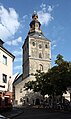
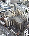
A church on the Rhine was built here in the early days and was consecrated as the collegiate church of St. Kunibert in 1247. Its origin can possibly be seen as early as the 7th century, it is said to have been built by Archbishop Kunibert of Cologne in front of the northern Roman wall, on the area of an early Franconian cult site . (A similar thing happened in Minden around 803 ).
Kunibert designated the small church as his tomb and consecrated it to St. Clement. The church later lost its original patronage and was probably consecrated after the canonization of its founder. Until 1106, when the suburb of Niederich was included in the urban area, the pastoral care of the residents there was under the sole responsibility of St. Kunibert.
Parish of Sankt Kunibert
The St. Kunibert Church, which later separated its west aisle for the services of the lay people, looked after the northern Eigelstein, the eastern parts of Plankgasse and Eintrachtstrasse as well as Gereonswall. Also the Weidengasse and the Thürmchenswall, as well as the residents of the streets "Unter Kahlenhausen" and "Unter Krahnenbäume". The street “An der Linde”, the Kunibertkloster and the street of the same name, the Machabäerstraße, the Servas-, Penz-, Platz- and Goldgasse (of the latter the northern part), as well as the northern part of the Johannisstraße and the street belonged to this district western corner of Maximinenstrasse. The Sprengel St. Kunibert, which had been cut up by the city expansion (as in the case of the parish of St. Severin ), was reunited in 1180. The former chapel of the St. Lupus Hospital was elevated to the parish church of the monastery.
Santa Lupus

The church of St. Lupus, which has become a parish since 1172, was subordinate to the parishioners of the streets Maximinenstraße (north side), Hofergasse and Johannisstraße (south to Goldgasse), those of the southern Goldgasse and “Waldemansgasse”. This was called Kotzgasse from the 15th century onwards because of the Kotzmenger that had become resident there , and it later became the Kostgasse. The community also included the residents of the street “Altes Ufer” (south to Goldgasse), the residents of Trankgasse east to Hubertusgasse. Because of the houses in Trankgasse west of St. Lupus (they were usually rented out by the canons ), there were frequent quarrels with the cathedral parish of St. Maria im Pesch , which sought parish rights over these houses.
Development
For Niederich, also known as “burgum inferius”, many local histories mention small settlement buildings around a chapel or the first modest church building. As in all early medieval cities, settlers built modest dwellings. As Koelhoff's chronicle from 1499 is said to have reported, the buildings from the older period were very “simply” built. This choice of words, which is also frequently used by Weinsberg, is to be equated with simple according to today's understanding, but at that time with inferior or bad. Simple stone buildings or houses made entirely of wood were the exception, the rule for a bourgeois Cologne house was a frame building . These buildings were simple and unadorned and mostly rested on a stone pedestal or other massive substructure. For example, near the banks of the Rhine, piles rammed into the ground were often used as a foundation in order to create a secure building site. This construction can still be found in an old Cologne rhyme of the children. The bars and beams were roughly hewn, the compartments were clad in wood or were filled with brushwood and clay , and were filled with bricks from around the 15th century . For the most part, however, only the street front was made of solid material; The rear building and possibly adjoining buildings in the courtyard were made of wood. With their open hearths, they were often the cause of devastating fires . In 1376 the Niederich was hit particularly hard; part of the parish, including the Kunibert Church, went up in flames. In 1462 it met the Machabä monastery, and in 1502 the St. Ursula monastery.

| Parish of Niederich including Eigelstein |
Chimneys or Fireplaces (1492) |
Registration as house census (1705) |
| S. Paul | 451 | 300 |
| S. Lupus | 412 | 262 |
| s. Maria indulgences | 177 | 317 |
| S. Kunibert | 767 | 583 |
| Source: Keussen |
In contrast to other suburban districts, in which different types of businesses settled, the “Niederich” remained an area primarily used for agriculture.
Water supply

families "von Groote" and "zum Pütz" ( Kendenich )
The water supply (drinking and service water) of the Cologne population in medieval times was provided by drawing wells . The tools of the well known in Cologne dialect "Pütze" included a fork with a rod, the length of which was adapted to the depth of the well. A bucket attached to the pole and a tub that absorbs the water drawn from the depths, which is still called “Bütt” in Cologne, initially completed the equipment. "Radpütze" equipped with winches , in which a bucket on a rope (later a chain) was lowered and filled with a wheel or roller, only appeared later. In some cases a kind of house rose above the fountain, which was also used as an apartment and was called the "Pützhaus".
- Old well technology
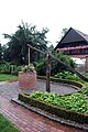
Pegs or draw wells

Joint from a tree fork
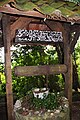
Example of a chain well


Public fountains in the district - as in the entire city - were increasingly on long streets. They were often found in the corner of two houses, on wide streets or in the middle of squares. But they also stood in dead ends, which were then often called "Pützgässchen" or "Pützhof". In the west of the city, a district of the Greek market was called Pützhof, and the founder of the “Einhorn” convent in Marzellstrasse was Odelindis de Pütz in 1291. The name of the street Klingelpütz in southern Niederich can also be seen in this context. So it said in a description of the place in 1457:
... and is located in the Spilergasse, where you go from the Aldergraven to the Klyngel plaster, on the side to the chapel of Our Lords Corpse with half of the Pütz and with the houses and vineyards behind with all their accessories .
Agriculture, farms, viticulture
Drinking troughs specially set up for the cattle were mostly set up in places where cattle markets were held in large squares or wide streets. Their facility also served the riding horses or the draft animals harnessed to carts and wagons.
Not only humans and cattle were dependent on water, but also agriculture and the vineyards (the Wingerts) were dependent on it and covered their needs through Pütze.

- A large trough from Niederich was located in front of the “Spiegeler Hof” in Machabäerstrasse, which was also known as “Hof an der Marvirenstrasse” or “Hof zum Irregang”. From 1431 the “Spiegeler Hof” was owned by Count Adolf IV. Von der Mark as “Hof von der Mark” or “Märkischer Hof” ; later it was prescribed for Karsilius von Palant-Breidenbent. In the 15th century there was presumably a beguinage or widow's house in the “Spiegeler Hof” , 1569/70 it is mentioned as a meeting place for the Anabaptists ; a "Jungfer Palant" living there was expelled. At the end of the 16th century, the "Spiegeler Hof" belonged to the humanist Karl von Utenhove (1536–1600) and his adopted daughter, the poet Anna von Palant-Breidenbent (around 1550–1599), who both died here. In 1611/15 the first Capuchin monastery in Germany (St. Franziskus) was founded in the building . In 1817 the monastery complex was converted into the infantry barracks Machabäerstraße 26-28, today the Evangelical parish hall of the old town is located on the site.
- The street name “Stavenhof” near the Eigelstein Gate still reminds us of the court towns of the patricians “Staben” (von Stabe, de baculo) . (Stabe was a family of mayors of the city)
- The “Riehl” farm on Marzellenstrasse
- The court of Duke Walram of Limburg on the grounds of Stolkgasse (before the Battle of Worringen )


- In 1301, Count Dietrich von Kleve leased the "Hof Niederich" on Johannisstrasse, which has since been called "Clever Hof", from Frank vom Horne. Johann Adolf Wolff called Metternich received the comfortable noble house in 1642 as a Brandenburg fief . This courtyard included stables, a brewery and a bakery, and around the building there were two acres of vineyards, for which Johann Adolf employed his own vineyard manager .
- The "Stedingshof" (to the crane)
- The court of Count zu Jülich at the "Klockring"
- The farms "Kalder Stessen" and "Kaldenhusen"
- The courtyard “Zur Pforte” on Johannisstrasse
- The “Zum Voispelz” farm in Hofergasse
- The “Melzhof” on Marzellenstrasse
- The farm "Zur Nasen" on the Eigelstein, mentioned in 1519, was a real farm, the remarkable inventory of which was described later
Courtyards of the monasteries, medals and monasteries
The term "courtyard" was also used in the sources for those properties that were to be found as settlements of foreign monasteries, namely on the terrain of the loosely built suburbs of Oversburg and Niederich. From the deeds of some of these properties it was clear how from small beginnings in the course of further development large, connected properties grew. These farms were primarily used as large storage facilities in order to be present in the market metropolis of Cologne with the products of their farms produced outside, such as grain and wine in large quantities. The properties in Niederich were also mostly surrounded by a few acres of vineyards and were not directly on the roadside. The religious used this for further income and built simple apartment buildings there . The sources name the following courtyards:
- The Fronhof of St. Kunibert, near the future Eigelstein Gate
- The courtyard of the Essen Abbey on the "Old Shore"
- The courtyards of Knechtsteden and S. Maria Roermonde in Maximinenstraße (Knechtsteden acquired a large number of adjacent houses over time and thus grew into one of the largest estates)
- The Templars' court in Trankgasse (owned by the cathedral chapter after its abolition in 1330)
- The Cistercian monks of Altenberg Abbey (curia ecclesie de veteri-monte) also had a farm on the Niederich, commonly known as "the Aldeberg". In 1268 they were given the right to operate the first ferry service from Mülheim to the coast of the Electorate of Cologne . In addition to this privilege from the ferry operation (which later became the Mülheimer Schiffbrücke ), they achieved their main income from agriculture. In this way, the friars could now also reach their court there, on Johannisstrasse, more easily. Around 1700 they returned their rights to the Mülheim ferry service to Haus Berg . This courtyard, built by the abbey in Cologne in the second half of the 12th century (1156), became an efficient urban trading post that played an important role in the monastery’s economy. From there, a considerable part of their income, which they generated in the nearer Cologne area and in the Jülich area, was sold on the Cologne market. From the 14th century onwards, the Altenberg abbots concentrated their trade entirely on the Cologne sales opportunities, due to the customs privileges they had received, and neglected the trade relations they had previously cultivated with Flanders . The city courtyard on Johannisstrasse served the abbots as a secondary residence in the late Middle Ages .
- The Cologne court of the Eberbach Monastery (also Cistercian) was located near the Altenberger Hof, on both sides of Servasgasse. The monastery took a leading position among the monasteries that were often involved in viticulture. The Eberbach monastery management also recognized the good sales opportunities offered by a Cologne branch and began to expand their Cologne court around 1160. In a privilege granted by Pope Alexander in 1163 to the Eberbach monastery , the Eberbach court in Cologne was listed as “cellarium et domus”. The Eberbach monks, too, had gradually been granted customs privileges and mainly transported wine to Cologne on their own ships. The Cologne branch of the Upper Rhine wine producer developed into one of the most important suppliers of the Cologne wine market in the late Middle Ages.
- One of the so-called monastery courtyards (curiae claustrales) was in the immunity district of St. Kunibert, and the Bishop of Trier used it as a lodging facility.
Mercator's city map from 1571 shows in the Niederich area not only the vineyards of the cathedral chapter mentioned in 1449 but also other large areas, some of which belong to the collegiate churches of Niederich and are covered with vines.
Collegiate Churches
According to a regulation contained in the Aachen rules , the collegiate churches had the duty of care for a hospital that was mostly built adjacent to them . The provisions of the rule, however, saw their main task in the poor and not in the sick care in the early period . Of the institutions documented by the Cologne monasteries, the oldest of the Cologne church institutions is that of the cathedral monastery. The foundation emerged from the Gunthar property division of 866, in which it was significantly involved for Cologne.
In addition to the cathedral monastery, the monasteries St. Gereon , St. Severin , St. Kunibert and St. Ursula in Cologne, the monasteries St. Cassius and Florentius in Bonn and St. Viktor in Xanten , as well as the church of St. Pantaleon in the Cologne foreland with its local poor hospice.
- The former collegiate churches today

St. Kunibert
St. Ursula
St. Andrew


To the holy virgins


The Abbey of St. Kunibert, already mentioned above, was joined by a canonical monastery around 816 with a church called "To the Holy Virgins" ( called St. Ursula from the 16th century ). St. Maria Ablass became their parish church.
The church of St. Marienablaß was first mentioned in 927 again in 1172, now as "s. Marie (-ae) prope virgines “(near the virgins). At the beginning of the 13th century it was named "s. Maria de campis vel avelasz ”(Maria from the field or indulgence) and later around 1220, she was called“ eclesia beate (-ae) dei genitricis Mariae ”. After all, from around 1300 onwards they were called “eclesia s. Marie (-ae) ad indulgentiam “(for indulgence).
Parish of Sankt Maria Ablass
As one of the parish churches in Niederich, Sankt Maria Ablass looked after the southwest and southeast corner of the Eigelstein, the northern terrain of Marzellenstrasse, Stolkgasse and Ursulastrasse. Next the northern section of the street Unter Sachsenhausen (the name originated because of the 16 houses standing there), as well as the southern part of its extension, the Gereonstraße. The southern part of the Klingelpütz street, the western part of the Plankgasse, the “Altengrabengässchen”, the western part of the Eintrachtstraße, the small streets of Enggasse and Hunnenback, as well as the Ursulakloster, Ursulaplatz and Kordulastraße belonged to their Sprengel. There was also a subordinate district in the Cologne foreland, the village of Ossendorf .
These two foundations of monasteries in the north of the city were already affected by the “Aachen rule”, which Archbishop Gunthar of Cologne (850 to 863) then enforced as an allocation of property by the Cologne churches.
St. Andrew
In the 9th century at the latest, a church was built that would later become the third collegiate church in Niederich: St. Andreas . It is said to have been a small chapel consecrated to St. Matthew, which stood at the ditch there in front of the north gate of the Roman wall. An appointment of canons from the monastery of St. Maria im Kapitol and the founding of a canon monastery under Archbishop Bruno are considered certain . The new church building associated with this foundation was consecrated in 974 by Archbishop Gero to the Apostle Andreas . During the Salian period (1050/60) the choir and crypt of the church were renewed, and the nave was built between 1190 and 1220. The church of St. Paul, which was elevated to the parish church of the monastery, was immediately adjacent to the area of immunity of the collegiate church.

Parish of St. Paul
St. Paul was the name of a former Romanesque parish church and parish of the medieval city, which later belonged to the collegiate church of St. Andrew. Possibly a parish was s. Paul was affiliated with the collegiate church of St. Andreas even before the city was expanded in 1106. According to Gelenius, it is said to have been built around 980 at Archbishop Warin's orders . In the Cologne sources it appeared in 1151/65 under the name “s. Pauli Hermanus ”.
The parish looked after the believers of the northern castle wall (as far as their houses were outside the Roman wall), those of today's Komödienstraße, the residents of the eastern part of today's Zeughausstraße, the residents of Kattenbug, the southern side of the eastern part of Gereonstraße, and likewise the south side of the street "Unter Sachsenhausen". Also belonging to St. Paul were the streets “An den Dominikanern”, the Andreaskloster, the northern part of Marzellenstraße and the northwest corner of Trankgasse.
Monasteries, convents, chapels
Apart from the canons there was only one male monastery on the Niederich. The inmates of the other convents consisted of women's communities. They were single girls and widows who were also called beguines . Convents with male occupancy, called begarden, were only occasionally located in Cologne (Alexian and olive monasteries), but not in the Niederich area.
Machabä monastery

Main article : Benedictine Convent of the Holy Maccabees
The Machabä monastery was one of the earliest monasteries in Cologne run by women religious. The nuns, who lived according to the Rule of St. Benedict , founded their convent in the suburb in 1178 next to a chapel there. It was at the level of the egg stone, at the “St. Mavirus "or" St. Marviren Strass ”, today's Machabäerstrasse. That the Collegiate Church St. Kunibert Subordinate monastery lost the 1803 secularisation and a few years later was demolished.
Augustinian women S. Maximin
A “Valdaverus” is said to have been the founder of the women's monastery near the church of S. Maximinen. In a deed of donation from Archbishop Philip , Maximinen was mentioned for the year 1186. Another document from 1188 revealed that the monastery belonged to the St. Ursula monastery. In this document, the monastery released the monastery and church from their dependency under certain conditions. This condition included the obligation not to carry out any excavations for “holy bodies” on the released site without the approval of the Ursula monastery. From 1201 the church and monastery were subordinate to the cathedral chapter.
Dominican monastery

The Dominican Monastery of the Holy Cross emerged from the S. Maria Magdalena Hospital founded in 1180 in Stolkgasse. This was left to the new convent founded by Father Heinrich von Mülhausen and some confreres at the behest of the order general Jordanus von Sachsen in 1220 by the St. Andreas monastery. As a result, the Dominicans expanded their branch through the acquisition of surrounding properties. In particular through the purchase of the immediately adjacent court of Duke Walram of Limburg , they gained the space they needed to expand their monastery complex into one of the largest in the city. In 1224 the convent bought more houses on the street front of today's street "An den Dominikanern". One of these houses was converted into a portal , the passage of which led to its own churchyard . They added a church to the facility, later also known as the “preacher monastery”, the west side of which had an atrium . The construction of the church, which was consecrated to the Holy Cross, was followed in 1252 as a preliminary completion of the construction of a wall to enclose it.

The later further development of the buildings of the convent, the reputation of the Cologne Order, but also teaching and science in Cologne was significantly influenced by Albertus Magnus , a member of the Cologne Order.
Convents
- 1230, "ver Selen", Stolkgasse, founder Sela Jude
- 1255, "Wijse", Ursulastraße, donor unknown
- 1267, "House of Rener Busse", Eigelstein, donor Richmond von Wipperfürth
- 1285, "zo dem Dorwege", Stolkgasse, donor Konstantin von Lyskirchen
- 1287, "Walde", Marzellenstrasse, donor Berta von Walde
- 1291, "unicorn" = little St. Ursula, Marzellenstraße, donor Odelindis de Pütz
- 1294, "Holzwilre", Komödienstraße, donor Gob. Vusgin

- In 1302, "Lufredus de Foro lignorum" donated the former "Hof Zederwald" located on Komödienstraße for the purpose of founding a convent for Beguines. From this first property of the sisters, which was also called "Lisloch" due to its location opposite a breakthrough in the Roman wall, the later Cellitinnenkloster Zederwald , which grew rapidly through extensive further foundations, developed . The convent, which was abolished in 1802, was in possession of a wealth of sacred furnishings, which is said to have come to the monastery of St. Maria in the Kupfergasse . Among them were 18 valuable paintings and a number of “heads of Ursulan virgins”, as well as the like of companions of St. Gereon .
- 1308, "Spies", Stolkgasse, donated by Katharina Konrredere
- 1315, "zur Lilie", Enggasse, donated by the von Cusin family
- 1320, "zum Hane", Enggasse, donor Ida de Lovanio
- 1321, "zum Mommersloch", Stolkgasse, donor Bela von Mommersloch
- 1335, "Ingendorp", Maximinenstrasse, donor Druda de Ingendorp
- 1333, "zum Berge", Marzellenstrasse, donor Merhildis de Berge
- 1334, “Monheim”, Marzellenstrasse, founder Aleidis von Monheim
- 1337, “Sister’s House Spiegel”, Huns Back
- In 1338, a hermitage of St. Achatius , also St. Agatius , was first mentioned in a document . It was on Marzellenstrasse in the southeastern Niederich. The hermitage created by foundations of Cologne citizens was abolished in 1582 in its capacity as the Dominican women's convent . The later Jesuit College Tricoronatum , which was largely destroyed by fire in 1727, was built on its premises .
- 1343, "at hand", Kattenbug, founder Aleydis a. Ida from Wiyse
- 1346, “Venekin”, Marzellenstrasse, 1385 no longer a convent
- 1359, "zum Hirzgin", Ursulastraße, 1366 no more convent
- 1363, "domus Bombardi" = zom Kessel, Sachsenhausen, donor Arn. De Palacio
- 1375, “Leichlingen”, Marzellenstrasse, donor Juta de Leichlingen
- 1514, "Duytze", back of the Huns,
- 1634, "Margarethen", Ursulastraße, founder Margareth von der Reeck
Chapels
In addition to the house chapels located within a monastery or charitable complex, there were also a number of chapel buildings in Niederich that had come from earlier times. Often they were originally built chapels or private chapels that were now subordinate to a nearby church (Cologne had a total of 28 separate chapels).

- In 1431 a Marian fresco on the outer wall of Maria Ablass Church was built to protect against the weather , and around 1431 an extension was built on the northern side of the parish church at that time, from which the Chapel of Grace , mentioned for the first time in 1528 and still preserved today, was built. The chapel is used today by the Russian Orthodox community in Cologne.
- According to Gelenius, tradition says that the S. Marcellus Chapel was founded by Kunibert, who consecrated it to Pope Marcellus . The chapel, located in the provost's vineyard, was first mentioned around 1180. The chapel survived the centuries and became the property of the domain administration after its closure in 1802. The sale of the chapel in 1820 was tied to the condition that the altar and effects were handed over to the Church of St. Mary's Assumption. In 1835 the structure was demolished except for its northern side gable.
- The Hubertuskapelle was a chapel subordinate to the cathedral monastery. It was in the vineyards of the monastery, in a cul-de-sac branching off north from Trankgasse. According to "Gelenius", it was a simple building ex lignis et caemento , which was donated to the Jesuits by Archbishop Ferdinand in 1615 with its associated area . In the course of the construction of the new church building on the east side of the southern Marzellestrasse, the chapel was demolished.
- The Servatius Chapel stood on the corner of Johannisstrasse, next to the Servasgasse archway, later known as Servatiuspforte (see Mercator detail Johannisstrasse). It was mentioned in early documents from 1150 and 1165. The rear chapel area, known as the Lustgarten (Virdarium) (1571, no longer visible), was transferred to the Servatius Brotherhood in 1336 . In the 16th century the chapel served St. Kunibert as a parish church until the parish church service was moved back in 1596. The Capuchins built their first Cologne branch next to the chapel in 1610/15. After it was closed in 1802, the building was sold in 1807 by the French administration to Servatius Zeidt, who built an oil mill there. The property then went to the Nicolini brothers in Worring , who built a house there. According to Keussen, remains of the old chapel in the form of tuff stone masonry were still visible in 1843 .
Politics and Law
The parishes or parishes were, so to speak, the electoral districts of the city tour. The elected representatives of the districts were recruited from them, who then formed the city's “Wide Council” as delegates.
The hereditary bailiwick
The court of the hereditary bailiwick on the Eigelstein appeared relatively late in the tradition. Originally it is said to have had its seat in the village of Volkhoven and moved it to the Eigelstein in connection with the expansion of the Niederich. There he was subordinate to the area between the Gereon district towards the Rhine, and included the parts of the Kunibert parish, which had not been included by the walling of the year 1106. Further subordinate to him were only the inherited areas of the core city, the Hacht district there. The seat of the court was the so-called Dinghaus on the Büchel des Eigelstein, next to the old Eigelsteinpforte. A mayor appointed by the Bailiff presided .
The family of those "von Pœ", lived on the Niederich from time immemorial and had the court there as a fief . Archbishop Walram bought it back in 1342 from "Tilnan von Pœ", another branch of the family.
The jurisdiction of the hereditary bailiwick on the Niederich was also subject to three larger farms far outside the old town. These included the village of Lintweiler , the entire village of Volkhoven with accessories, a Hufe Land to “Vulen” and one to Veltkassel .
Around the year 1351, the council occasionally raised a recurring dispute with the bailiff, accusing him that he was illegally bringing the neighbors on the Eigelstein to his court, although only those persons liable to Volkhoven were subject to his jurisdiction.
Civil court

The judicial district included the old "Eigelsteinthor" and led along the "Alten Graben" (today Eintrachtstraße) to the vicinity of St. Maria Ablass. There through the courtyard “Clockring” (today's street “Im Glockenring” reminds of him) to the “Wichhaus”, then down to the Rhine along the bank area, then up to the immunity of St. Kunibert and from there in the street "Unter Bodenmacher" back to the old Eigelstein gate.
The suburb of Niederich formed its unity after 1106 with a court and shrine , the common seat of which was on Johannisstrasse. The Niederich district building was located there, the front building of which was the seat of the jury's court and the courier's apartment. The rear building housed the officials and the shrine. The court was respected by the high court of the old town and not restricted by its competence.
As in the then incorporated “Oversburg”, municipal authorities in Niederich were developed based on the example of the old town parishes. At the latest after the reconciliation with the archbishop's city lords, both areas had been given their own court district, which had been given comprehensive civil jurisdiction.
Farmer's bench

The residents, who mainly worked in agriculture as small producers (later they were called “Kappesbuure”), greengrocers in markets, or day laborers , had organized themselves into a special “cooperative”, the farmers' bank . That of Niederich was one of the five Cologne farmers' benches and had its seat on the Eigelstein. Even after later fortification extensions, the association was responsible for the northern sector of the "Kölner Schweid ". The farmer's bank on the Niederich was the last to be set up by the council in 1391 and belonged to the St. Kunibert district.
Integration of the Niederich into the urban area


The spatial inclusion of the suburban area encompassed the following area: Beginning at the Judenpforte, which provided the previous access to Komödienstraße, the new line of fortifications ran west to the "Ipperwaldgraben" (today's Kattenbug), and led north to the "Würfelpforte", which is a - and the exit of the street "Unter Sachsenhausen" was. The fortification then continued north through the "Old Graben" (today's Cardinal Frings - / Eintrachtstraße) to the old Eigelsteintor. There it crossed the Eigelstein street and led through "Unter Kahlenhausen" until the immunity of St. Kunibert.
This fortification, consisting of ramparts and ditches, was a provisional and relatively quickly implemented protective measure. The growing population soon gave rise to considerations to build stronger and more extensive fortifications. This mighty project began in 1173. For the time being, only a wall with a ditch was again drawn, and it would take decades for a curtain wall to be fully erected with gates and towers. In 1207, the construction of the wall was expressly approved by King Philip , and in 1212, King Otto pushed for further construction by allowing the city to levy a three-year brewing and grinding tax that was supposed to be used to complete the fortress. The very slow progression of the entire complex is illustrated by a mention of the year 1254, at which time the new wall is only mentioned at Kahlenhausen in Niederich ( muri civitatis apud Caldinhuisin ).
Even after the city wall was later expanded, the duty to defend the old fortifications was retained until well into the 13th century.
Civil suburbs
Shrine Districts

From the early days of the Niederich area there is little information about a district division - probably due to the sparse settlements. So the egg stone itself only had a rough breakdown. On the southern side of the street it was the subdistrict "Weidengasse", and that on the eastern side was the subdistrict "Therdenhoven (possibly in connection with Thenhoven ) et Kaldenhusen". From 1303 the area between the Rhine and Johannisstraße was called "ad portam". The district to the west up to Maximinenstrasse and Eigelstein was called "a pistrino Maximini". The strip beyond Maximinenstrasse to Marzellenstrasse was the district “a s. Lupo. The square ”between Komödien and Unter Sachsenhausen, as well as Marzellenstrasse and Kattenbug, was the district“ hospitalis s. Andree ". Between the Marzellenstrasse, the Stolkgasse, as well as in front of the Dominicans and the Ursulastrasse, it was the district "a dono pistorea". To the west of there and south of the street Hunnenrück the district was called "a domo Hilden" and north of the last two districts was the one that was known as "a s. Virginhus ”.
Municipal development
Social facilities

Around the middle of the 19th century, the Vinzenz Hospital of the Vinzentinerinnen in Eintrachtstraße and the only remaining hospital in the Niederich area, the Marien Hospital founded in 1864 next to the St. Kunibert Church, cared for the residents of the district. Predecessors of these houses have been documented in this old part of the city since the middle of the 12th century.
Hospital St. Heribert

In 1147, the St. Andrew's Hospital was mentioned on the St. Martinus shrine maps . A house acquired by the provost Theodoric in 1195 for hospital purposes was called Andreashospital in 1203, standing next to St. Paul. 1281 there was a beginner's convent on the upper floor, while the poor and the sick lived on the ground floor. A new building erected in 1306 served the same purposes, but now, according to a document from Archbishop Heinrichs of 1314, also accepted pilgrims.
A chapel belonged to the hospital, which "Konrad von Leyden", dean of the Andreasstiftes, donated an altar consecrated to St. Heribert in 1364 . In 1615 a guard building of the city was placed east of the chapel. The building itself was without special features, but together with the guard and the choir of the St. Andrew's Church, offered a picturesque picture. With the secularization , the chapel became the property of the municipal poor administration, from which it was used until 1844 as a foundation. Then the termination took place.
- 1180, Hospital S. Maria Magdalena, Stolkgasse, equipped with a chapel. The establishment was left to the Dominicans around 1220
- 1183, Hospital S. Lupus in Trankgasse, existed as such until 1398
- In 1308 the Hospital Haus Grunewald was built on Maximinenstrasse (also All Saints' Day) to accommodate poor and converted Jews. The institution was founded by Hermann de Ederne and Adolph de Reven.

Hospital Ipperwald
"Ipperwald", named after the Ippen (elms) standing there, was a hospital and hostel. In 1323, the married couple Alexander and Agnes Halbhaus designated a part of the "Ipperwaldgraben" between the Jews and Würfelpforte that belonged to them to receive sick clergymen and other people in need. In particular, Ipperwald accepted as a hostel for the Hungarian pilgrims .
Hospital St. Revilien
In 1426, “Daem von Loeven” bought the house “Wevelkoven”, or St. Revilien (Revilien = reverendae filiae) on Stolkgasse. It was first mentioned in the sources as "novum hospital" in 1427, when it was richly presented by the patrician Werner Overstolz . In 1462/65 the facility was expanded to include a department for "madmen" from the estate of the Cologne merchant Johann Rinck . The foundation was established in 1500 by Johann's son, Dr. Peter Rinck expanded, just as the hospital continued to receive many patrons. They were bequests from Lic. Hermann († 1579) and the auxiliary bishop “Theobald Crassel” († 1587). The chapel consecrated to St. Ursula was a small hall building measuring 10 × 18 m and was located south of the hospital on Stolkgasse and the street “Vor St. Ursula”. The entire administration was subordinate to four provisional who were provided by the council.
Educational institutions
Some of the faculties of the University of Cologne , founded in 1388, had settled in Niederich . The medical faculty, which is only weakly represented in Cologne , was only able to use the premises of the artist school to a limited extent. They had owned the Versėlenkonventes building (probably a former property of the mayor family Jude) on Stolkgasse since 1398. It had been rebuilt and expanded several times for the purposes of the artist faculty.
The artist faculty on Gereonstrasse had built the house “Zur roder Porzen” as a hospital for its sick students . From 1411 to 1416 the faculty also owned the “Riehle” farm on Marzellenstrasse.
Jesuit school

Under the rain of "Jakob Leichius" in 1552 the theologian Dr. Johannes von Kuyck on the Eigelstein, the Burse , the Bursa Cucana , was relocated to a municipal building on Maximinenstrasse and was named bursa tricoronata . The school was then taken over by the Jesuits on February 2, 1557 , who immediately began to expand the building. They acquired several houses on Johannisstrasse, which they had extensive renovations carried out on. These buildings that were accessible via a drive-through (a Portzhaus) from the Maximinenstraße Street, then left with one of the St. Mary consecrated oratory provided. In 1598 the Jesuits moved their institute to houses they had bought before the Dominicans. In 1599 they sold their buildings on Johannisstrasse to the city, for which the council paid 5000 Reichstaler . The council had the property converted into a municipal orphanage , which existed there until 1800.
Montanergymnasium
Around 1420 Heinrich from Gorichen founded the Montanergymnasium in the Stolkgasse. It was enlarged by Regens Lambertus de Monte († 1499) and later received his name. The institution acquired additional property around 1504 through a foundation of Dr. Valentin Engelhard in the form of a "stone house" and other buildings on the tower in Untersachsenhausen. By the rain Gerhard Mathisius, the Montanum got two more houses in his possession, they were in the Enggasse, and were called "to the two goats". The later Regens Johann Titz (1624 to 1658) rebuilt the institution. He added an alumnate and a chapel dedicated to St. Thomas Aquinas from his own resources .
Ursuline School

The Ursulines , who fled from Liège to Cologne as a result of the Thirty Years 'War , looked after the church and the girls' school in Machabäerstrasse until the end of the 20th century. The educational institution of the order, founded in 1651, was the first of its kind in Germany at the time. According to plans by the Jesuit father Antonius Halse, new convent buildings were built between 1673 and 1676, followed by other school buildings in 1693/95. In 1712 the Corpus Christi church designed by the Venetian architect Matteo Alberti was completed. The facilities of the Ursulines also suffered severe damage in the Second World War , and the repair work continued until the end of the 20th century. The Ursuline School exists to the present day at the historical location with a secondary school and a high school branch exclusively for girls.
literature
- Directory of the Shrine Books. IX. Niederich . In: Communications from the Cologne City Archives 32 (1904), pp. 82–86.
- Hermann Keussen : Topography of the City of Cologne in the Middle Ages , in 2 volumes. Cologne 1910. ISBN 978-3-7700-7560-7 and ISBN 978-3-7700-7561-4 .
- Ludwig Arntz , H. Neu and Hans Vogts : Paul Clemen (Hrsg.): The art monuments of the city of Cologne , Volume II, extension of the former churches, monasteries, hospitals and school buildings of the city of Cologne. Verlag L. Schwann, Düsseldorf 1937. Reprint 1980. ISBN 3-590-32107-5 .
- Joachim Deeters: in sources on the history of the city of Cologne , Volume II. Late Middle Ages and early modern times. Friends of History in Cologne V., JP Bachem Verlag Cologne, ISBN 3-7616-1285-0 .
- Karl Stommel : Johann Adolf Freiherr Wolff called Metternich zur Gracht. From country knight to country steward . A career in the 17th century. Cologne 1786. ISBN 3-7927-0919-8 .
- Adam Wrede : New Cologne vocabulary . 3 volumes A - Z, Greven Verlag, Cologne, 9th edition 1984, ISBN 3-7743-0155-7 .
- Manfred Becker-Huberti , Günter A. Menne: Cologne churches, the churches of the Catholic and Protestant communities in Cologne . JP Bachem Verlag, Cologne 2004, ISBN 3-7616-1731-3 .
- Winfried Schich : The trade of the Rhenish Cistercian monasteries and the establishment of their city courts in the 12th and 13th centuries in: Raymund Kottje (ed.), The Lower Rhine Cistercians in the late Middle Ages, reform efforts, economy and culture. Cologne-Bonn 1992.
Individual evidence
- ↑ Here, "Keussen" referred to the village of Leimersdorf an der Ahr , which, analogous to the medieval Cologne suburbs, also had Niederich and Overich (Oversburg).
- ↑ a b c Ludwig Arntz, H. Neu and Hans Vogts: Paul Clemen (ed.): Die Kunstdenkmäler der Stadt Köln , p. 253 ff.
- ↑ Chronicle of the City of Minden http://www.alt-minden.de/klchronik.html ( Memento from March 2, 2007 in the Internet Archive ), accessed on July 22, 2009
- ↑ "Dat Huus dat is up stippen, dat the Deubel should rock"
- ↑ Keussen, Volume I., pp. 78, 181 ff
- ^ Keussen: Topography of the City of Cologne in the Middle Ages , Bd. IS 196
- ↑ Keussen, vol. IS 171, reference to the commemorative publication: The lighting and water supply of the city of Cologne (1895), 89/90.
- ↑ Keussen, Bd. IS 171, reference to the drawings Vinckenboom: Zeitschrift für christl. Art 23 (1910), 43/4, 47/8.
- ^ Keussen: Topography of the City of Cologne in the Middle Ages , Vol. II. P. 229
- ↑ In the 13th and 14th centuries, councilors "vanme Spiegele (de Speculo) zome Yrregange" were mentioned in documents in Niederich. One “Haus zum Irregang” was in Schildergasse, another “Haus zum Irregang” in today's Marzellenstrasse on Eigelstein-Büchel; see. Hugo Stehkämper : Citizens and Churches in Cologne in the High Middle Ages (publications of the Cologne History Association 45), Cologne: SH-Verlag 2007, p. 129.
- ↑ See Keussen, Vol. I., p. 94.
- ↑ See Main State Archive Düsseldorf, Jülich-Berg I, 160 (files 1522 to 1523)
- ^ Cf. Leonhard Ennen: History of the City of Cologne , Vol. III, Cologne / Neuss: L. Schwann 1869, p. 829.
- ^ Cf. Leonard Ennen: The antiquity studies in Cologne . In: Monthly for Rhenish-Westphalian historical research and antiquity 3 (1877), pp. 384–413, esp. Pp. 400 and 410f.
- ↑ Cf. Keussen, Vol. I., p. 173, reference to Schickungsbuch: (C 17), 104 a (1479)
- ^ Chronicle of the City of Cologne, printed in the Annalen des Hist. Association for the Lower Rhine. Issue 16, p. 58.
- ^ Keussen, Topography of the City of Cologne in the Middle Ages, Vol. I, p. 139
- ^ Karl Stommel: Johann Adolf Freiherr Wolff called Metternich zur Gracht, from Landritter to Landhofmeister , s. 238.
- ↑ Keussen: Topography of the City of Cologne in the Middle Ages , Bd. IS 96, reference to a description of the yard inventory in: "Cardauns in the Annals of the Lower Rhine", 41, 113 u. 134/5.
- ^ Hans Mosler: The Cistercian Abbey Altenberg. (= Germania Sacra; New Series 2. ) Walter de Gruyter & Co., Berlin 1965, p. 116f. Digitized
- ^ Joachim Deeters: in sources on the history of the city of Cologne .
- ↑ Keussen, Vol. II, p. 98, "given by Willemannus Parfus to Kl. Altenberg", further purchases and donations of properties there follow.
- ↑ a b Winfried Schich, pp. 49-73.
- ↑ Keussen, Vol. IS 92
- ^ Keussen, Volume I., p. 154, with reference to: Woikowsky-Biedau, The poor being of medieval Cologne . Wroclaw 1891.
- ↑ Oediger: The Regests of the Archbishops of Cologne in the Middle Ages . First volume.
- ^ Toni Diederich : The Archdiocese of Cologne. 1st issue, pp. 15-16.
- ^ Adam Wrede, Volume I, p. 13.
- ↑ Keussen: Topography of the City of Cologne in the Middle Ages , Bd. IS 5, reference to: Lacomblet , Mention 817, Urk. Book I n. 35, also i. J. 875, Schäfer in: Niederrheinische Annalen 74, 79.
- ↑ Manfred Becker-Huberti , Günter A. Menne: Kölner Kirchen, the churches of the Catholic and Protestant communities in Cologne , p. 30.
- ^ Boundaries of all parish districts: Keussen: Topography of the City of Cologne in the Middle Ages , vol. IS 192 ff.
- ↑ The poem Dat of hiliger Macabben VND afflaes tzo Mauyren bynen Colen Lyden (after 1504 Köln printed 1507). In: Oskar Schade: Spiritual poems of the XIV. And XV. Century vom Niderrhein , Hanover: Carl Rümpler 1854, pp. 261–395, esp. P. 391 (online resource, accessed on January 10, 2012), interprets this name as “mater virorum” , d. H. “Mother of Men” , on Saint Solomon; see. Keussen, Vol. II, p. 119.
- ↑ Ludwig Arntz, H. Neu and Hans Vogts: Paul Clemen (ed.): Die Kunstdenkmäler der Stadt Köln , p. 235 ff.
- ↑ Ludwig Arntz, H. Neu and Hans Vogts: Paul Clemen (ed.): Die Kunstdenkmäler der Stadt Köln , p. 313 f.
- ↑ H. Keussen, Vol. IS 149.
- ↑ H. Keussen, vol. II. P. 123 col. 1.
- ^ Adam Wrede, Volume I, p. 13.
- ↑ Ludwig Arntz, H. Neu and Hans Vogts: Paul Clemen (ed.): The art monuments of the city of Cologne. P. 341.
- ↑ Ludwig Arntz, H. Neu and Hans Vogts: Paul Clemen (ed.): The art monuments of the city of Cologne. P. 337.
- ↑ Ludwig Arntz, H. Neu and Hans Vogts: Paul Clemen (ed.): The art monuments of the city of Cologne. P. 352.
- ↑ Keussen: Topography of the City of Cologne in the Middle Ages , Vol. IS 75/77.
- ^ Keussen, Topography of the City of Cologne in the Middle Ages , vol. I., p. 46 f.
- ^ Keussen, Topography of the City of Cologne in the Middle Ages , Vol. I., p. 43.
- ^ Keussen, Topography of the City of Cologne in the Middle Ages , vol. I., p. 60.
- ^ Keussen: Topography of the City of Cologne in the Middle Ages , Vol. IS 181 ff.
- ↑ Ludwig Arntz, H. Neu and Hans Vogts: Paul Clemen (ed.): Die Kunstdenkmäler der Stadt Köln , p. 367 f.
- ↑ Ludwig Arntz, H. Neu and Hans Vogts: Paul Clemen (ed.): Die Kunstdenkmäler der Stadt Köln , p. 373 f.
- ^ Keussen, Topography of the City of Cologne in the Middle Ages , Vol. I, p. 139.
- ↑ Ludwig Arntz, H. Neu and Hans Vogts: Paul Clemen (ed.): Die Kunstdenkmäler der Stadt Köln , p. 389 f.
- ↑ Ludwig Arntz, H. Neu and Hans Vogts: Paul Clemen (ed.): Die Kunstdenkmäler der Stadt Köln , p. 386 f.
- ↑ Manfred Becker-Huberti , Günter A. Menne: Cologne churches, the churches of the Catholic and Protestant communities in Cologne , p. 153 f.