
List of the Rhine islands
The Rhine islands are referred to as Wörth, Werth ( Middle High German for island), Aue or simply as an island , depending on their geographical location or language usage . Some of the islands in the list are no longer islands in the literal sense due to electricity construction measures , but are still designated as such (marked with an "X"). In most of the river arms that can no longer be navigated by Rhine navigation , marinas have been created. This list does not claim to be complete; Kilometers are not exact. The areas in the Upper and Lower Rhine that were flown around in the course of straightening the Rhine are not islands in the sense of the word. In other words, they are not in the Rhine, but in the bank area. The information with respect to length and width of the islands are only approximate values, depending on the water level and additional longitudinal stations , dams , sluices or Kribben arise other values.
Since the Alpine Rhine “flows” through Lake Constance and merges with the Seerhein into the Untersee , the islands above the High Rhine are counted among the islands in Lake Constance . The island of Werd near Stein am Rhein is the last island of Lake Constance before it flows into the Upper Rhine, and the island of Wörth in the Rhine Falls basin with the castle of the same name is the first Rhine island downstream of the High Rhine towards Basel .
The official Rhine kilometer “zero” is in Constance .
In addition to the islands, there are also well-known shallows of the Rhine in the Middle Rhine .
Islands in the Upper Rhine

Bridge on the "Judenäule"

Grien Island near Koblenz AG (CH)


| Surname | Rhine km | Rhine side | Shore connection | surface |
|---|---|---|---|---|
| Castle Wörth | km | l | bridge | |
| Rheinau | km | l | bridge | |
| Upper Island ( near Rüdlingen ) | km | r | ||
| Lower island (near Rüdlingen) | km | r | ||
| Schwarzwasserstelz (near Kaiserstuhl AG ), formerly the location of Schwarzwasserstelz Castle | km | r | ||
| Island near Rheinheim | km | r | ||
| Insel at Rietheim AG | km | l | ||
| Island near Ettikon | km | r | ||
| Jewish column | km | r | Footbridge from the east | 1.1 ha |
| Grien (Mühlegrien) | km | l | x | 1.8 ha |
| Albbrucker Rheininsel , artificial island between the works channel of the former paper mill Albbruck and the Rhine, which is diverted from the Rhine | km | m | Foot crossing on the weir of the Albbruck-Dogern power plant (east) and Rhine bridge Albbruck – Schwaderloch (west) | |
| Fridolin Island | km | m | x | |
| Stein Castle (Rheinfelden) | km | l | Pedestrian bridge from the south |
Islands in the Upper Rhine

Aerial view of the Märkt weir (from the north), tee of the southern Baden Old Rhine from the Rhine canal , in the middle of the southern tip of the Île de Rhin
Map around 1850: The Ingelheimer Aue still appears as an island

Kühkopf-Stockstadt Old Rhine

Manor house on the Königsklinger Aue

Rheininsel Mariannenaue opposite Erbach (Rheingau)

Nonnenau-Langenau (from the north)


| Surname | Rhine km | Rhine side | Shore connection | surface |
|---|---|---|---|---|
| Tomato islands near Au am Rhein | km 349.5 | r | ||
| Rappen word at Daxlanden | km 355.7 | r | Road bridge Altrheinbrücke , Rhine dike | 137 ha |
| Rott (near Hochstetten ) | approx. km 377 | r | bridge | |
| Green (under Germersheim) | km 386.6 | l | x | 240 ha |
| Rheinschanzinsel with Philippsburg nuclear power plant | km 389.2-391.7 | r | x | 440 hectares |
| Corsica island | km 391.7 | r | x | 20 ha |
| Flotzgrün | km 392 | l | x | |
| Kollerinsel (peninsula) | km 409 | l | x | |
| Friesenheimer Insel (in Mannheim ) | km 428.5-431.35 | r | x | |
| Mulberry | km 443.8-449.1 | r | Worms railway bridge over the Rhine and Old Rhine, Rosengarten road bridge over the Old Rhine (Küblingersdamm, Lampertheim ), Nordheim road bridge over the Old Rhine (Altrheinstrasse, Biblis ) | 5.25 km × 1.1 km (319 ha) |
| Ibersheimer Wörth (in Worms-Ibersheim ) | km 454-459.5 | l | x | |
| Kühkopf with Reichertsinsel , Kleiner Kühkopf and Krönkesinsel | km 468.35-473.4 | r | Stockstadt road bridge and Erfelden pedestrian bridge over the Stockstadt-Erfelder Altrhein , Guntersblum ferry over the main stream | 5.0 km × 5.85 km (1700 ha) |
| Schusterwörth | km 479 | r | x | |
|
Nackenheimer Werth, Sändchen and Kisselwörth, in between Nachengasse |
km 489 | l | 3.25 × 0.30 km | |
| Nonnenau-Langenau (on the Ginsheimer Altrhein ) | km 487.0-492.3 | r | Dam and Old Rhine Ferry | 5.2 × 0.58 km (193 ha) |
| Rabenwörth | km 493 | r | x | |
| Bleiaue (opposite Mainz-Weisenau) | km 493.95-495.85 | r | bridge | |
| Maaraue at the Floßhafen ( Mainz-Kostheim ) | km 496.65-498.0 | r | Landing with road bridge on the banks of the Main, pedestrian bridge | 1.83 × 0.61 km (64 ha) |
| Petersaue | km 499.0-501.9 | r | Private bridge from the industrial park Kalle-Albert , railway bridge with stairs | 2.98 × 0.27 km (50 ha) |
| Ingelheimer Aue (former island between the wax bleach arm and the industrial port ( Mainz-Neustadt )) | km 500.0-503.2 | l | flood-proof embankment | 3.2 × 0.4 (100 ha?) |
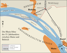
| Rettberg sow | km 501.05-505.30 | m | Motorway bridge with stairs, passenger ferry from Biebrich and Schierstein | 3.10 × 0.40 km (68 ha) |
| Haderaue (former island, to Budenheim ) | km 507.5-509.8 | l | 2.3 × 0.39 (approx. 46 ha) | |
| Königsklinger Aue | km 510.0-512.1 | l | 2.15 × 0.515 km (80 ha) | |
| Mariannenaue | km 512.9-516.2 | m | Reinhartshausen Castle private ferry | 3.30 × 0.30 km (68.5 ha) |
| Winkeler Aue | km approx. 520 | r | 0.65 × 0.15 km (10.4 ha) | |
| Fulderaue | km 520.8-522.4 | l | 2.00 × 0.29 km (34 ha) | |
| Schönborn'sche Aue | km 521-523 | r | two bridges | 4.6 ha |
| Ilmenaue | km 524.0-524.7 | l | 0.75 × 0.14 km (4.6 ha) | |
| Rüdesheimer Aue | km 524.8-527.3 | m | 0.9 × 0.15 km (29 ha) | |
| Krausaue (shoal) | km 527.5 - 528.5 | r | ? |
Islands in the Middle Rhine

Binger mouse tower around 1900

Kauber Werth

Falkenau rock island with Pfalzgrafenstein Castle, connected to Kauber Werth

Tauberwerth near Oberwesel

Island (s) Nonnenwerth (and Grafenwerth, left) from Drachenfels seen from


| Surname | Rhine km | Rhine side | Shore connection | surface |
|---|---|---|---|---|
| Mouse Tower Island | km 530.1-530.4 | l | 0.25 x 0.05 km | |
| Lorcher Werth | km 537.9-539.7 | r | 1.80 × 0.19 km | |
| Bacharacher Werth | km 543.5-544.2 | l | 0.71 × 0.16 km | |
| Kauber Werth connected to the island of Falkenau | km 544.55-545.15 | r | 1.6 × 0.10 km | |
| Tauberwerth (below Oberwesel ) | km 550.9-551.2 | 0.2 x 0.06 km | ||
| Ehrenthaler Werth (below St. Goar-Fellen ) | km 560.25-560.95 | l | 0.81 x 0.09 km | |
| Oberwerth ( Koblenz ) | km 590 | l | x | |
| Niederwerth (only Rhine island with a village) | km 594.5-597.8 | r | 3.70 × 0.62 km | |
| Graswerth | km 595.5-598.7 | r | 2.60 x 0.22 km | |
| Urmitzer Werth | km 602.6-603.7 | r | 1.10 x 0.16 km | |
| Weißenthurmer Werth | km 606.2-608.1 | m | 1.9 × 0.27 km | |
| Namedyer Werth (with geyser Andernach ) | km 614-616.6 | l | x | 2.6 × 0.08 km |
| Hammersteiner Werth | km 616.8-618.2 | r | x | 1.34 x 0.16 km |
| Nonnenwerth | km 640.5-642.5 | l | 1.96 × 0.20 km | |
| Grafenwerth | km 640.5-641.8 | r | x | 1.20 x 0.26 km |
Islands in the Lower Rhine
The Cologne Werthchen from: Large view of Cologne 1531 by Anton Woensam

Bislicher island with an old arm of the Rhine


| Surname | Rhine km | Rhine side | Shore connection | surface |
|---|---|---|---|---|
| Herseler Werth | km 660.84-662.43 | l | 1.8 × 0.16 km | |
| Werthchen , Cologne | km 687.5 | l | x | |
| Ölganginsel , Neuss | km 738.5-740 | l | x | |
| Kaiserswerth (district of Düsseldorf ) | km 755 | r | x | |
| Budberger Island | km 767-768.3 | l | x | |
| Graf (v) island (campsite) | km 817 | r | x | |
| Bislicher island | km 823 | l | x | |
| Reesereyland | km 834-36 | r | x | |
| Dornick Grieth | km 847 | r | x | |
| Emmericher Eyland Kalkar | l | x |
Former Rhine islands
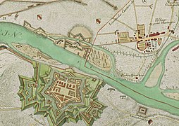
Bridgehead fortress Hüningen 1796–1797 and the former "Schusterinsel" near Kleinhüningen

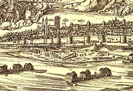
Old town of Säckingen with the women's monastery Säckingen flowed around by the Rhine, copper engraving from Topographia Alsatiae , Matthäus Merian

_p_021.JPG)
| Surname | Rhine km | Rhine side | Shore connection | surface | Silted up / year |
|---|---|---|---|---|---|
| Old town of Säckingen | km | r | bridge | middle Ages | |
| Schusterinsel near Kleinhüningen | km | r | bridge | Modern times | |
| Ceylon | 383 | r | after 1800 | ||
| Volmerswerth Düsseldorf | 734 | r |
See also
Web links
- polizei.hessen.de: Aerial photos of some islands (PDF, 2 MB)