Mulberry
| Mulberry | ||
|---|---|---|
|
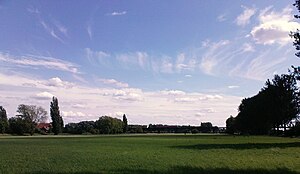
Meadows on the mulberry meadow with a railway bridge in the background and a forester's house on the left in the picture, looking south |
||
| Waters | Rhine ( Upper Rhine ) | |
| Geographical location | 49 ° 39 '52 " N , 8 ° 22' 36" E | |
|
|
||
| length | 5.25 km | |
| width | 1.1 km | |
| surface | 3.19 km² | |
| main place | (Forester's house) | |
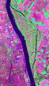
| NASA Geocover 2000 satellite image, with forester's house in the crosshairs | ||
The Maulbeeraue is an island on the Rhine in the Bergstrasse district of Hesse .
location
The mulberry meadow lies between the 290 meter wide Rhine in the west and the 40 meters wide Nordheimer Altrhein in the east, between Rhine kilometers 443.8 and 449.1. The northern third of the island belongs to the municipality Biblis (district Nordheim ), the larger southern part belongs to the city of Lampertheim (district Hofheim ). Opposite the mulberry meadow on the left bank of the Rhine lies the city of Worms . To the north of it, the Pfrimm flows into the Rhine at Rhine kilometer 446.7 . The island has a maximum north-south extension of 5.25 kilometers. At its widest point, it measures 1.1 kilometers. It occupies 3.19 square kilometers. A large part of the mulberry meadow consists of meadows and is a FFH area under nature protection . There are also some corn fields in the northern part of the island . The railway line Worms – Bensheim crosses the island in the south at Rhine kilometer 445.4 on an elongated bridge as a continuation of the Worms railway bridge.
According to the census of December 3, 1861, the mulberry meadow, marked as belonging to Nordheim, was given a population of 10, and exactly three years later a population of 8.
On October 31, 1937, the previously independent district Maulbeeraue was (partially) incorporated from the Bensheim district into the Worms district. This also included the rose garden (partially) newly created by renovation work .
swell
- ^ Note sheet from the Hessian State Office for Soil Research in Wiesbaden. Hessian State Office for Soil Research., III. Episode, Issue 1, No. 1–12, Darmstadt 1862, Hofbuchhandlung von G. Jonghaus limited preview in the Google book search
- ^ Rolf Jehke: District of Worms. In: territorial.de. Retrieved January 9, 2015 .


