Meru (Garhwal)
| Meru (south peak) | ||
|---|---|---|
|
on the left in the foreground the Shivling , on the right in the background the Meru |
||
| height | 6660 m | |
| location | Uttarakhand ( India ) | |
| Mountains | Gangotri Group ( Garhwal Himalaya ) | |
| Dominance | 3.22 km → Bhrigupanth | |
| Notch height | 460 m | |
| Coordinates | 30 ° 52 '1 " N , 79 ° 1' 58" E | |
|
|
||
| First ascent | 1980 from a japan. expedition | |
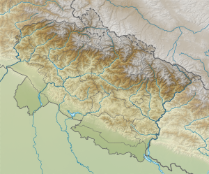
The Meru ( English Meru Peak ) is a 6660 m high mountain in the western Himalayas .
It is in the Gangotri Group , which is part of the Garhwal Himalayas and is located in the Indian state of Uttarakhand . The mountain is located between the Shivling in the east and the Thalay Sagar in the west. The 6,772 m high Bhrigupanth is 3.22 km east-northeast.
In addition to the southern main peak, the mountain has three secondary peaks. The only ascent of the south summit was achieved by a Japanese expedition in 1980 over the south-east ridge.
Middle Peak (Shark's Fin)
The middle summit, also Shark's Fin (" shark fin "), 6310 m high, was first climbed in 2001 by Valeri Babanow . On October 2, 2011, the US climbers Conrad Anker , Jimmy Chin and Renan Ozturk managed to climb the northeast face to the summit.
North summit
The north summit has a height of 6450 m. It was first climbed in 1980 from the north.
West summit
The west summit has a height of 6361 m. It was first climbed from the west in 1981.

