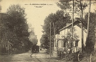
Pornic – Paimbœuf meter-gauge railway
| Pornic – Paimbœuf | |||||||||||||||||||||||||||||||||||||||||||||||||||||||||||||||||||||||||||||||||||
|---|---|---|---|---|---|---|---|---|---|---|---|---|---|---|---|---|---|---|---|---|---|---|---|---|---|---|---|---|---|---|---|---|---|---|---|---|---|---|---|---|---|---|---|---|---|---|---|---|---|---|---|---|---|---|---|---|---|---|---|---|---|---|---|---|---|---|---|---|---|---|---|---|---|---|---|---|---|---|---|---|---|---|---|
|
Timetable, 1914
| |||||||||||||||||||||||||||||||||||||||||||||||||||||||||||||||||||||||||||||||||||
| Route length: | 31.2 km | ||||||||||||||||||||||||||||||||||||||||||||||||||||||||||||||||||||||||||||||||||
| Gauge : | 1000 mm ( meter gauge ) | ||||||||||||||||||||||||||||||||||||||||||||||||||||||||||||||||||||||||||||||||||
|
|||||||||||||||||||||||||||||||||||||||||||||||||||||||||||||||||||||||||||||||||||
The Pornic – Paimbœuf meter-gauge railway was a 31.2 km long meter -gauge railway from Pornic to Paimbœuf in the French Loire-Inférieure department . It was operated by the Compagnie de Chemins de fer du Morbihan under a license issued by the Ministry .
Route
This line, which is not connected to the rest of the Morbihan railway network, had its main station in Paimboeuf. From the terminus in Pornic and Paimboeuf, Nantes could be reached with the state railway. The Loire ferries also connected Paimboeuf with Donges and Mindin with Saint-Nazaire .
history
The line was inaugurated on August 20, 1906 after three years of construction and served the seaside resorts of the Côte de Jade between Pornic and Paimboeuf over a distance of 31.2 km (plus a 1.6 km junction between Plaine-sur-Mer and Préfailles) .
The route was operated by the Compagnie de Chemins de fer du Morbihan for 32 years . It was shut down on June 15, 1938, after which a bus service took over the transport of people.
Individual evidence
- ^ Jean-Pierre Nennig: Un chemin de fer d'intérêt local en Loire-Inférieure. JPN éditions, 2003, ISBN 2-9519898-0-6 .
Coordinates: 47 ° 7 ′ 46.6 " N , 2 ° 12 ′ 45.7" W.


