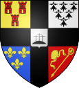
Saint-Hilaire-de-Chaléons
|
Saint-Hilaire-de-Chaléons Sant-Eler-Kaleon |
||
|---|---|---|

|
|
|
| region | Pays de la Loire | |
| Department | Loire-Atlantique | |
| Arrondissement | Saint-Nazaire | |
| Canton | Machecoul | |
| Community association | Pornic Agglo Pays de Retz | |
| Coordinates | 47 ° 6 ′ N , 1 ° 52 ′ W | |
| height | 1–32 m | |
| surface | 34.98 km 2 | |
| Residents | 2,287 (January 1, 2017) | |
| Population density | 65 inhabitants / km 2 | |
| Post Code | 44680 | |
| INSEE code | 44164 | |
| Website | http://www.saint-hilaire-de-chaleons.fr/ | |
Saint-Hilaire-de-Chaléons ( Breton : Sant-Eler-Kaleon ) is a French municipality with 2287 inhabitants (as of January 1 2017) in the department of Loire-Atlantique in the Region Pays de la Loire . It belongs to the arrondissement of Saint-Nazaire and is part of the canton of Machecoul (until 2015: canton of Bourgneuf-en-Retz ). The inhabitants are called Chaléonnais .
geography
Saint-Hilaire-de-Chaléons is located about 26 kilometers southwest of Nantes in the Pays de Retz countryside . Here the wine is produced in the Gros Plant du Pays Nantais growing area . Saint-Hilaire-de-Chaléons is surrounded by the neighboring communities of Chaumes-en-Retz (formerly Arthon-en-Retz and Chéméré ) in the north, Rouans in the northeast, Sainte-Pazanne in the east, Villeneuve-en-Retz (formerly Bourgneuf-en -Retz and Fresnay-en-Retz ) in the south and Pornic in the west.
Population development
| 1962 | 1968 | 1975 | 1982 | 1990 | 1999 | 2006 | 2013 |
|---|---|---|---|---|---|---|---|
| 1,304 | 1.311 | 1,255 | 1,362 | 1,333 | 1,551 | 1,791 | 2.136 |
| Source: Cassini and INSEE | |||||||
Attractions
- Saint-Hilaire church
- Calvaires in the cemetery
literature
- Le Patrimoine des Communes de la Loire-Atlantique . Flohic Editions, Volume 1, Charenton-le-Pont 1999, ISBN 2-84234-040-X , pp. 208-209.

