Mingora
| Mingora | ||
| State : |
|
|
| Province : | Khyber Pakhtunkhwa | |
| Coordinates : |
34 ° 47 ' N , 72 ° 22' E
|
|
| Height : |
984 m
|
|
| Residents : | 331.091 (2017) | |
| Time zone : |
PST ( UTC + 5 )
|
|
|
|
||
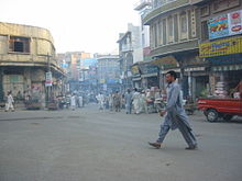
Mingora (sometimes also Mingaora ; Pashtun مینګورہ) is the largest city in the Swat district in the Pakistani province of Khyber Pakhtunkhwa with about 331,000 inhabitants .
location
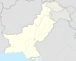
Mingora is located on the Swat River at an altitude of almost 1000 m above sea level. d. M. The national road N-95 runs through Mingora. Saidu Sharif , the administrative capital of the Swat Valley, is only about 2.5 km south.
economy
The villages in the Swat Valley are traditionally characterized by agriculture; the city functioned as a craft, trade and service center. Before the Taliban rule , tourism was an important industry.
history
Around 2000 years ago, Buddhism and Hinduism played an important religious and cultural role in the Swat Valley - this changed with the arrival of Islam around the year 1000.
In the period from October 2007 to May 2009, Mingora was temporarily and partially under the control of the Taliban extremists. Even after the city was retaken by the Pakistani army, there was still isolated fighting and terrorist attacks.
On October 2, 2012, Taliban extremist Atta Ullah Khan shot 14-year-old Pakistani civil rights activist Malala Yousafzai when she tried to get on a bus. She survived seriously injured.
Attractions
- About halfway between Mingora and Saidu Sharif is the Swat Museum with numerous exhibits on the history and culture of the Swat Valley.
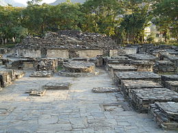
- About 1.5 km southeast of Mingora is the archaeological excavation site of Butkara I with the ruins of the Buddhist stupa and the adjoining monastery complex.
sons and daughters of the town
- Malala Yousafzai (* 1997), child rights activist and Nobel Peace Prize laureate


