
Minin archipelago
| Minin archipelago | ||
|---|---|---|
 |
||
| Waters | Kara Sea | |
| Geographical location | 74 ° 37 ′ N , 85 ° 40 ′ E | |
|
||
| Main island | Kolossov Island | |
| Residents | uninhabited | |

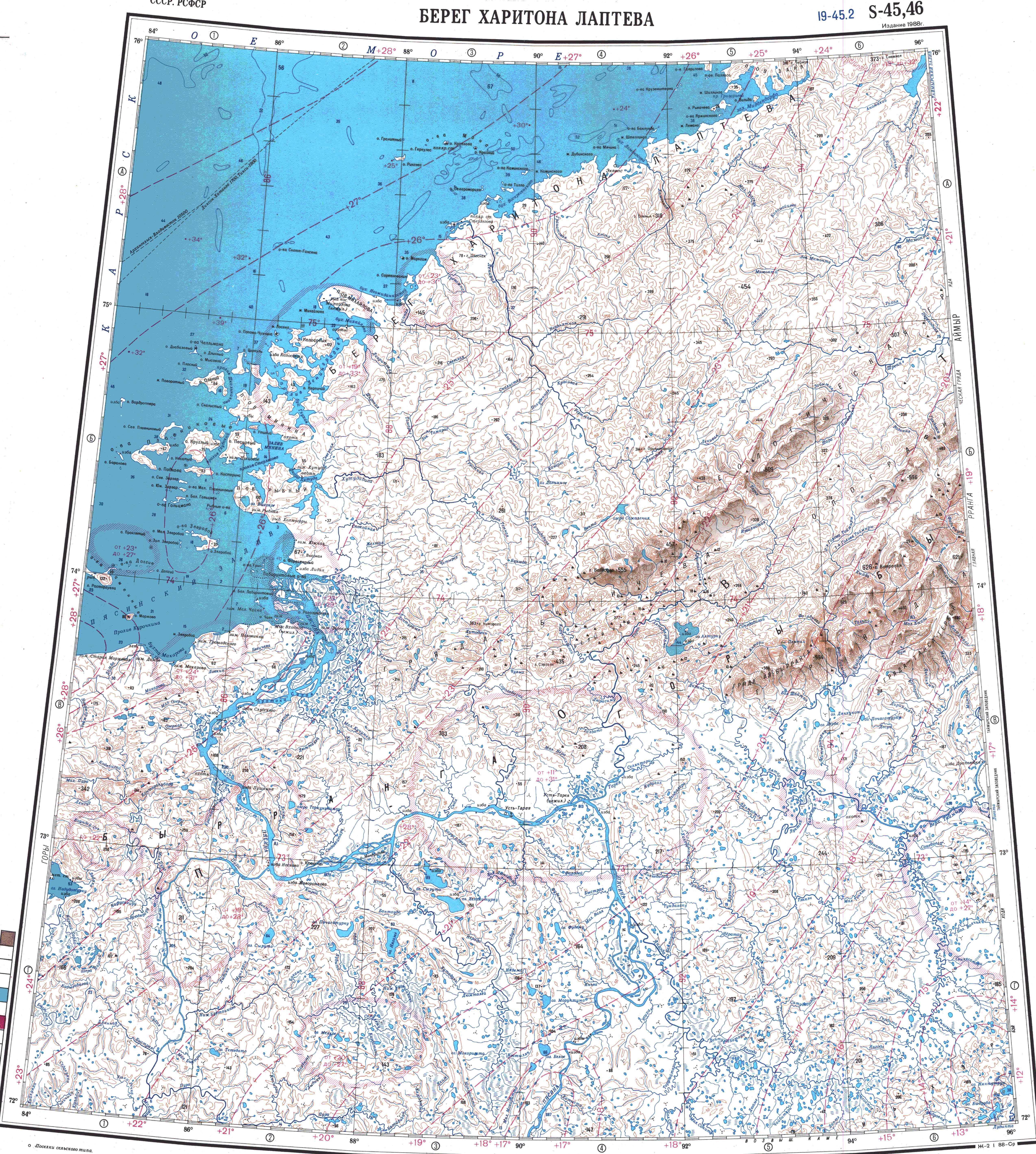
The Minin archipelago ( Russian Шхеры Минина , wiss. Transliteration Šchery Minina ) are an uninhabited archipelago of numerous smaller islands off the Khariton-Laptev coast in the western part of the Taimyr peninsula . Administratively they belong to the Taimyrski Dolgano-Nenezki Rajon of the Russian Krasnoyarsk region . It is named after Fyodor Minin (1709–1765), who mapped the coast of the Taimyr Peninsula west of the Pyassina estuary from 1738–1741 during the Great Nordic Expedition .
geography
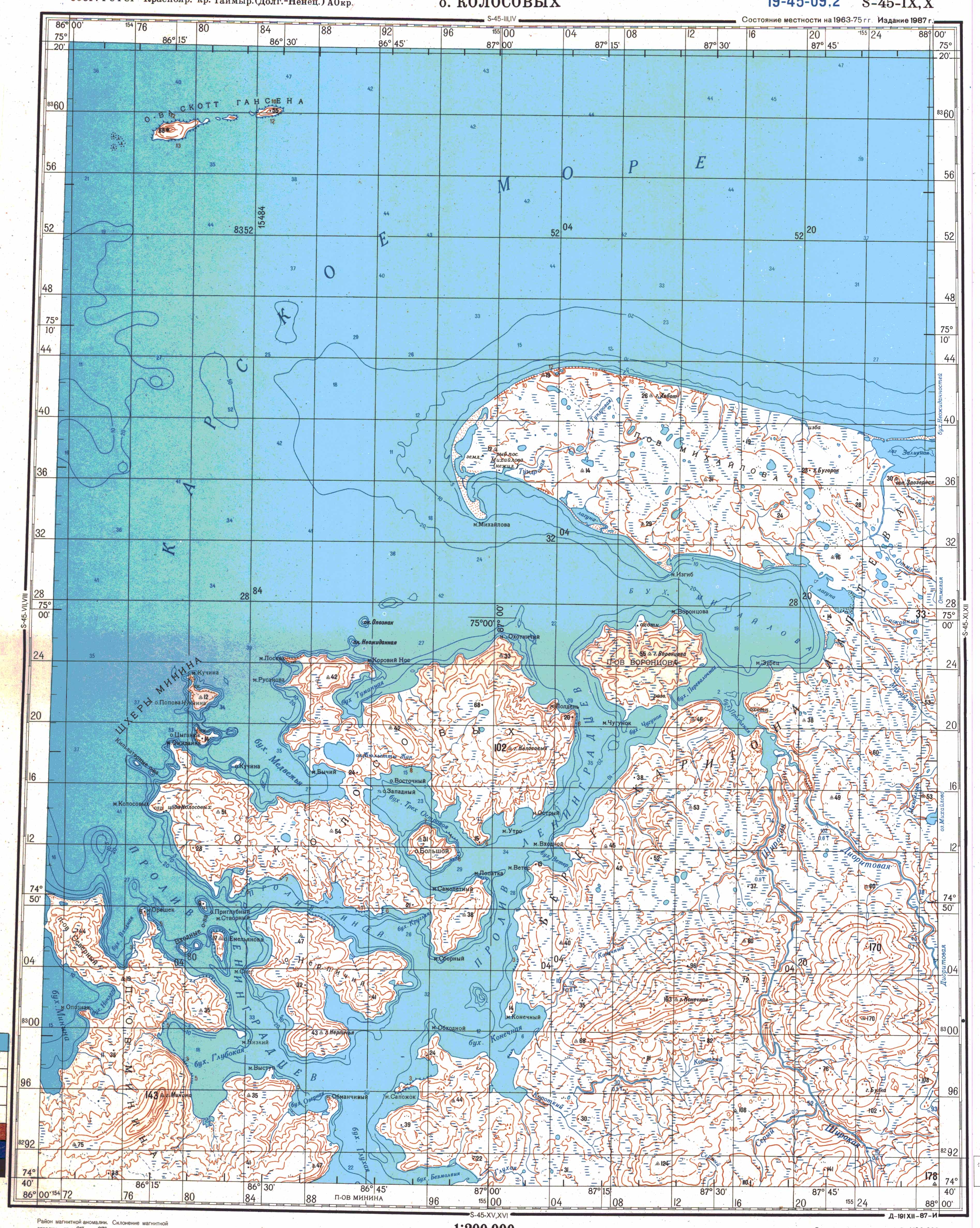
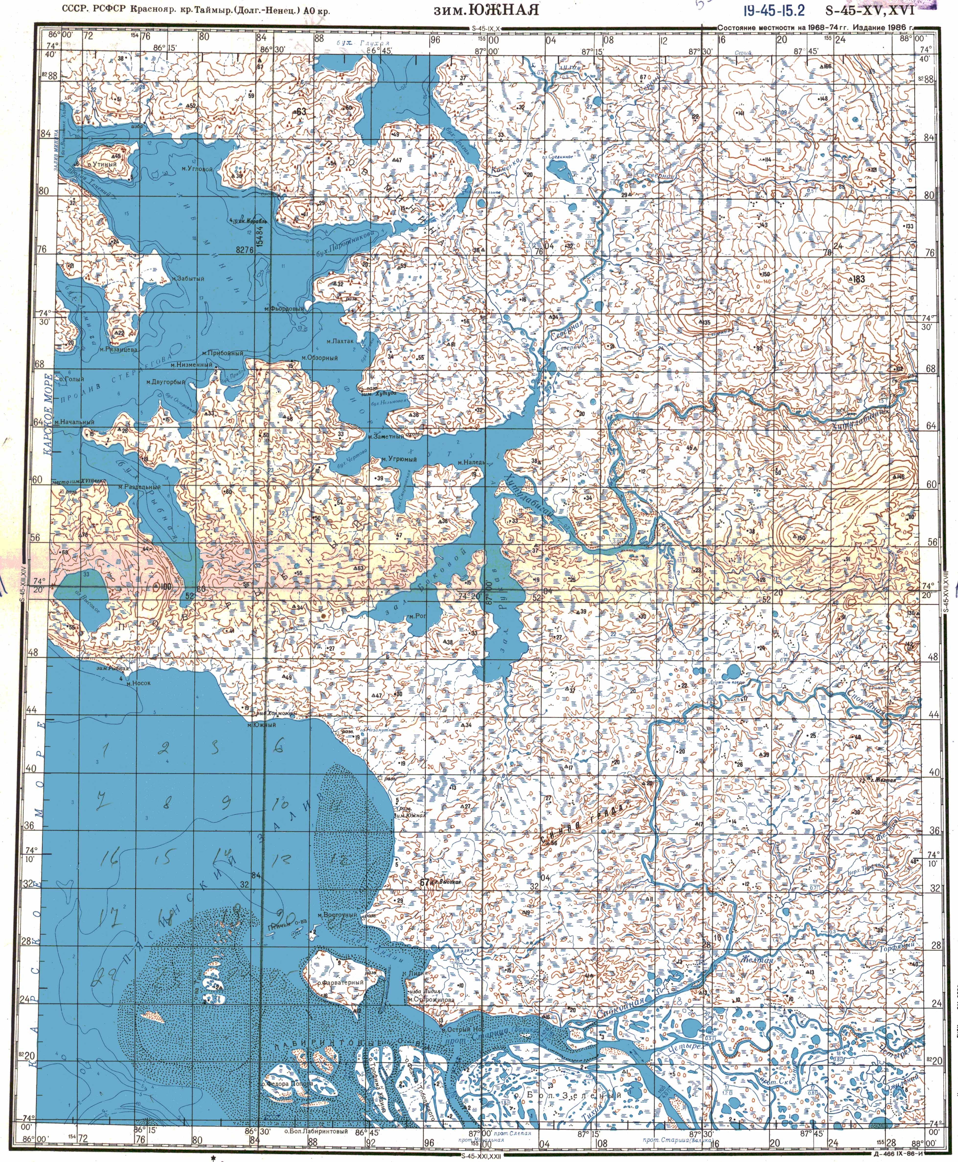
The archipelago is located in the southern Kara Sea between Dikson Island and the Mikhailov Peninsula . It includes archipelagos and individual islands. Many of the islands have an irregular, very rugged shape. The Kolossow Island is the largest with an area of around 255 km² and the highest with up to 102 m . It is 26 km long and up to 11 km wide.
The main archipelagos and islands belonging to the Minin archipelago are:
- the Kamennyje Ostrowa (Wostotschny Kamenny, Sapadny Kamenny, Rastorgujew Island, Morschowo),
- the Plawnikowyje Ostrowa (Peszowy, Krugly, Podkowa, Kosterin Island, Baranow Island, Severny Plawnikowy),
- the Kjellman Islands (Oleni, Zirkul, Dlini, Diabasowy, Mysowoi, Ploski and others),
- the Golzman Islands,
- Kolossov Island, Popov-Chukchin Island, Ragosinsky Island, Torosovy, Nerpitschi, Sweroboi and the like. a.
The channels between the islands are considered dangerous for navigation because they have not yet been fully examined for shoals . The islands of Baranow, Wardroper, Oleni, Diabasovy and Popow-Chukchin are fired to secure shipping traffic .
history
Fyodor Minin led the mapping work of the Great Nordic Expedition east of the mouth of the Yenisei from 1738 to 1741 . The most easterly point it reached was the mouth of the Pyassina. He discovered the southernmost of the Minin archipelago and named them Kamennyye Ostrowa ("stone islands"). More than 100 years later, Adolf Erik Nordenskiöld landed on an island that he called "Minin Island" when he first crossed the Northeast Passage on August 11, 1878. According to the given location (74 ° 51 ′ north; 85 ° 3 ′ east) it must have been one of the Kjellman Islands belonging to the Minin archipelago, which Fridtjof Nansen's Fram expedition also visited in 1893 . Nansen named the largest of these islands after the animals living there as "Reindeer Island" (Russian Oleni Ostrow).
The name Minin Archipelago for the entire archipelago goes back to Eduard von Toll . While he was crossing the archipelago with his ship Zarya and naming many geographical locations, the ship ran aground three times. In 1901 the Rastorgujew Island was named, in 1906 the Plawnikowyje Ostrowa. Many current names were given by Soviet expeditions that mapped the islands between 1933 and 1937.
In the 1930s, objects were found on Popov-Chukchin Island that could clearly be assigned to the expedition of Vladimir Russanov , which had been missing since 1912 .
natural reserve
Parts of the Minin archipelago - the Plawnikowye Ostrowa and the island of Sveroboy - belong to the Great Arctic Protected Area .
Individual evidence
- ↑ GP Awetissow: Minin Fyodor Alekseevich (1709-1765) . In: Imena na Karte Rossijskoi Arktiki , Nauka, Sankt Petersburg 2003, ISBN 5-02-025003-1 (Russian).
- ^ William James Mills: Exploring Polar Frontiers - A Historical Encyclopedia . tape 2 . ABC-CLIO, 2003, ISBN 1-57607-422-6 , pp. 429 f . (English, limited preview in Google Book Search).
- ↑ a b c d e Ostrowa na Polititscheskoi Mira map (PDF; 26.5 MB). Volume 4: Asia , Moscow 1990, pp. 26-28 (Russian).
- ↑ Sailing Directions (Enroute). North Coast of Russia. Pub. 183, National Geospatial-Intelligence Agency, Springfield, Virginia 2017, pp. 141 ff. (English).
- ^ List of Lights, Radio Aids and Fog Signals. Pub. 115: Norway, Iceland and Arctic Ocean (PDF; 2.9 MB), National Geospatial-Intelligence Agency , Bethesda, Maryland, 2007, p. 251 (English).
- ^ AE Nordenskiöld (Ed.): The scientific results of the Vega expedition . Volume 1, Brockhaus, Leipzig 1883, p. 56 f.
- ↑ Fridtjof Nansen: In night and ice . Volume I. Brockhaus, Leipzig 1897, p. 122 .
- ↑ William Barr : Baron Eduard von Toll's Last Expedition: The Russian Polar Expedition, 1900-1903 (PDF; 5.59 MB). In: Arctic . Volume 34, No. 3, 1980, pp. 201-224 (English).
- ↑ GP Awetissow: Rusanov Vladimir Alexandrovich (? 03 (15) .11.1875-1913) . In: Imena na Karte Rossijskoi Arktiki , Nauka, Sankt Petersburg 2003, ISBN 5-02-025003-1 (Russian).
- ↑ Map of the Great Arctic Conservation Area on its homepage, accessed on November 18, 2019.
Web links
- Topographic maps ( 1: 1,000,000 , 1: 200,000 , 1: 200,000 , 1: 200,000 , 1: 200,000 )