Mittagstein (Bavarian Forest)
| Midday stone | ||
|---|---|---|
|
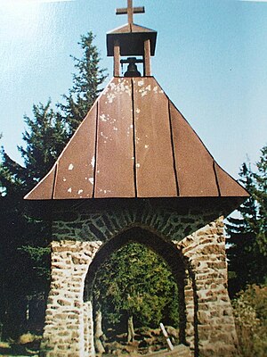
The bell tower in honor of the fallen |
||
| height | 1034 m above sea level NHN | |
| location | District of Cham , Bavaria ( Germany ) | |
| Mountains | Bavarian forest | |
| Coordinates | ||
|
|
||
The Mittagstein is 1034 m above sea level. NHN high mountain peak that rises in the middle of the Kaitersberg in the Bavarian Forest .
On the wooded summit there is a chapel to commemorate those who died in the war, and there is also a lookout rock with a view of the Zellertal and over to the Großer Riedelstein . A little below the highest point is the Kötztinger Hütte , which is open daily during the summer months and only on Wednesdays, Saturdays and Sundays during the winter months.
Various hiking trails lead to the Mittagstein, for example from Hohenwarth , Bad Kötzting , Bärndorf or Steinbühl. Popular with hikers is the crossing of the entire Kaitersberg from Bad Kötzting along the E6 long-distance hiking trail over the Kreuzfelsen , the Mittagstein, the Rauchröhren and the Großer Riedelstein to the Ecker Sattel .

