Mokopane
| Mokopane | ||
|---|---|---|
|
|
||
| Coordinates | 24 ° 11 ′ S , 29 ° 1 ′ E | |
| Basic data | ||
| Country | South Africa | |
| Limpopo | ||
| District | Waterberg | |
| ISO 3166-2 | ZA-LP | |
| local community | Mogalakwena | |
| height | 1204 m | |
| Residents | 30,151 (2011) | |
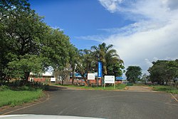
Mokopane (until 1858 Vredenburg, then until 2003 Potgietersrus ) is a town in the municipality of Mogalakwena , District Waterberg , in the South African province of Limpopo . It is located at an altitude of 1204 meters above sea level. In 2011 the city had 30,151 inhabitants.
history
The city was founded as Vredenburg by the Voortrekkers and later named after one of their leaders, Piet Potgieter . The name was changed to Mokopane in 2003, after a previous traditional ruler. The area around Mokopane is home to the IsiNdebele speaking tribes. Four kingdoms are located near the city: Langa (eMapela), Gegana (eMshade), Lebelo (eGarasvlei) and Langa (eBakenburg). There are also mainly Pedi and Sotho .
economy
The Mokopane area is one of South Africa's most productive agricultural areas. Wheat, tobacco, cotton, beef, corn, peanuts and citrus are produced there. The Zebediela Citrus Estate , 55 kilometers southeast, is one of the largest citrus farms in the southern hemisphere .
The area is also rich in mineral resources, with platinum , diamond and granite mining as the main sources of income.
Attractions
Located just two hours by car from Gauteng Province , the city acts as a destination and stopover for travelers to Botswana , Zimbabwe and the Kruger National Park . The area is a typical bushland with many acacia trees and aloes and is located in the Waterberg Mountains .
In Mahwereleng, near Mokopane, traditional lifestyles are presented to tourists.
The Arend Dieperink Museum presents the history of the city, from the great apes to humans on Makapansgat, San drawings and early activities in the area to the First and Second Boer Wars and recent events.
The Makapansgat palaeontological site has been part of the UNESCO World Heritage Site , along with other sites in South Africa . It is located 15 kilometers north of Mokopane.
Web links
Individual evidence
- ^ Administrative borders of South Africa
- ↑ 2011 census , accessed October 5, 2013

