Mole Creek Karst National Park
| Mole Creek Karst National Park | ||
|---|---|---|
| Inside the Marakoopa Cave | ||
|
|
||
| Location: | Tasmania , Australia | |
| Specialty: | Dripstone caves, karst | |
| Next city: | Deloraine | |
| Surface: | 13.45 km² | |
| Founding: | 1996 | |
| Address: | Mole Creek Karst National Park | |
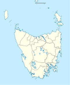
The Mole Creek Karst National Park (English Mole Creek Karst National Park ) is a national park on the Australian island of Tasmania and is located about 168 km northwest of Hobart . It is the only national park in Tasmania that was created specifically to protect karst areas .
The two most famous caves are the Marakoopa Cave and the King Solomons Cave. Both caves are accessible to visitors and allow an insight into this karst landscape . The fireflies in Marakoopa Cave are one of the largest observable populations in Australia. In addition to these two larger caves, there are about 300 other caves and ponors .
The Mole Creek area is known not only for its caves, but also for its canyons, underground water systems, and springs. Guided tours through caves and forests are offered.
Mole Creek
Main article: Mole Creek
In this area is the small town of Mole Creek , which is about 25 km from Deloraine . The place has 223 inhabitants and offers a starting point for hikes in the national park. There is a beekeeping in the village, which offers various types of honey and accommodation options.


