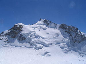
Mont Maudit
| Mont Maudit | ||
|---|---|---|
|
Mont Maudit northeast side of Mont Blanc du Tacul |
||
| height | 4465 m | |
| location | France and Italy | |
| Mountains | Mont Blanc group | |
| Dominance | 1.9 km → Mont Blanc | |
| Notch height | 162 m ↓ Col de la Brenva | |
| Coordinates | 45 ° 50 '50 " N , 6 ° 52' 45" E | |
|
|
||
| First ascent | King, Davidson, Jaun, v. Bergen on September 12, 1878 | |
| Normal way | Over the NW flank and the NW ridge, mainly glacier tour | |
The Mont Maudit is a 4465 m high mountain in the French Alps .
It is located in the Mont-Blanc group on the Mont-Blanc north-east ridge, which leads from the Aiguille du Midi to the 4810 m high main peak of the group. The valley locations for ascents to the summit are Chamonix in France and Courmayeur in Italy.
history
The mountain was first climbed by the Englishmen Henry Seymour King and William Edward Davidson on September 12, 1878 . They were led by the Swiss mountain guides Johann Jaun the Younger and Johann von Bergen.
In an avalanche accident on Mont Maudit on July 12, 2012, nine people died while climbing Mont Blanc. It was the worst accident in the Mont-Blanc group for years. Another avalanche accident claimed three lives on August 16, 2016, when a German mountain guide based in Chamonix and his two clients were swept away by collapsing Séracs .
Routes
In most cases, the Mont Maudit is not climbed as an independent ascent, but is visited from the Aiguille du Midi or the Cosmiques hut when climbing Mont Blanc . From both bases the ascent first leads to the Col du Midi and from there over the northwest flank to the Col du Mont Maudit ( 4354 m ). From there you can reach the summit in 40 minutes via the northwest ridge (level of difficulty). The total walking time from the Col du Midi is 6–7 hours; this ascent can also be done as a ski tour in winter.
The southeast ridge stands out from the many other climbs on Mont Maudit in terms of its popularity. It was first committed by Moriz von Kuffner , Alexander Burgener and Joseph Furrer in July 1887 and is therefore also called the Kuffner ridge . The tour offers combined climbing, steepness in the ice of up to 60 ° and rock difficulties in the III. and IV. Difficulty level. The starting point for this ascent, which takes at least 7 hours, is the Col du Trident ( 3609 m ), close to which there is an overnight stay in the Fourche bivouac ( 3679 m ).
literature
- Helmut Dumler, Willi P. Burkhardt: Four-thousanders in the Alps . 12th, updated edition. Bergverlag Rother, Munich 2001, ISBN 3-7633-7427-2 .
- Hartmut Eberlein: Mont Blanc Group. Area guide for mountaineers and climbers. Written according to the guidelines of the UIAA . 10th edition. Bergverlag Rother, Munich 2005, ISBN 3-7633-2414-3 .
Web links
- Mont Maudit at 4000m - the four-thousanders of the Alps
- Ski tour to Mont Blanc via Mont Maudit

