
Monte Stella (Cilento)
| Monte Stella | ||
|---|---|---|
 Monte Stella (right) |
||
| height | 1130 m slm | |
| location | Italy , province of Salerno | |
| Mountains | Southern Sub-Apennines | |
| Coordinates | 40 ° 14 ′ 16 ″ N , 15 ° 4 ′ 1 ″ E | |
|
||
| Normal way | Street | |
 View to the north |
||

The Monte Stella (also Monte della Stella or Montestella) ( German about "Sternberg") is the highest point of the western Cilento .
geography
The mountain is enclosed in three directions by the Tyrrhenian Sea . In the east the valley of the Alento river forms its border.
reachability
A road leads to Monte Stella, which begins in Omignano and leads up to the mountain in about 7 km. There are also hiking trails starting from the surrounding villages of Serramezzana , Perdifumo and San Mauro Cilento .
There is a church and a radar station on the summit.
photos


signpost

The church from the front
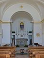
Look into the church


Web links
Commons : Monte Stella (Cilento) - Collection of images, videos and audio files