
Moorwerder

Moorwerder is part of the Elbe island Wilhelmsburg and today belongs to the Hamburg district of the same name . The diked and sparsely populated area is located on the southeastern tip of Wilhelmsburg between the Elbe arms of the north and south of the Elbe, which are divided here . The place name indicates that the settlement was founded on a Werder , that is, on a river island in the damp, " boggy " area of the Elbe river.
history
In contrast to the rest of Wilhelmsburg, which was only incorporated in the course of the Greater Hamburg Law in 1937, Moorwerder, together with the other marshland, had been part of the Hamburg area since 1395. Until 1830 it was under the rulership of Bill- and Ochsenwerder, then the rulership of the marshland . When the Hamburg city area was reorganized according to the Greater Hamburg Law, Moorwerder came to what was then District 8 in 1938, from which the Harburg district emerged after the war in 1951 . In 2008, Moorwerder went over to the district of Hamburg-Mitte together with the Wilhelmsburgs as part of a district administration reform .
Up until the storm surge in 1962 , Moorwerder was diked on its own, only then was it incorporated into the new Wilhelmsburg ring dike in the course of the new flood protection systems.
Ecological assignment
The district is a local recreation area in Hamburg with the well-known Heuckenlock nature reserve with its freshwater mudflats and the Bunthaus peak . Moorwerder is dominated by agriculture; there is horse breeding and vegetable cultivation in the south . Here one finds the midst of big city nor flocks of sheep and old farmhouses along the Elbe - dikes . The southern course of the Elbe is also the state border with Lower Saxony.
Nature museum
On the colored houses tip the Nature Museum is located since 2006 same-Tideauenzentrum Bunthaus , Moorwerder Hauptdeich 33. Here is what is special about flora and fauna informed the Elbe habitats. In addition, topics such as dyke construction , electricity construction and tides are explained and relationships are explained.

Aerial view: Moorwerder on the right, Spadenland on the left

The Elbe Tideau Center Bunthaus
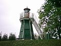
Bunthaus lighthouse


Web links
Individual evidence
- ^ Heinz Aschenberg, Gerhard Kroker: Storm surges and flood protection in Hamburg. An outline of the history of dike construction and inland drainage in the Elbe river splitting area , Hamburg 1992, p. 34.
Coordinates: 53 ° 28 ′ 39 ″ N , 10 ° 2 ′ 56 ″ E