Bunthaus lace

At the Bunthausspitze ( Elbe river kilometer 609), the Elbe divides for about 15 kilometers into the North and South Elbe and forms an inland delta . The two Elbarme enclose the Elbe islands with today's Hamburg districts Wilhelmsburg , Veddel , Kleiner Grasbrook and Steinwerder .
Beacon Bunthaus
In 1914, the Bunthaus lighthouse , a wooden lighthouse just under seven meters high , was built on the Bunthaus peak itself . It marked the separation of the fairway with an all-round fire ( belt lens ) and was decommissioned in 1977. Today, on the initiative of the last Hamburg stackmaster, a registered association takes care of the preservation of this gem, which was restored on the occasion of the 800th Hamburg port birthday in 1989.
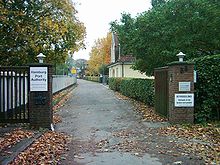
Bunthaus Stack Mastery
The Süderelbe has always been the main arm of the Elbe and carried most of the water. In the 3rd coal fire contract between Hamburg and Prussia of November 13, 1908, the aim of the regulation work with the Bunthauser Leitdamm was set with an even division of the flowing water volume.
If the target is not achieved - if the water volumes were to shift by more than 5% - follow-up action should be taken. The goal has not yet been achieved, the Norderelbe averages 45% and the South Elbe 55%. This was mainly due to the shorter and deeper Süderelbe / Köhlbrand (access to the seaports). Follow-up actions - such as B. the change in the regulatory lines above the Bunthauser peak - have never been taken, although there is a plan for it.
In addition, it was agreed in the Köhlbrand contract that each of the two states of Hamburg and Prussia has the right to participate in the water volume measurements to be carried out by a building official. Hamburg carried out the measurements every year with a fair degree of regularity (except for the war years). It is not known whether a Prussian construction officer ever took part.
The common term water flow measurement is incorrect. The respective flow velocities were measured in Bunthaus . With the measured cross-sections of the North and South Elbe, it was then possible to calculate the amount of water that had flowed through.
Historical measurement method
The flow rate was measured with a lot of personnel using stopwatches and wooden floats. These consisted of disc-shaped floats made of spruce wood, on which barrel-shaped weights made of wood with iron inlay hung. The target distance between the floats and the weights was 3/5 of the water depth and was constantly adjusted; The attempt was made to reduce the effects of wind and waves on the buoyant body through the weight.
In the north and south Elbe, the two three auxiliary boats were anchored in parallel. Every 15 minutes, a wooden float was put into the water on command from each boat. At each river profile on both banks there were so-called “callers” who each had to watch three swimmers.
A man with three stopwatches sat on each bank. When the numbered swimmers passed the profile line, the command came: “Number 1 through!” And the corresponding stopwatch was pressed. A launch caught the swimmers and brought them back to the boats for the next round. At the north and south Elbe there was also a level reader that recorded the level for each measurement process.
A total of twelve boats, four launches and 60 men including the detachments were required for a complete measurement cycle. It took the whole day from 4:00 a.m. to 9:00 p.m. with assembly and dismantling. Supervision was in the hands of the aquatic measuring service. Most of the staff and vehicles were provided by the stack maintenance department .
Despite the long working hours, the water volume measurements were popular with the workers. The main motive was the paid overtime - but also the light work and the breaks with " Klönschnack " as well as the good care contributed to this.
Modern ultrasound method
The last old type of measurement was carried out in 1980. Since 1977 attempts have been made to determine the flow velocity with an ultrasonic flow measuring system. Since it was a new development, it took a long time before usable data could be delivered.
Today the third, improved type of measuring system is in operation. It can deliver the required data continuously. The major advantages of this system compared to the old process are:
- Meaningful measurement results from the whole year and not just from one day of the year
- lower costs
- the influences of upstream water and wind can be recorded much more precisely.
The measurement results are required to answer questions relating to water management and electricity engineering , e.g. B. in the preliminary investigation to adjust the fairway or to research the sedimentation in the port.
The ultrasonic flow measurement system is a so-called "cross-section system". At 45 degrees to the river axis, sound impulses are simultaneously emitted downstream and upstream, which are picked up on the opposite bank and thrown back electrically amplified. The sound waves now need different times depending on whether they run through the water with or against the current. The flow velocity is calculated from the difference between these very small time differences.
The four transmitters on the Bunthauserspitze receive the necessary energy from the network at the lighthouse and the reflectors in the foreland of Bullenhausen and Ochsenwerder each from a small accumulator. The measuring cables had to be extended from the lighthouse to the office building of the Stackmeisterei, where the computers and display devices are in a small room, after the lighthouse was deliberately damaged several times.
Web links
- Beacon Bunthaus - "Bunthäuser Spitze" Moorwerder Hauptdeich - 21109 Hamburg ( Memento from September 21, 2013 in the Internet Archive )
Coordinates: 53 ° 27 '25 " N , 10 ° 4' 9" E


