Hamburg-Steinwerder
|
Steinwerder district of Hamburg |
|
|---|---|
| Coordinates | 53 ° 32 '4 " N , 9 ° 57' 26" E |
| surface | 10.4 km² |
| Residents | 33 (Dec. 31, 2019) |
| Population density | 3 inhabitants / km² |
| Post Code | 20457, 21107 |
| prefix | 040 |
| district | Hamburg-Mitte district |
| Source: Statistical Office for Hamburg and Schleswig-Holstein | |
Steinwerder (spelling until 1946: Steinwärder ; Low German : Steen Warder ) is a Hamburg harbor situated district in Hamburg-Mitte of the Free and Hanseatic City of Hamburg .
geography
Geographical location
The former island of Steinwerder is located at the confluence of the Norderelbe with the Köhlbrand . To the east it is limited by the Reiherstieg , a canalised Elbarm. In the south lies the former island of Neuhof , the northern part of which also belongs to the Steinwerder district.
Neighboring districts
Steinwerder borders Hamburg's Kleiner Grasbrook district in the east, Wilhelmsburg in the south-east , Waltershof in the west and in the north, across the Elbe, on Altona-Altstadt , St. Pauli , Neustadt and Hamburg-Altstadt .
Structure of the district
Together with the neighboring district of Kleiner Grasbrook , Steinwerder forms the eastern part of the Port of Hamburg . Steinwerder was almost completely declared as a free port until December 31, 2012 . The district consists of port, industrial and commercial areas. There are no residential areas here.
history
The Elbe island Steinwerder, formerly Nordersand , was diked in the Middle Ages and could therefore be managed. Through the Gottorper Treaty , the island came to Hamburg in 1768 together with the leasehold farms Grevenhof , Ellerholz and Roß . The name Steinwerder came into being in the vernacular after the Great Fire of 1842, when the area towards the river and the Reiherstieg was increased with the city's rubble. The part of the name Werder describes the river island. Then the first shipyards were built here. The first dry and floating docks on Hamburg's territory were built there in the 1850s . On December 1, 1862, with the participation of well-known shipowners, u. a. Ferdinand Laeisz and Robert Miles Sloman (the younger) founded the Hamburg seaman's school, which was located in Steinwerder until 1889 and then relocated to Hamburg-Waltershof due to the port expansion . After the settlement had been elevated to a suburb in 1871, Steinwerder was incorporated into Hamburg as a district in 1894, and in 1902 the previously popular name Steinwerder was officially adopted.
At the turn of the 20th century, the Kuhwerder Hafen , the Kaiser-Wilhelm-Hafen , the Ellerholzhafen , the Oderhafen , the Travehafen and the Roßhafen were built as part of the port expansion . Individual basins, such as the Kaiser Wilhelm Harbor, have already been partially filled in again. Due to the Köhlbrand contract of 1908, the Köhlbrand , which connects the North and South Elbe, was relocated 600 meters to the west. The old course can still be seen today from the location of the coal ship port .
politics
For the election to the citizenry , Steinwerder belongs to the constituency Billstedt-Wilhelmsburg-Finkenwerder , results are summarized with Kleiner Grasbrook .
Culture and sights
theatre
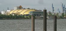
On the site of the former Stülcken shipyard between the Norderelbe and Guanofleet , a private musical theater was built in the early 1990s , in which the musical The Lion King is currently being performed. In 2014, the opening of another theater led by Stage Entertainment followed : The Stage Theater on the Elbe . The first production in the house was " Das Wunder von Bern ".

Buildings
In addition to the Old Elbe Tunnel and the Köhlbrand Bridge, the old Blohm + Voss administration building , which was built in 1908, is particularly worth seeing. With its massive appearance, which was clearly visible at the time, it was intended to symbolize the size and importance of the shipyard at the beginning of the 20th century. Due to the approaching development on the outside and the modernization by the architects Schramm, Pempelfort and von Bassewitz , who z. B. the continuous atria inside fell victim, but the building lost some of its imposing appearance.
Economy and Infrastructure
The Hamburg Port Authority (HPA) is planning the Central Terminal Steinwerder (CTS) in the center of the Port of Hamburg . Here the restructuring of a 125 hectare area is planned. In the summer of 2009, a market research process started in which the conceptual concepts and ideas of a broad and international group of interested parties were called up.

traffic
The old Elbe tunnel under the Norderelbe has been connecting Steinwerder with the landing stages in the St. Pauli district since 1911 .
The Köhlbrand Bridge , the driveway of which stretches along the entire southern edge of the district, has been leading from Steinwerder to Waltershof since 1974 . The bridge is part of the free zone; it connects the eastern and western parts of the port of Hamburg and is only approved for motor vehicle traffic.
The entire district is crossed by the tracks of the Hamburg port railway . There are no railway systems for passenger traffic in Steinwerder.
The HADAG ferries connect Steinwerder with Altona, St. Pauli and Waltershof from numerous small ferry docks. Bus routes 256 from PVG and 152 from HHA (to the Roß area) only run on weekdays in Steinwerder.
The third cruise center for cruise ships in Steinwerder has also been located in Steinwerder since 2015 .
Public facilities
In the northwest of Steinwerder is the main sewage treatment plant Köhlbrand of the Hamburg city drainage system from 1961 with its egg-shaped sewage sludge tanks made of steel.
Established businesses
The Container Terminal Tollerort (CTT) of Hamburger Hafen und Logistik AG (HHLA) is located in the northwest of Steinwerder. It is one of the four container terminals in the port of Hamburg . The Buss Group's Hansa Terminal is located at the Travehafen . In January 2016 it became known that the city of Hamburg would not extend the contract for the Hansa Terminal, which expired in December, and that Buss would therefore have to close it.
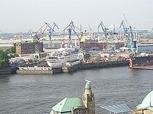
The area of the Blohm + Voss shipyard , which also includes the Elbe 17 dry dock, is located directly on the Norderelbe . Another shipyard is the Norderwerft . There used to be three other large shipyards in Steinwerder:
- Schlieker shipyard , 1954 to 1962 (bankruptcy), shipyard premises taken over by Blohm & Voss
- HC Stülcken Sohn , founded in 1840, taken over by Blohm + Voss in 1966 and closed
- AG Vulkan Hamburg (1905 to 1929), from 1930: Howaldtswerke AG Kiel, previously Vulcan department , from 1939: Howaldtswerke AG, from 1953: Howaldtswerke Hamburg AG, from 1968: Howaldtswerke- Deutsche Werft (HDW) - Ross plant, 1986/87 : Ross Industrie GmbH (HDW Hamburg was closed in 1985)
See also
- List of streets, squares and bridges in Hamburg-Steinwerder
- List of cultural monuments in Hamburg-Steinwerder
Web links
- Steinwerder on hamburg.de
- HHLA Container Terminal Tollerort
- Terminal project for Steinwerder ( Die Welt , January 31, 2005)
Individual evidence
- ^ Franklin Kopitzsch , Daniel Tilgner (ed.): Hamburg Lexikon. 4th, updated and expanded special edition. Ellert & Richter, Hamburg 2010, ISBN 978-3-8319-0373-3 , p. 629.
- ^ Horst Beckershaus: The names of the Hamburg districts. Where do they come from and what they mean , Hamburg 2002, ISBN 3-434-52545-9 , p. 118
- ↑ "Port Development Plan Hamburg 2025" ( Memento of the original dated November 12, 2013 in the Internet Archive ) Info: The archive link was inserted automatically and has not yet been checked. Please check the original and archive link according to the instructions and then remove this notice. , P. 68f, HPA page, accessed on November 21, 2012 (PDF file, 6.74 MB).
- ↑ "Lease not renewed: Off for the Hansa Terminal" on www.mopo.de, accessed on January 27, 2016.


