
Hamburg-Hamm
|
district of Hamburg |
|
|---|---|
  |
|
| Coordinates | 53 ° 33 '18 " N , 10 ° 3' 27" E |
| surface | 3.8 km² |
| Residents | 38,330 (Dec. 31, 2019) |
| Population density | 10,087 inhabitants / km² |
| Post Code | 20535, 20537, 22087, 22089 |
| prefix | 040 |
| district | Hamburg-Mitte district |
| Transport links | |
| Federal road |
|
| Subway |
|
| Train |
|
| Source: Statistical Office for Hamburg and Schleswig-Holstein (data for Hamm-Mitte, -Nord and -Süd cumulative) | |
.2.13810.ajb.jpg)

.jpg)
.jpg)
Hamm is a district in the Hamburg-Mitte district of the Free and Hanseatic City of Hamburg . Once a preferred villa suburb of wealthy merchants, it grew into one of the most populous districts in the first half of the 20th century, before it was almost completely destroyed in the Second World War . Between 1951 and 2010, Hamm was divided into three parts of the city (Hamm-North, Central and South). At the initiative of the district assembly, these were reunited to form one district on January 1, 2011.
geography
Hamm is about 2.6 kilometers east of Hamburg's main train station . It borders in the west on Borgfelde and Hammerbrook , in the north on Eilbek , in the east on Marienthal and Horn and in the south on Rothenburgsort .
The landscape of Hamm is shaped and structured by its location on the northern edge of the Ice Age Elbe glacial valley : While the northern part of Hamm ("Oben-Hamm"), including the Hammer Park and the old village center, lies on the Geestrücken , the southern part ("Unten- Hamm ", formerly Hamm-Mitte and Hamm-Süd) to the Elbmarsch, which is around 10 to 15 meters lower (see also Hammerbrook, Niederdt. -Bruch).
Hamm is intersected by several traffic axes running in a west-east direction, on which the long-standing structure in Hamm north, center and south was based. Thus formed the hammer road (with the parallel U-Bahn -lines U2 and U4 ), the boundary between north and Hamm -Mitte that Eiffestraße ( B 5 ), however, that between Hamm-center and -Süd.
Surname
The name Hamm is traced back to the Saxon words Ham, Hamme, Hemm or Hemme and is part of several place names north of the Elbe. However, the meaning has not been established beyond doubt, as the historian Otto Clausen translates it as "forest", whereas the place name researcher Wolfgang Laur translates it as "land in a river bend". In the case of the district, “forest” has a basis in the history of its origins: Hamm was an Old Saxon settlement in a large forest area that stretched across the Geestrücken . However, the ham part in the name “Hamburg” refers to the early settlement on the Alsterschleife. There are unsubstantiated suspicions that the Hammaburg was named after the old village of Hamm.
population
The population in Hamburg-Hamm is made up as follows (data from the North Statistics Office, as of December 2016):
- Total population: 38,136 people
- Minor quota: 11.4%, well below the Hamburg average of 16.2%.
- Share of households with children: 10.9%, well below the Hamburg average of 17.8%.
- Elderly rate (65-year-olds and older): 14.4%, below the Hamburg average of 18.3%.
- Proportion of foreigners: 18.0%, is slightly above the Hamburg average of 16.7%, but well below the average for the Hamburg-Mitte district (28.2%).
- Share of benefit recipients according to SGBII (Hartz IV): 10.5%, corresponds almost exactly to the Hamburg average of 10.3%
- Unemployment rate: 5.6%, corresponds almost exactly to the Hamburg average of 5.3%.
Hamm is one of the less affluent districts of Hamburg. The average annual income per taxpayer was around 25,745 euros in 2013 and is significantly lower than the Hamburg average (39,054 euros).
There are 25,809 households in Hamm. The vast majority of the Hammer population is of working age (74.2%). People under the age of 18 and over 65 make up a total of only 25.8% of the population (Hamburg as a whole: 34.5%).
Living
There are currently 2,273 residential buildings with around 22,000 apartments in the district. The average apartment size is 57.4 square meters. The vast majority of households are single-person households. The share of social housing is 5.5 percent. According to data from the North Statistics Office, real estate prices (condominiums per square meter) in Hamm have risen by more than 41 percent since 2004, with a sharp acceleration in price increases recently noticeable: between 2011 and 2012 alone, prices rose by more than 26 percent was recorded. In February 2014, Hamm emerged as the most popular district of all Hamburg districts from a market study.
history
Origins
-ausschnitt-eilbek-hamm.jpg)
The first documentary mention comes from the year 1256, when the two Counts Johann and Gerhard von Schauenburg-Holstein leased their lands east of Hamburg between the villages “Hamme” and “ Eilenbeke ” to the city of Hamburg. In 1383, Count Adolf VII of Holstein-Kiel pledged his share of the property in Hamm and Hammerbrook to the city of Hamburg and sold it to them a few years later. The remaining Hammer estates had been in the possession of the Hamburg cathedral chapter since 1288 , which also sold them to the city in 1566. The rulership of Hamm and Horn was formed as early as 1410 , to which the current districts of St. Georg , Borgfelde, Eilbek, Uhlenhorst , Hammerbrook and Fuhlsbüttel also belonged.
From villa suburbs to districts


The village character of Hamm gradually began to change in the 17th century, when wealthy Hamburg citizens bought land and built summer houses , especially along Hammer Landstrasse . Many street names (e.g. Beltgens Garten, Borstelmannsweg, Droopweg, Dobbelersweg) are still reminiscent of the former owners. These new residents also initiated the construction of the Trinity Church in Hamm, consecrated in 1693. In 1781, the merchant Jacques de Chapeaurouge from Geneva bought part of the Hammer Forest and laid the foundation stone for today's Hammer Park . The property later passed into the possession of the Sieveking family through marriage and developed into a cultural and social center of Hamburg in the course of the 19th century, when numerous well-known personalities frequented the "Hammer Hof".
In the siege winter of 1813/14 , Hamm was burned down by the French in order to create a clear field of fire against the advancing Russian army; A memorial in the old Hammer cemetery commemorates the victims of that time . After the Great Hamburg Fire of 1842, many summer house owners settled permanently in Hamm, and since the lifting of the gate lock in 1860, more and more Hamburg citizens have migrated to the surrounding area. In order to do justice to the increasing urbanization, Hamm left the country lordship in 1871 and was placed under municipal administration as a suburb. In 1894 it was finally incorporated as a district.
At around the same time, the marshy marshland in the south began to be backfilled in order to gain additional building land. The Hammerbrooker canals , which had already been laid out in 1842, were extended to the east and served both for drainage and as transport routes. A “consortium Hammerbrook” founded by landowners provided for the construction of a field railway, which from 1906 brought sand from the Boberger dunes in order to raise the area more than five meters. As a result, the newly gained areas were intensively built on with tenements (so-called “ slit buildings ”), which are mainly inhabited by workers and small businesses. The proletarian character of South Hamm formed a strong contrast to the more bourgeois north, so that the distinction between “above” and “below Hamm”, which was becoming popular at the time, also expresses a social demarcation. In order to mitigate this contrast, a new residential area was built in the far east of Hamm in the 1920s and 1930s according to plans by the then city planning director Fritz Schumacher - between Hammer Steindamm and the then city limits of Wandsbek down to the Osterbrookviertel.
Destruction and rebuilding

During the Second World War, Hamm was almost completely destroyed in Allied air raids as part of Operation Gomorrah in July 1943. Thousands of people perished in the firestorm ; the survivors fled to the countryside or moved to emergency shelters ( Nissen huts ) and allotment houses. The numerous air raid shelters distributed over Hamm and the bunker museum set up in a tubular bunker in the garden of the Wichernkirche are still a reminder of the horrors of war today.
Since the early 1950s, housing cooperatives in particular have been rebuilding the destroyed Hamm. In order to quickly resolve the housing shortage, a large number of small apartments were built, which is a problem for urban development today, as families with children in particular can hardly find adequate housing. In addition, the once densely populated southern part was almost completely depopulated after the war and was used commercially from then on; Residential buildings can only be found there in the Osterbrookviertel.
Population development
- 1811: 852
- 1866: 3.162
- 1894: 14.697
- 1939: 90.316
- 1946: 7,489
- 1959: 53.835
- 1990: 36,355
- 2012: 37,607
- 2015: 37,948
Personalities
- Amandus Augustus Abendroth , Senator and Mayor, is buried in the Hammer Cemetery
- Cisco Berndt , musician and founding member of Truck Stop lived here
- Johannes Brahms lived on Black Street for a few years
- Joachim Heinrich Campe ran a school on Hammer Deich and wrote his youth novel "Robinson the Younger" here
- Jaques de Chapeaurouge , merchant and founder of Hammer Park
- Jean Dauphin de Chapeaurouge , 1st Deputy Mayor 1811–1813
- Walter Giller grew up as the son of a pediatrician practicing in Hamm
- Helmut Griem went to the Hammer Kirchenpauer-Gymnasium and did his Abitur there
- Martin Irwahn , painter and sculptor lived and worked (with other artists) in the Ohlendorffhaus ( Villa Ohlendorff ) until it was bombed out in 1943
- Maximilian Jahns had his studio on Hammer Landstrasse , which was bombed out in 1943
- Max Mendel , consumer cooperative member and Senator ( SPD ) last lived at Hammer Landstrasse 59.
- John Neumeier , founder and director of the Hamburg Ballet School in Caspar-Voght-Straße
- Heinrich Ohlendorff , merchant, at the time richest man from Hamburg and owner of a villa in Hamm
- Johann Heinrich Ohlendorff , landscape gardener and operator of a tree nursery in Hamm
- Julius Adolf Petersen , alias "the Lord von Barmbeck", professional criminal, born and raised in Borstelmannsweg
- Arno Schmidt , writer, lived in "Unter-Hamm" (Rumpffsweg 27) until he was 14
- Karl Sieveking , Hamburg Senate Syndicate , owner of the Hammer Hof and promoter of the arts and the Rauhe Haus
Religions
Christianity
Like the entire Hamburg area, Hamm has been evangelical-Lutheran for a long time since the Reformation . Since the construction of the first Trinity Church in 1693, there has been a separate Hammer community, which initially also included Horn and part of Eilbek. In the 19th and 20th centuries several subsidiary congregations were founded for the growing population ( Dankeskirche 1895, Wichernkirche 1934, Pauluskirche 1955, Simeonkirche 1965/66). Some of them reunited in 1999 due to falling membership numbers and church tax revenues to form a congregation, which currently has around 7400 believers; the Wichernkirche remained independent.
In addition, there has been a separate Roman Catholic community (Herz Jesu Hamm) as well as several Protestant free churches ( Evangelical Methodist Christ Church , Evangelical Free Church Community Hamburg-Hamm ( Baptists ), Trinity Church of the SELK ) since the 1950s .
More recently the Greek Orthodox community ( Nikolauskirche , since 2003, formerly Simeonkirche) was added.
Islam
There is also a DITIB mosque.
politics
For citizenship elections , Hamm belongs to the Hamburg-Mitte constituency . The 2015 general election brought the following results:
- SPD : 47.8% (-2.5)
- Greens : 12.6% (+0.4)
- Left : 11.3% (+2.8)
- CDU : 10.1% (−6.5)
- AfD : 6.6% (+6.6)
- FDP : 4.7% (+0.4)
- Others: 6.9% (-1.2)
The election for the district assembly Hamburg-Mitte 2014 brought the following results:
Culture and sights
Buildings
.JPG)
Due to the extensive destruction in the Second World War, only a few historical buildings have survived in the district. In addition to a few Wilhelminian style villas in the extreme northwest, the district is therefore mainly characterized by the typical red brick buildings of the 1920s to 1950s. The school buildings by Fritz Schumacher Osterbrook, Griesstrasse and the former girls' high school in Caspar-Voght-Strasse, which now houses the Hamburg Ballet Center by John Neumeier (art on the building by Ervin Bossányi , mural by Anita Rée ) , are particularly striking . The building of the former Kirchenpauer grammar school, named after the former First Mayor of the city, on the corner of Sievekingsallee and Hammer Steindamm , dates back to the same time and has served as an education center for the Hamburg tax administration since 1987 (since 2010: North German Academy for Finance and Tax Law ) is being used.
Probably the best-known landmark of Hamm is the Trinity Church, newly built in 1956/57 by Reinhard Riemerschmid with its characteristic tower. Another important church building from this period is the Christ Church, built by Helmut Lubowski in 1958 on Carl-Petersen-Strasse / the corner of Sievekingdamm . Immediately next to the Evangelical Lutheran Trinity Church is the Roman Catholic Sacred Heart Church. Also in Hamm-Nord is the Greek Orthodox Church of St. Nicholas , the former Evangelical Simeon Church . Other Protestant churches are the Pauluskirche in Hamm-Nord, the Wichernkirche in Hamm-Mitte and the Dankeskirche in Hamm-Süd.
Parks


With Hammer Park , redesigned by Otto Linne , which goes back to a landscape garden of the Chapeaurouge and Sieveking families over 200 years old , Hamm is home to one of the largest and oldest parks in Hamburg. The park includes a sports stadium, a children's playground, a toboggan run, a paddling pool, several flower and herb gardens and a mini golf course .
Behind the Dreifaltigkeitskirche, which was rebuilt after the war was destroyed, is the historic Hammer Friedhof , which is a listed building , with numerous historically significant graves, including Amandus Abendroth , Elise Averdieck and Johann Hinrich Wichern , the founder of the Rauhen Haus in neighboring Hamburg-Horn . The oldest mausoleum in Hamburg, the Sieveking Mausoleum , designed by the architect Alexis de Chateauneuf, is also located on the site . It is the burial place of the Sieveking and Chapeaurouge families , including the builder Karl Sieveking and his cousin Amalie Sieveking . Several memorials commemorate the victims of the First and Second World Wars, as well as those of the winter siege of 1813/14 , when numerous residents of Hamm who had been driven out of their homes lived in holes in the ground and in grave vaults and died in the process.
On the western edge of Borgfelde is Thörls Park , on the site of which one of Hamm's most important merchant's villas used to stand.
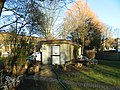
Bunker Museum
The Hamm district archive has been operating a bunker museum in an underground air raid shelter from the Second World War since 1997 . The completely preserved tubular bunker in the garden of the Wichernkirche was built in 1940/41 and consists of an entrance structure with stairs and gas lock , an emergency exit structure and four concrete tubes. The floor is about five meters underground, the tubes are each 17 meters long, two meters wide and have a clear height of 2.25 meters. Each of the tubes was intended for about 50 people, they offered space for a total of 200 people. Dry toilets, heating and lighting as well as a hand-operated ventilation machine were provided. There are wall inscriptions inside, besides equipment and documents on the subject of air protection and aerial warfare are also exhibited. Reports from contemporary witnesses who witnessed the air raids on Hamburg-Hamm in 1943 are also shown. The tube bunker is looked after by the Hamm district archive and has been entered in the Hamburg monument list since October 2002.
Access structure in the Wichernkirchhof
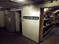
Vestibule / gas lock

Exhibits in one of the tubes

Screening room for films


Cultural institutions

Above the subway station Castle Road is currently being built the new district center Hamm, in the next to the sports club HT16 shall come in several cultural institutions, including the previously located in Borgfelde fringe theater Sprechwerk well as the district archive and the Kulturladen Hamm. The culture shop offers political discussions, colorful afternoons in Low German, cabaret performances, children's theater, courses from potters to yoga, computers for senior citizens and tutoring for schoolchildren. Once a year there is a large flea market and a children's festival in Hammer Park. The district archive contains 30,000 historical photos of buildings, sorted by street and house number, often with sets of images ("Before the firestorm of the bombing war / war-torn state / reconstruction / today"); In addition, lectures, city tours and historical barge rides are offered on a regular basis.
The Factory of the Arts in Kreuzbrook offers classical and experimental art as well as rooms for other events.
Sports


Several traditional sports clubs are located in Hamm , including the Hamburg gymnastics club from 1816 (HT16), which it claims to be the "oldest gymnastics and sports club in the world", and the Hammerdeich rowing club from 1893 , with the multiple world champion and Olympic champion Peter-Michael Kolbe produced one of the most successful German rowers. SV St. Georg from 1895 , which is also based in Hamm, enjoyed national fame in earlier years, especially for its athletics department and its stadium festivals in Hammer Park . The clubhouse and tennis facility are still in the immediate vicinity of the park.
The Hamm United FC football club, on the other hand, is comparatively young and , after it was founded in 2005, was promoted to the league in just a few years . The club plays its home games in the Hammer Park Stadium.
On the Bille in the south of Hamm, water sports are practiced , especially rowing, canoeing and kayaking . There is a small yacht and motorboat harbor on the Braunen Brücke, where the North German Sport Boat Club is located. On the opposite Billerhuder Insel ( Rothenburgsort ) is the Biller Ruder Club v. 1883 r. V. at home, which was founded in 1883 as the workers' rowing club Theodor von der Bille and is also one of the oldest sports clubs in the area.
Also in Hamm-Süd is the training ground of the police dog sports club Bille von 1925 e. V. as well as the Aschbergbad, an outdoor pool of the municipal bathing state Hamburg with the longest outdoor water slide in the city (110 meters).
Economy and Infrastructure
In the north, small shops, restaurants and cafés have mainly settled around Hammer Park, on Carl-Petersen-Straße and on Hasselbrook. In the center of Hamm, near the Rauhes Haus subway station, there are several grocery stores, drugstores, (specialist) doctor's offices, two pharmacies. In addition, a good dozen smaller shops and kiosks, pubs and cafes. There is also a fitness center that is only open to women. There are also several smaller and larger hotels.
In the south of the district there are some industrial plants, e.g. for paper recycling , numerous warehouses, internet service providers and freight forwarders . A number of car and motorboat dealers are also located here. The coffee roastery of Tchibo GmbH , one of the largest roasters in Europe, is located on Süderstrasse . The Störtebekerhaus commercial building, completed in 2005 , stands out due to its historicizing facade .
The animal shelter at the end of Süderstrasse (40,000 square meters, 80 keepers) is known throughout the city, where around 11,000 abandoned and abandoned pets are taken in and given to new owners every year. The animal shelter belongs to the Hamburger Tierschutzverein von 1841 e. V. and is the only official acceptance point for stray animals in Hamburg. The operation costs more than five million euros annually and is funded by the city with around one million euros.
Especially in the evenings there is a street line on Süderstraße , which, however, keeps a clear distance from the residential area and is limited to the street section in the industrial area between Ausschläger Weg and Borstelmannsweg.
Established businesses

One of the most important companies in Hamm-Süd is the aforementioned coffee roasting company owned by Tchibo GmbH . There are also numerous forwarding agencies , such as Hoyer GmbH and Konrad Zippel GmbH . Also worth mentioning is Fragrance Resources GmbH , which develops fragrances. The Vocational Training Foundation (SBB) has its headquarters in Wendenstrasse . It resides behind the historic brick facade of the Hansaburg castle (built 1913–1915), the former Lehmann and Hildebrandt paper mill . In addition to the Osterbrook school, the Hansaburg is one of the few buildings in Hamm-Süd that at least partially survived the firestorm of 1943 .
traffic

Several main traffic axes run through Hamm in a west-east direction, including federal highway 5 (Eiffestrasse) in the direction of Berlin and Sievekingsallee , which is one of the busiest roads in Hamburg as a feeder to federal highway 24 (junction Hamburg-Horn). The freight bypass line , which runs along the eastern border of the district, is important for rail freight transport .
On the local public transport (ÖPNV) within the Hamburger Verkehrsverbund (HVV) Hamm is through the S-Bahn stations Landwehr and Hasselbrook of the S-Bahn lines S1 and S11 as well as the underground stations Burgstraße , Hammer Kirche and Rauhes Haus der Lines U2 and U4 connected.
The Hammer Landstraße runs parallel to the U2 / U4 route , which continues to Billstedt and Bergedorf and goes back on a medieval army route . Before the expansion of Eiffestrasse to Bergedorf (this used to end in front of the embankment of the freight bypass line on Schurzallee-Nord), it was the main access road for traffic coming from the east. Here run about the HHA -Stadtbuslinie 116 ( Wandsbek market → Billstedt) and the TBR - express bus route 31 (downtown - Bergedorf - Geesthacht - Lauenburg ), at night the VHH wrong night bus line 609 ( Altona station → Nettelnburg ). The HHA Metrobus route 25 (Altona → Winterhude → Hammerbrook) also touches Hamm.
Other bus lines in Hamm are line 112, which connects the south of the district with downtown Hamburg , and line 261 ( Berliner Tor → Horn → Wandsbek → Barmbek ). From the Burgstraße underground station, line 130 runs during the day in the direction of Billstedt over the Braune Brücke (corner of Süderstraße / Diagonalstraße) and Rothenburgsort .
Public facilities
- House of Youth at Hammer Park
- Police station 41
- Hamburg Animal Welfare Association from 1841 at Süderstrasse 399
- District initiative Hamm
education
.Marienthaler_Stra%C3%9Fe_172.2.30160.ajb.jpg)
_01a.JPG)
Hamm has four primary schools , two of which are state-run and two privately-run, as well as two secondary schools:
- Elementary school Hohe Landwehr
- All-day primary school in Osterbrook
- Evangelical Paulus Primary School Quellenweg
- Catholic School Hammer Church (primary school)
- District school Hamburg-Mitte, location Griesstrasse
- Louise-Weiss-Gymnasium ( Hamm high school until July 2020 )
- Förderschule Pröbenweg
Vocational educational institutions:
- Vocational school vehicle technology (BS16, formerly G9)
- Vocational Education Foundation (SBB)
- Education center for health professions at Asklepios Kliniken Hamburg
- North German Academy for Finance and Tax Law
- Ballet School of the Hamburg Ballet
See also
- List of cultural monuments in Hamburg-Hamm
- List of streets, squares and bridges in Hamburg-Hamm
- List of stumbling blocks in Hamburg-Hamm
literature
- Adolf Diersen: From the old lordship of Hamm and Horn . Hamburg homeland books, Hamburg 1961.
- Kerstin Rasmußen, Gunnar Wulf: Changes 1894–1994. Hamburg-Hamm in the mirror of experienced history (s) . Hamm district archive - Volume 5, Hamburg 1994, ISBN 3-9803705-2-6 .
- Kerstin Rasmußen, Gunnar Wulf: 750 years of Hamm (1256 - 2006), from village to district . Hamm district archive, Hamburg 2006.
- Biography group: Hamm 'we experienced everything , seven life stories from Hamm, Hamburg 2013, reference: bookstore Seitenweise.
- Hamm district archive: We moved to Hammer Landstrasse - life and death of a Jewish family, Hamburg 2001, ISBN 3-9807953-0-6 .
Web links
Individual evidence
- ↑ Population on December 31, 2009: North: 22737; Center: 11319; South: 4165. Area in km²: North: 1.8; Middle: 0.9; South: 1.1.
- ^ By changing the law on the spatial structure of the Free and Hanseatic City of Hamburg of July 6, 2006 (HmbGVBl, p. 397), cf. Press release of the Interior Authority of November 2, 2010 and press release of the North Statistics Office of December 15, 2010
- ^ Horst Beckershaus: The names of the Hamburg districts. Where do they come from and what they mean. Hamburg 2002, ISBN 3-434-52545-9 , p. 49.
- ↑ a b Statistics Office North, Hamburg District Profiles, reporting year 2016, pages 36–37; Data status December 31, 2016 (accessed February 9, 2018)
- ↑ statistik-nord.de
- ↑ statistik-nord.de
- ↑ statistik-nord.de
- ↑ mopo.de
- ↑ Map of the destruction in 1945
- ↑ Hamburg District Profiles 2015 (PDF) , accessed November 15, 2016.
- ↑ hammer-kirche.de
- ↑ Church congregation Herz Jesu. December 7, 2018, accessed on April 18, 2019 (German).
- ↑ efg-hamburg-hamm.de
- ↑ selk-hh.de
- ↑ ditib-nord.de
- ↑ wahlen-hamburg.de
- ↑ statistik-nord.de
- ↑ Barbara Leisner, Norbert Fischer: Der Friedhofsführer - Walks to known and unknown graves in Hamburg and the surrounding area . Christians-Verlag, Hamburg 1994, ISBN 3-7672-1215-3 .
- ↑ The Hamburg Bunker Museum. Retrieved May 20, 2011 .
- ↑ NDR: Hamburger Sprachwerk moves into the district center HT16. Retrieved July 9, 2019 .
- ^ Hamm district initiative. Accessed on July 9, 2019 .
- ↑ ht16.de
- ↑ rudern.de
- ↑ hamm-united.de
- ↑ nsc-bille.de
- ↑ phv-bille.de
- ↑ Map of the average daily vehicle traffic volume on working days (Monday – Friday), Hamburg 2013 (PDF file; 5.3 MB)
- ↑ hh-hamm.de
- ↑ stiftung-berufliche-bildung.de
- ↑ asklepios.com
Billbrook | Billstedt | Borgfelde | Finkenwerder | HafenCity | Hamburg old town | Hamm | Hammerbrook | Horn | Little Grasbrook | Neustadt | Neuwerk | Rothenburgsort | Steinwerder | St. George | St. Pauli | Veddel | Waltershof | Wilhelmsburg