
Storm surge 1962
During the storm surge of 1962 , there was a flood disaster on the German North Sea coast . On the lower reaches of the Elbe and Weser and their tributaries, which were still unsecured at the time, high water levels that had not been observed before were reached. In particular, the dikes in these river areas, which had not been raised since the flood disaster of 1953 (Holland storm flood ), suffered severe damage and countless dike breaches , whereas the sea dikes withstood the floods, with a few exceptions, despite severe damage. A total of 340 deaths were to be mourned.
The Lower Elbe area with the Hanseatic City of Hamburg was particularly hard hit , where the Wilhelmsburg district in particular was affected by dike breaches; Most of the 315 deaths to be lamented in Hamburg died there. The reasons for the extent of the disaster in Hamburg were serious urban development and administrative deficiencies as well as technically inadequate and in some cases poorly maintained dykes and other flood protection facilities.


Preliminary remark
The storm surge from 16./17. February 1962 took place at a time when modern information technology and the methodology of water level and weather forecasting were in their infancy. There were no weather satellites, the bodies responsible for water level and weather forecasting worked on a national level, and there was only a rudimentary international network. At sea, in particular, the continuous weather observation only took place in the form of hourly observations based on precisely defined phenomenological criteria ( Beaufort scale for wind, Petersen scale for sea state), which were then entered manually in weather maps. Sudden worsening weather could in some cases only be recognized when it was too late for a timely warning, as was the case with the Hollandorkan 1953 , the Adolph Bermpohl hurricane in 1967 or the hurricane Quimburga in 1972 .
Analogue technologies in the form of telephone, teletype and radio were available as means of communication. Notices, daily newspapers, air raid sirens and loudspeaker trucks from the police and fire brigade served as a link between the authorities and the population. Television and radio only broadcast a limited number of hours a day. The current programs were often taken over by other German broadcasters and were very difficult to change or interrupt. The fact that in the 1960s the power supply in the settlement areas both in the countryside and in the cities was via overhead lines also repeatedly proved to be problematic. These overhead lines were often badly damaged by lightning strikes and storms, which led to widespread, long-lasting power outages. Under such conditions the population could only be warned by loudspeaker vans from the police and fire brigade or by officers going from house to house. These technical framework conditions played an important role in the storm surge in February 1962.
Chronicle of the disaster
2.jpg&filetimestamp=20060117174800&)


Development of the weather situation
The hurricane Vincinette, which triggered a storm surge that hit the entire German North Sea coast on the night of February 16-17, 1962, was at the end of a stormy westerly wind that had lasted since December 1961.
As early as February 12, 1962, the entire German North Sea coast was affected by a severe storm surge, which, however, with water levels of around 2 meters above the mean high tide by far did not reach the record values that were five days later at all North Sea gauges east of Bensersiel and in the river basins of the Ems, Weser and Elbe as well as their tributaries were recorded. This low had developed in the previous days in the Irmingersee and was on February 11 with a core pressure of 975 hectopascals over the sea area southwest of Iceland and on February 12, 1962 with a core pressure of 953 hectopascals over southern Sweden.
This low, which preceded the storm surge, had left a partial low in the Irmingersee, so that behind the hurricane low on February 12th, which moved eastwards, the cold air over Greenland and Labrador could only advance to the south to a limited extent. Nevertheless, between February 12 and 15, 1962, there were repeated ingresses of cold air with stormy north-westerly winds in the northern North Sea region, so that at this point in time a great deal of water was forced from the European Arctic Sea into the North Sea.
On February 12, 1962, the partial low that had been left behind in the Irmingersee formed an independent low pressure area. In the period that followed, it moved through the control of an Azores high advanced far to the north, initially deepening into the area northwest of Iceland. On February 16, it reached the central Norwegian coast in the Trondheim area and then moved south-east into the Stockholm area, where it reached the lowest air pressure with a core pressure of 950 hectopascals.
In the evening hours of February 16, 1962, the Azores high, which had advanced far to the north, formed a powerful wedge over the British Isles, so that the sea areas of the North Sea came under the influence of increasingly pronounced atmospheric pressure gradients.
On Thursday, February 15, at 9 p.m., a storm warning for the North Sea with strength 9 was sent via Norddeich Radio and the storm signals were set in coastal ports. In the late evening hours, a strong increase in winds was observed along the entire German coast and a turn from south-westerly to westerly directions. On February 16, the storm reached the field from Iceland pulling over the Norwegian Sea to southern Sweden hurricane lows the North Sea. In the sea areas of the northern North Sea and in the Skagerrak , wind speeds occurred beyond the measuring range of the wind measuring devices of the time. From around 10 a.m. on the morning of February 16, there was a western storm of 9 Bft in the sea area of the German Bight . on an hourly average.
As a result of the steadily deteriorating weather situation, on the morning of February 16, 1962, the storm warning of the Cuxhaven weather situation was provided with an indication that a very dangerous storm surge situation was to be expected.
Around noon, the storm turned to northwestern directions and continued to increase, so that when the lunch flood subsequent ebb the water fell only marginally. In Bremen and Hamburg, the low water that occurred around 8 p.m. was roughly the same as the normal high tide. In the evening hours after the passage of the cold front of the low in the very unstable cold air of polar origin, the weather situation worsened dramatically. With the passage of a high trough , the wind from north-westerly directions increased again strongly in the inland near the coast; the mean wind force in the sea areas of the German Bight was 9 to 10 Bft. measured in gusts of 12 Bft. At the same time, thunderstorms, sleet and snow showers increased. The storm continued on February 17, until the inflowing polar air came under the influence of high pressure in the following days and a longer period of frost set in, which led to the formation of closed ice sheets in the flooded areas.
Course of the tide
With the exception of the coastal gauges on the Lower Saxony mainland coast west of Horumersiel and on the Ems below Leer , the storm surge from February 16 to 17, at all gauges on the German North Sea coast and on the gauges of the East Frisian islands of Weser and Elbe as well as their then tributaries not yet protected by barrages, the highest water levels recorded to date were found.
Due to the strong freshening wind since the evening hours of February 15, the levels in the entire North Sea coast area and in the rivers were already at the tide at noon on February 16, significantly increased values of around 2 meters above the predicted high tide. This Tide already led to the filling of protected only by summer dikes summer polders . As the weather situation continued to deteriorate and the wind turned to the northwest, the main noon tide was largely slowed down, so that the low tide in the early evening of February 16 in many places corresponded to the height of a normal high tide.
With the re-emergence of the tide, a rapid and very strong rise in the water levels was observed both on the North Sea coast and in the rivers, as these hit summer polders that were already full and so advanced very quickly to the main dikes. Around 9 p.m. ferry traffic on the Lower Weser, the Oste, the Stör and the Lower Elbe came to a standstill due to the flooding of the access roads and the closure of the Deichscharte (Stöpen) . At this point in time, extremely critical situations arose at the sea dikes and on the East Frisian Islands.
The night flood was followed by an extraordinarily high night tide at noon on February 17th , at which record values were no longer set, but which, particularly in the Hamburg area, caused further water to flow into the flooded areas through the dyke breaches that had not yet been closed and the rescue and recovery work there was massive Disabled person.
Damage

North Sea coast and islands
Schleswig-Holstein coastal area
On the west coast of Schleswig-Holstein, the dikes at the Uelvesbüller Koog in Eiderstedt and the sea dike in front of the uninhabited Dockkoog near Husum broke. Over a length of around 150 kilometers, the mainland dykes showed severe to very severe damage from rashes on the outer embankments and slides on the inland embankments; at Büsum a destruction of the sea dike could only be prevented by a massive contingent of civilian and military helpers. In St. Peter-Ording , there was big dunes crashes. The Köge Friedrich-Wilhelm-Lübke-Koog near Klanxbüll and the Hauke-Haien-Koog near Dagebüll were largely spared from severe damage, for reasons of coastal protection they were only partially populated or not at all.
The dykes in front of the Finkhaushalligkoog and the Adolfskoog were very badly damaged. Although the dyke did not break, large amounts of water could penetrate the hinterland due to their exposed location in the surf area. The dykes of the Norderheverkoog , the Westerhever Koog and the Tümlauer Koog were also seriously damaged. At the Tümlauer Koog, the situation was exacerbated by the fact that fishing trawlers that were torn loose by the storm surge were thrown against the dike and smashed on the outer embankment by the surf, which led to further serious damage to the dike. The situation on the dike of the Christiankoog near Meldorf , which was completely evacuated for safety reasons, became extremely critical during the night of February 17th .
Serious damage was also caused to the dikes in southern Dithmarschen and in the area of the Outer Eider . In Süderdithmarschen the dikes of the Friedrichskoog , the Kaiser-Wilhelm-Koog and the Dieksanderkoog were so badly damaged that their repair amounted to a new building. The holes hit by the surf reached z. T. a volume of several hundred cubic meters.
Due to the timely warning of the population and alerting of the emergency services by the responsible authorities, property damage remained on the west coast of Schleswig-Holstein; The cattle in the Uelvesbüller Koog and from the Christianskoog could also be removed from the danger area in good time. A total of around 5000 to 10,000 people were evacuated in Schleswig-Holstein. The clean-up and repair work began in the early morning hours of February 17th.
The dike breach at Uelvesbüller Koog is of particular scientific importance. Immediately after the flood, extensive pedological and geomorphological investigations began here on the seven-meter-deep scour created by the breach of the dyke and on the flooded and salinated agricultural areas and their recultivation.
Schleswig-Holstein North Sea Islands
On Amrum, the protective wall at Wittdün was badly damaged by swell, and dikes broke at Norddorf and Wittdün. The jetty on Wittdün was destroyed. For a short time there was a risk that Wittdün would be cut off from the island. On Sylt there were massive dune breaks and near Hörnum dune breakthroughs and floods. The wall of the Westerland beach promenade was washed away in the southern section as a result of severe dune breaks. Due to strong breakers, the storm surge could partially penetrate the western urban area at two beach crossings and flood the town hall and the island train station. Tetrapods were carried away up to 40 meters. At the Morsumer Kliff, the spray was up to 12 meters high.
The island of Föhr was largely spared. An impending dike breach at Dunsum was prevented by the fire brigade and other volunteer workers. They were helped by the unexpected drop in the water level shortly before the flood. This could only be explained by a dike breach in other places. In fact, the dike on Amrum was broken and saved Föhr from flooding.
On the Halligen almost all houses were destroyed or badly damaged due to the inadequate height of the terps . The furniture was destroyed by the water and the stored supplies had become inedible. Numerous animals such as sheep and cattle drowned in the water. In the days and weeks that followed, the drinking water supply on the Halligen turned out to be a particular problem, as salt water had penetrated the fethinge used to obtain drinking water and their water had become inedible.
In the early morning hours of February 17th, the Amrum ferry from Amrumer Schiffahrts-AG (ASAG), which had to break off its crossing due to the storm and the high tide and anchor in the windbreak of Langeneß , was able to cross the Hallig with its 203 Supply residents with 3000 liters of drinking water.
In the following days, drinking water was supplied to the Halligen with special ships from the Husum marsh construction authority and the water and shipping authority; In parallel to the supply of the Halligen with drinking water, extensive measuring programs were carried out in which the development of the chloride content of the drinking water in the Fethingen was examined. These measuring programs provided important information for the future drinking water supply on the Halligen.
Lower Saxony coastal area
In the entire coastal area of Lower Saxony, the sea dikes, which were only strengthened shortly before the flood and therefore not yet fully consolidated, as well as dyke sections that had not yet been strengthened, were severely damaged in some cases. The dyke sections in front of the Augustgroden on the east side of the Jadebusen and on the canal polder on the Dollart were particularly affected, which were under heavy surf during the high tide in the evening hours of February 16, 1962 and in some cases were flooded by waves for several hours. The outer slopes of the dykes were almost completely destroyed by massive waves. Some of the inland embankments, which were much too steep, slipped over large areas. In the Pogum (Dollart) area, houses standing directly on the sea dyke were buried by slipping earth. The Emsdeich broke near Völlen ( Westoverledingen municipality , Leer district). As a result, the lands and the village itself were flooded by the water. A Bundeswehr soldier drowned after saving the lives of 13 people. Property damage occurred to houses and a garden settlement.
In the Jade Bay in particular, the lack of adequately developed dike defense routes turned out to be a major problem. For example, the material required to defend the dike could not initially be driven to the damaged area by truck, but had to be carried by hand for kilometers, which made the safety measures considerably more difficult.
Between the north dike and Wilhelmshaven , the dikes lying close together were z. T. considerably damaged. The unreinforced dike on Maadesiel in Wilhelmshaven could not withstand the onrushing water and was completely destroyed. The sea dike between Bremerhaven and Cuxhaven was also badly damaged. At Berensch-Arensch , in addition to the breach of the Maadedeich near Wilhelmshaven, the only breach of the dike in the immediate North Sea coast of Lower Saxony occurred. In the ports of Dorum-Neufeld , Wremen and Spieka-Neufeld , fishing trawlers lying there were torn from their anchorages by the tide and some of them were driven to the dike and destroyed. This led to severe damage to the dyke sections concerned.
In the urban area of Cuxhaven there was a dike breach in the district of Duhnen ; other dyke stretches were caused by waves on the outer embankments z. Partly badly damaged. Large parts of the port area were also flooded, causing severe damage to the local businesses. The port dike and the Neufelder Strasse on the main dike north of the station were also flooded, which led to the flooding of the houses immediately behind it and the Cuxhaven station. In addition, the water in the area of the seaside resort Sahlenburg to the north of the Wernerwald penetrated far into the inland.
Lower Saxony North Sea Islands
On the East Frisian Islands, the storm surge caused severe property damage and extensive flooding in the grasslands on the south side of the islands, which were then insufficiently protected by sea dikes. The dike protecting the Ostlanddorf broke on Borkum, and the Borkumer Kleinbahn railway system in the area of the Reededamm was partially destroyed. Serious dune demolitions occurred on all islands.
Particularly severe damage was caused to the heavy revetments on the western heads of Norderney, Baltrum, Spiekeroog and Wangerooge. During the entire storm surge, the upper areas of the revetments were in the direct surf area for hours and were completely crushed due to the extreme mechanical stress caused by the surf waves, which are estimated to be 4 to 5 meters high.
Elbe region
Schleswig-Holstein Elbe region

While the Elbe dykes in Schleswig-Holstein did not suffer any breaches of the dikes, the lowlands of Stör , Krückau and Pinnau , which were not yet protected by barriers in 1962, with their inadequate dykes, were badly affected. Serious damage occurred in Itzehoe , Elmshorn and Uetersen . Due to the timely warning of the population and the timely alarming of the emergency services, only one human life was to be lamented. The damage to buildings, public roads and also to the train tracks was comparable to the damage in Hamburg.
The flood could not drain due to the flood build-up, the wind direction and the strength of the hurricane, and the water flowing from the rivers in the direction of the Elbe caused a backwater that had an impact far into the hinterland. Masses of water flooded parts of the Haseldorfer- and Seestermüher marches from Wedel to the Krückau.
A complete flood was only prevented by the joint efforts of the Bundeswehr with around 1,500 soldiers, the dike and voluntary fire departments, the technical relief organization and many other voluntary helpers. A total of around 300,000 sandbags were moved. Only the foreland and the farms of Idenburg, Giesensand and the Hetlinger Schanze in the Hetlinger Vorland were flooded meters high. The flood reached here with 5.83 m above sea level. NN Haseldorfer Hafen reached its highest level. In Wedel, the masses of water destroyed the lido and carried away changing rooms and the rescue station of the DLRG . Boats and ships were torn loose and badly damaged. The wall surrounding the Schulau Fährhaus collapsed and parts of the city were flooded. The Elmshorn and Uetersen sewage treatment plants were also shut down due to the flood, so that there was a risk of an epidemic outbreak.
Area of sturgeon

Previously unobserved water levels were also reached in the sturgeon catchment area. At the Kasenort gauge on February 17th at around 2:30 a.m., a water level of 5.2 m above sea level was reached. NN , at the Itzehoe gauge around 3:01 a.m. a water level of 4.71 m above sea level. NN reached. At the Breitenberg gauge on February 17, around 2:00 a.m., a maximum water level of 3.08 m above sea level occurred . NN , even 50 km above the mouth of the Stör, the storm surge at the Rensing gauge (municipality of Kellinghusen) was still detectable. Due to the numerous bends in the river, the maximum water level only reached 3.06 m above sea level on the evening of February 17th at 19:50 . NN a.
As a result of these high water levels, large-scale flooding and dike breaches occurred. In Wewelsfleth , the storm surge caused damage of around 630,000 D-Marks. In the further course of the sturgeon, the sturgeon dike broke at Heiligenstedten and at Münsterdorf over a length of 60 meters, the water flooded large parts of the hinterland. The cause of this dike breach was not only its completely insufficient height, but also its complete rooting by the trees in the dike.
The industrial area, the Alsen cement factory and Itzehoe city center were also flooded. There the Hamburg-Westerland railway line and Bundesstraße 5 became impassable. The damage caused by the water masses in Itzehoe was estimated at 14 to 15 million Deutschmarks. One person and 50 livestock were killed in the hinterland.
Area of the Krückau
Large areas of flooding occurred in the area of the Krückau catchment area, which was not yet protected by a barrage in 1962 . At 2:40 a.m. on February 17, the Elmshorn gauge reached a maximum water level of 5.11 m above sea level. NN determined.
The urban area of Elmshorn, whose old town was almost completely flooded, was particularly hard hit. There was serious damage to property, houses collapsed. The residents of the urban retirement home "Elbmarsch" were particularly hard hit. There the old people were taken from the beds floating in the water and first lifted onto the tables in their rooms until rescuers carried them into boats and rescue vehicles. However, there were no human lives to be mourned.
Area of the Pinnau

On February 12th, a severe hurricane of force 12 with heavy rain showers swept over Uetersen, uprooted trees and covered entire roofs of apartment blocks. Flying roof tiles damaged parked cars. According to initial estimates, the property damage was around 150,000 DM. In Haselau, the heavy storm caused damage of around 20,000 DM to the tower of the Holy Three Kings Church .
A tidal wave from the Elbe pushed the water into the Pinnau, the river turned into a torrent and flooded the Uetersen city center and the monastery complex from the port of the river. From midnight to four in the morning, the flood reached its highest level of 4.09 m above sea level. NN , at the Pinneberg gauge on February 17th at 7:50 a.m. a high of 3.49 m above sea level was reached. NN determined.
Helpers from the surrounding fire brigades, a squadron of the flight candidate regiment from the Uetersen Air Base and the local branch of the Federal Air Protection Association as well as countless volunteers were on duty until February 28th. In the vicinity of the Harles and Jentzsch factory premises , the Pinnau dike was broken to a width of four to five meters. For several days, volunteers and soldiers dragged sandbags until they were exhausted, rammed stakes and laid fascines to close the hole again.
In the further course the Pinnau flooded parts of Pinneberg . The city's "Pinnau settlement" was evacuated for security reasons. The Bilsbek , a stream from the Pinnau, flooded large meadow areas in Prisdorf , the water only drained away after days.
Lower Saxony Elbe region
In the entire Elbe region in Lower Saxony between Cuxhaven and Geesthacht, the storm surge caused severe damage to the dikes and numerous dike breaches, as the storm surge in this region often hit dikes that were not yet intensified and that were insufficiently high; At least 21 people were killed in the floods, including four rescue workers.
The areas of Südkehdingen immediately below the Schwing estuary , the first and third mile of the Altes Land and the areas above Hamburg to the west of the Lühe estuary were particularly hard hit . Large dike breaches occurred at Bützfleth , through which parts of southern Kehdingen were flooded, as well as at the Schwinge below Stades, which led to the first mile of the old country being flooded. A police officer and three Bundeswehr soldiers were killed in a rescue operation on the Schwinge near Stade when their boat was sucked into a large breach of the dike that suddenly formed near the Symphonie excursion restaurant . In Stade itself, extensive flooding in the urban area caused severe damage.
In the second mile of the Altes Land, the previously reinforced and raised Elbe dykes largely withstood the storm surge. Nevertheless, there were massive floods as a result of several dike breaches on the Lühe below the barrage at that time in the village of Höhen , near Borstel and at the beach café in Cranz. Numerous buildings in the immediate vicinity of the dike were completely destroyed by the falling water. As a result of the flood, one person was killed in Lühe.
The third mile of the Altes Land was hardest hit by the storm surge. It was flooded from behind as a result of the large dike breaches on the Altes Süderelbe near Moorburg and Francop . In addition, the dike broke at the rose garden and in neighboring Neuenfelde . A total of 13 people were killed here, and numerous houses were completely destroyed.
Severe damage suffered was not yet secured by the main dikes settlements on the Elbe island Krautsand and Gauensieckersand well as in Freiburg / Elbe , where despite immediate emergency measures a total of four people in their collapsing, insufficiently high mounds were built homes killed.
Serious damage and dike breaches also occurred in the Elbe section between Hamburg and Geesthacht. The Elbe dike between Hamburg-Harburg and the mouth of the Seeve was completely overflowed due to its insufficient height. At Bullenhausen , due to structural deficiencies in the dike, a large dike breach occurred, which quickly expanded and flooded the entire area of the then Harburg dike association.
The territory of the Vogtei Neuland was also flooded. Here the dike held, although the floods stood by the rupture of the dike of the opening into the Seeve Ashauser Mühlengraben in place , however, the dike was running behind.
Eastern area
On the lower reaches of the Oste , a tributary of the Elbe, which was not yet protected against storm surges by a barrage in 1962, numerous dike floods and dyke breaches occurred on both sides in the entire area between the confluence at Otterndorf and Bremervörde over the entire river length of 72 km. At the Oberndorf gauge on February 16, 1962 at around 11 p.m. a maximum water level of 4.94 m above sea level was reached. NN , at the east gauge at 11 p.m. a water level of 4.71 m above sea level. NN and at the Hechthausen gauge around midnight a maximum water level of 3.83 m above sea level. NN determined.
Due to the extremely unfavorable subsoil conditions, the dikes in the eastern area were only very low, so that the floods quickly reached the top of the dike and overflowed it. A total of 8,000 hectares of land on the Oste alone were flooded in the old district of Hadeln, which was still in existence at that time .
The length of the damaged areas added up to a total of around 19 kilometers with a total of 141 dike breaches. The villages Osten , Oberndorf , Brobergen and Geversdorf and their very low-lying hinterland were particularly hard hit . After the flooding of the federal highway 73 near Basbeck , the federal highway 74 between Bremervörde and Elm and the Niederelbebahn Cuxhaven-Hamburg , the rail and road connections to Hamburg were interrupted.
Serious property damage occurred in the areas affected by the floods, but there was no reason to complain about human lives due to the timely evacuation of the population and their timely warning by the responsible authorities, since the crisis teams of the responsible circles had already met on the afternoon of February 16, 1962 and were able to initiate necessary defensive measures.
Hamburg


.Flutmarke.ajb.jpg)
The first dike floods occurred shortly after midnight in the area of the southern Elbe , which quickly expanded to dike breaches due to massive structural inadequacies, in particular buildings and systems in the dyke, external uses and steep inner slopes. The buildings directly on the dike breaches were completely destroyed. Overall, the dykes broke in more than 60 places.
The districts between the North Elbe and the South Elbe, which were flooded from the Berlin bank at the Spreehafen , were particularly hard hit . The fact that the Klütjenfelder main dike , which is very broad here, was used as an allotment area permanently inhabited by bombed out during the Second World War, and that there were different, competing official responsibilities here, proved to be disastrous .
Since the closed turf, which is essential for the dike safety, was missing here due to the use of the garden, large erosions occurred very quickly, which ultimately led to the dike breaking. For around 200 residents of the makeshift homes on and around the Klütjenfeld main dike between the Spreehafen and the Ernst-August Canal , any help came too late, as after the settlement areas of Wilhelmsburg that were no longer protected by the broken main dike, rescue measures were only possible with boats. Sometimes the people surprised by the water were washed into the cellars of their houses by the masses of water that burst in the form of a surge wave several meters high and drowned there or were slain by their collapsing houses.
A total of 222 people were killed in Wilhelmsburg . The bomb damage to the Wilhelmsburg dykes had only been repaired with rubble.
The Waltershof district, which was still used as a residential area in 1962 and where 37 people died, and the districts of Billbrook (13 dead), Neuenfelde (10 dead) and Moorburg (5 dead) were also badly affected . Large parts of the Vier- und Marschlande in the Bergedorf district were flooded by a dam breach in Moorfleet . Billwerder , Moorfleet and Allermöhe were badly affected . The large dike breaches in the area of the Süderelbe between Neuenfelde and Harburg also flooded large parts of the hinterland belonging to Lower Saxony. The places Rübke and Seefeld were particularly hard hit .
In addition to the entire port of Hamburg and the areas mentioned, parts of the city center in the area of the Alster and the Rödingsmarkt were also flooded .
As a direct result of the storm surge, 315 deaths (including 5 soldiers and other helpers), 20,000 homeless and around 6,000 buildings destroyed. In addition, 1,500 cattle, 2,500 pigs, 125 horses, 90 sheep and 20,000 “heads of poultry” perished. Almost a sixth of Hamburg's national territory (120 km²) was under water, the traffic routes to the south and - after major dike breaches in the Moorburg and Francop area - to the Alte Land were interrupted, and basic services were restricted. Overall, there was property damage of around three-quarters of a billion Deutschmarks. The Waltershof district was given up as a settlement after the flood.
As a result of massive disruptions in the communication links, it was not possible to get precise information about the extent of the disaster in Hamburg and to carry out rescue and evacuation measures in a coordinated manner during the disaster. Nor was it possible for the Hamburg authorities to obtain more precise information from the regions downstream of the Elbe, especially from Cuxhaven, as the telephone connections were not only disrupted, but also destroyed after the large dike breaches on the Oste between Otterndorf and Bremervörde. Earlier warnings by the Cuxhaven authorities had not been taken seriously by those in charge of the Hamburg authorities and had been ridiculed.
Lower Weser
Bremen
- see also map of the flooded areas: -
In Bremen, there was serious damage to property, particularly in the areas not protected by dykes. At the Ochtum , the entire lowland area between Lemwerder and Stuhr and parts of the northern urban area of Delmenhorst were flooded. The Ochtumdeich was overflowed between the districts of Strom and the northern part of Bremen Neustadt, so that the entire Niedervieland was flooded. Some of the dykes were severely damaged in the process, but there were no dike breaches in the Bremen city area. The allotment gardens on Woltmershauser Groden and Stadtwerder were also flooded ; a total of several hundred people had to z. Some of them are evacuated by boats. In the districts of Bremen-Farge, Bremen-Blumenthal and Bremen-Vegesack, the tide penetrated as far as the Geestrand. This led to the flooding of the industrial plants located directly on the Weser and the Bremen-Blumenthal and Bremen-Vegesack train stations. Serious damage occurred and a. at the Bremer Wollkämmerei in Bremen-Blumenthal, in numerous shipyards and at the Farge power station. In Bremen-Vegesack, the area on Alte Hafenstrasse was completely flooded.
A total of seven people who had refused to leave their makeshift home despite urgent warnings died in Bremen.
As a result of the flood, living in the floodplains was banned in Bremen. The Bremen Senate under Wilhelm Kaisen built replacement homes for the affected residents in flood- protected urban areas (e.g. flood-damaged settlement in Huchting ).
Bremerhaven
In September 1961, the storm surge structure on the Geeste to protect the city and the Geeste valley was put into operation just in time. The barrage prevented an otherwise safe disaster in Bremerhaven . The flood reached here the level of 5.35 m above sea level. NN . Otherwise the city would have been 80% under water, as the city would have been flooded from the back over the Geeste.
There were several places in Bremerhaven where the dike broke or threatened to break. At the water level indicator in the middle of the lido / maritime museum , the walled dike, 30 meters wide, was very much endangered by a hole around 10.30pm to 11.50pm; Water could break through. A section broke in Weddewarden . The US soldiers and the THW men managed to secure the dike again in a long, hard fight. At the animal grottoes the wall to the grottoes broke; Animals drowned. With the help of many helpers from the technical relief organization , the fire brigade, the police, the Hanseatic City of Bremen Port Authority , the American army, other volunteers and - albeit late - the German Navy at the dike breaches, worse could be prevented. Since the forces were on standby or deployed very early from 5 p.m. due to early warnings and activation activations, especially from the THW and the American armed forces, the relief measures were successful. Damage was also recorded in the port area.
Lower Saxony Lower Weser region
After the forelands between the confluence of the Hunte and the Ochtum had already been flooded at noon on February 16, 1962, the situation during the night became significantly worse during the low tide. Already at around 10:30 p.m., around one and a half hours after the low tide water, the access roads to the Weser ferries Vegesack-Lemwerder, Blumenthal-Motzen and Berne-Farge were flooded to such an extent that the ferry traffic had to be stopped and all dykes in the dyke had to be closed . Train traffic on the Hude – Blexen railway line in the area of the Elsfleth, Nordenham and Blexen stations also had to be stopped. The Lemwerder and Hasbergen stations on the Delmenhorst-Lemwerder railway line were also flooded during the night .
The rapidly rising water and the associated increasing swell on the flooded outer dyke areas meant that from around midnight the dikes were increasingly flooded by the impact of waves. Since the dykes, which did not yet meet the latest requirements, had an inner slope that was much too steep and large sections of them were built on, there were many landslides and the dyke defenses were spilled. In the Warfleth area and in the district of Käseburg, which belongs to the town of Brake (Unterweser), these landslides expanded to two dike breaches after the maximum water level was reached. The mere fact that these breaks occurred when the water level fell, meant that the floodplains were limited and the breakpoints could be closed again until the midday flood on February 17, 1962. In the urban area of Elsfleth , however, the newly built flood wall proved its worth and prevented the city and the areas behind it from being flooded. Only in one area in which the new flood wall had not yet been completed was the dike flooded in Elsfleth. The old, not yet reinforced dike wall was destroyed by the overflowing water. A dike breach could not form here, however, as both the dike slope and the dike foot were paved at this point and therefore no erosion of the dike body could set in
Due to the timely warning of the population and the timely alerting of civilian and military aid workers by the authorities, there was serious property damage in the Lower Weser region in Lower Saxony, but no human life was to be complained about.
On the eastern bank of the Weser between Bremerhaven and the Bremen state border, the crest of the dykes, which had not been raised since 1953, was also flooded in places. This resulted in serious damage to the dikes, dike breaches and personal injury, but due to timely warnings, there was no. When the situation at the main dike came to a head, the towns of Rade and Aschwarden were evacuated by the authorities during the night of the flood. Large-scale flooding of areas behind the main dikes did not take place.
Serious damage also occurred on the Weser islands that are not protected by main dikes, such as the Elsflether Sand , the Harriersand and the Strohauser Plate . This is where the buildings erected on insufficiently high caves stood, which only before storm surges up to a water level of 4.5 m above sea level. NN , with their stables and living quarters high under water for hours.
Territory of the Ochtum
In the Ochtum area the highest water levels ever recorded during storm surges were measured. At the Ochtum gauge , around 2.5 km above the former estuary near Altenesch , a maximum water level of 4.9 m above sea level was reached on February 17 at 2:24 a.m. NN registered; At 04:39 a.m. at the Bremen-Strom gauge there was a maximum water level of 4.23 m above sea level. NN a. The storm surge also penetrated the Delme and Varreler Bäke water systems . At the Varreler Bäke in the early morning hours of February 17th at the bridge near Varrelgraben, a water level of 4.43 m above sea level. NN determined. The highest water level in the entire Ochtum area was 4.95 m above sea level. NN at the level of the allotment garden colony at Warfeld, where the masses of water storming up the river accumulated on the embankment of the Bremen – Oldenburg railway line in front of the Grolland flood bridge and the Ochtum bridge at the stork's nest . The amount of water that ran off from the floodplains that emptied after the flood ensured that no tidal movement was noticeable in the Ochtum in the Strom area for days and that the water levels in the river did not begin to normalize until 19 February.
Not only was the entire lowland area of the Ochtum between the existing main dikes flooded , in the Bremen-Strom area the dike there was also flooded due to its too low height, so that the entire Niedervieland between the Hasenbürener Umdeich in the west and the Bremen district of Woltmershausen was flooded. The Hasenbürener Umdeich was badly damaged.
The situation became particularly critical at night in the allotment garden colonies in the Huchting area, which were still permanently inhabited by numerous bombed-out people and refugees. Despite early warnings, around 450 people had to be evacuated from the flooded colonies on Wardamm and in Surfeld at night with the help of boats. Several people were killed because they had not complied with urgent requests to leave their makeshift homes; an impending rupture of the dyke of the Varreler Bäke could be prevented by the emergency services at the last minute. The municipality of Hasbergen, which today belongs to Delmenhorst, was not protected by dikes, so that it was flooded from several sides by the Ochtum, Delme and Varreler Bäke. Because some of the sausages were not high enough, water penetrated the houses and stables and caused severe damage and high livestock losses.
The storage polder system in the Ochtum proved to be completely ineffective. The storage polders were already largely full during the vortide at noon on February 16, 1962. During the subsequent, very high low water, the storage polders could not empty, so that the water in the Ochtum area rose at a devastating speed of up to 140 cm / hour with the incoming tide and could penetrate into the houses and the dike tops. Due to the rapid accumulation of the flood in the late evening and night hours, numerous summer dikes and roads in the flooded area were completely destroyed.
Territory of the Hunte
While the main dykes of the Hunte largely withstood the storm surge, the city of Oldenburg suffered extensive flooding on February 17, 1962. This affected the port area at the traffic jam, the station district, the Haarenviertel and the banks of the coastal canal. This caused severe damage. There were further floods in Drielake and in the municipality of Wardenburg.
Lesum, Hamme and Wümme area
In the Lesum and Wümm areas, dike floods occurred during the storm surge due to insufficient dyke heights. In the Hamme area, on the other hand, the storm surge was swept away by the recently reinforced lock Ritterhude so that the storm surge could not penetrate the Teufelsmoor. In this area too, previously unobserved storm surge water levels were found. The flood reached a high of 4.5 m above sea level on February 17 at 2:46 a.m. at the Wasserhorst gauge . NN . At 3:41 a.m., a water level of 4.21 m above sea level occurred at the Ritterhude gauge . NN , at the Niederblockland gauge at 3:30 a.m. 3.8 m above sea level. NN .
The situation at the Wasserhorst pumping station in the Bremen district of Lesum , where the engine room was flooded, became particularly critical . At Lesumbrok, an impending dike breach at the Murken restaurant could only be averted by a massive contingent of police, fire brigade, technical aid organization and the German armed forces. On the right bank of the Wümme there was extensive dike flooding, so that the uninhabited St.-Jürgens-Land was flooded. Heavy flooding also occurred in the Borgfeld , Warf-Butendiek and Timmersloh areas , where the storm surge met a major flood of the Wümme. Here z. Sometimes severe damage from surf.
Damage to shipping
Despite the early hurricane warnings, which meant that many ships either postponed their departure or sought protection in the ports, numerous ships were in distress as a result of the storm. The stranding of the Swedish freighter Silona in the outer dike area near Balje on the Lower Elbe and the Danish coaster Dunja on the Knechtsand resulted in two spectacular strandings, which however remained without victims. In the fishing ports on the North Sea coast of Lower Saxony and Schleswig-Holstein, numerous fishing trawlers broke loose and were sometimes driven to the sea dikes, where they were smashed by the surf. On the Lower Weser, a floating dock tore open at a shipyard in Berne and drifted upstream. It severely damaged a ferry pier in Lemwerder and sank a passenger ferry lying there before it ran aground in the trees on the Schönebecker sand in front of Vegesack. It was retrieved from the flooded outer dike area with several tugs around the time of the highest storm surge water level. Boats and ships were torn loose in Wedel and badly damaged. The Hadag jetties and ferry docks with the Willkomm-Höft ship-welcoming system and the Lühe-Schulau ferry were torn away. In many places, ships moored on the quay walls of smaller ports drifted onto the quay walls due to insufficiently high dolphins , such as the motor ship Widder, which was moored on the then still existing quay wall at the Vegesack-Lemwerder ferry, or the middle section of a new freight ship building on the Columbuskaje in Bremerhaven.
Crisis management
The consequences of the flood were largely influenced by the local crisis management. While in Hamburg the danger of the situation was completely misunderstood by the authorities and there was a complete organizational failure due to different responsibilities and a lack of competence, a catastrophe could occur on the North Sea coast as well as in the Weser and Ems area due to the early meeting of the crisis teams and the timely deployment of military personnel and civil aid organizations are avoided. In the evening hours of February 16, the German armed forces, US armed forces and the British Army on the Rhine were already involved in disaster response. Early evacuations of the endangered areas ensured that there was mostly property damage and that the clean-up and repair work was in full swing in the morning and morning hours of February 17, when the rescue operation in Hamburg only began. Numerous breaches of the dyke could be closed again by the afternoon flood on February 17th and the floodplain could be limited spatially.
Crisis management in Bremen and Bremerhaven
In contrast to Hamburg, the dangerous situation in Bremen and Bremerhaven was recognized in the early evening, after the first dike damage had occurred in the afternoon at the Hasenbürener Umdeich in Bremen-Strom and, due to the rapidly deteriorating weather, it had to be assumed that this was Night floods would reach a significantly higher water level than that at noon on February 16, 1962.
Even before the low tide level , the first accommodations for evacuees were available in the Lesum area from 7:00 p.m. , and gyms in Bremen Neustadt were open to the homeless and evacuees from 10:00 p.m. A warning to the population in the endangered areas, these were allotment gardens with makeshift homes for bombed out from the Second World War, was issued by police vans from 9:00 p.m., i.e. at the time of the low tide that preceded the actual storm surge.
Due to the timely alerting of the armed forces, fire brigade, police and technical aid organization, the breaking of the Lesum dike near Lesumbrook and thus the flooding of the low-lying Bremen city area could be prevented as well as the breaking of the dike of the Varreler Bäke in Bremen-Huchting in the morning hours of February 17th.
The main burden in the area of dike defense as well as the rescue measures that started in the evening hours on the coast and in the areas outside Hamburg lay with the numerous volunteer fire brigades , the technical relief organization , with the police as well as with the post-alarm in the late evening hours as part of the emergency aid Bundeswehr of the coastal locations, the British Rhine Army and the US armed forces stationed in Bremerhaven at the time. In Bremen, NATO forces were already on duty eight hours before Interior Senator Helmut Schmidt took over the management of the crisis team in Hamburg.
In many places, the first crisis teams met in the district administrations of the coastal districts as early as the afternoon of February 16, 1962. This led to the fact that in the early morning of February 17, when the rescue operation only started in Hamburg, the clean-up work on the North Sea coast and in the Weser and Ems area was already in full swing.
Crisis management at Uelvesbüller Koog (Eiderstedt peninsula)
As early as the afternoon of February 16, it became apparent that a dangerous situation would arise at Uelvesbüller Koog in Eiderstedt due to the exposed location of the sea dike. The storm surges in autumn 1936 and Christmas 1954, which were significantly lower than in the February storm surge in 1962, had already led to very dangerous situations and the dike was badly damaged.
When the night floods began to rise, these fears were confirmed due to the very strong waves on the dike in the immediate area of the surf. For this reason, the authorities decided in the early evening hours to completely evacuate the residents of the Kooge and the cattle in the stables. Despite the clearing of the Koog, the surveillance of the dyke section running from southwest to northeast was continued until around 10:00 p.m. a stay on the dyke became life-threatening for the dyke guards and serious damage increased. As more and more water penetrated into the Koog and the dyke had to be expected to break, the dyke gap (Stöpen) in the second dyke line was closed. When the dike broke at around 10:45 p.m., there was no one left on the dike or in the Koog, the incoming water masses were swept away by the second line of the dike. Due to this crisis management, not only could the floodplain be limited spatially, it only remained with, albeit severe, property damage.
Crisis management in the Pinneberg district
In the district building and the Pinneberg police station, as well as in the town halls of the district town and in the most severely affected towns of Elmshorn, Uetersen and Wedel, the emergency services were coordinated by disaster teams. They were supported by the state police in Neumünster, which maintained communication between the emergency teams and the rescue workers. Emergency vehicles drove through the district day and night until telephone connections were restored. The power supply for vital businesses, such as dairy farms, waterworks and hospitals, was maintained by switching over as part of the electricity network system.
Crisis management in Hamburg
Length of the recording 5 min 14 sec.
After the authorities in Hamburg misunderstood the danger of the situation until late in the evening and urgent warnings from the coastal towns were not taken seriously, the responsible authorities from the police and fire brigade completely lost track of everything from midnight onwards after all telephone and traffic connections had collapsed the actual situation.
A warning to the population in the endangered allotment garden areas was either inadequate by a few police officers or not at all. The authorities' existing plans were found to be inadequate and useless. On the one hand, they did not provide for an evacuation of the population, and on the other hand, the police control center was not informed of the danger of the worsening situation and was manned by only one officer. The responsible building authority also refrained from raising the alarm because of the concern that a blind alarm might be triggered.
The warning of the population by the German Hydrographic Institute via radio and television also proved to be inadequate for organizational reasons: it was not possible to interrupt the Hesselbach family television series, which was popular with the population at the time , so that the warning could only be broadcast after the people have long been in bed in the endangered areas.
Even after the first dike floods, the particularly hard-hit disaster areas in Wilhelmsburg, Moorburg, Francop and Neuenfelde could no longer be reached by direct land, but only via a detour via Lauenburg. The disaster area between the Spreehafen and the Ernst-August-Kanal in the Hamburg district of Wilhelmsburg could not be reached at all, several hundred people were completely enclosed by the water. Heavy seas in the flooded area and countless underwater obstacles made the rescue measures much more difficult.
The motorway and all rail connections were also interrupted here. In Wilhelmsburg, a train derailed on the Klütjenfelder main dike after the embankment was washed away by the dike breaking. The flooding of the cable ducts and the power plants quickly led to a total power and telephone failure in the affected areas. The still working telephone lines were blocked by constant incoming emergency calls.
Radio amateurs supported the authorities and started emergency radio operations . On Sunday morning, an amateur radio fixed station was set up on the 9th floor of the district office at the main train station in the city high-rise, a fixed station was used at the Finkenwerder local office and mobile stations were used at the two other local offices. Over 400 radio messages, largely in the 80 m band, were sent or received in the course of 29 hours up to Monday evening, calls for help for medication, food and doctors were accepted and forwarded, telegrams were recorded to relatives and messages were sent to other authorities and private individuals.
Unclear decision-making paths, competing responsibilities between the individual authorities and the lack of practicable disaster control plans made the situation even more difficult; important officials, but also the building senator Rudolf Büch stayed at home, even after the state of emergency had been declared in the Hanseatic city at 12:30 a.m. the then First Mayor of the Free and Hanseatic City of Hamburg was on vacation. A central coordination of the rescue operation was not possible until the appearance of the then Interior Senator Helmut Schmidt , who took over the central operations management for the Hamburg city area from the morning of February 17 and, after ascertaining the existence of a catastrophic general emergency, granted himself extensive powers.
Those responsible only got an initial overview of the extent of the disaster in the morning hours of February 17th. According to the reports received up to that point, it was to be feared that the storm surge in Hamburg alone would have claimed or would claim several thousand deaths if military aid is not called upon as soon as possible . Since Helmut Schmidt had previously dealt with defense matters as a member of the Bundestag and knew most of the NATO commanders personally, on the morning of February 17, although he was not constitutionally authorized to do so, he was able to use assault boats and 100 helicopters from NATO armed forces, especially engineer troops Request the German Armed Forces and the Royal Air Force , which the approx. 25,000 civilian helpers u. a. the German Red Cross , the technical relief organization and the fire brigades that have been in constant use since the beginning of the disaster .
This well-known and always published account of history, however, corresponds only to a limited extent with the realities: at the time of his telephone calls and telegrams this morning, there were already thousands of soldiers from Defense Area Commands I (Kiel) and II (Kiel) in the threatened areas on the German North Sea coast and its hinterland. Hanover) in action, including in Hamburg. The Hamburg police command had asked the Bundeswehr after the arrival of Police President Buhl at 1.30 a.m. to “helicopters for use at dawn”. Therefore, the first helicopter squadrons from Bückeburg, Celle and Rheine arrived at around 9 a.m.
Schmidt later explained that he wanted to help his hometown without having looked up his competencies in the Basic Law beforehand. This representation overlooks the fact that in 1962 it has been a common practice for six years (i.e. since the beginning of the Bundeswehr) to call the armed forces for help in difficult situations.
Schmidt made his vigorous crisis management known nationwide; it was the basis of a career in politics, which culminated in Schmidt's tenure as Federal Chancellor from 1974 to 1982.
Donations for the flood victims
Pinneberg district
The wave of helpfulness that began the day after the disaster was remarkable. The families who had been housed in reception centers from their flooded apartments were spontaneously provided with beds, blankets, clothing and other household items. In addition, large amounts of money were deposited into the accounts of private individuals and companies set up by the authorities and charitable organizations, which benefited the victims. A preliminary overview of the material damage apart from the dike damage caused by the flood disaster in the area of the Pinneberg district was put at around 30 million DM.
Hamburg
Through the reporting, states, cities, companies, social institutions and private individuals all over the world paid 23 million DM into the donation account of the Hamburg Senate. Charity stamps, school collections and collections from Tagesspiegel and Spiegel brought further donations. Furthermore, recreational stays for children and mothers were donated. The majority of the donations were used for emergency aid. Around 4 million DM of the donations were brought into the Flood Victims Survivors' Foundation established by the Hamburg Senate on July 4, 1962, and served to provide basic supplies for the surviving dependents of the flood victims, the unfortunate helpers and people with physical injuries. Later on, apartments for the elderly were built for flood victims and other needy people. So the donations also had a long-term effect. Currants and sultanas were made available by Greece as donations in kind. These were distributed to the Hamburg students through the schools.
Altena district (Märkischer Kreis)
Substantial donations in kind and other aid were also made nationwide. So z. B. in the community of Altena / Westphalia from February 29, 1962 first 74 children, partly orphans, from Wilhelmsburg were accommodated in the holiday home and conference center of the Free Church of the Seventh-day Adventists Bergheim Mühlenrahmede, which was built in autumn 1961, and were supported by the local ev. Church congregation, the DRK, local business people and private donors completely re-dressed, the Advent charity, local associations. Then 90 elderly people came successively who had lost everything.
Improvement of flood protection
Dyke construction

After the Dutch storm flood , the bodies responsible for coastal protection had already come to the conclusion that the coastal protection systems on the German North Sea coast urgently needed revision and reinforcement. Based on the experience of this storm surge, the Lower Saxony Coastal Protection Program had already been decided in 1955. With the funds available here, the most glaring danger spots on the sea dikes as well as on the Ems and Weser could be removed by the February storm flood of 1962; At the time of the storm surge in 1962, however, the Lower Saxony coastal protection program was far from over. However, the storm surge meant that coastal protection was no longer a matter for the federal states alone, but was declared a federal responsibility. With the law on the “improvement of the agricultural structure and coastal protection”, the federal government committed itself to assuming 70% of the investments necessary for coastal protection. In Lower Saxony, coastal protection was completely reorganized and reformed by the Lower Saxony Dyke Act . The dyke law replaced the z. Some of the old local dyke regulations, which were shaped by small states, date back to the 18th and 19th centuries. As part of this reform, the dykes were organizationally separated from the dyke and sewer associations and subordinated to the state.
The most important element of Lower Saxony's coastal protection program was the elevation and reinforcement of the dykes and their structural adaptation. An important finding of the Holland storm flood was that the dykes only broke after they had started to flow over them, after the in that time, much too steep, inland embankments began to slide after being saturated and finally the entire dyke was washed away. This finding was confirmed in many places during the February storm flood in 1962. In the period that followed, the sea and river dikes, which were directly exposed to storm surges, were not only raised but also given significantly flatter slopes.
The storm surge led to a fundamental restructuring of the coastal protection. The flood protection line was partially straightened and dyke systems were completely rebuilt on the basis of new knowledge from civil engineering . I.a. The lower Süderelbearm (also: Alte Süderelbe ) lost its connection to the Mühlenberger Loch and the Köhlbrand . In some cases, extensive pre-dikes were made in order to provide settlements that were previously outside the dike with adequate dike protection. Examples of this are the pre-dikes on the Lower Elbe between Balje and Freiburg / Elbe , the complete dike on the former Elbe island Krautsand and the dike in the Meldorfer Bucht . The dike line was also massively shortened by building storm surge barriers on the tributaries of the Elbe and Weser and the Eider.
From the experiences made on 16./17. February won, it was decided that the long-planned flood gate for the Krückau below Elmshorn near Spiekerhörn must be tackled more quickly. In addition, the dykes on the Krückau and Pinnau were further strengthened where weaknesses had become apparent.
Numerous dikes were strengthened and in Hamburg area and along the Lower Elbe to at least 7.2 m above sea level. NN significantly increased. In Lower Saxony, the Lower Saxony Dyke Act came into force in 1963, which in 1965 led to the increase and reinforcement of the approximately 575 km long coastal dyke in Lower Saxony. This also includes the dikes of around 35 km in length on the East Frisian Islands. Although another so-called “ flood of the century ” on January 3, 1976 in Hamburg was one meter higher than it was in 1962, all dykes with the exception of one point near Hetlingen on the Lower Elbe withstood the water pressure.

By 2010, a minimum height of 8.50 m - in individual cases up to 9.00 m - should be achieved. In 2011 the dikes in Hamburg were at heights between 7.50 and 9.25 m above sea level. NN expanded. In the Schleswig-Holstein Elbe area, the dikes are 8 m above sea level. NN expanded, with the exception of the dike section at the Hetlinger Schanze and between the Pinnau and Krückau, there the dike is 8.5 m above sea level. NN increased. The highest dykes are located in the Hamburg-Finkenwerder area , where wave heights of up to one meter must be taken into account due to the large water surface accessible to the influence of wind. Further expansions of the flood protection are planned by 2019 in the area Johannisbollwerk / Baumwall , as well as at the Billhafen. Around 600 million euros have been spent on the expansion program that has been running since 1990. For residential buildings outside the dyke line, erection on terps of at least 7.5 meters is required, most of the buildings in HafenCity are built on terps of around 8 meters. Areas not intended for residential development, such as the fish market, are flooded during storm surges and then cleaned. Particularly exposed buildings, for example in Altona , were partially protected by armored glass.
Dike maintenance
Another important experience from the Dutch storm flood was that buildings in and on the dike and other external uses of the dike pose a massive risk during storm surges. This endangerment of the dike security through external use - for example as gardens - became particularly tragic in February 1962 at the Klütjenfelder main dike on the Berliner Ufer in Hamburg-Wilhelmsburg with around 200 deaths. These findings led to the fact that trees and buildings in and on the dyke were removed throughout the coastal area and dyke crossings were replaced by dike crossings; External uses of dykes were also prohibited.
processing
Scientific documentation
The 1962 storm surge was of great importance to science. In addition to numerous scientific studies on the history of the emergence and the course of the storm surge in the coastal area, studies were also carried out on the development of dike breaches, the formation of ponds and the question of salinisation and recultivation of the flooded areas. Just a few days after the storm surge, extensive geoscientific investigations began at the Uelvesbüller Koog in Schleswig-Holstein and at Hohenwischer Brack in the Hamburg district of Francop. At the Hohenwischer Brack it was possible to observe and describe the development and settlement of a still water that was created during a catastrophic natural event.
Commemorations
To commemorate the flood victims, according to official estimates, more than 150,000 people gathered on February 26, 1962 at the Hamburg Rathausmarkt and beyond to the Petrikirche and the Kleiner Alster for a large funeral service. Federal President Heinrich Lübke and other representatives from the federal and state governments expressed their condolences. In a speech, the then First Mayor Paul Nevermann remembered the dead and thanked the helpers. All traffic in western northern Germany was idle for a minute's silence .
A central funeral service was held at the cemetery in Bremen-Huckelriede for those who died in the storm surge in the state of Bremen .
Thanks to the helpers
The states of Schleswig-Holstein, Lower Saxony and the Hanseatic City of Hamburg donated medals of thanks as a visible sign of thanks for the numerous helpers of the aid organizations and the German and allied armed forces as well as for the many individual helpers.


Memorials
Some memorials were erected to commemorate the victims or the record water levels.
- Flood memorial at the Ohlsdorf cemetery with a memorial stone for the 221 dead who were not buried there.
- Flood markings in downtown Hamburg, Rödingsmarkt 27
- Waltershof flood memorial, boulder with bronze plate for 42 deceased Waltershofers
- Flood memorial on Kirchdorfer Strasse in Hamburg-Wilhelmsburg
- Finkenriek cemetery in Hamburg-Wilhelmsburg (relief on the bell tower with the inscription: “In memory of all who lost their lives to save others - storm surge in February 1962”)
- New cemetery on Bremer Strasse in Hamburg-Harburg
- Hamburg-Moorburg: memorial plaque in the cemetery of the Maria Magdalena Church. Marking of the high water level (one meter high in the church) to the left of the church portal
- Storm surge monument at Hohenwischer Brack in Hamburg-Francop
- Memorial in memory of the state of the flood in Hamburg-Nienstedten

Flood memorial in the Ohlsdorf cemetery
Hamburg-Wilhelmsburg, Finkenriek cemetery: Free-standing tower of the chapel with a monument to the flood victims to commemorate the helpers and victims of the storm surge in 1962

Memorial plaque to the storm surge victims in the cemetery of the Maria Magdalena Church in Hamburg-Moorburg

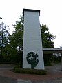
Storm surge memorial on the Hohenwischer Brack in Hamburg-Francop , created by the flood , 2006

Memorial with the peak levels of storm surges in 1962 and 1976 in Hamburg-Nienstedten , 2008
.1.ajb.jpg)


2.jpg&filetimestamp=20060117174800)
Documentation in the media
- In 1987, 25 years after the catastrophe, television broadcast the film Sturmflut (director: Lutz Büscher ).
- In 2005, under the leadership of NDR, a filmic reconstruction of the events was created under the title “ The Night of the Great Flood ” , directed by Raymond Ley , u. a. with Ulrich Tukur as Helmut Schmidt.
- On 19./20. In February 2006, the private broadcaster RTL broadcast the two-part action drama Die Sturmflut based on the historical events .
- The Hamburg storm surge - Helmut Schmidt tells. TV interview by Raymond Ley with Helmut Schmidt (spring 2005); North German Broadcasting 2006.
- NWZ special on the 50th anniversary of the storm surge in February 1962 in February 2012
- 50 years ago: Hamburg is sinking in the water , NDR - North German History, accessed on February 21, 2012
- 50th anniversary of the 1962 storm surge in Hamburg , accessed on February 21, 2012
Other storm surges in the Elbe region
Severe storm surges are events of the century. For the Elbe area the following are also mentioned:
- Julian flood of February 17, 1164
- The flood of Cecilia on November 21, 1412
- All Saints Flood 1570 from 1st / 2nd November 1570
- All Saints' Day flood of November 7, 1627
- Natural disaster in Holstein on February 14, 1648 (storm surge, simultaneous earthquake)
- Christmas flood 1717 from 24./25. December 1717
- Storm surge of April 16, 1745
- Mark's flood of October 7, 1756
- February flood 1825 from 3rd / 4th February 1825
- New year's flood 1855 from 1/2. January 1855
- March flood 1906 from March 13th 1906
- Adolph Bermpohl storm of February 23, 1967
- Storm surge chain from autumn 1973
- Capella storm of January 3, 1976
literature
- Hans Bütow (ed.): The great flood in Hamburg. A chronicle of the catastrophe of February 1962. Free and Hanseatic City of Hamburg, School Authority, approx. 1963.
- Walter Hensen : Lessons for science and practice from the North Sea storm surge on 16./17. February 1962. Vandenhoeck & Ruprecht, Göttingen 1964.
- Fritz-Otto Busch : Storm surge at night. Franz Schneider Verlag , Munich 1964.
- Verlag A. Pockwitz Nachf. Karl Krause (Ed.), Stade-Buxtehude 1962: The storm surge catastrophe in February 1962 , 352 pages.
- Günther Schönfeld, Heiko Tornow: Fear behind the dike - storm surges 1962–1976 . Newspaper publisher Krause, Buxtehude 1976.
- Uwe Sönnichsen, Hans-Werner Staritz: Trutz, blanke Hans - photo documentation of the flood disasters in 1962 and 1976 in Schleswig-Holstein and Hamburg. Husum Druck- und Verlagsgesellschaft, Husum 1978, ISBN 3-88042-055-6 .
- Joost Kirchhoff: Storm surge 1962: The disaster night on the Ems and Dollart. Process - findings - conclusions. Risus, Weener 1990, ISBN 3-88761-046-6 .
- Holger Carstensen: Black landscape after a storm. Arnold Fiedler experienced the Hamburg storm surge of 1962. Cord Oltmanns publishing house, Hamburg 2011, ISBN 978-3-9813552-9-1 .
- Katrin Schäfer: "Getting away" The storm surge on the west coast of Schleswig-Holstein . Husum Verlag, Husum 2012, ISBN 978-3-89876-608-1 .
- Alexander Schuller: Storm surge over Hamburg. The night a city drowned. Hamburg 2012, ISBN 978-3-453-40148-8 .
- Martina Heßler , Christian Kehre (eds.): The Hamburg storm surge of 1962. Risk awareness and disaster control from a contemporary, technological and environmental-historical perspective (= Environment and Society . Volume 11). Vandenhoeck & Ruprecht, Göttingen u. a. 2014, ISBN 978-3-525-31716-7 .
- Felix Mauch: Floods of memories. The storm flood of 1962 in the memory of the city of Hamburg (= Research Center for Contemporary History in Hamburg (FZH ). Forum Contemporary History. Volume 25). Dölling u. Galitz, Munich et al. 2015, ISBN 978-3-525-31716-7 .
Web links
- Documentation on the occasion of the 50th anniversary on the website of the City of Hamburg
- Storm surge in Delmenhorst in 1962. Website of the secondary school on Holbeinstrasse in Delmenhorst.
- Storm surge 1962 , dossier with pictures, eyewitness reports and graphics on the NDR website
- Flood images from the Elbe island Wilhelmsburg
- Pictures of the storm surge from Wilhelmsburg
- Flood images from Oldenburg (Oldb.)
- Website of the Heimatmuseum Neuhaus (Oste) with pictures of the damage.
- Website of the Friends of Baljer Lighthouse with pictures and newspaper clippings etc. a. for the stranding of the freighter Silona .
- Photo album storm surge 1962 in Büsum ( Memento from April 17, 2012 in the Internet Archive )
Individual evidence
- ↑ Hamburg sinks into the water . NDR
- ↑ a b c G. Boljahn: Two North Sea Orcans in one week. In: Herbert Huster (Ed.): The great February storm flood of 1962 at the mouths of the Elbe, Weser and Oste. Otterndorf / Cuxhaven 1962, p. 9.
- ↑ Wolfgang Pfeifer: Bremen in the protection of its dikes. Bremen 1963.
- ↑ G. Roediger: Development and course of the weather situation from 16./17. February 1962. In: The Coast. Vol. 10, volume 1, 1962.
- ↑ Herbert Huster (Ed.): The great February storm flood in 1962 at the mouths of the Elbe, Weser and Oste. Otterndorf / Cuxhaven 1962, p. 16.
- ↑ "Wind strength could no longer be measured / hurricane swept over MSB Meerkatze", newspaper clipping of the Cuxhavener Nachrichten of March 7, 1962 on a private website. Archived from the original on November 7, 2007 ; Retrieved August 20, 2008 .
- ^ Johann Kramer: Storm surges. Coastal protection between the Weser and Ems. Norden 1984, p. 40.
- ↑ Herbert Huster (Ed.): The great February storm flood in 1962 at the mouths of the Elbe, Weser and Oste. Otterndorf / Cuxhaven 1962, p. 15.
- ^ Heinrich Schulz: Course of the storm surge from February 1962 in the coastal and tidal areas of the North Sea. In: The coast. 10th vol., H. 1, Heide 1962, pp. 5-16.
- ↑ Erwin Stütz: The storm surge from 16./17. February 1962 - in the Lower Weser area, Landwuehrden, Osterstader Marsch - their consequences and lessons. Bremerhaven 1963.
- ↑ Katrin Schäfer: "Getting away" The storm surge in 1962 on the west coast of Schleswig-Holstein. P. 6.
- ^ Ministry of Food, Agriculture and Forests - State Office for Water Management - Schleswig-Holstein: The storm surge from 16./17. February 1962 on the west coast of Schleswig-Holstein. In: The coast. Vol. 10, H. 1, Heide 1962, pp. 55-80.
- ↑ Katrin Schäfer: "Getting away" The storm surge in 1962 on the west coast of Schleswig-Holstein. P. 6.
- ↑ Erich Wohlenberg: The breach of the dyke of the Uelvesbüller Kooges in the February storm surge in 1962. Salinisation - over-sanding - recultivation. In: The coast. 11th year Heide 1963.
- ^ Ministry of Food, Agriculture and Forests - State Office for Water Management - Schleswig-Holstein: The storm surge from 16./17. February 1962 on the west coast of Schleswig-Holstein. In: The coast. Vol. 10, H. 1, Heide 1962, pp. 55-80.
- ↑ Katrin Schäfer: "Getting away" The storm surge in 1962 on the west coast of Schleswig-Holstein. P. 16.
- ↑ Katrin Schäfer: "Getting away" The storm surge in 1962 on the west coast of Schleswig-Holstein. P. 19.
- ↑ Erich Wohlenberg: The drinking water supply after the storm surge in 1962. An investigation, experience and experience report. In: The coast. Vol. 10, H. 2, Heide 1962.
- ^ Ministry of Food, Agriculture and Forests - State Office for Water Management - Schleswig-Holstein: The storm surge from 16./17. February 1962 on the west coast of Schleswig-Holstein. In: The coast. Vol. 10, H. 1, Heide 1962, pp. 55-80.
- ↑ Erich Wohlenberg: The drinking water supply after the storm surge in 1962. An investigation, experience and experience report. In: The coast. Vol. 10, H. 2, Heide 1962.
- ^ Johann Kramer: Storm surges. Coastal protection between the Weser and Ems. Norden 1984, p. 54 ff.
- ↑ www.ga-online.de: Exhibition commemorates the great storm surge in 1962 , General-Anzeiger, February 2, 2012, accessed on February 5, 2012.
- ^ Johann Kramer: Storm surges. Coastal protection between the Weser and Ems. Norden 1984, p. 59.
- ↑ Erwin Stütz: The storm surge from 16./17. February 1962 in the Lower Weser region - Land Wursten, Bremerhaven, Osterstader Marsch - their consequences and lessons. Bremerhaven 1963, p. 22. f.
- ↑ Herbert Huster (Ed.): The Great February Storm Flood 1962 at the Elbe, Weser and East estuaries. Otterndorf / Cuxhaven 1962.
- ^ Johann Kramer: Storm surges: Coastal protection between Weser and Ems. Norden 1984, p. 83 f.
- ↑ Katrin Schäfer: "Getting away" The storm surge in 1962 on the west coast of Schleswig-Holstein. P. 91.
- ↑ a b c Jürgen Wolff: From midnight the water came to Uetersen. In: Uetersener Nachrichten. February 11, 2012: Storm surge 1962 / The great flood 50 years ago on February 16 and 17
- ↑ a b c d e f Gerrit Mathiesen: 50 years ago: "The Pinnau was a torrent". In: Wedel-Schulauer Tageblatt. February 11, 2011, February 1962: The great storm surge in the Pinneberg district
- ↑ Marcus Petersen: Sturmflut 1962. Water levels on the coasts of the North Sea. In: The Coast : H. 15. Heide 1967.
- ↑ Traveling exhibition storm surge 1962 in Steinburg ( page no longer available , search in web archives ) Info: The link was automatically marked as defective. Please check the link according to the instructions and then remove this notice. .
- ^ Ministry of Food, Agriculture and Forests - State Office for Water Management - Schleswig-Holstein: The storm surge from 16./17. February 1962 on the west coast of Schleswig-Holstein. In: The coast. Vol. 10, H. 1, Heide 1962, pp. 55-80.
- ↑ Marcus Petersen: Sturmflut 1962. Water levels on the coasts of the North Sea. In: The Coast : H. 15. Heide 1967.
- ↑ Walther Krause (ed.): The storm surge catastrophe in February 1962. Stade 1962.
- ^ Walther Krause: The storm surge catastrophe in February 1962 . Buxtehude 1962.
- ^ A b c Walther Krause (ed.): The storm surge catastrophe in February 1962. Stade 1962.
- ↑ a b c J. Kramer, R. Liese, K. Lüders: Die Sturmflut from 16./17. February 1962 in the coastal area of Lower Saxony. In: The coast. Vol. 10, no. 1, Heide 1962.
- ↑ Marcus Petersen: Sturmflut 1962. Water levels on the coasts of the North Sea. In: The coast. H. 15. Heath 1967.
- ↑ Herbert Huster (Ed.): The Great February Storm Flood 1962 at the Elbe, Weser and East estuaries. Otterndorf / Cuxhaven 1962, p. 38.
- ↑ Herbert Huster (Ed.): The Great February Storm Flood 1962 at the Elbe, Weser and East estuaries. Otterndorf / Cuxhaven 1962.
- ↑ Heinz Mohrhoff, District Administrator: The great February flood of 1962 - experienced at the desk. In: Herbert Huster (Ed.): The Great February Storm Flood 1962 at the Elbe, Weser and East estuaries. Otterndorf / Cuxhaven 1962.
- ^ Walter Hensen: Lessons for science and practice from the North Sea storm flood on 16./17. February 1962. Series of lectures by the Lower Saxony state government to promote scientific research in Lower Saxony. Published on behalf of the Prime Minister of Lower Saxony. H. 28. Göttingen 1964, p. 11 f.
- ^ Walter Hensen: Lessons for science and practice from the North Sea storm flood on 16./17. February 1962. Series of lectures by the Lower Saxony state government to promote scientific research in Lower Saxony. Published on behalf of the Prime Minister of Lower Saxony. H. 28. Göttingen 1964, p. 11 f.
- ↑ Lord of the Flood . In: Der Spiegel . No. 10 , 1962, pp. 26 ( online ).
- ↑ The Night of Heroes. In: TV listening and seeing. 6/2012, pp. 32-33.
- ↑ The night when the horror came. In: Hamburger Abendblatt. February 15, 1992, p. 11.
- ↑ Herbert Huster (Ed.): The great February storm flood of 1962 at the Elbe, Weser and East estuaries. Otterndorf / Cuxhaven 1962, p. 19 f.
- ^ Deichverband on the right bank of the Weser: Map of the flooded areas in Bremen 1962
- ↑ Wolfgang Pfeifer: Bremen in the protection of its dikes. Bremen 1963.
- ↑ Harry Gabcke , Renate Gabcke, Herbert Körtge, Manfred Ernst: Bremerhaven in two centuries. Volume III: from 1947 to 1991. Nordwestdeutsche Verlagsgesellschaft, Bremerhaven 1989/1991, ISBN 3-927857-22-X , p. 72.
- ↑ Rosemarie Krämer, Heinz Hoffer: Between storm surge and upper water. From the history of the I. Oldenburg dike tape. Oldenburg 1991.
- ↑ Harald Fuge: Storm surges in the Stedinger Land. Memories of the storm flood of the century in February 1962. Lemwerder 2002.
- ↑ Erwin Stürz: The storm surge from 16./17. February 1962 in the state of Wursten, Bremerhaven, Landwührden, Osterstader Marsch - their consequences and lessons. Bremerhaven 1962, p. 29 ff.
- ↑ Marcus Petersen: Sturmflut 1962. Water levels on the coasts of the North Sea. In: The Coast : H. 15. Heide 1967.
- ↑ a b c Günther Traeger: The storm surge from 16./17. February 1962 in the state of Bremen. In: The coast. Vol. 10, no. 1, Heide 1962.
- ↑ Wolfgang Pfeifer: Bremen in the protection of its dikes. Bremen 1963.
- ↑ Kurt Müsegades: Hasbergen - A Millennium Community History . Published by the municipality of Hasbergen, 1974.
- ↑ Marcus Petersen: Sturmflut 1962. Water levels on the coasts of the North Sea. In: The Coast : H. 15. Heide 1967.
- ↑ Tim Schwabedissen: Stranded: Ship accidents off the North Sea coast. Stade 1962.
- ↑ Wolfgang Pfeifer: Bremen in the protection of its dikes. Bremen 1963.
- ↑ Harald Fuge: Storm surges in the Stedinger Land. Memories of the storm flood of the century in February 1962. Lemwerder 2002.
- ↑ Wolfgang Pfeifer: Bremen in the protection of its dikes. Bremen 1963.
- ↑ Wolfgang Pfeifer: Bremen in the protection of its dikes. Bremen 1963, p. 130 ff.
- ↑ Heinz Mohrhoff, District Administrator: The great February flood of 1962 - experienced at the desk. In: Herbert Huster (Ed.): The Great February Storm Flood 1962 at the Elbe, Weser and East estuaries. Otterndorf / Cuxhaven 1962.
- ↑ Erich Wohlenberg: The dike breach of the Ülvesbüller Koog in the February storm surge in 1962. Salinisation - over-sanding - recultivation. In: The coast. 11th year, Heide 1963, pp. 52-89.
- ↑ Erich Wohlenberg: The dike breach of the Ülvesbüller Koog in the February storm surge in 1962. Salinisation - over-sanding - recultivation. In: The coast. 11th year, Heide 1963, pp. 52-89.
- ↑ Herbert Huster (Ed.): The Great February Storm Flood 1962 at the Elbe, Weser and East estuaries. Otterndorf / Cuxhaven 1962, p. 19.
- ↑ a b city under . In: Der Spiegel . No. 9 , 1962, pp. 23 ( online ).
- ↑ City under . In: Der Spiegel . No. 9 , 1962, pp. 20 ( online ).
- ↑ Hamburg radio amateurs in action, storm surge Hamburg 1962. ( Memento from March 4, 2016 in the Internet Archive )
- ↑ Helmut Schmidt. Tabular curriculum vitae in the LeMO ( DHM and HdG )
- ↑ Helmut Stubbe da Luz : "The Basic Law not looked at", "excited chickens" found. Helmut Schmidt, the rescuer from the disaster. In: Great disasters in Hamburg. Human failure in history - defensive urban development for the future? Accompanying volume to the exhibition "Great Disasters in Hamburg" in the Helmut Schmidt University, Hamburg 2018, ISBN 978-3-86818-094-7 , pages 99–153
- ↑ "Helmut Schmidt: others acted immediately", interview with Helmut Stubbe da Luz in ZEIT Hamburg nr 30/2018 from July 19, 2018 https://www.zeit.de/2018/30/helmut-schmidt-hamburg-retter flood 1962
- ↑ Ronald D. Gerste: How the weather makes history: Disasters and climate change from antiquity to today. Klett-Cotta Verlag, Stuttgart 2015, ISBN 978-3-608-94922-3 , pp. 247-256.
- ↑ Flood Victims Foundation from 1962 (ed.): Help that is still effective today. 50 Years of the Flood Victims Foundation from 1962. Brochure, Hamburg 2012, pp. 9–25.
- ↑ Jens Meyer-Odewald: Sweet aid package from Greece. In: Hamburger Abendblatt. April 3, 2012, p. 7.
- ↑ Werner Junge: The general plan for coastal protection . Retrieved April 5, 2012.
- ↑ Project office fairway adjustment: Basics of flood protection on the Lower Elbe . Accessed February 20, 2012.
- ^ Office for Construction and Operation: Flood Protection in Hamburg. Status of the construction program (PDF; 1.8 MB), status February 2005, accessed on February 20, 2012.
- ↑ New construction of the Niederhafen flood protection wall on lsbg.hamburg.de, accessed on January 16, 2019.
- ↑ Living with water: this is how Hamburg protects itself. Interview with Olaf Müller, State Office for Roads, Bridges and Waters in Hamburg, from February 10, 2012 on ndr.de
- ^ Johann Kramer: Storm surges: Coastal protection between Weser and Ems. Norden 1984, p. 107 f.
- ↑ Erich Wohlenberg: The dike breach of the Ülvesbüller Koog in the February storm surge in 1962. Salinisation - over-sanding - recultivation. In: The coast. 11th year, Heide 1963, pp. 52-89.
- ↑ Petra Kürbs: Limnological comparison of the two neighboring bracks Brakenburger Brack (Brakenburg) and Flutbrack (Hohenwisch) in the area of the Old South Elbe in Hamburg . Hamburg 2002.
- ↑ hamburg.de Information on the geotope flood break Hohenwisch on Hamburg.de
- ↑ ndr.de
- ↑ Scholz: "The catastrophe has burned itself into the soul of the city". In: Hamburger Abendblatt. February 17, 2012, p. 12.
- ↑ Alexander Laux: Waltershof. In: Hamburger Abendblatt. August 8, 2012, p. 12.
- ↑ Flood Victims Foundation from 1962 (ed.): Help that is still effective today. 50 Years of the Flood Victims Foundation from 1962. Brochure. Hamburg 2012, p. 17.
- ↑ Free and Hanseatic City of Hamburg. The cemetery signpost. Mammut Verlag Leipzig, August 2008, p. 109.
- ↑ The night of the great flood. Stimme.de, July 23, 2010, archived from the original on February 12, 2016 ; accessed on February 12, 2016 .
- ^ NWZ special on the 50th anniversary of the storm surge in February 1962
- ↑ The night when the horror came. In: Hamburger Abendblatt. February 15, 1992, p. 11.
- ↑ Jürgen Wolff: Disaster times in Uetersen over the centuries. In: Uetersener Nachrichten. May 23, 2009, 775 years of Uetersen / Contributions to history