
Horumersiel
|
Horumersiel
Wangerland municipality
Coordinates: 53 ° 41 ′ 3 ″ N , 8 ° 0 ′ 38 ″ E
|
||
|---|---|---|
| Height : | 2 (2-10) m above sea level NN | |
| Residents : | 1109 (Dec. 31, 2001) | |
| Postal code : | 26434 | |
| Area code : | 04426 | |
Location of Horumersiel in Lower Saxony |
||

Horumersiel , part of the district Horumersiel- Schillig is a North Sea - Spa in the municipality Wangerland in Lower Saxony district of Friesland in Germany .
Location
The place is about two kilometers south of the extreme northeast tip of the East Frisian peninsula , on the Inner Jade , about 20 kilometers north of Wilhelmshaven , two kilometers south of Schillig and four kilometers east of Minsen . Upstream are the islands of Mellum and Minsener Oog .
history
Surname
The place name Horumersiel, formerly also called Horumer Syhl , is made up of the words Horum and Siel . Horum is related to Horn, which means the location on the corner of the country where the place is. With sluice is meant here the dike passage of a river into the sea.
development
The place was created around 1542. At that time, people settled here when the Kastensiel was moved from the Stumpenser Mühle to the Horumer-Siel. This resulted in a Sielort with a coastal port. The hinterland was supplied with goods landed by ships. Despite the port, there was no fishing fleet in Horumersiel. The reason was the insufficient sales area in the hinterland, and the neighboring ports of Carolinensiel and Hooksiel also had fishing rights. The heyday of the Sielhafen only lasted until the middle of the 18th century. After that, shipping traffic declined as the Weser deepening made other ports more attractive for larger ships. Competition in the movement of goods also arose from road and railroad construction. In 1889 a railway line was built to Carolinensiel, and in 1914 one to Schillig, which led past Horumersiel. Around 1900 naval parades of the imperial navy took place on the sea in front of Horumersiel and Schillig . During the First and Second World Wars, the place was a naval base for the defense of the shipping channel to the southern naval port of Wilhelmshaven. In Horumersiel there was a fortress, the so-called Sielbatterie , to protect the war port in Wilhelmshaven .
Storm surges

Due to its location near the northeast corner of the East Frisian peninsula, Horumersiel was at great risk from storm surges . As a result, several dikes and lands were lost from the 15th century , which were later regained. The Christmas flood of 1717 tore a creek 82 m wide and 7 m deep in the sea dike between Schillig and Horumersiel , which is now included in the spa facilities. The hurricane flood in 1962 destroyed almost all of the beach facilities.
Tourism and health spa
Bathing began as early as 1856 after a storm surge destroyed the holiday resort on Wangerooge. The islanders were partially settled in Horumersiel. They brought their recreational guests with them and thus established tourism. After their return to the island, tourism was continued by business people in Horumersiel. After the establishment of a seaside association, the place had the additional designation North Sea from 1900. In 1952 the municipality of Minsen took over the tourism administration and expanded the beach and bathing facilities with the establishment of the campsite. The campsite, one of the largest in Germany, increased to around 3,000 pitches when the area was flushed out in the 1970s. Today there is a wide range of holiday homes and houses or apartments with around 6,000 guest beds in the village. Horumersiel has been officially recognized as a North Sea spa since 1985. Will also be parent-child cures offered. The recreational facilities include a spa center, a guest house, a leisure pool (Friesland-Therme) with brine from a 160 m deep well, a sports boat harbor and a children's playhouse. In 2007 there was only one fisherman in the village who moored in the harbor with his crab cutter .
The 30 m long coast guard boat 19 (KW 19) has been on display in the center of town since 1985 . It was built in 1952 and initially served the US armed forces to monitor the Weser , from 1957 the German Navy . Since 1985 it has been the comradeship home of the Horumersiel naval comradeship .
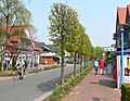
Main street in town

Sketch of the old port (still in place), 1962

Issued coast guard boat week 19

Harbor with gate of the Wangertief

Inflow of the Hohenstief to the Wangertief at the Wangerland pumping station


Rescue station of the DGzRS

The regional association for the rescue of castaways for the Oldenburg coast set up a rescue station in Horumersiel in 1862 and stationed an English peake boat for six rowers. After the station was taken over by the German Society for the Rescue of Shipwrecked People (DGzRS), a new boat for ten rowers came to the station in 1873. The heavy duty of the Horumersieler sea rescuers from 1909 went down in the history of the DGzRS as the "death voyage of the Vegesack", during which six castaways and one sea rescuer stayed at sea.
In 1936, the Heinrich Tiarks was the first motor lifeboat ten meters long to be stationed. In 1945, the DGzRS took over the boat KR C 304 from the Luftwaffe's maritime emergency service and named it Horumersiel . It is one of 14 boats of this type that were built during the war . In the course of the following years, older motor lifeboats came to the station again and again through relocations.
With the redesign of the lifeboats , the DGzRS created a smaller counterpart to the rescue cruisers with the same properties as, for example, self-righting . A boat in the 7-meter class in 1978 was the Gesina , which was previously in service on Wangerooge . In contrast, the Max Carstensen from 1981 was a new boat that corresponded to the daughter boats of the Eiswette class . As a replacement in 1999, the Wilhelm Hübotter came from the station on Wangerooge. After five years it was already taken out of service and with the Baltrum , which had previously been in service in Baltrum, the company sent a second-generation rescue boat in 2004 . The newest boat since October 2019 is the Wolfgang Paul Lorenz , a new build of the current design with a completely closed steering position.
Today's DGzRS Horumersiel station is located on Wangersiel in the Wanger outer low with the marina. The original station was further north in the former Sielhafen , which was filled in and redesigned between 1960 and 1965. The territory of the voluntary sea rescuers is the outer jade , which is strongly shaped by the tides. It extends from Hooksiel in the south to the island of Wangerooge in the north.
traffic
Between 1935 and 1939, special trains ran on vacation services on the naval railway ; this line was dismantled in 1949.
Horumersiel is currently connected to Wilhelmshaven and Jever by the Weser-Ems Bus lines. In the summer and autumn holidays, there is also a tourist bus that runs to Jever via various sections of the other two lines. However, many journeys, especially on weekends, only run if you reserve in advance by telephone . Horumersiel is in the tariff area of the Ems-Jade transport association , holidaymakers with a guest card can use the normal bus services for € 1 per person (so-called holiday bus).
Personalities
- Theodor Pekol (1888–1958), bus manufacturer and transport operator
See also
literature
- Erhard Ahlrichs : Horumersiel - Vom Sielort zum Nordseeheilbad , Ed .: Gemeinde Wangerland, Isensee-Verlag, Oldenburg 1992, ISBN 3-89442-130-4 .
Web links
Individual evidence
- ^ Station Horumersiel of the DGzRS. In: seenotretter.de. German Society for the Rescue of Shipwrecked People, accessed on June 15, 2020 .
- ↑ By tourist bus through East Friesland at www.urlauberbus.info, accessed on September 23, 2018

Altgarmssiel | Forrien | Friederikensiel | Hohenkirchen | Hooksiel | Horum | Horumersiel | Middoge | Minsen | Neugarmssiel | Oldorf | Schillig | Tettens | Waddewarden | Wiarden | Wiefels