
Bremervörde
| coat of arms | Germany map | |
|---|---|---|

|
Coordinates: 53 ° 29 ' N , 9 ° 8' E |
|
| Basic data | ||
| State : | Lower Saxony | |
| County : | Rotenburg (Wümme) | |
| Height : | 4 m above sea level NHN | |
| Area : | 150.18 km 2 | |
| Residents: | 18,582 (Dec 31, 2019) | |
| Population density : | 124 inhabitants per km 2 | |
| Postal code : | 27432 | |
| Primaries : | 04761, 04764 , 04767 , 04769 | |
| License plate : | ROW, BRV | |
| Community key : | 03 3 57 008 | |
| LOCODE : | DE BMV | |
City administration address : |
Rathausmarkt 1 27432 Bremervörde |
|
| Website : | ||
| Mayor : | Detlev Fischer ( CDU ) | |
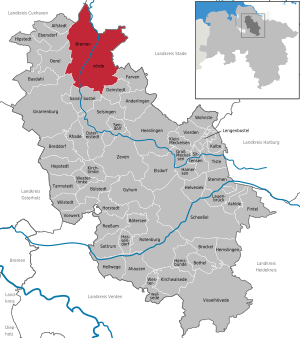
| Location of the city of Bremervörde in the Rotenburg (Wümme) district | ||
  |
||

The city of Bremervörde is a state-approved resort in the north of the Rotenburg (Wümme) district in Lower Saxony with around 19,000 inhabitants.
geography


Bremervörde is located in the center of the Elbe-Weser triangle on the Oste between Bremerhaven and Hamburg . Bremervörde is enclosed by the joint municipality Börde Lamstedt in the northwest, the joint municipality Oldendorf-Himmelpforten in the northeast, the joint municipality Fredenbeck in the east, the joint municipality Selsingen in the south, Gnarrenburg in the southwest and the joint municipality Geestequelle in the west.
City structure
The city is divided into the core city and the associated localities. These include Bevern , Elm , Hesedorf , Hönau-Lindorf , Nieder Ochtenhausen , Iselersheim , Mehedorf , Minstedt , Ostendorf , Plönjeshausen and Spreckens . The districts include the following:
- The Dänenviertel (all streets have Danish names; dates back to the Danish rule) is a residential area in the eastern part of the city.
- Engeo is the southernmost urban area and is separated from the others by the oste and dpe railroad tracks . The OsteMed Clinic , the Delphino swimming pooland numerous schools (grammar school, secondary school, secondary school, vocational schools, Engeo elementary school) are located there.
- The Fresenburg is located with the Fresenburger Moor north of the Vörder See and serves as a floodplain during floods.
- The Gnattenbergswiesen are located in the northeast of the city on the federal highway 74 in the direction of Stade and are home to some commercial sites and the municipal sewage treatment plant.
- The northernmost district of Höhne is located in the forest area of the same name with the Plietenberg (33.4 m), the highest elevation in the urban area.
- The Bremervördes industrial and commercial area is located in the west on federal highway 71/74. It is divided into north, south, Vossberg and the residential area Kornbeck. In January 2013, the new Bremervörde correctional facility was opened in the north industrial area .
- The north of the city center is bounded by the B 71/74 and the Vörder See. There are the exhibition grounds, the market square (now a car park), the harbor, the house on the lake and part of the nature and adventure park as well as the old town hall.
- The Downtown South is located between the railway tracks and the B 71/74. It is home to the train station, the mill center , the school on Mahlersberg, the Catholic Church and the OsteMed clinics with care facilities.
- The district of Neues Feld and Finkenmoor is located in the northern part of the city. There you will find the nature and adventure park with the world of the senses and the community park as well as the barrier-free youth hotel Ostel .
- The urban area Schützenpark and Walkmühle extends from the court Herrenbrücke to Mulsumer way at Tinste (part of Mulsum ) in which the site of the former Walkmühle the powder mill stream which Schützenhof and sports facilities of the Bremervörder SC with Schützenhof stadium are located.
- The city center houses the town hall, the town hall market, the pedestrian zone with shops, the Stadtmitte elementary school and the St. Liborius Church .
- The new development area Vörder Feld is located in the east and is a purely residential area that was built towards the end of the 20th century.
- The Vorwerk , which is largely located on the right bank of the Eastern River, is predominantly a forest area and, together with the former castle and palace grounds, owns the historic grounds of Bremervördes. The district building and the Bachmann museum are located on the castle hill . There is also the weir on the right eastern arm, the road maintenance depot and the Stuhmer Museum

Nearest cities
|
Langen , Cuxhaven 37 km, 51 km |
Hemmoor , Otterndorf 22 km, 39 km |
Stade , Glückstadt 25 km, 38 km |
|
Bremerhaven 38 km |
.svg)
|
Harsefeld , Buxtehude , Hamburg 24 km, 37 km, 57 km |
|
Osterholz-Scharmbeck , Bremen 37 km, 51 km |
Zeven , Rotenburg (Wümme) 24 km, 45 km |
Tostedt , Buchholz in the north heath 44 km, 52 km |
Neighboring communities
The following communities border the city of Bremervörde :
- Gnarrenburg community
- Joint municipality Börde Lamstedt with the municipalities Hollnseth and Lamstedt
- Integrated community of Fredenbeck with the community of Kutenholz
- Integrated community Geestequelle with the communities Alfstedt , Ebersdorf and Oerel
- Joint community of Oldendorf-Himmelpforten with the communities of Estorf , Heinbockel and Oldendorf
- Joint municipality Selsingen with the municipalities Deinstedt , Farven and Sandbostel
Waters

The Oste flows through Bremervörde , which is a navigable waterway from there to the mouth . This section marked as Lower East (north of the Bremervörde weir ) was a federal waterway until June 2010 . The Oberoste (south of the weir) is only accessible for recreational shipping . On the left Ostearm is the Bremervörde port (river kilometer 0.2), which is used for recreational boating as well as the Oste-Yacht-Club and Vörder-Yacht-Club . In the southern part of the city, the Bever flows into the Oberoste, and the Oste-Schwinge Canal branches off to the northeast .
There are also several lakes in Bremervörde, the most famous of which is the Vörde lake . This is an artificially created lake that serves as a local recreation area and is part of the Bremervörde nature and adventure park . The only tributary is the Balbecksbach, which flowed into the Oste before the lake was established. Other lakes in the city area are the former moat , the yellow lake and the Auesee in the Auepark .
geology
Bremervörde is located at the intersection of the Zevener and the Stader Geest and is therefore mainly located on Geestboden . However, there are some moor areas around the city (Vörder Moor in the north, Teufelsmoor in the southwest), so that the influence of this can also be seen. The deepest points in the urban area are in the bog villages in the north ( Hönau-Lindorf , Iselersheim , Mehedorf , Ostendorf ), the lowest point are the Ostendorfer meadows (−0.5 m). The highest elevations are the Plietenberg (33 m) and the Steinberg (30 m) in the Höhne forest area , the Rethwiesenberg (25 m) near Elm , the Sprakelsberg (25 m) near Hesedorf and the Feldberg (22 m) near Minstedt .
climate
|
Monthly average temperatures and precipitation for Bremervörde, Lower Saxony
|
||||||||||||||||||||||||||||||||||||||||||||||||||||||||||||||||||||||||||||||||||||||||||||||||||||||||||||||||||||||||||||||||||||||||||||||||||||||||||||||||||||||||||||||||||||||||||||||||||||||||||||||||||
history

At the beginning of the 12th century, the Duke of Saxony Lothar von Süpplingenburg (later Emperor Lothar III ) built the Vörde moated castle, called "castrum vore" , at a strategically important ford over the Oste . Because of its size and dominant importance in the land between the Elbe and Weser rivers, Vörde Castle was often the subject of bitter armed conflicts during the following centuries. In the dispute over the inheritance of the Stade Counts in 1144 , the fortress initially came into the possession of Duke Heinrich the Lion and his sons, before it fell to the Archbishops of Bremen in 1219 . Since Vörde Castle was at the center of the clerical principality, it soon became the main castle of the Archdiocese of Bremen , and in the late Middle Ages also the seat of the central administration of the Archbishopric and the local administration of the Bailiwick or the Bremervörde Office. Several Bremen archbishops ruled from Bremervörde as secular and spiritual heads of the archbishopric, as they rarely stayed in Bremen due to the frequent disputes with the city council and the merchants there.

During the Thirty Years War Bremervörde was besieged several times by imperial, Danes and Swedes, for example in 1627 and 1646. Since the place was largely destroyed, the Swedes moved the seat of government of their newly created Principality of Bremen-Verden to Stade . The place suffered another siege in 1657 during the First Northern War or Danish-Swedish War.
In the Swedish-Brandenburg War from 1675 to 1676, the Swedish Bremervörde was conquered in a campaign by several states of the Holy Roman Empire and Denmark and remained in Allied ownership until the end of the war in 1679. In the course of the Peace of Saint-Germain in 1679 Bremervörde fell back to Sweden.
In 1682 Vörde Castle was finally demolished and the castle buildings demolished. Only the former chancellery of the archbishops of Bremen and Verden from around 1608 remained, today's old district building . The building material obtained was used, among other things, for the construction of the Swedish warehouse in Stade.
The elevation to the city dragged on from 1833 to 1852.
In the 19th and early 20th centuries, the port of Bremervörde was an important transshipment point for peat from the Teufelsmoor as well as for Stackbusch , which was transported on by Ewern, as the end of shipping on the Oste . With the improvement of land-based transport routes in the 20th century, however, river navigation completely lost its importance. Until the dissolution of the Bremervörde district in 1977, the city was the seat of the district administration.
In 1855 a 7.25 kilogram meteorite fell near Bremervörde . It belongs to the class H / L3.9 of the common chondrites . The largest part that still exists today is located in the University of Göttingen .
Incorporations
On March 1, 1974, the communities Bevern, Elm, Hesedorf bei Bremervörde, Hönau-Lindorf, Iselersheim, Mehedorf, Minstedt, Nieder Ochtenhausen, Ostendorf, Plönjeshausen and Spreckens were incorporated.
religion
St.-Liborius parish of Bremervörde
The St. Liborius Church is centrally located in the city center of Bremervörde.
Other communities
There are several Protestant parishes in Bremervörde, as well as a Catholic and New Apostolic parish and Jehovah's Witnesses. There are a total of ten municipalities in the urban area:
- Evangelical Lutheran Church of the Resurrection
- Evangelical Lutheran parish of Bevern
- Evangelical Lutheran Parish Elm
- Evangelical Lutheran parish of Hesedorf
- Evangelical Lutheran parish Iselersheim
- Free Protestant Congregation (Evangelical Free Church)
- Jehovah's Witnesses
- Catholic Church of St. Michael
- New Apostolic Church
politics
City council
The city council is the municipal representative body and the main body of the city of Bremervörde and consists of 32 councilors. This is the specified number for a municipality with a population between 15,001 and 20,000. The 32 council members are elected by a local election in general, direct, free, equal and secret ballot for five years each. The current term of office began on November 1, 2016 and ends on October 31, 2021. Another permanent and voting member of the city council is the full-time mayor of the city.
While the Party of Reason (PDV) and Die Linke were elected for the first time in the 2011 local elections and each received a seat on the city council, the Christian Center (CM) did not run again in 2016 after insufficient votes for a seat on the council in 2011 were. The left was able to confirm the result of 2011, but the representative of the PDV stood for election as an independent candidate in 2016, but did not get enough votes. The Free Citizens' Association of Voters (WFB), which stopped running in 2011, did not submit any candidates for the 2016 election either.
In 2011 a coalition of the SPD , the proBRV electoral group , the Greens and the FDP was formed , so that the CDU and PDV formed the opposition. However, the coalition dissolved after a while, whereupon the previous opposition leader, the CDU, agreed with the Greens and the FDP on a new majority in the council, which would last until the 2016 election. Due to the absolute majority held by the CDU after the 2016 election results, there was no need to find a coalition.
mayor
Detlev Fischer (CDU) is the full-time mayor of the city of Bremervörde. In the last mayoral election on May 25, 2014, he was elected with 65.4% of the vote. His opponent Doris Brandt (SPD) received 34.6%. The turnout was 53.5%. Fischer took up his post on November 1, 2014, replacing the previous incumbent Eduard Gummich (CDU), who was no longer running. The deputy mayors since the local elections in 2011 have been Uwe-Jürgen Matthias (CDU), Hans Klaus Genter-Mickley (SPD) and Rolf Hüchting (Greens). Since the local elections in 2016 , Fischer's deputies have been his party colleagues Uwe-Jürgen Matthias, Mathias Betz and Hans Klaus Genter-Mickley.
Local councilor and local mayor
After a referendum in September 2009 determined the formation of a local council in the core city of Bremervörde, this was elected for the first time in the 2011 local elections.
In the 2016 local elections , the distribution of the nine seats in the local council was as follows:
| Party / list | Seats |
| CDU | 4th |
| SPD | 3 |
| Flat share Bremervörde / Engeo | 1 |
| Colorful list | 1 |
On the occasion of the local council elections in 2011, a local mayor was also elected for the core city of Bremervördes. Susanne Morgenstern (citizen list) received the most votes and became the first female mayor, Alexander Oppermann (SPD) was her deputy. In March 2015, Morgenstern resigned from office and resigned from the local council, whereupon Heinrich Tiedemann (SPD) was elected the new local mayor.
After the local council elections in 2016, Frank Pingel (CDU) was elected as the new local mayor. His deputy is Rainer Hartmeyer (SPD).
coat of arms
|
|
Blazon : “In red the growing, golden (yellow) nimbled St. Liborius with a gold (yellow) bordered silver (white) coat and a silver (white) cap, holding an upright silver (white) key on the right and an open book with gilt edging on the left. " |
| Reasons for the coat of arms: The coat of arms of the city of Bremervörde shows a silver portrait of Saint Liborius with a halo on a red background, who holds a silver key in his right hand and an open book in his left. |
Town twinning
![]() Barth , Mecklenburg-Western Pomerania , since September 10, 1990 Krosno Odrzanskie , Poland , since November 7, 2008
Barth , Mecklenburg-Western Pomerania , since September 10, 1990 Krosno Odrzanskie , Poland , since November 7, 2008
![]()
City friendships
![]() Falmouth , Cornwall , UK , since 1977
territorial reform
Falmouth , Cornwall , UK , since 1977
territorial reform
Culture and sights


Museums
The Bachmann Museum is located in the old district building, the oldest preserved building in the city (over 400 years old) . After the construction of the district house on the opposite side of the castle hill , the former site of Vörde Castle , the building was initially used as a district museum and until 1991 also as a district archive. Today the museum, which is named after the local historian August Bachmann , houses exhibits on geological history , archeology , as well as history and folklore , mostly relating to the region. There are also theme-related touring exhibitions, guided tours and lecture series. Just a few minutes walk from the museum is located on the banks of Auesee Lake a reconstructed hut village of the Middle Stone Age, which is part of the museum.
The Stuhmer Museum is located in Vorwerkstrasse . Since 1959, this has represented life in the former West Prussian district of Stuhm , as it was between the turn of the century and 1945. Exhibits from everyday life, but also photos, art objects and documents are used for this purpose. The district of Rotenburg (Wümme) , in which Bremervörde is located, has been a partner district of the “Heimatkreis Stuhm” of the West Prussian Landsmannschaft since 1956 . The museum makes a significant contribution to the preservation of the cultural assets and customs of the expellees and refugees from the former eastern regions of the German Empire .
music
Les Garcons
Les Carcons was a beat band founded in 1963 from Bremen , which played in northern Germany until 1968 and made a comeback in 1992. The first public appearance took place in the summer of 1963 in the extension building of the old middle school, which was demolished in 1963. Due to the success, further appearances followed at the dance tea in the House of Youth and very often in the Bremen Schützenhof. 25 years later the core of the group got back together and they played a.o. a. at the Oldie Night at the Vörder See . This performance with many enthusiastic "old" fans was so moving that it was decided to start over. In the next 10 years, Bremen festivals, store openings and anniversaries as well as dance teas were played.
Bremervörde city band
The “Bremervörde Stadtkapelle” or “Stadtkapelle Bremervörde” was founded on August 8, 1988 at the suggestion of the mayor at the time and other people. Today the town band plays at local events, including the well-known “summer concert” in Bremervörde. The town band maintains a youth orchestra and has around 60 active members.
Monuments

There are some monuments in the urban area, but these are not in Bremervörde, but in the surrounding villages.
- Heimathausanlage with museum barn: The entire ensemble, consisting of a sheepfold, bakery, drive-through barn, free-standing clay oven, carriage shed, Göpelschauer with horse work and a reconstructed barn, some of which date from the past centuries, is located in Plönjeshausen .
- Heimathaus Logehuus : Theater performances, concerts, permanent exhibitions and other events take place in the Hesedorf cultural center. The area also includes the bakery and the remise.
- Heimathaus Mehedorf : The mehedorfer Heimathaus was rebuilt in 1991 together with a well and stone oven after it was demolished in Ostendorf . Events such as theater performances take place there regularly.
- Holländer-Galerie-Windmühle Henriette : The over 20 meter high mill, which was rebuilt in Elm in 1871 after having stood in Hamburg for almost 100 years, is part of the mill route and an attractive cultural monument.
- Granary: The in low Ochtenhausen standing attic storage already served since then as a storage space for grain, only in the period around the Second World War it was used as a shelter. After its renovation in 2000, it was approved as a memorial and event location.
- Pape brickworks: The former Bevener brickworks is an important industrial monument in the region, which is particularly worth seeing because of its integration into the landscape and the precisely depicted history.
Natural monuments
The table below lists all current and former natural monuments in the entire city area. (As of December 2012)
| Memorial number | designation | Location | Date of regulation | Remarks |
|---|---|---|---|---|
| ND-ROW 50 | Boulders (granite and gneiss) | Bevern | 07/07/1937 | |
| ND-ROW 51 | Plietenberg moraine group with tumulus and group of trees | Bremervörde | 07/07/1937 | |
| ND-ROW 74 | Court oak | Iselersheim | 10/31/1939 | |
| ND-ROW 75 | Royal fir | Hesedorf | 10/31/1939 | not available anymore |
| ND-ROW 79 | Hilgenborn | Hesedorf | 10/31/1939 | |
| ND-ROW 84 | Court oak | Bevern | December 01, 1947 | |
| ND-ROW 95 | Broad oak (shade tree in the field) | Bremervörde | 06/29/1951 | |
| ND-ROW 109 | Old European beech | Bremervörde | 03/17/1955 | |
| ND-ROW 110 | 300 year old oak | Bremervörde | 03/17/1955 | |
| ND-ROW 143 | Group of 3 tumuli Hexenberg | Bevern | 04/26/1957 | |
| ND-ROW 144 | Group of 2 barrows | Bevern | 04/26/1957 | |
| ND-ROW 145 | Group of 3 barrows | Bevern | 04/26/1957 | |
| ND-ROW 146 | Tumulus | Bevern | 04/26/1957 | |
| ND-ROW 147 | Tumulus | Bevern | 04/26/1957 | |
| ND-ROW 156 | Barrows cemetery | Hesedorf | 04/26/1957 | |
| ND-ROW 189 | Old beech | Minstedt | 02/16/1960 | Disposal approved May 11, 1987 |
| ND-ROW 201 | Gorse (about 7 bushes) | Bremervörde | 07/07/1937 | not available anymore |
| ND-ROW 205 | chestnut | Lower Ochtenhausen | 10/31/1939 | not available anymore |
Green spaces and recreation
The nature and adventure park , which is located around the Vörder See , is the largest park in Bremervörde. It offers leisure and sports opportunities and serves the city as a figurehead for the state-approved resort . In it are the Café Dunkel , the Haus am See , the Haus des Waldes , the park landscape with large flower beds, the world of the senses and the mobile home station .
The rather small-scale Bürgerpark near the Neuen Feld is primarily intended for walkers and is directly connected to the Neuenfeld cemetery .
graveyards
The Neuenfelder Friedhof is the largest cemetery in the city and is located in the southern area of the Neuer Feld . It also includes a chapel and a small war cemetery and is directly connected to the Bürgerpark , the services for burials take place in the nearby Church of the Resurrection .
The other two cemeteries at Engeoer Wäldchen and at Schützenpark are quite small and serve as a supplement to the Neuenfeld cemetery .
Sports
The handball department of TSV Bremervörde is known nationwide . The first team played in the 2nd Bundesliga (North) in the 2008/2009 season . Since the 2010/2011 season, the team has been playing in the Oberliga North Sea (4th division) and became champions a year later, but for economic reasons did not go ahead.
Furthermore, TSV Bremervörde has a large athletics department, which can show some successes, especially in the youth teams. The other branches of the association are badminton , basketball , canoeing , karate , bowling , cycling , rowing , swimming , dancing , table tennis , gymnastics and volleyball .
A second rowing club has existed in Bremervörde since October 24, 2014. It has set itself the task of preserving competitive sport in Bremervörde for this sport and promoting the active people appropriately.
In the soccer field there is the Bremervörder SC, who plays in the district league Lüneburg 3 from 2011 to 2013 and since 2015 . He also maintains a chess community together with TSV Gnarrenburg .
Regular events
The following events take place regularly in Bremervörde:
- Christmas market on the Rathausmarkt, every year at the beginning of December
- City-West-Stadtfest , annually in July
- Schützenfest Bremervörde , annually
- Store-keeping market , every six months (spring, autumn)
- Fair on the exhibition grounds near the Vörder See, every six months (spring, autumn)
Economy and Infrastructure
economy
Bremervörde is the headquarters of around 150 mostly medium-sized companies from various industries. The largest employers in the region are Geti Wilba GmbH & Co. KG , refiner of game and poultry and manufacturer of ready meals, Thomas GmbH & Co. KG with the brand Lattoflex , inventor of the slatted frame, today producer of internationally patented bed systems, which operate nationwide Mode Steffen group of companies, the printing company Oste-Druck.
tourism

Bremervörde is the starting or end point of the German ferry route . The Vörder See is popular for swimming, but also for boating. The Bremervörde nature and adventure park is located directly on Lake Vörde , with the world of the senses , the house of the forest and the sculpture meadow, which emerged in 1991 from the exhibition “ Nature in Urban Development ” in Lower Saxony. In the park, Hugo Kükelhaus' conception of the “ Experience Fields for Developing the Senses ” was put into practice.
Bremervörde is the stop of the Moorexpress , a historic railway line that runs from Bremen via Worpswede and Bremervörde to Stade . It allows you to take bicycles with you, but only runs regularly on summer weekends.
media
In Bremervörde, the Bremervörder Zeitung and its special editions ( Rundschau , Sonntagsjournal ) and the Bremervörde Anzeiger are distributed. Supraregional print media are largely obtained from the greater Bremen area , radio media come from Bremen and Hamburg .
Public facilities
- Employment Agency , Stader Strasse 5
- Bremervörde District Court , Amstallee 1–2
- Deutsche Post AG , Alte Strasse 85-86
- Education and counseling center in the district of Rotenburg (Wümme) , Amtsallee 10
- Health department of the district of Rotenburg (Wümme), Amtsallee 4
- Youth meeting place (JUBS), Am Bahnhof 5
- Land registry office Bremervörde, Amtsallee 7
- Kreisarchiv Landkreis Rotenburg (Wümme), Bremer Strasse 38
- District building : The district building (formerly responsible for the Bremervörde district) contains the branch of the Rotenburg district (Wümme), the district's veterinary office and the land registry office of the LGLN . The district building is located at 7 Amtsallee.
- Chamber of Agriculture Hanover , Albrecht-Thaer-Straße 6
- Lower Saxony rural people, Bremervörde district association, Albrecht-Thaer-Straße 6a
- Town hall complex: The town hall of Bremen includes the city administration, the citizen service, the registration and trade office, the tourist information, the registry office, the art library, the external office and the city library. The complex is located at Rathausmarkt 1.
- Road maintenance department of the State Authority for Road Construction and Transport Stade , Zevener Straße 6


public safety
The following institutions are responsible for maintaining public safety:
- Bremervörde volunteer fire brigade with eight vehicles and 11 other local fire brigades in the city area
- Police station Bremervörde, Huddelberg 30
- Prison Bremervörde, Am Steinberg 75
The rescue service as throughout the county by the German Red Cross ensured. In Bremervörde, the Bremervörde rescue station is partially located in the premises of the former fire station , which is currently the headquarters of the DRK district association Bremervörde. An emergency doctor's vehicle , two ambulances and an ambulance are regularly stationed at the rescue station.
In addition to the regular rescue service, a rapid response group is operated by the DRK in Bremervörde . Next to this, in the western part of the city, there is the DRK readiness guard in Bremervörde, which acts as a rapid response group support and is equipped with two ambulances , a team transport vehicle , an equipment vehicle and an operations control vehicle .
education
Day care centers
There are nine day-care centers in the city , four of them in the surrounding towns.
- DRK kindergarten
- DRK children's home
- Evangelical day care center starlight
- Evangelical Kindergarten Butterfly Meadow , Iselersheim
- Evangelical Kindergarten St. Liborius
- Childcare center run by Lebenshilfe Unterm Regenbogen , Hesedorf
- Urban day care center adventure land
- Municipal kindergarten Kunterbunt , Elm
- Municipal kindergarten treasure chest , Plönjeshausen
schools

There are six primary schools , four of them in the surrounding villages.
- Findorff Primary School Iselersheim
- Bevern Primary School
- Elementary school Elm
- Engeo primary school
- Elementary school town center
- Josef Guggenmos primary school in Hesedorf
All secondary schools are located in the Engeos school center, only the special needs school is located in the city center.
- Findorff secondary school in Bremervörde
- Bremervörde high school
- Bremervörde secondary school
- Johann Heinrich von Thünen School, Vocational Schools Bremervörde
- Special school on Mahlersberg
Other institutions
In the district music school (branch of the district ) near the train station, basic musical skills and the use of instruments can be learned. There are also courses for children aged three to eight.
The only adult education center in Bremervördes, the Elbe-Weser Academy , supports and trains adults in four areas. These focal points are the vocational training center for learning commercial and industrial professions, the senior citizen academy (special support for senior citizens), adult education courses and courses as well as business seminars (in particular company training courses).
The city library offers a selection of over 20,000 units consisting of print media (books, newspapers, magazines) and audio and video media (CDs, DVDs, audio books). An Internet parking space is also available, and readings and lectures are held regularly.
The barrier-free Ostel Jugendhotel Bremervörde is an integration hotel and educational facility for disabled and non-disabled people of all ages, especially on the subject of the environment in cooperation with the Regional Environmental Education Center (RUZ) NABU Environmental Pyramid . Bremervörde has been the location of a seaman's school since 1957 . It was a branch of the Hamburg seaman's schools. The school was located at Brackmannstrasse 8, the first director was Captain Neugebauer.
Healthcare
In the southern part of the city is the Oste Clinic of OsteMed Kliniken und Pflege GmbH , which is a hospital for the greater Bremervörde area (includes the city area as well as Geestequelle , Gnarrenburg , Kutenholz and Selsingen ). In the future, the catchment area of the previous Zeven hospital will also be part of it, i.e. the municipalities of Zeven , Tarmstedt and Sittensen . There are also many smaller specialist medical practices in the complex . There are also many general practitioners' and dental practices in the city center . In addition, the OsteMed clinics have other locations in the city, especially in the care sector.
Transport links

Road traffic
Due to its central location in the Elbe-Weser triangle, Bremervörde is connected to numerous federal highways of the long-distance road network. The federal road 71 ( Bremerhaven - Magdeburg ) leads in a westerly direction via Beverstedt to Bremerhaven and in a southerly direction via Zeven to Rotenburg (Wümme) . The federal highway 74 ( Berne - Stade ) connects Bremervörde to the southwest with Hambergen , Osterholz-Scharmbeck , Ritterhude and Bremen , to the northeast with Stade. Via the federal highway 495 ( Glinde - Glückstadt ) beginning west of Bremervörde you can reach Hemmoor and by using the Elbe ferry Glückstadt - Wischhafen Glückstadt.
Bremervörde is connected to the local traffic network via state road 123 ( Horneburg - Bremervörde) as well as numerous district roads . The district roads 102 (to Gnarrenburg ), 105 (to Iselersheim ) and 148 (to Glinstedt ) have their start and end in the core town of Bremervörde. State road 114 ends in the Elm district and leads to Himmelpforten . The district roads 106, 107, 125, 127 and 136, which mostly connect the districts with each other, also run in the extended urban area.
Bremervörde will receive another long-distance transport connection with the construction of the Federal Motorway 20 , which will run in a west-east direction through the northern urban area and the districts of Hönau-Lindorf and Nieder Ochtenhausen . The "Bremervörde" junction is to be built north of Glinde on federal highway 495 . Bremervörde will be connected to Beverstedt, Bremerhaven and north-western Lower Saxony to the west via the federal highway 20, and to the east with Himmelpforten, Drochtersen and Schleswig-Holstein .
The table lists the long-distance traffic connections in Bremervördes with street category , street number, street course (includes a selection of cities and towns) and comments on the respective connection.
| Cat. | number | course | Remarks |
|---|---|---|---|
| A. | Westerstede - Bremerhaven - Bremervörde - Lübeck - Wismar - Rostock - Stralsund - Greifswald - Neubrandenburg - Uckermark | in italics in planning | |
| B. | Bremerhaven - Bremervörde - Zeven - Rotenburg (Wümme) - Soltau - Uelzen - Salzwedel - Gardelegen - Magdeburg | ||
| B. | Berne - Bremen - Ritterhude - Osterholz-Scharmbeck - Hambergen - Bremervörde - Stade | Weser ferry from Berne | |
| B. | ( Bremervörde via |
Elbe ferry to Glückstadt |
Rail transport

Bremervörde is connected to a complex system of railway lines, of which only the Bremerhaven – Buxtehude railway line is used for passenger transport. The Stade – Osterholz-Scharmbeck railway is used by the Moorexpress as nostalgic tourist traffic and only runs on weekends and on public holidays from spring to autumn. Both routes are operated and maintained by EVB . For some time now, large parts of the population have been calling for the Moorexpress route to be reactivated and this has been checked by the parties involved. The preserved portion of the railroad track Bremervörde-Walsrode of Bremervörde to Rotenburg (Wümme) is used as a freight line of the EVB and is part of the Elbe-Weser triangle practiced hinterland traffic . In the course of this, EVB is restoring, engineering and expanding its routes so that, for example, a traffic link (Y-route) is to be built between Hesedorf and Bevern as soon as the volume of goods increases sharply.
| line | Line course | Cycle (min) | EVU |
|---|---|---|---|
| RB 33 | ( Cuxhaven - Dorum -) Bremerhaven Hbf - Geemmeneth - Bremervörde - Harsefeld - Buxtehude | 60 | EVB |
|
|
Stade - Fredenbeck - Bremervörde - Gnarrenburg - Worpswede - Osterholz-Scharmbeck - Bremen main station | four trains a day | EVB |
Long-distance bus transport
Bremervörde is served by long-distance bus from Flixbus on the line between Cuxhaven and Berlin (via Hamburg).
Shipping
Bremervörde has a sports boat harbor at the beginning of the Lower East . You can reach the Elbe via the Oste . There is no longer any cargo shipping.
bicycle
There are many cycle routes around and through Bremervörde that are part of cycle tourism in the Rotenburg district . The most important surrounding routes are the German Ferry Route , the Geest Route , the Moorteufel Route , the Mühlenroute , the Ostekultur Route , the Oste Cycle Path , the Cycle Path from Teufelsmoor to the Wadden Sea and the Forest Discovery Route .
Personalities
Born in Bremervörde
- Johann Adolf Tassius (1585–1654), mathematician, natural scientist
- Michael Havemann (1597–1672), theologian and general superintendent of the General Diocese of Bremen-Verden
- Johann Friedrich von Marschalck (1618–1679), Chancellor of the Danish King for Norway, based in Bergen (Norway).
- Johann Hugo von Lente (1640–1718), diplomat and chancellor of Schleswig-Holstein
- Dietrich Tiedemann (1748–1803), former philologist and philosopher, university professor
- Georg Alexander Ruperti (1758–1839), German Lutheran theologian
- Diedrich Wilhelm Andreas Augspurg (1818–1898), politician (National Liberal Party), member of the Reichstag
- Friedrich Adolf Willers (1883–1959), mathematician, university professor
- Harald Heyns (1913-2004) SS member (Caen massacre)
- Hans-Hubertus Bühmann (1921-2014), District Administrator and Member of Parliament ( CDU )
- Martin Greiffenhagen (1928–2004), political scientist
- Hermann Meyn (* 1934), journalist
- Burghard von Lüpke (* 1939), forest scientist
- Heinrich Schmidt-Gayk (1944–2007), laboratory doctor and osteologist
- Hans-Peter Nolting (* 1945), psychologist
- Rainer Brandt (* 1945), local history researcher and writer
- Ulrich Eggers (* 1955), journalist, publicist, Protestant theologian and pastor
- Peter Weihe (* 1955), guitarist
- Michael Ehrhardt (* 1966), historian
- Angelika Dreock-Käser (* 1967), paracycler
- Antje Krause (* 1966), bioinformatician and university lecturer
- Dorothea Brandt (* 1984), swimmer
- Brian Behrendt (* 1991), footballer
Connected with Bremervörde
- Albert II (Bremen) (1359–1395), Archbishop of Bremen, died here
- Johann III. Rode von Wale (1445–1511), Archbishop of Bremen, died here
- Heinrich von Sachsen-Lauenburg (1550–1585), unrecognized arch-prince-bishop and prince-bishop, died here
- Jürgen Christian Findorff (1720–1792), bog colonizer, founded the districts of Iselersheim , Mehedorf and Ostendorf , died here
- Joachim Burfeindt (1892–1982), politician, farmer, managing director of Kleinbahn Bremervörde, died here
- Bernd Klingner (* 1940), 1968 Olympic champion in small-caliber three-position combat, founder of Klingner GmbH Schützenbedarf in Bremervörde
- Peter Kohnke (1941–1975), 1960 Olympic champion in the small bore / recumbent competition, died here
- Joachim von der Wense (* 1945), lawyer, politician, was city director from 1983 to 1992
- Klaus Thomforde (* 1962), soccer coach and former soccer goalkeeper, born in the Minstedt district
- Martin Müller-Falcke (* 1972), rower
- Falko Hönisch (* 1977), German opera and concert singer, cultural worker, politician (SPD) and mayor of St. Goar am Rhein
- Anja von Issendorff (* 1985), actress
- Wilhelm Lührs (1885–1974), Mayor of Bremervörde from 1934 to 1945
literature
- Elfriede Bachmann, Rainer Brandt: Bremervörde - Pictures from the history of a city . Bogardt Druck, Bremervörde 1987.
- Sparkasse Rotenburg-Bremervörde: 175 years of Sparkasse Rotenburg-Bremervörde . Druckerei Rosebrock GmbH, Sottrum 2012, ISBN 978-3-00-036867-7 .
Web links
- Article with historical photos from the port of Bremervörde
- Official tourism website of the Rotenburg (Wümme) district
- Official website of Bremervördes
Individual evidence
- ↑ State Office for Statistics Lower Saxony, LSN-Online regional database, Table 12411: Update of the population, as of December 31, 2019 ( help ).
- ↑ a b Bremervörde and the localities
- ↑ Bremervörde. Meteoritical Bulletin, accessed June 5, 2020 .
- ↑ Bremervörde metorite, Bremervörde. mindat.org, accessed June 5, 2020 .
- ^ Federal Statistical Office (ed.): Historical municipality directory for the Federal Republic of Germany. Name, border and key number changes in municipalities, counties and administrative districts from May 27, 1970 to December 31, 1982 . W. Kohlhammer GmbH, Stuttgart / Mainz 1983, ISBN 3-17-003263-1 , p. 242 .
- ↑ Kirchen in bremervoerde.de, accessed on February 13, 2013
- ↑ Local elections 2016. In: bremervoerde.de. City of Bremervörde, accessed on November 28, 2016 .
- ↑ a b politics. In: bremervoerde.de. City of Bremervörde, accessed on November 28, 2016 .
- ↑ Individual results of the direct elections on May 25, 2014 in Lower Saxony ( Memento of the original from March 3, 2016 in the Internet Archive ) Info: The archive link was inserted automatically and has not yet been checked. Please check the original and archive link according to the instructions and then remove this notice. , accessed November 23, 2014
- ↑ Eduard Gummich is not running again in marktplatz-bremervoerde.de, accessed on July 29, 2013
- ↑ Politics in bremervoerde.de, accessed on February 16, 2013
- ↑ Clear majority for a local council in the city center ( Memento from July 14, 2014 in the Internet Archive ) in brv-zeitung.de
- ↑ a b Partnerships in bremervoerde.de, accessed on February 16, 2013
- ↑ Museums in bremervoerde.de, accessed on February 13, 2013
- ↑ Stuhmer Museum in Bremervörde in tourow.de, accessed on February 13, 2013
- ↑ http://bremervoerder-stadtkapelle.de/Geschichte.html
- ↑ Monuments in bremervoerde.de, accessed on February 19, 2013
- ↑ Natural monuments ( Memento of the original from March 4, 2016 in the Internet Archive ) Info: The archive link was inserted automatically and has not yet been checked. Please check the original and archive link according to the instructions and then remove this notice. in lk-rotenburg.de, accessed on February 17, 2013
- ^ City of Bremervörde: Events
- ↑ Bremervörde Nature and Adventure Park: Sensory noise in the nature and adventure park ( Memento from December 20, 2015 in the Internet Archive )
- ↑ Bremervörde Nature and Adventure Park: Who was Hugo Kükelhaus? ( Memento of the original from August 31, 2010 in the Internet Archive ) Info: The archive link was inserted automatically and has not yet been checked. Please check the original and archive link according to the instructions and then remove this notice.
- ↑ Police Directorate Lüneburg: Police Commissioner Bremervörde
- ↑ BOS-Fahrzeuge.info: Bremervörde rescue station
- ↑ BOS-Fahrzeuge.info: Readiness Bremervörde
- ↑ day care centers in bremervoerde.de, accessed on February 13, 2013
- ↑ Primary schools in bremervoerde.de, accessed on February 13, 2013
- ↑ Schools in bremervoerde.de, accessed on February 13, 2013
- ↑ Kreismusikschule in bremervoerde.de, accessed on February 13, 2013
- ↑ Community College in bremervoerde.de, accessed on February 13, 2013
- ↑ City library in bremervoerde.de, accessed on February 16, 2013
- ^ Educational offers in the Ostel ( memento of July 6, 2014 in the Internet Archive ), accessed on June 14, 2014
- ^ BStU study on the handling of the GDR State Security with Nazi perpetrators , press release of the Federal Commissioner for the Stasi files of October 17, 2005, "3. Case "(last paragraph); Retrieved September 19, 2014
Ahausen | Alfstedt | Otherlings | Basdahl | Botersen | Bothel | Breddorf | Bremervörde | Brockel | Bülstedt | Deinstedt | Ebersdorf | Elsdorf | Farven | Fintel | Gnarrenburg | Groß Meckelsen | Gyhum | Hamersen | Hassendorf | Heeslingen | Hellwege | Helvesiek | Hemsbünde | Hemslingen | Hepstedt | Hipstedt | Horstedt | Calf | Kirchtimke | Kirchwalsede | Klein Meckelsen | Lauenbrück | Lengenbostel | Oerel | Ostereistedt | Reeßum | Rhade | Rotenburg (Wümme) | Sandbostel | Scheeßel | Seedorf | Singing | Sittensen | Sottrum | Chisel | Tarmstedt | Tiste | Vahlde | Vierden | Visselhövede | Vorwerk | Westertimke | Westerwalsede | Wilstedt | Residential | Zeven
Bevern | Elm | Hesedorf | Hönau-Lindorf | Iselersheim | Mehedorf | Minstedt | Lower Ochtenhausen | Ostendorf | Plönjeshausen | Sprecks