
You
|
You
City of Cuxhaven
|
|
|---|---|
 |
|
| Height : | 8 m above sea level NHN |
| Area : | 4.63 km² |
| Residents : | 938 (May 19, 2018) |
| Population density : | 203 inhabitants / km² |
| Incorporation : | March 1, 1935 |
| Postal code : | 27476 |
| Area code : | 04721 |
  Location of Duhnen in Cuxhaven
|
|

Duhnen (von Dünen ) is a district of the city of Cuxhaven on the North Sea coast of Lower Saxony . It is located west of the core city of Cuxhaven and is an area in Cuxland that is heavily influenced by tourism .
history
Incorporations
The communities Arensch , Berensch , Cuxhaven , Döse , Duhnen, Groden , Gudendorf , Holte , Neuwerk , Oxstedt , Ritzebüttel , Sahlenburg , Spangen , Stickenbüttel , Süder- and Westerwisch belonged to the Hamburg office of Ritzebüttel until 1864 and then to the Ritzebüttel estate . In 1926 the municipalities of Arensch, Berensch, Duhnen, Groden, Gudendorf, Holte, Insel Neuwerk, Oxstedt, Sahlenburg, Spangen, Stickenbüttel, Süder- and Westerwisch became part of the Hamburg rulership. When the law on the incorporation of the rural communities of Groden, Westerwisch, Süderwisch, Stickenbüttel, Duhnen and Neuwerk with Scharhörn came into force on February 6, 1935, these were assigned to the area of the city of Cuxhaven with effect from March 1, 1935, which in turn was assigned to the city of Cuxhaven on April 1, 1937 passed with the Greater Hamburg Law from Hamburg to the Stade administrative district of the Prussian province of Hanover .
Population development
| year | 1866 | 1867 | 1871 | 1910 | 2006 | 2018 |
|---|---|---|---|---|---|---|
| Residents | 189 | 184 | 207 | 440 | 1037 | 938 |
(Sources: 1866–1871, 1910, 2006, 2018)
politics
City Councilor and Mayor
At the local level, Duhnen is represented by the Cuxhaven city council.
Culture and sights
Buildings

Twellberg burial mound
- The 3 m high hill was named Twellberg (twin mountain) because of a second hill that fell victim to cultivation at the beginning of the 20th century. In the 17th century, the two hills (indicated in the trial files as being 5 m high) were controversial border markings between the Duhnen and Sahlenburg farmers . During the 1948 excavation, Dietwald Brandt found the stone packing of a tree coffin and its remains. In addition to the corpse burn, there were two bangles, a finger ring fragment, a knife, a needle and a bronze belt hump as grave goods. According to finds from the Middle Bronze Age (around 1200 BC), a woman was buried here.
Ring wall at the churchyard
- The ring wall (formerly Judenkirchhof ) located in the flat Geest area, still clearly recognizable in the terrain, has an inner diameter of around 40 m. The facility consists of a main rampart that has been preserved approx. 1.2 m high and - separated by a berm - a significantly smaller rampart with a ditch in front. The latter two can only be seen to the north-west and south of the complex and are likely to have fallen victim to the agricultural use of the adjacent plots in the other areas. Originally, the main wall had an access to the east, but this was closed in the course of the 20th century. There are several hills in the immediate vicinity as well as in the interior of the ring wall system, which are still preserved in varying degrees in the area. The rampart owes its good state of preservation to a late conversion of the Duhner coastal strip into arable land. Obviously they shied away from the great effort of reclaiming this plot of land. In addition, the Duhner Ringwall was designated as a natural monument back in the 1930s.
- The first archaeological investigation was carried out in 1905 by the prehistorian Carl Schuchhardt , who measured the earthwork and uncovered the gate area in the east, which was then still visible in the area. During this measure, the documentation of which is largely lost today, he recorded a gate alley 2.5–2.8 m wide, which was flanked on both sides by foundation trenches with traces of vertically positioned posts. In addition, the remains of a wooden beam construction laid horizontally on the wall base were recorded. Archaeological finds did not come to light, which is why Schuchhardt dated the ring wall system on the basis of comparative findings in the Saxon period (approx. 6th century).
- Doubts about this time approach led to the establishment of a joint project of the Institute for Prehistory and Early History and Archeology of the Middle Ages at the University of Tübingen and the Archaeological Monument Preservation of the City of Cuxhaven. In the course of this, the ring wall and its surroundings were extensively researched archaeologically and scientifically for the first time in several campaigns between 2001 and 2009. It turned out that the ramparts were largely built from stacked heather plagues . There was no evidence of supporting wooden fixtures, as Schuchhardt had documented them. The most surprising results of the investigations include the determined age of the system. The scientific dating of the organic components of a thin layer at the base of the rampart, which reproduces the old surface of the terrain shortly before the ring rampart was built, showed an age of around 3500 years. In terms of cultural history, this corresponds to the construction of the ring wall at the transition from the early to the older Nordic Bronze Age .
- The actual function of the earthwork could not be determined. So far, no traces of Bronze Age interior development have been found. It remains to be seen whether this, as well as the general lack of funds, suggests that the facility will only be used temporarily - for example as a meeting place.
- In the course of the new research, however, not only the ring wall itself, but also the archaeological investigation of other archaeological monuments in the area were the focus of interest. A repeated, multi-period use of the space could be proven. In the interior of the ring wall, for example, numerous flint artifacts and ceramics were found, which prove that the space was already used in the Middle and Late Neolithic and thus long before the ramparts were built. The most striking findings were originally two smaller hills, of which only one is preserved today. This probably contained the remains of a funeral pyre from the 2nd or 1st century BC. Was laid out on the surface of the earth and then covered with heather plagues. This is extremely remarkable, since this form of burial was previously unknown for the younger pre-Roman Iron Age in the area east of the Weser. The exploration of another hill belonging to a group to the west of the ring wall also resulted in a cremation, which should be placed in the same time horizon. Together with the Bronze Age large grave mound Twellberg northeast of the ring wall (fire grave; 13th / 12th century BC) as well as a fire pit grave, which was brought into the examined interior mound as a subsequent burial at the turn of the times , thus a use of the after as before the prominent ramparts and their surroundings as a burial site.
- In addition, the Torgasse of the ring wall, which had already been exposed by Schuchhardt - despite the discrepancy between the complex, which was documented as an oval in 1905 but now appears to be circular - was precisely located in the area, systematically examined, and the earlier excavation results were thus confirmed in detail. The samples taken from the recorded remains of the post positions will result in a more precise dating of the gate in the foreseeable future through a scientific age determination.
Other structures

- The village fountain, Duhnen's landmark from 1935, which is also shown on the Duhner coat of arms (see picture at the beginning of the article). The part above ground is made of sandstone. It is roofed with a wooden frame and straw. Today's building is built over a medieval well system about 4 m deep, in which shards of vessels from around 1300 were found.
- The Duhner Chapel is originally a farm built around 1860. Nowadays, services and events take place in the stable part, which was converted in 1953. In 2005 a modern bell carrier and bell were installed in front of the building .
- Gasthof Zur Post (Cuxhavener Strasse 101)
- Fischerhaus Duhnen (Wehrbergsweg)
- Strandhotel Duhnen (Duhner Strandstrasse 5-9)
- Reading hall Duhnen (Duhner Strandstrasse 35)
- Duhner School (Rugenbargsweg 7)
Others
In the south of Duhnen, in the pastureland directly behind the dike, a dirt road branching off from the dune path leads through the ring wall. The burial mound next to it can be seen from afar.
Architectural monuments
→ See: List of architectural monuments in Duhnen
Economy and Infrastructure
tourism
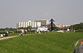
Duhnen is one of the most important tourist destinations in Lower Saxony on the Wadden Sea and is characterized by hotels , guest houses , holiday apartment houses and catering establishments as well as an adventure pool. Duhnen is a starting point for the watt wagon trips and mudflat hikes to the island of Neuwerk . The beach is very shallow, so swimming is almost impossible even at high tide. To the northeast of Duhnen is the district of Döse , to the east of Stickenbüttel and to the southwest is Sahlenburg . Duhnen offers high-quality hotels and restaurants and is considered a little more expensive than the neighboring seaside resorts of Döse and Sahlenburg, which have more of a reputation for family seaside resorts. Nevertheless, you can also find inexpensive, family-run guesthouses, campsites and holiday apartments in Duhnen. An important attraction is the traditional Duhner Wattrennen , a horse race in the mudflats.

View from the Watt near Duhnen to the Friedrich-Clemens-Gerke-Tower

View from the mudflats
On the dike from Duhnen towards Döse

Geestkliff on the edge of the Duhner Heide


.jpg)

Infrastructure
The center of Duhnen is on the streets Am Dorfbrunnen and Duhner Strandstraße . In addition to multi-storey functional hotel, restaurant and commercial buildings in the style of the 1970s and 1980s, there are individual buildings in the seaside resort style of the first decade of the 20th century. More upscale hotels have also settled on Duhner Strandstrasse near Am Dorfbrunnen . Since the 1980s, multi-storey apartment buildings have been built in the south-west near the indoor swimming pool, while in the direction of Döse on Cuxhavener Strasse , there are also larger, upscale hotels with the Hotel Seelust and the Hotel Sternhagen . There are also camping facilities here. The hinterland of Duhnen is characterized by single-family houses, some of which also rent holiday apartments.
traffic
The Duhner Zentrum is partially closed to general road traffic or traffic-calmed. There are city bus connections to the center of Cuxhaven, where the nearest train station is located, and to Sahlenburg . Large parking spaces for day visitors have been created in front of the town entrance. The island of Neuwerk can be reached by horse-drawn carriage . The Jan-Cux-Strandbahn, which runs between Alte Liebe and the nudist beach, serves several stops on the Duhner beach section.
Personalities
Sons and daughters of the place
- Peter Thode (1647–1701), Vogt on Neuwerk
People connected to the place
- Robert Dohrmann (1850–1932), entrepreneur who worked as a fish wholesaler, shipowner and real estate agent in Cuxhaven, is considered to be the founder of the Duhnen seaside resort
- Hermann Daur (1870–1925), painter and graphic artist, from 1895 onwards there were annual stays in Duhnen, where he met his future wife Margarete Boldt
- Diedrich Hahn (1884–1967), businessman and shipowner, he was president of the association for horse races on the Duhner Watt
- Karl Waller (1892–1963), teacher and homeland and prehistory researcher of the Elbe-Weser area, under his direction numerous excavations and emergency rescues a. a. in Duhnen instead
- Peter Samulski (1938–2012), library director at the University and State Library of Münster, long-distance runner, he ran the half marathon in Duhnen on September 4, 1994
- Monika Held (* 1943), writer and journalist, she completed her apprenticeship as a publishing clerk in Duhnen
literature
- J. Spohn: Bronze Age ring wall in Cuxhaven-Duhnen. In: Archeology in Germany 4/2008, p. 44 f.
- J. Spohn: More than "just" a well-known earthwork. In: Archeology in Germany 1/2010, p. 68 f.
- U. Veit, A. Wendowski-Schünemann: A Bronze Age ring wall in Cuxhaven-Duhnen, Lower Saxony. Preliminary report on the archaeological and scientific investigations (2002–2005). In: Archäologisches Korrespondenzblatt 36. 2006, pp. 473–486.
Web links
- Information page about Duhnen
- City wiki Cuxhaven - Duhnen
- "Am Kirchhof" ( Memento from August 25, 2007 in the Internet Archive )
Individual evidence
- ↑ a b Statistical Bureau of the Tax Deputation (ed.): The city of Hamburg, the suburbs, municipalities, localities and independently named areas of the Hamburg state . Otto Meissner Verlag, Hamburg 1875, p. 81–82 ( digitized in Google Books [accessed July 10, 2019]).
- ^ A b Heike Leuschner: The districts at a glance. Twelve in one go . In: Nordsee-Zeitung . May 19, 2018, p. 30 .
- ^ Law on Greater Hamburg and other area adjustments. Art. 1 (RGBl. 1937 I p. 91). In: www.verfassungen.de. January 26, 1937, archived from the original on September 6, 2017 ; accessed on October 15, 2018 .
- ^ Ulrich Schubert: Municipal directory Germany 1900 - Landherrenschaft Ritzebüttel. Information from December 1, 1910. In: www.gemeindeververzeichnis.de. February 3, 2019, accessed July 7, 2019 .
- ↑ Youhnen. In: Website Stadtwiki Cuxhaven. Retrieved July 7, 2019 .
- ↑ a b c d e Peter Bussler: A cultural and historical tour through Duhnen. Klaus Kamp Foundation, accessed on March 7, 2017 .
- ^ Kurt Eisermann: Flood catastrophe 300 years ago. The Christmas flood of 1717 on Neuwerk and the Thode family . In: Men from Morgenstern, Heimatbund an Elbe and Weser estuary e. V. (Ed.): Niederdeutsches Heimatblatt . No. 815 . Nordsee-Zeitung GmbH, Bremerhaven November 2017, p. 3–4 ( digitized version [PDF; 6.6 MB ; accessed on July 7, 2019]).
Altenbruch | Altenwalde (with Franzenburg , Gudendorf and Oxstedt ) | Berensch-Arensch (with Arensch and Berensch ) | Cuxhaven | Doze | Duhnen | Groden | Holte braces | Lüdingworth | Sahlenburg | Stickenbüttel | Süderwisch-Westerwisch