
Dunsum
| coat of arms | Germany map | |
|---|---|---|

|
Coordinates: 54 ° 44 ' N , 8 ° 25' E |
|
| Basic data | ||
| State : | Schleswig-Holstein | |
| Circle : | North Friesland | |
| Office : | Foehr-Amrum | |
| Height : | 0 m above sea level NHN | |
| Area : | 2.72 km 2 | |
| Residents: | 65 (Dec. 31, 2019) | |
| Population density : | 24 inhabitants per km 2 | |
| Postal code : | 25938 | |
| Area code : | 04683 | |
| License plate : | NF | |
| Community key : | 01 0 54 025 | |
| Office administration address: | Hafenstrasse 23 25938 Wyk auf Föhr |
|
| Website : | ||
| Mayor : | Erk Hemsen | |
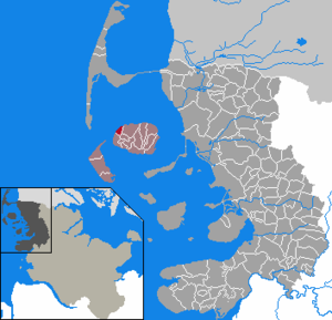
| Location of the community of Dunsum in the district of North Friesland | ||
  |
||

Dunsum ( Frisian : Dunsem , Danish : Dunsum ) is a municipality on the west coast of the island of Föhr in North Frisia . It consists of the districts Groß- and Klein-Dunsum.
geography
Groß-Dunsum is the larger of the two districts. It is located near the west coast of Föhr. Klein-Dunsum is about 600 meters further east. Further east is Süderende , south of Utersum .
As of the date of the census on May 25, 1987, there were 47 inhabitants in 15 households in Groß-Dunsum, and 38 inhabitants in 17 households in Klein-Dunsum.
history
In 1462 the place was first mentioned as Dompsum , in 1509 as Duesem . The name Dunsum may refer to dun , "dune", and - um , "home", according to another interpretation, Dunsum means "home of Dando". Almost all Föhrer villages have the suffix - um .
From 1717 to 1720 storm surges destroyed several houses in Dunsum, so that the residents founded the town of Klein-Dunsum. In 1804 there were 24 houses in the place now called Groß-Dunsum and nine houses in Klein-Dunsum.
As part of Westerland Föhr , Dunsum belonged to the royal enclaves and belonged directly to the Kingdom of Denmark, while Osterland Föhr and Wyk belonged to the Duchy of Schleswig . Only after Denmark lost Schleswig to Prussia , Dunsum also came to Schleswig-Holstein in 1864.
In 1911/1912 the Køkkenmødding of Groß-Dunsum was found north of Groß-Dunsum , which is one of the numerous prehistoric finds in the municipality.
politics
Community representation
The Dunsumer Voting Association (DWG) holds six of the seven seats of the municipal council , one seat is held by an individual applicant . In the previous electoral term, there had been a community meeting in Dunsum instead of a community council, as the number of inhabitants on December 31, 2010 was below 70.
mayor
For the 2013-2018 electoral period, Erk Hemsen was elected mayor and thus successor to Arfst Christiansen.
Economy and Transport
Main industries are tourism and agriculture. The state road 214, the "Rundföhrweg", leads through both districts. In Groß-Dunsum it bends to the east or south.
Tourism and sightseeing
From Dunsum, mudflat walks to the island of Amrum are offered. Amrum and Sylt can be seen from Dunsum.
In the mud flats north of Dunsum lies the Baalk-Stian , a large boulder that had been in a place that was destroyed by a storm surge . According to legend, a treasure should be hidden under him; however, it was never found.
Web links
Individual evidence
- ↑ North Statistics Office - Population of the municipalities in Schleswig-Holstein 4th quarter 2019 (XLSX file) (update based on the 2011 census) ( help on this ).
- ↑ Schleswig-Holstein topography. Vol. 2: Boren - Ellerau . 1st edition Flying-Kiwi-Verl. Junge, Flensburg 2002, ISBN 978-3-926055-68-2 , p. 318 ( dnb.de [accessed June 11, 2020]).
- ↑ State Statistical Office Schleswig-Holstein: Housing Directory Schleswig-Holstein 1987, Kiel 1992 , p. 35
- ↑ a b c d story on the parish website , accessed October 18, 2015
- ↑ Uwe Bonsen: Geography of Föhr. In: Margot and Nico Hansen: Föhr: History and shape of an island. Hansen & Hansen, Münsterdorf 1971, p. 28.
- ^ Föhr-Land: communities of voters in front. In: Der Insel-Bote from May 7, 2018, accessed on May 9, 2018
- ↑ Erk Hemsen inherits Arfst Christiansen Der Inselbote from July 2, 2013

Achtrup | Ahrenshöft | Ahrenviöl | Ahrenviölfeld | Alkersum | Almdorf | Arlewatt | Aventoft | Bargum | Behrendorf | Bohmstedt | Bondelum | Bordelum | Borgsum | Bosbull | Braderup | Bramstedtlund | Bredstedt | Breklum | Dagebüll | Drage | Drelsdorf | Dunsum | Elisabeth-Sophien-Koog | Ellhöft | Emmelsbüll-Horsbüll | Narrow Sands | Fresendelf | Friedrich-Wilhelm-Lübke-Koog | Friedrichstadt | Galmsbüll | Garding | Garding, parish | Goldebek | Goldelund | Gröde | Grothusenkoog | Haselund | Hattstedt | Hattstedtermarsch | Högel | Spar | Hooge | Hörnum (Sylt) | Horstedt | Hude | Humptrup | Husum | Immenstedt | Joldelund | Kampen (Sylt) | Karlum | Katharinenheerd | Klanxbüll | Klixbull | Koldenbüttel | Kolkerheide | Kotzenbüll | Ladelund | Langeneß | Langenhorn | Leak | Lexgaard | List on Sylt | Löwenstedt | Lütjenholm | Midlum | Mildstedt | Fog | Neukirchen | Nieblum | Niebüll | Norddorf on Amrum | Norderfriedrichskoog | North beach | Norstedt | Ockholm | Oevenum | Oldenswort | Oldersbek | Olderup | Oldsum | Ostenfeld (Husum) | Oster-Ohrstedt | Osterhever | Pellworm | Poppenbüll | Ramstedt | Rantrum | Reußenköge | Risum-Lindholm | Rodenäs | Sankt Peter-Ording | Schwabstedt | Schwesing | Seeth | Simonsberg | Sollwitt | Sönnebüll | Sprakebull | Stadum | Stedesand | Struckum | South end | Süderhöft | Süderlügum | South March | Sylt | Tating | Tetenbull | Tinningstedt | Tönning | Tümlauer-Koog | Uelvesbüll | Uphusum | Utersum | Viöl | Vollerwiek | Vollstedt | World | Wenningstedt-Braderup (Sylt) | Wester-Ohrstedt | Westerhever | Westre | Winnert | Wipe | Witsum | Wittbek | Wittdün on Amrum | Joke word | Wobbenbüll | Wrixum | Wyk on Föhr