
Breklum
| coat of arms | Germany map | |
|---|---|---|

|
Coordinates: 54 ° 36 ' N , 8 ° 59' E |
|
| Basic data | ||
| State : | Schleswig-Holstein | |
| Circle : | North Friesland | |
| Office : | Central North Friesland | |
| Height : | 7 m above sea level NHN | |
| Area : | 10.06 km 2 | |
| Residents: | 2330 (Dec. 31, 2019) | |
| Population density : | 232 inhabitants per km 2 | |
| Postal code : | 25821 | |
| Area code : | 04671 | |
| License plate : | NF | |
| Community key : | 01 0 54 020 | |
| LOCODE : | DE EKU | |
| Office administration address: | Theodor-Storm-Strasse 2 25821 Bredstedt, Germany |
|
| Website : | ||
| Mayor : | Claus Lass (WGB) | |
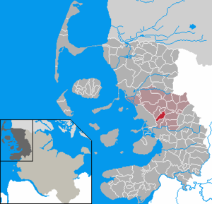
| Location of the municipality of Breklum in the district of North Friesland | ||
  |
||

Breklum ( North Frisian : Brääklem ) is a municipality in the district of North Friesland in Schleswig-Holstein . Borsbüll and Riddorf are in the municipality.
geography
Geographical location
The municipal area extends on both sides of the transition of the Schleswig Geest with the North Frisian Marsch (in the Breklumer Koog ) overlapping it in the western part in the landscape of the Nordergoesharde .
Community structure
In addition to the name-giving main town Breklum, there are u. a. also:
- Borsbüll ( Danish : Borsbøl ; North Frisian: Buursbel )
- Borsbüllfeld
- Breklumer Koog (proportionately)
- Breklumfeld
- Riddorf ( Ridderup ; Rääderup )
- Riddorffeld
in the municipality.
Neighboring communities
Neighboring municipalities of Breklum are as follows:
| Bredstedt | Sönnebüll | Vollstedt |
| Reußenköge |
.svg)
|
Drelsdorf |
| Struckum |
geology
From a geological point of view, the municipality was formed in two very different time periods. The higher Geest area is a product of the northern European mainland ice sheet that has advanced to this point during the Saale complex . This pushed the old moraine of the Stollberg in the north of Bredstedt as its highest peak far to the edge of the North Sea. The slopes, which descend steeply towards the south, are less powerful in the south-east. These gently undulating foothills form the subsoil of the eastern municipality today. The comparatively small marshland area in the western part of the municipality is part of the Breklumer Koog . This was diked in around 1520 and in the south reaches close to the former mouth of the Arlau at Wallsbüller Saatkoog .
history

The first traces of settlement date from the younger Stone Age (approx. 4300–2300 BC). Settlement remains and megalithic graves (large stone graves) were found, which suggest a larger settlement in the area of today's Breklum. Likewise, cultural relics were as pottery shards and daggers from Flint found. The settlement can be traced through time since then: burial mounds and other finds from the Bronze Age (approx. 2300–550 BC), urn fields from the Iron Age (approx. 550 BC – 400 AD) and traces a settlement from the Viking Age (800–1100 AD).
The Breklum Church, which was presumably dedicated to Saint Olaf , was built around 1200. It is considered a special building of the late brick Romanesque in the Schleswig region . The masonry, which partly consists of large field stones , identifies the church as a fortified church in which the residents of the surrounding area could find protection in the event of attacks. Breklum was a parish , and the church in the Nordergoesharde was a center for the residents of this harde . In the 14th century, the communities Bordelum and Drelsdorf , which were previously part of the parish, gained their respective independence. Until 1530 Bredstedt belonged to the parish of Breklum.

In 1876 the Breklum pastor Christian Jensen (1839-1900) founded the Mission Society for Schleswig-Holstein (today: Center for Mission and Ecumenism - Northern Church Worldwide ). Today, the center no longer trains missionaries , but through grants it supports temporary stays abroad for volunteers in the field of church service. In addition, the center acts as a network to church and ecumenical institutions, as well as non-governmental organizations in Africa, Asia, Europe, America and the Pacific region.
After the Prussian province of Schleswig-Holstein was founded in 1866, the parish of Breklum became a parish land municipality . It comprised the eleven villages of Almdorf , Borsbüll, Breklum, Fehsholm, Högel , Lütjenholm , Riddorf, Sönnebüll , Struckum , Vollstedt and Wallsbüll.
In the Reichstag election in March 1933 , with a turnout of 85.6%, the NSDAP voted 72.6%, the DNVP 10.9%, the SPD 9.5% and the KPD 3.3%.
In the course of 1934, the parish district of Breklum was dissolved.
In its current size, the rural community of Breklum was created on December 1, 1934 by merging the village switches Riddorf, Breklum, Borsbüll and the northern part of the Breklumerkoog.
politics
Community representation
- Of the 17 seats in the municipal council, the WGB community of voters had eight seats since the 2008 local elections, the CDU has seven and the SPD two.
- In the local elections on May 26, 2013, the WGB received 43.6 percent and thus six seats. The CDU got 38.1 percent and five seats. The SPD had 18.3 percent and two seats. There were only 13 mandates left. The turnout was 51.6 percent.
mayor
After the local elections in 2018, Claus Lass (WGB) was elected mayor for the 2018–2023 term.
coat of arms
Blazon : "In green an asymmetrical silver fern frond, top right a silver-red Luther rose."
Economy and Infrastructure

The economic structure of the community is characterized by medium-sized companies . The locally based companies offer a wide range of goods and services.
Residential use is more important than agriculture for the place today.
Tourist businesses are several holiday apartments and a pension in Riddorf .
Beltringharder Koog , which has been declared a nature reserve in its entirety, is located on the North Sea coast west of Breklum in the neighboring municipality of Reußenköge .
Established businesses
There are three family businesses in the retail sector in the municipality . You work in the areas of food retailing ( EDEKA ), furniture trading and automobile trading. The latter sells brands of the Volkswagen Group and also has branches in Husum and Tarp .
There is also a branch of the retail company Lidl in the community .
With the Christian Jensen College there is a conference and education center in town. The origin of this institution lies in the North Elbian Mission Institution, which was founded by Christian Jensen .
The DIAKO Nordfriesland company is based in the Riddorf district and operates a specialist clinic for psychiatry and psychosomatic illnesses on site.
traffic
Breklum is crossed by the federal highway 5 and the Marschbahn almost in parallel. Both form the backbone of travel to the North Frisian Islands and Halligen as well as the weekday commuter traffic to the central locations along the route. In the first-mentioned function, the federal road was also part of the Green Coastal Road, which was formerly marketed as a holiday route .
Due to the increasing traffic flows, an eastward relocation in the course of the bypass Hattstedt – Bredstedt has been planned. Due to pending lawsuits in the area of another route section, however, there are delays in the implementation of the planning, which makes a plan change procedure necessary.
Since Breklum never had its own train station - the neighboring towns of Bredstedt and Struckum had a dominant role in passenger and freight transport due to the established structure - the public transport connection has now been made via a regional regional bus line (R120) since August 1, 2019 between Husum and Bredstedt / Langenhorn. There are two stops in the elongated core area. Another line (R125 Bredstedt – Flensburg) runs through the northern municipality on the outskirts of the Riddorf district. The stops Breklum, Riddorfer Ring and Breklum, Kirche are served here . In addition, Breklum is part of the Bredstedt on-call bus area.
Sports
SV Germania Breklum is one of the largest non-urban sports clubs in North Friesland. The new sports park was inaugurated on June 19, 2010.
Personalities
Sons and daughters of the church
- Uwe Pörksen (* 1935), professor of language and older literature
- Fiede Kay (1941–2005), singer and songwriter of Low German songs
Associated with Breklum
- Heinrich Hansen (* 1861 in Klockries near Lindholm , † 1940 in Breklum), Protestant pastor and initiator of the high church association
- Christian Jensen (1839–1900), Protestant pastor and founder of missionary training in Breklum
literature
- Uwe Pörksen , Breklehem. Novel of a village, Husum Verlag, Husum 2016
See also
Web links
Individual evidence
- ↑ North Statistics Office - Population of the municipalities in Schleswig-Holstein 4th quarter 2019 (XLSX file) (update based on the 2011 census) ( help on this ).
- ↑ Schleswig-Holstein topography. Vol. 2: Boren - Ellerau . 1st edition Flying-Kiwi-Verl. Junge, Flensburg 2002, ISBN 978-3-926055-68-2 , p. 105 ( dnb.de [accessed June 11, 2020]).
- ↑ Harry Kunz, Albert Panten: The Köge of North Friesland. Verlag Nordfriisk Instituut, Bredstedt 1997, p. 43f.
- ↑ Klaus-Joachim Lorenzen-Schmidt, Ortwin Pelc (Ed.): The new Schleswig-Holstein Lexicon. Wachholtz, Neumünster 2006, Lemmata Breklum and Bredstedt.
- ↑ AKENS Information 39, Omland: "All of us 'yes' to the leader". Retrieved November 26, 2019 .
- ↑ State Statistical Office Schleswig-Holstein (Ed.): The population of the communities in Schleswig-Holstein 1867-1970 . State Statistical Office Schleswig-Holstein, Kiel 1972, p. 251 ( digital copy [PDF]).
- ↑ Historical municipality register Schleswig-Holstein: Notes on the municipality of Breklum (footnote) . ( Digitized version ).
- ^ Result of the Breklum municipal election 2013. ( Memento from June 8, 2013 in the Internet Archive ) on the website Amt Mittleres Nordfriesland
- ↑ Schleswig-Holstein's municipal coat of arms
- ↑ Vacation rentals in Breklum and the surrounding area of North Frisia (North Sea) Schleswig-Holstein. Retrieved August 9, 2019 .
- ↑ Facts & Figures: The west coast at a glance. Retrieved August 9, 2019 .
- ↑ Timetable line R120. (PDF) Retrieved August 10, 2019 .
- ↑ Timetable for bus route R125. (PDF) Retrieved November 11, 2019 .
- ↑ Flyer on call bus area Bredstedt. (PDF) Retrieved November 11, 2019 .
- ^ Message from SV Germania Breklum ( Memento from March 4, 2016 in the Internet Archive ) (PDF file; 53 kB)
Achtrup | Ahrenshöft | Ahrenviöl | Ahrenviölfeld | Alkersum | Almdorf | Arlewatt | Aventoft | Bargum | Behrendorf | Bohmstedt | Bondelum | Bordelum | Borgsum | Bosbull | Braderup | Bramstedtlund | Bredstedt | Breklum | Dagebüll | Drage | Drelsdorf | Dunsum | Elisabeth-Sophien-Koog | Ellhöft | Emmelsbüll-Horsbüll | Narrow Sands | Fresendelf | Friedrich-Wilhelm-Lübke-Koog | Friedrichstadt | Galmsbüll | Garding | Garding, parish | Goldebek | Goldelund | Gröde | Grothusenkoog | Haselund | Hattstedt | Hattstedtermarsch | Högel | Spar | Hooge | Hörnum (Sylt) | Horstedt | Hude | Humptrup | Husum | Immenstedt | Joldelund | Kampen (Sylt) | Karlum | Katharinenheerd | Klanxbüll | Klixbull | Koldenbüttel | Kolkerheide | Kotzenbüll | Ladelund | Langeneß | Langenhorn | Leak | Lexgaard | List on Sylt | Löwenstedt | Lütjenholm | Midlum | Mildstedt | Fog | Neukirchen | Nieblum | Niebüll | Norddorf on Amrum | Norderfriedrichskoog | North beach | Norstedt | Ockholm | Oevenum | Oldenswort | Oldersbek | Olderup | Oldsum | Ostenfeld (Husum) | Oster-Ohrstedt | Osterhever | Pellworm | Poppenbüll | Ramstedt | Rantrum | Reußenköge | Risum-Lindholm | Rodenäs | Sankt Peter-Ording | Schwabstedt | Schwesing | Seeth | Simonsberg | Sollwitt | Sönnebüll | Sprakebull | Stadum | Stedesand | Struckum | South end | Süderhöft | Süderlügum | South March | Sylt | Tating | Tetenbull | Tinningstedt | Tönning | Tümlauer-Koog | Uelvesbüll | Uphusum | Utersum | Viöl | Vollerwiek | Vollstedt | World | Wenningstedt-Braderup (Sylt) | Wester-Ohrstedt | Westerhever | Westre | Winnert | Wipe | Witsum | Wittbek | Wittdün on Amrum | Joke word | Wobbenbüll | Wrixum | Wyk on Föhr