
Süderlügum
| coat of arms | Germany map | |
|---|---|---|

|
Coordinates: 54 ° 52 ' N , 8 ° 55' E |
|
| Basic data | ||
| State : | Schleswig-Holstein | |
| Circle : | North Friesland | |
| Office : | Südtondern | |
| Height : | 14 m above sea level NHN | |
| Area : | 26.59 km 2 | |
| Residents: | 2417 (Dec. 31, 2019) | |
| Population density : | 91 inhabitants per km 2 | |
| Postal code : | 25923 | |
| Area code : | 04663 | |
| License plate : | NF | |
| Community key : | 01 0 54 131 | |
| LOCODE : | DE SUW | |
| Office administration address: | Marktstrasse 12 25899 Niebüll |
|
| Website : | ||
| Mayor : | Rainer Eggers ( CDU ) | |
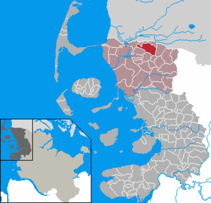
| Location of the municipality of Süderlügum in the district of North Friesland | ||
  |
||

Süderlügum ( Danish : Sønder Løgum , North Frisian : Läigem , South Jutland : Lym ) is a municipality in the district of North Friesland in Schleswig-Holstein . Wimmersbüll ( Vimmersbøl ) is in the municipality.
geography
Geographical location
The municipality of Süderlügum is located at the transition from Schleswigscher Geest to the North Frisian Marsch shortly before the Danish border . The district town of Husum is located about 50 kilometers to the south, the associated regional center of Flensburg about 40 kilometers to the east. The small town of Tønder is located three kilometers north of the municipality, already in Denmark .
Community structure
The 1987 census was recorded using the following list of housing locations. The following districts were registered:
- Horsberg (Danish Horsbjerg )
- Süderlügum ( Sønder Løgum )
- Süderlügum field
- Süderlügum forest
- Wimmersbüll ( Vimmersbøl )
Neighboring communities
Süderlügum shares a short section in the northwest of the municipality with the municipality of Tønder on the Süderau (Danish: Sønderå). The other directly adjacent neighboring communities are (starting clockwise in the north): Ellhöft , Westre , Lexgaard , Braderup , Humptrup and Aventoft (all in the district of North Friesland).
history
The place on Ochsenweg was first mentioned in 1177. The name Lügum means "on the waters" and refers to the port that the place owned in the Middle Ages. (cf. old Danish løgh ≈ washing water meaning lake, water accumulation ). In the southern Jutland dialect, the place name became Lym through the narrowing of / ø / to / y / before / g / and the omission of the intervowel gh . The addition "Süder" served to distinguish between the places Norderlügum and Osterlügum, which are also in the Duchy of Schleswig and now north of the border . The field name Horsberg (derived from Old Norse hross or hors for horse) probably refers to earlier pastures for horses, the expression was also used in southern Jutland for insignificant elevations in the landscape.
Süderlügum formed the center of the parish of the same name within the Karrharde . After the German-Danish War in 1864, the place became part of Prussia. From 1889 to 2007, Süderlügum was the administrative seat of the administrative district or office of the same name . Since January 1, 2008, it has belonged to the South Tondern office with the city of Niebüll , the municipality of Leck and the municipalities of the offices of Bökingharde , Karrharde and Wiedingharde .
On February 28, 1970 Wimmersbüll was incorporated.
politics
Community representation
Out of 17 seats in the municipal council had CDU since the local elections in 2008 six, the voter community WGS five and the SPD and SSW three seats. The election on May 26, 2013, with only 13 seats left, had the following result: WGS four and CDU, SPD and SSW three seats each.
According to the final result of the 2018 local elections, the SSW received four seats. The other parties represented in the municipal council, the CDU, the WGS and the SPD, each received three seats. The turnout in this election was 49.7 percent.
mayor
In 2018 Rainer Eggers (CDU) was elected mayor for Süderlügum. He has thus succeeded Christian Magnus Petersen (WGS).
From 2013 to 2018 he was mayor and thus successor to Harro Hansen (CDU), who previously held the office for 15 years.
coat of arms
Blazon : "Above blue-silver waves in green under a raised, inclined silver bar, eight golden dunes, forming the shape of an eight-mountain, gently rising at the front and steeply sloping at the rear."
Until 2007 the municipality had no coat of arms. With the dissolution of the office in Süderlügum, the municipality decided to continue to use its coat of arms with only minor changes.
Economy and Infrastructure
Companies
The economic structure of Süderlügum has always been characterized by agriculture. There are now many retail businesses in the village that benefit from border trade with Denmark.
One of the origins of today's VR Bank Nord is rooted in the local agricultural trade. This formed a complementary core area of the predecessor institute, most recently VR-Bank Niebüll, into the 21st century . A comparable connection had been handed over to the main cooperative north by other cooperative banks much earlier .
traffic

Süderlügum can be reached by motorized private transport via federal highway 5 near the German-Danish border. The connection from Husum and Niebüll to Tønder, which runs through the village, is part of the former green coastal road and runs through the center of the municipality in a north-south direction. In Süderlügum, state road 1 branches off from federal road 5 to Wallsbüll .
In the local rail transport , Süderlügum is reached via the stop of the same name. This is located in the district of Wimmersbüll. As a former part of the march line between Tønder and Niebüll, this railway line was reactivated in 2001 after 20 years of inactivity. The breakpoint is the northernmost train breakpoint on the German mainland.
Attractions
The list of cultural monuments in Süderlügum includes the cultural monuments entered in the list of monuments of Schleswig-Holstein.
The Marien-Kirche was built around 1200 on a sand hill from the Ice Age as a branch church of Humptrup . At first it was a mere cemetery chapel in Romanesque style, with no extensions to the east or west. Around 1500 the Marienkirche was extended to its current length and the Romanesque beam ceiling was replaced by Gothic vaults. During this time, the vaults were painted for the first time. In the years 1929/1930 the church was completely restored. In the process, the ceiling frescoes described, which had previously been whitewashed, were exposed again. The baptismal font, which is carved out of two granite blocks, still reminds of the founding days of the Marienkirche. In the church there are seven portraits from the Claudius family of pastors, whose most famous son was the poet Matthias Claudius . Since 2015 the church has a new Marcussen organ .
Web links
Individual evidence
- ↑ North Statistics Office - Population of the municipalities in Schleswig-Holstein 4th quarter 2019 (XLSX file) (update based on the 2011 census) ( help on this ).
- ^ Housing directory Schleswig-Holstein 1987. (pdf) Retrieved on November 17, 2019 .
- ↑ Johannes Kok: Det danske folkesprog i Sønderjylland , Volume 2, København 1867, pp. 188/189
- ^ M. Mørk Hansen: Kirkelig Statistics over Slesvig Stift: Med historiske og topografiske bemærkninger, Vol. 1, Kjøbenhavn 1863, p. 205
- ^ History of Süderlügum
- ↑ Wolfgang Laur: Historisches Ortsnamelexikon von Schleswig-Holstein , 2nd edition, Neumünster 1992, p. 633
- ↑ Johannes Kok: Det danske folkesprog i Sønderjylland , Volume 2, København 1867, pp. 188/189
- ↑ Web editor: Results of the 2013 municipal elections in the South Tondern office. In: www.amt-suedtondern.de. South Tondern Office, accessed on October 15, 2018 .
- ↑ Web editor: Results of the 2018 municipal elections in the South Tondern office. In: www.amt-suedtondern.de. South Tondern Office, accessed on October 15, 2018 .
- ↑ Minutes of the public part of the 1st meeting of the Süderlügum municipal council on Wednesday, June 13, 2018. (pdf) Retrieved on October 6, 2018 .
- ^ Farewell after 31 years in local politics. In: Nordfriesland Tageblatt. July 18, 2013, accessed August 29, 2013 .
- ↑ Schleswig-Holstein's municipal coat of arms
- ^ Orgel Süderlügum ( Memento from June 27, 2017 in the Internet Archive )
Achtrup | Ahrenshöft | Ahrenviöl | Ahrenviölfeld | Alkersum | Almdorf | Arlewatt | Aventoft | Bargum | Behrendorf | Bohmstedt | Bondelum | Bordelum | Borgsum | Bosbull | Braderup | Bramstedtlund | Bredstedt | Breklum | Dagebüll | Drage | Drelsdorf | Dunsum | Elisabeth-Sophien-Koog | Ellhöft | Emmelsbüll-Horsbüll | Narrow Sands | Fresendelf | Friedrich-Wilhelm-Lübke-Koog | Friedrichstadt | Galmsbüll | Garding | Garding, parish | Goldebek | Goldelund | Gröde | Grothusenkoog | Haselund | Hattstedt | Hattstedtermarsch | Högel | Spar | Hooge | Hörnum (Sylt) | Horstedt | Hude | Humptrup | Husum | Immenstedt | Joldelund | Kampen (Sylt) | Karlum | Katharinenheerd | Klanxbüll | Klixbull | Koldenbüttel | Kolkerheide | Kotzenbüll | Ladelund | Langeneß | Langenhorn | Leak | Lexgaard | List on Sylt | Löwenstedt | Lütjenholm | Midlum | Mildstedt | Fog | Neukirchen | Nieblum | Niebüll | Norddorf on Amrum | Norderfriedrichskoog | North beach | Norstedt | Ockholm | Oevenum | Oldenswort | Oldersbek | Olderup | Oldsum | Ostenfeld (Husum) | Oster-Ohrstedt | Osterhever | Pellworm | Poppenbüll | Ramstedt | Rantrum | Reußenköge | Risum-Lindholm | Rodenäs | Sankt Peter-Ording | Schwabstedt | Schwesing | Seeth | Simonsberg | Sollwitt | Sönnebüll | Sprakebull | Stadum | Stedesand | Struckum | South end | Süderhöft | Süderlügum | South March | Sylt | Tating | Tetenbull | Tinningstedt | Tönning | Tümlauer-Koog | Uelvesbüll | Uphusum | Utersum | Viöl | Vollerwiek | Vollstedt | World | Wenningstedt-Braderup (Sylt) | Wester-Ohrstedt | Westerhever | Westre | Winnert | Wipe | Witsum | Wittbek | Wittdün on Amrum | Joke word | Wobbenbüll | Wrixum | Wyk on Föhr