Goldelund
| coat of arms | Germany map | |
|---|---|---|

|
Coordinates: 54 ° 41 ′ N , 9 ° 6 ′ E |
|
| Basic data | ||
| State : | Schleswig-Holstein | |
| Circle : | North Friesland | |
| Office : | Central North Friesland | |
| Height : | 10 m above sea level NHN | |
| Area : | 12.02 km 2 | |
| Residents: | 414 (Dec. 31, 2019) | |
| Population density : | 34 inhabitants per km 2 | |
| Postal code : | 25862 | |
| Area code : | 04673 | |
| License plate : | NF | |
| Community key : | 01 0 54 038 | |
| Office administration address: | Theodor-Storm-Strasse 2 25821 Bredstedt, Germany |
|
| Website : | ||
| Mayoress : | Waltraud Schnoewitz (ABCWGG) | |
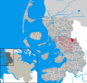
| Location of the municipality Goldelund in the district of North Friesland | ||
Goldelund ( Danish : Goldelund , North Frisian : Gelün ) is a municipality in the district of North Friesland in Schleswig-Holstein . Hogelund is in the municipality.
history
The place name is first mentioned in writing in 1321 and goes to Danish. was valid (old north. gǫltr ) for boar and -lund for wood. The meaning would be wood, where boars reside .
On April 1, 1934, the parish county Joldelund was dissolved. All of their village communities, village communities and farmers became independent communities / rural communities, including Goldelund.
politics
Community representation
Of the nine seats in the municipal council, as a result of the local elections on May 6, 2018, the ABCWGG received six seats and the AAGW three.
Mayoress
Waltraut Schnoewitz (ABCWGG) will continue to serve as mayor during the 2018–2023 election period.
coat of arms
Blazon : “Raised under a narrow blue shield head of gold and green divided by a dividing line that is bent twice on the right , the first arch higher than the second. At the top left a green oak branch, at the bottom a golden village stick with a golden corn on the cob in two golden bracts (lisies). "
economy
The municipality is predominantly agricultural. The state road 12 leads from the federal road 5 in Bredstedt via Goldelund to the federal road 200 in Wanderup .
Halverstangen mountains
The Halverstangen Mountains, also known as the Königsberge, are a chain of dunes that were originally almost a kilometer long. A part was removed during land consolidation .
Web links
Individual evidence
- ↑ North Statistics Office - Population of the municipalities in Schleswig-Holstein 4th quarter 2019 (XLSX file) (update based on the 2011 census) ( help on this ).
- ↑ Schleswig-Holstein topography. Vol. 3: Ellerbek - Groß Rönnau . 1st edition Flying-Kiwi-Verl. Junge, Flensburg 2003, ISBN 978-3-926055-73-6 , p. 259 ( dnb.de [accessed April 26, 2020]).
- ↑ Anders Bjerrum: Sydslesvigs stednavne , Vol. 4, Copenhagen 1979–1984. P. 425
- ↑ Wolfgang Laur: Historisches Ortsnamelexikon von Schleswig-Holstein , 2nd edition, Neumünster 1992, p. 276
- ↑ State Statistical Office Schleswig-Holstein (Ed.): The population of the communities in Schleswig-Holstein 1867-1970 . State Statistical Office Schleswig-Holstein, Kiel 1972, p. 251 .
- ↑ Announcement of the municipal election results of the municipality of Goldelund. (pdf) Retrieved September 24, 2018 .
- ↑ Constituent meeting of the Goldelund community council. Retrieved September 25, 2018 .
- ↑ Schleswig-Holstein's municipal coat of arms


