
List on Sylt
| coat of arms | Germany map | |
|---|---|---|

|
Coordinates: 55 ° 1 ′ N , 8 ° 26 ′ E |
|
| Basic data | ||
| State : | Schleswig-Holstein | |
| Circle : | North Friesland | |
| Office : | Sylt landscape | |
| Height : | 2 m above sea level NHN | |
| Area : | 18.47 km 2 | |
| Residents: | 1493 (Dec. 31, 2019) | |
| Population density : | 81 inhabitants per km 2 | |
| Postal code : | 25992 | |
| Area code : | 04651 | |
| License plate : | NF | |
| Community key : | 01 0 54 078 | |
| LOCODE : | DE LIS | |
| Office administration address: | Andreas-Nielsen-Strasse 1 25980 Sylt |
|
| Website : | ||
| Mayor : | Ronald Benck ( CDU ) | |
| Location of the municipality of List on Sylt in the district of North Friesland | ||
  |
||


List on Sylt (until December 31, 2008 List , North Frisian List üp Söl , Danish List på Sild ) is a municipality in the district of North Friesland in Schleswig-Holstein . The seaside resort is located in the north of the island of Sylt and is the northernmost municipality in Germany. Therefore she is a member of the Zipfelbund . Möwenberg, Mellhörn, Süderheidetal, Westerheide and Klappholttal are in the municipality.
geography
Geographical location
The municipality of List on Sylt forms the northern end of the North Frisian island of Sylt in the North Frisian Wadden Sea . As such, it is also the northernmost municipality in the Federal Republic of Germany (the northernmost German mainland municipality is Rodenäs ). The northernmost point of land is the Ellenbogen peninsula , which encloses the Wadden Sea Bay Königshafen to the west. The village is located on the south bank of the royal port.
At the same time, List is the northernmost point of the closed German-speaking area in Central Europe. The counterpart is the Swiss community of Zermatt am Matterhorn, 1005 km further south .
Neighboring communities
List on Sylt only has one neighboring municipality that adjoins the municipality to the south. It is the municipality of Kampen (Sylt) .
geology
List is surrounded by a landscape of shifting dunes , heather and salt marshes . This landscape, also known as Listland , has been privately owned for centuries by a community of heirs that arose from the town's two Stavenplatz , the Osthof and the Westhof .
To the south and east of the town on the east coast, the Schleswig-Holstein Wadden Sea National Park extends with the remains of the Danish Hallig Jordsand . The Königshafen, a mudflat that belongs to protection zone I of the national park and cannot be entered, and the bird protection island of Uthörn are located between the Lister Hafen and the Ellenbogen peninsula .
history


The name List is said to be taken from the old Danish listi (strip, border, in the sense of coastal strip). Listed ( Bornholm ) and Lister ( Norway and Blekinge ) are closely related in terms of language . From Danish place names there is also the street name Brünk (Danish brink , South Jutian brynk , = slope). List, a Danish ( Jutish ) foundation, was first mentioned in 1292 when the town and its foreland came into the possession of the city of Ripen . The place was destroyed several times by storm surges . List has no longer been a church village since the storm surge of 1362. Before 1864 Listland was not part of the Duchy of Schleswig , like the surrounding area , but to the Kingdom of Denmark (the royal enclaves ), together with the southern part of the neighboring island of Rømø and a small mainland area to the Ballum district under the Ripen office. It had been part of Schackenborg County since 1661 . Despite the constitutional and administrative separation from the Duchy of Schleswig and the landscape Sylt List belonged to his own church to the parish since losing Keitum .
In the course of the Thirty Years War in 1644, a sea battle between Swedish-Dutch and Danish ships took place in the Royal Harbor. The name Königshafen goes back to this battle. In 1682 the Danish king's first customs post was built in List on Sylt.
After the German-Danish War in 1864, the possessions of the Kingdom of Denmark, like the rest of Schleswig, initially came under Prussian administration on behalf of the German Confederation, and after the Prussian-Austrian War in 1866, together with the Duchy of Holstein, became part of the Kingdom of Prussia. List continued to form its own community, which now belonged to the Tondern district . With the formation of the districts in 1889 List came to the district of Sylt.
Until the First World War, List consisted of only two courtyards, the east and west courtyards. By 1900 the Listland had fewer than 100 inhabitants. List has been a border town since the referendum in Schleswig in 1920.
In the period between the two world wars, a sea air base with numerous buildings and civil accommodation was built in List . The port in its current form was also laid out at that time. In July 1932, the pilot Wolfgang von Gronau started his spectacular circumnavigation of the world in a seaplane from this lair . During the Second World War, Wehrmacht emergency squadrons were located here . List owes its present appearance mainly to the construction activity in the 1930s. Today's Protestant church was also built as a garrison church; it was part of the Seefliegerhorstes List and is one of the few garrison churches built during the National Socialist era .
After the dissolution of the districts and the formation of the offices, List became vacant in 1948. On January 1, 2004, List gave up its freedom of office and joined the Sylt Landscape Office .
politics
Community representation
Of 20 seats that had CDU since the municipal election in 2008 seven, the voter community FWG six, the SSW four and the SPD three seats.
In the local elections on May 26, 2013, the CDU received 42.5 percent and eight seats, the FWG 23.3 percent and four seats, the SSW 18.1 percent and three seats, and the SPD 15.7 percent and three seats. 18 seats were awarded and the turnout was 43.7 percent.
mayor
At the municipal council meeting on July 7, 2015, Ronald Benck was elected as the new mayor of List from October 1, 2015.
Ronald Benck (CDU) was re-elected mayor for the 2018-2022 election period.
coat of arms
The coat of arms drawn by Albert Aereboe was approved by the Schleswig-Holstein State Minister of the Interior on August 31, 1948.
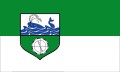
Blazon : “Divided; above in silver over blue waves a blue whale, below in green a silver compass with a black and white border, the needle of which points to the head of the whale. "
The representation of the waves in the coat of arms officially used by the municipality does not comply with the heraldic rules, so the coat of arms can only be described as commercial graphics or a logo . The whale stands for historical whaling, which was one of the most important sources of income for the population until the beginning of the 19th century, while the compass with the needle pointing north marks the former fishing areas near Spitsbergen . The shield colors silver and green refer to the dune vegetation and the sea.

Heraldically correct coat of arms

Utility coat of arms or logo
Hoist flag


religion
The population in List is predominantly Evangelical Lutheran. There are two Christian churches: on the one hand the former Protestant garrison church of St. Jürgen , which is under monument protection, and on the other hand the modern building of the Catholic church of St. Raphael .
Tourism and sightseeing
The municipality of List on Sylt has combined its tourist activities and land management in its own operation Kurverwaltung List on Sylt.
The place houses the northernmost fish stall in Germany , with which the entrepreneur Jürgen "Jünne" Gosch founded his restaurant and gastronomy chain "Gosch". In addition, Dittmeyer's oyster company is the only oyster farm in Germany where the Sylt Royal ripens in the Wadden Sea off List . This breed has a long tradition; As early as the 1920s, Lister oysters were being shipped to restaurants and delicatessens all over Germany.
The Rømø-Sylt-Linie provides a ferry connection from Lister Harbor to the Danish neighboring island of Rømø . Excursions to the Wadden Sea, to the seal banks and off the west coast of the island are also offered from the Lister harbor. The port was redesigned in 2002/2003, which should do justice to its increased tourist importance. The Pidder Lüng , a rescue cruiser of the DGzRS , is also stationed in this port . The Adler shipping company offers excursions to the seal banks with the former war fishing cutter Gret Palucca , and the Mya II , a research ship from the Alfred Wegener Institute for Polar and Marine Research (AWI), has its home port here. In the summer of 2017, the "Sylter Rad", a 35 meter high Ferris wheel, was set up for the first time at the List harbor on Sylt.
West of the town, the Sylt beach, a 40-km long stretches sandy beach , which for bathing and barefoot hiking inviting and where during the summer months beach chairs can be rented. In the summer months, Sylter Verkehrsgesellschaft buses run from the town center on the east side to reach the beaches, which are up to four kilometers away.
List is also home to the Sylt Wadden Sea Station of the Alfred Wegener Institute for Polar and Marine Research (AWI), which is currently being extensively expanded. Together with the municipality of List, the National Park Office, the National Park Service and all Sylt nature and coastal protection associations, the AWI planned a further project and implemented it for around 11.5 million euros: Since its opening on February 21, 2009, the Sylt Adventure Center has offered the Guests and locals of the island of Sylt information and insights into maritime topics such as the North Sea , marine and climate research , the Schleswig-Holstein Wadden Sea National Park and environmental and coastal protection .
The “northernmost point of Germany” is also on the elbow . Bordering on the southern area of the elbow in Königshafen a surf - and Kite -Revier. The elbow can only be reached via a toll road, as this is also privately owned.
The place has been shaped by the naval supply school since the Bundeswehr was founded . Since then, the Bundeswehr has been one of the largest employers alongside tourism. As part of the location closings in the Federal Republic of Germany, the List location on Sylt was also affected; At the end of March 2007, the last soldiers and civilian employees left the site. The barracks and federal properties in the town center will be given new, civil uses.

At the Lister cemetery u. a. the honorary citizen of the community Wolfgang von Gronau found his final resting place.
On July 21, 2017, the municipality of List on Sylt celebrated its 725th anniversary with a large harbor festival as well as an open-air concert by Santiano and a laser show with fireworks. The Gosch company also celebrated its 50th anniversary on the same day .
Sports
The Sportfreunde List association offers running, swimming and fistball, among other things. The club organizes the annual elbow run.
Panorama picture

Climate table
| List (Sylt) | ||||||||||||||||||||||||||||||||||||||||||||||||
|---|---|---|---|---|---|---|---|---|---|---|---|---|---|---|---|---|---|---|---|---|---|---|---|---|---|---|---|---|---|---|---|---|---|---|---|---|---|---|---|---|---|---|---|---|---|---|---|---|
| Climate diagram | ||||||||||||||||||||||||||||||||||||||||||||||||
| ||||||||||||||||||||||||||||||||||||||||||||||||
|
Monthly average temperatures and precipitation for List (Sylt)
Source: wetterkontor.de
|
|||||||||||||||||||||||||||||||||||||||||||||||||||||||||||||||||||||||||||||||||||||||||||||||||||||||||||||||||||||||||||||||||||||||||||||||||||||||||||||||||||||||||||||||||||||||||||||||||||
Picture gallery

List, aerial photo 2013

NSG North Sylt

Klappholtal

Sütterknoll

Elbow, aerial photo 2013

List-Ost lighthouse

List-West lighthouse

Koenigshafen (Sylt)

St. Jürgen

Port of List

Uthörn, seen from the south bank of the royal port

List (Sylt) -Rømø (DK) ferry


.jpg)
.Au%C3%9Fenansicht._f%C3%BCr_WLM.JPG)


_F%C3%A4hre_SyltExpress@20160101_03.JPG)
Web links
Individual evidence
- ↑ North Statistics Office - Population of the municipalities in Schleswig-Holstein 4th quarter 2019 (XLSX file) (update based on the 2011 census) ( help on this ).
- ↑ Destatis: Area changes from January to September 2015 , accessed on August 31, 2015
- ↑ Schleswig-Holstein topography. Vol. 6: Kronprinzenkoog - Mühlenrade . 1st edition Flying-Kiwi-Verl. Junge, Flensburg 2006, ISBN 978-3-926055-85-9 , pp. 169 ( dnb.de [accessed on July 25, 2020]).
- ↑ Nudansk Ordbog, 13th edition, Politiken Forlag
- ↑ Layout north: North Sea resort List on Sylt. Retrieved January 23, 2018 .
- ^ Result community election List on Sylt 2013. In: www.gemeinde-sylt.de. Sylt municipality, archived from the original on June 26, 2013 ; accessed on May 26, 2016 .
- ↑ Schleswig-Holstein's municipal coat of arms
- ↑ Sportfreunde List - Welcome to Germany's northernmost sports club. Retrieved November 11, 2019 (German).
- ↑ Gabi-List: Elbow Run on Sunday, August 4, 2019. In: Sportfreunde List. July 22, 2019, accessed on November 11, 2019 (German).
- ↑ wetterkontor.de
Achtrup | Ahrenshöft | Ahrenviöl | Ahrenviölfeld | Alkersum | Almdorf | Arlewatt | Aventoft | Bargum | Behrendorf | Bohmstedt | Bondelum | Bordelum | Borgsum | Bosbull | Braderup | Bramstedtlund | Bredstedt | Breklum | Dagebüll | Drage | Drelsdorf | Dunsum | Elisabeth-Sophien-Koog | Ellhöft | Emmelsbüll-Horsbüll | Narrow Sands | Fresendelf | Friedrich-Wilhelm-Lübke-Koog | Friedrichstadt | Galmsbüll | Garding | Garding, parish | Goldebek | Goldelund | Gröde | Grothusenkoog | Haselund | Hattstedt | Hattstedtermarsch | Högel | Spar | Hooge | Hörnum (Sylt) | Horstedt | Hude | Humptrup | Husum | Immenstedt | Joldelund | Kampen (Sylt) | Karlum | Katharinenheerd | Klanxbüll | Klixbull | Koldenbüttel | Kolkerheide | Kotzenbüll | Ladelund | Langeneß | Langenhorn | Leak | Lexgaard | List on Sylt | Löwenstedt | Lütjenholm | Midlum | Mildstedt | Fog | Neukirchen | Nieblum | Niebüll | Norddorf on Amrum | Norderfriedrichskoog | North beach | Norstedt | Ockholm | Oevenum | Oldenswort | Oldersbek | Olderup | Oldsum | Ostenfeld (Husum) | Oster-Ohrstedt | Osterhever | Pellworm | Poppenbüll | Ramstedt | Rantrum | Reußenköge | Risum-Lindholm | Rodenäs | Sankt Peter-Ording | Schwabstedt | Schwesing | Seeth | Simonsberg | Sollwitt | Sönnebüll | Sprakebull | Stadum | Stedesand | Struckum | South end | Süderhöft | Süderlügum | South March | Sylt | Tating | Tetenbull | Tinningstedt | Tönning | Tümlauer-Koog | Uelvesbüll | Uphusum | Utersum | Viöl | Vollerwiek | Vollstedt | World | Wenningstedt-Braderup (Sylt) | Wester-Ohrstedt | Westerhever | Westre | Winnert | Wipe | Witsum | Wittbek | Wittdün on Amrum | Joke word | Wobbenbüll | Wrixum | Wyk on Föhr