
Tümlauer-Koog
| coat of arms | Germany map | |
|---|---|---|

|
Coordinates: 54 ° 21 ' N , 8 ° 41' E |
|
| Basic data | ||
| State : | Schleswig-Holstein | |
| Circle : | North Friesland | |
| Office : | Eiderstedt | |
| Height : | 0 m above sea level NHN | |
| Area : | 6.2 km 2 | |
| Residents: | 106 (Dec. 31, 2019) | |
| Population density : | 17 inhabitants per km 2 | |
| Postal code : | 25881 | |
| Primaries : | 04862, 04863 | |
| License plate : | NF | |
| Community key : | 01 0 54 140 | |
| Office administration address: | Welter Strasse 1 25836 Garding |
|
| Website : | ||
| Mayor : | Christian Marwig (WGT) | |
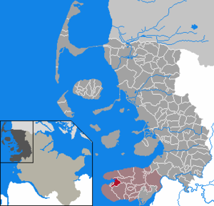
| Location of the municipality of Tümlauer-Koog in the district of North Friesland | ||
  |
||

Tümlauer-Koog (Danish: Tømlaus Kog ) is a municipality in the district of North Friesland in Schleswig-Holstein . The community is located in the Tümlauer Koog .
Geography and traffic
Tümlauer-Koog is located in the west of the Eiderstedt peninsula , between the Tümlauer Bucht and Sankt Peter-Ording .
history
The embankment of the Tümlauer Koog was completed in 1935. The Koog was named after the later Reichsmarschall Hermann Göring at its inauguration and was called Hermann-Göring-Koog until 1945 . Like the Adolf-Hitler-Koog (today: Dieksanderkoog ), which was inaugurated in the same year, and the Bupheverkoog, which was diked in 1939 on Pellworm , it was a model Koog in the context of the National Socialist politics of blood and soil . The ideology of the National Socialists fell on fertile soil among the rural population. This was shown by the above-average election results for the NSDAP in what is now the district of North Friesland .
The dike created an agriculturally usable area of 585 hectares and created 32 settler sites. The new Koog was inaugurated personally by its namesake Hermann Göring in October 1935. As in the Adolf-Hitler-Koog, the settlers were strictly selected according to race criteria. Hermann Göring felt personally responsible for "his" settlers and even intervened directly in the event of problems. The Hermann-Göring-Koog was not marketed in the media as a peace achievement by the National Socialists like the much more present and larger Adolf-Hitler-Koog . There was also a lack of a meeting hall comparable to the Neulandhalle in order to cultivate the desired National Socialist Kooggemeinschaft and to show it to the outside world. The land won was very small in the Kögen with a few thousand hectares, but was ideally suited to illustrate the struggle for race and space in the sense of the National Socialist blood-and-soil ideology , since the new agricultural areas in the struggle with the " wild North Sea “had been wrested from the sea. The landscape on the west coast of Schleswig-Holstein was made to stage a combative Nordic race .
During the Second World War , interest in the Musterkoog quickly waned, as new settlement areas in the east were much easier to find. The fall of the Third Reich meant a deep turning point for the residents of the model National Socialist settlements. In contrast to the Adolf-Hitler-Koog , where all the handpicked settlers were deserving party members from the immediate vicinity of Dithmarschen , there was a great identity crisis in the Hermann-Göring-Koog with a subsequent dissolution of the settler community. Most of the first generation of settlers emigrated in the post-war period.
politics
Community representation
In the 2008 local elections, of the seven seats in the municipal council, the DTK electoral community had four seats and the WGTK electoral community three. In the local elections on May 26, 2013, the DTK achieved 36.9% of the votes cast and received three seats. The WGTK received 63.1% and occupied four seats. The turnout was 78.8 percent.
mayor
Christian Marwig was re-elected mayor for the 2013–2018 election period.
coat of arms
Blazon : “Divided by blue and green by a broad golden bar. Above a silver fishing cutter and a silver bell with a mallet, below a silver sheep. "
The coat of arms was created for the 75th Koog anniversary in 2010.
economy
Infrastructural facilities such as schools, kindergartens and healthcare are located in Sankt Peter-Ording.
Tümlauer-Koog is shaped by tourism . There are numerous accommodations available for holiday guests. The community benefits from the proximity to the holiday resort Sankt Peter-Ording and the well-known Westerheversand lighthouse .
Culture and leisure

The Tümlauer Koog forms a parish together with the municipality of Tating .
There is a marina that is operated by a water sports club from Sankt Peter-Ording.
Bell jar

For the inauguration of the new Koog, a bell was hung in a wooden tower, which is also shown in the municipality's coat of arms. Until sirens were set up, the bell was used to warn the population of dangers such as fire or storm surges. It is also used to announce the birth of new Koog residents, the ringing time being one minute per pound of birth weight.
The original bell is decorated with runes and swastikas in the style of National Socialism and bears the inscriptions “ Reichsnährstand ”, “Hermann Göring Koog, inaugurated by Prime Minister Hermann Göring in October 1935” and “The German peasantry is the eternal source of blood for the German people”. When cracks appeared and it was replaced by a new one, the Göring bell was given a new place in 2008 in the center of the memorial for those killed in the war, along with a plaque with explanations. The inscription on the tablet read:
“The NSDAP (National Socialist German Workers' Party) has been in power since 1933. Their ideology was based on Germanism and the blood and soil mentality and they claimed to be a people without space. In the eyes of the NSDAP, a new Koog was a new home on the water, created from the strength of the down-to-earth peasantry. This thought is symbolized by the runes at the top and repeated by the saying at the bottom of the bell. After almost 80 years we no longer follow this ideology, but we have to accept it as a phase in our history. Winning a Kooge remains a great achievement; it creates land and food. The ideological exaggeration is also to be understood from the need of a certain epoch. "
After a tourist complained to Prime Minister Peter Harry Carstensen about the Göring bell and the explanations about it , the municipal council had the bell and board removed on November 25, 2011.
See also
- Norderheverkoog , formerly Horst-Wessel-Koog
- Dieksanderkoog , formerly Adolf-Hitler-Koog
Individual evidence
- ↑ North Statistics Office - Population of the municipalities in Schleswig-Holstein 4th quarter 2019 (XLSX file) (update based on the 2011 census) ( help on this ).
- ↑ Bonn City Museum on the naming practice under National Socialism ( Memento from August 1, 2012 in the web archive archive.today )
- ↑ a b c Lars Amenda: “People without space create space”. Racial policy and propaganda in the National Socialist land reclamation project on the west coast of Schleswig-Holstein. In: Informations zur Schleswig-Holsteinische Zeitgeschichte 45 (2005), pp. 4–31 (PDF; 228 kB) Accessed: December 24, 2008
- ↑ Official result of the Tümlauer Koog municipal election 2013 , accessed on November 11, 2015
- ↑ Schleswig-Holstein's municipal coat of arms
- ↑ The explanatory table of the community to Nazi Bell , Spiegel Online, 25 November 2011
- ^ Spiegel online: Görings Glocke.Retrieved November 25, 2011
- ^ German official asks town to remove Nazi bell with swastikas , accessed on August 26, 2017
- ↑ Spiegel online: North Frisian community removes Göring bell.Retrieved November 25, 2011
Web links
Achtrup | Ahrenshöft | Ahrenviöl | Ahrenviölfeld | Alkersum | Almdorf | Arlewatt | Aventoft | Bargum | Behrendorf | Bohmstedt | Bondelum | Bordelum | Borgsum | Bosbull | Braderup | Bramstedtlund | Bredstedt | Breklum | Dagebüll | Drage | Drelsdorf | Dunsum | Elisabeth-Sophien-Koog | Ellhöft | Emmelsbüll-Horsbüll | Narrow Sands | Fresendelf | Friedrich-Wilhelm-Lübke-Koog | Friedrichstadt | Galmsbüll | Garding | Garding, parish | Goldebek | Goldelund | Gröde | Grothusenkoog | Haselund | Hattstedt | Hattstedtermarsch | Högel | Spar | Hooge | Hörnum (Sylt) | Horstedt | Hude | Humptrup | Husum | Immenstedt | Joldelund | Kampen (Sylt) | Karlum | Katharinenheerd | Klanxbüll | Klixbull | Koldenbüttel | Kolkerheide | Kotzenbüll | Ladelund | Langeneß | Langenhorn | Leak | Lexgaard | List on Sylt | Löwenstedt | Lütjenholm | Midlum | Mildstedt | Fog | Neukirchen | Nieblum | Niebüll | Norddorf on Amrum | Norderfriedrichskoog | North beach | Norstedt | Ockholm | Oevenum | Oldenswort | Oldersbek | Olderup | Oldsum | Ostenfeld (Husum) | Oster-Ohrstedt | Osterhever | Pellworm | Poppenbüll | Ramstedt | Rantrum | Reußenköge | Risum-Lindholm | Rodenäs | Sankt Peter-Ording | Schwabstedt | Schwesing | Seeth | Simonsberg | Sollwitt | Sönnebüll | Sprakebull | Stadum | Stedesand | Struckum | South end | Süderhöft | Süderlügum | South March | Sylt | Tating | Tetenbull | Tinningstedt | Tönning | Tümlauer-Koog | Uelvesbüll | Uphusum | Utersum | Viöl | Vollerwiek | Vollstedt | World | Wenningstedt-Braderup (Sylt) | Wester-Ohrstedt | Westerhever | Westre | Winnert | Wipe | Witsum | Wittbek | Wittdün on Amrum | Joke word | Wobbenbüll | Wrixum | Wyk on Föhr