
Galmsbull
| coat of arms | Germany map | |
|---|---|---|

|
Coordinates: 54 ° 46 ' N , 8 ° 46' E |
|
| Basic data | ||
| State : | Schleswig-Holstein | |
| Circle : | North Friesland | |
| Office : | Südtondern | |
| Height : | 0 m above sea level NHN | |
| Area : | 49.05 km 2 | |
| Residents: | 615 (Dec. 31, 2019) | |
| Population density : | 13 inhabitants per km 2 | |
| Postal code : | 25899 | |
| Primaries : | 04665, 04667, 04661 | |
| License plate : | NF | |
| Community key : | 01 0 54 165 | |
| LOCODE : | DE 72E | |
| Office administration address: | Marktstrasse 12 25899 Niebüll |
|
| Website : | ||
| Mayoress : | Sinje Stein (AfWG) | |
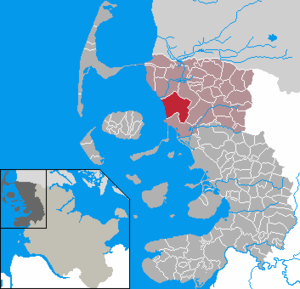
| Location of the municipality of Galmsbüll in the district of North Friesland | ||
  |
||

Galmsbüll ( Danish : Galmsbøl or Galmesbøl , North Frisian : Galmsbel ) is a municipality in the district of North Friesland in Schleswig-Holstein .
geography
Location and districts
Galmsbüll is a large rural municipality between Niebüll and Dagebüll . The community area is formed by the following five kings:
- Alter Christian-Albrechts-Koog ( nf.Uülje Krisen-Albrechen-Kuuch , Danish Gammel Christian Albrechts Kog )
- New Christian-Albrechts-Koog ( nf.Naie Krisen-Albrechen-Kuuch , Danish Ny Christian Albrechts Kog )
- Kleiseerkoog ( nf.Kloisiiekuuch , Danish Klægsøkog )
- Marienkoog ( nf.Mariienkuuch , Danish Marie Kog )
- Galmsbüllkoog ( nf.Galmsbelkuuch , Danish Galmesbøl Kog )
In terms of settlement structure, the municipality largely corresponds to a scattered settlement . Only the district of Neugalmsbüll (nf. Naigalmsbel , Danish. Ny Galmsbøl ) in the border area of the two Christian-Albrechts-Köge forms a closed settlement core . Its structure and the St. Gallus Church represent the community center.
Neighboring communities
Galmsbüll borders on the following neighboring communities:
| Emmelsbüll-Horsbüll | Niebüll | |
.svg)
|
Risum-Lindholm | |
| Dagebüll |
history
Hallig Galmsbüll
The Hallig Galmsbüll was first mentioned as an island in the middle of the 13th century in King Waldemars Erdbuch . At that time it was slightly larger than Oland and one of the most important salt mining areas on the west coast. In the liber censualis of the Schleswig Cathedral Chapter , a church has been recorded since 1462 on the 'Gelmelsbüll', which was then part of the Horsbüllharde .
In the 17th century there were various plans to dike the Dagebüller Bay, which should also include Galmsbüll. In 1634 the so-called Dagebüller work had already advanced quite a long way when the Burchardi flood ruined all efforts. The continuation of the work failed because of the costs and difficulties in containing the tidal currents deepened by the flood, especially the Kleiseetief. The silting up of the following decades made it possible to dike the Christian-Albrecht-Köge. In connection with this, the Hallig was firmly connected to the mainland by a dam in 1701, but not diked in itself, although this had been determined in an Octroy 1700.
According to the visit report of 1710, there were around 80 households on the Hallig. Galmsbüll was considered the poorest parish in the Duchy of Schleswig . During the Christmas flood of 1717 , the water stood a foot deep in the church and almost completely destroyed numerous houses, including the pastorate, sexton and teacher house. Although the income of the Hallig residents was no longer sufficient for the tax since the 1730s and the king had to contribute to the maintenance costs of the terp since 1745, the dilapidated old wooden church was replaced by a new building at the old location directly on the demolition edge in 1749. This new church was the first tile-roofed stone church on Galmsbüll. The Galmsbüller got into considerable debt for this. Duke Christian Albrecht gave the congregation a bell that came from the church of Evesbüll on Strand , which was lost during the Burchardi flood . Only 26 years later this church was again in dire need of repair.
Land ready for dykes was formed along the dam built in 1701 by 1780. It was therefore decided in 1788 to abandon the holm and instead the Anwachs embank . It was not until 1782 that the salt works, once the main source of income for the residents alongside seafaring, ceased after they had long since ceased to be profitable. At that time, the Hallig, which was unsecured in contrast to Dagebüll, had already shrunk considerably due to storms and the mining of the salt peat. From the original four terps only one remained, which lay directly on the sea without foreland and whose habitable area became smaller with every storm. The Marienkoog, which was diked in 1798, led to a further change in the current near the Hallig. In 1800 the church had to be demolished because of the risk of collapse. The parish was dissolved. In the following years the last residents moved to the new Marienkoog. A poor house was built from the stones of the demolished church for those who did not have their own land, in which services were held until the church was rebuilt. In the so-called Hallig flood of 1825, the terp , which had been completely flooded since 1802, was completely submerged.
Old Christian-Albrechts-Koog
In 1681, Christian Albrecht , the then Duke of Schleswig-Holstein-Gottorf , signed an octroy , which was intended to attract financially strong interested parties to participate in the dike of land growth in the Dagebüller Bay. In return for their commitment, the land they won should be given to them as their property and they should also be subject to jurisdiction, police violence, dike supervision, administration and the patronage of a church that is still to be built. Already in 1682 the dike circuit was completed. The interested parties, most of whom came from the surrounding Harden Wiedingharde , Bökingharde and Karrharde , received land according to their financial participation. The newly won land was considered to be the most fertile in the whole kingdom, so that those involved in building the dyke benefited greatly from it.
There are several old farms in the Koog. In 1970, the film Deutschstunde was filmed on the Fehlmehl farm , a film adaptation of the novel by Siegfried Lenz .
New Christian-Albrechts-Koog
The new Christian-Albrechts-Koog was diked after another October 1705-06. One of the oldest courtyards, the Carolinenhof, which was built around 1710, can now be viewed as a typically North Frisian closed four - sided courtyard with tiles and chests in the open-air museum Molfsee .
Kleiseerkoog
The Kleiseerkoog was diked around 1725. In the same year, a three-sided courtyard was built in the Koog, which is a listed building due to its high historical value.
Marienkoog
After the dike was dyed, the settlement of the new Koog began in 1799. He is after Maria von Hessen-Kassel , the wife of the Danish King Friedrich VI. named. The residents of Hallig Galmsbüll, who could afford it, built a house or a farm in Marienkoog. At the census in February 1803, 17 families lived here. Of the 29 households that still lived on Hallig Galmsbüll in 1803, most of them also moved to Marienkoog when Hallig had to be abandoned in 1825.
Galmsbüllkoog
The Galmsbüllkoog, which also encloses part of the area of the old Hallig, was created in 1913 as a summer koog in front of the Marienkoog, which the Marienkoog farmers cultivated. After storm surges destroyed the harvest every second year, it was decided in 1933 to strengthen the dike and, as part of a land reclamation program underpinned by the National Socialist blood-and-soil ideology, the Galmsbüllkoog was dyed in 1939 (see, inter alia, Adolf-Hitler-Koog , Hermann-Göring-Koog ). The Reich Labor Service , which had carried out the work, was withdrawn at the beginning of the war. The first houses in Galmsbüllkoog were only occupied in 1950, eleven years after the outer dike was completed.
Communities
The Köge Alter and Neuer Christian-Albrechts-Koog, Kleiseerkoog and Marienkoog initially formed independent communities and were assigned to the Dagebüllerkoog district in 1889 . At the turn of the century, the two Christian-Albrechts-Köge were merged into one community. (In the municipal registers of 1900 and earlier, both municipalities were listed, in 1908 at the latest only one. No documents are known about the exact date of the merger.) After the Second World War, the administrative district was dissolved and the Dagebüll office took its place until 1967 . After its dissolution, the communities came to the office of Bökingharde .
On February 1, 1974, the three communities Christian-Albrechts-Koog, Kleiseerkoog and Marienkoog merged to form today's community, which was named after Hallig, which was lost at the beginning of the 19th century. Since the termination of the Bökingharde office at the end of 2007, Galmsbüll has been administered by the Südtondern office.
Neugalmsbüll and the St. Gallus Church
In the village of Neugalmsbüll between the old and the new Christian-Albrechts-Koog, the St. Gallus Church is the center of the village with many clubs and organizations.


Although the construction of a separate church had already been planned when the old Christian-Albrecht-Koog was dyed, a building site was only designated in 1742. But the construction continued to be delayed. Instead, a costly new Hallig church was built in 1749, which had to be demolished again in 1800. After that, Galmsbüll did not have its own church for almost 90 years. The Oktroy allowed the inhabitants of the Köge to adhere to one of the neighboring parishes of Emmelsbüll , Dagebüll or Deezbüll . Only after Schleswig-Holstein had become Prussian, the Koogsgemeinden were obliged either to decide which parish they wanted to join or to build their own church. The inhabitants of the Christian-Albrecht-Kögen, the northern area of the Kleiseerkoog and the Marienkoog merged in 1876 to form the new parish of Galmsbüll. The right of patronage granted to them by the Oktroy remained, however. It was not until 1982 that the Galmsbüller congregation became a member of the North Elbian Church . In 2012 the parish merged with the parish of Emmelsbüll .
The St. Gallus Church was built in 1890/1891 by Heinrich Moldenschardt in the neo-Gothic brick style. Like the earlier Hallig churches, it bears the name of St. Gallus . Their ornamental sgraffito plaster is unique in Northern Europe. Since most of the inventory also comes from the time it was built, the church has a uniform appearance. Only the chandelier still comes from the old Hallig church. The medieval granite baptismal font originally belonged to the Rickelsbüller Church. The wooden baptism donated in 1750 for the new Hallig Church and the even older baptismal cover from the old church were left to St. Niels Church in Westerland .
The organ was built by Marcussen & Søn in 1891 . Due to the fact that it was created at the same time as the rest of the inventory, the organ fits perfectly into the church interior. It is romantically tuned and has ten registers on a manual and pedal . The disposition is:
| Manual Cf 3 | Pedal Cd 1 | |
|---|---|---|
| Bourdon 16 ' | Sub-bass 16 ' | |
| Principal 8 ' | Principal 8 ' | |
| Salicional 8 ' | Choral bass 4 ' | |
| Reed flute 8 ' | ||
| Octave 4 ' | ||
| Flute 4 ' | ||
| Octave 2 ' |
The 38 meter high west tower can be seen from afar. In 1954 it was given a new facing on three sides. The original construction can still be seen very clearly on the back of the tower. Inside there is a mechanical tower clock and two bronze bells that were cast by the Rincker bell foundry in 1957 . They have the notes a 'and f sharp' and hang in a steel bell chair . There is also an hour bell on the back of the tower.
Ewald Dittmann was a pastor here until 1932, who was murdered in 1945 as a member of the Confessing Church .
politics
Community representation
Of the nine seats in the municipal council, the AfWG community of voters had five and the AdWG four seats since the 2008 local elections. The election on May 26, 2013 confirmed this result. The turnout was at last 68.6 percent.
In the local elections on May 6, 2018, of the nine seats in the municipal council, the WG5K electoral community received six seats and the AdGW three. The turnout this time was 65.1 percent.
coat of arms
Blazon : "Half to the left by a narrow green oblique left bar in silver and gold and diagonally to the right divided in blue, from the division a growing black church tower."
economy

The community is predominantly agricultural. However, tourism is becoming increasingly important as a source of income.
Citizen wind farm
In Galmsbüll, the "Bürgerwindpark Galmsbüll" is operated, which is an amalgamation of old operators of wind power plants and the participation of citizens from the community. Overall, electricity production is expected to be sufficient to cover the electricity needs of private households in North Friesland with around 165,000 inhabitants.
traffic
The closest federal road is the B 5 , which passes the neighboring municipalities of Niebüll and Risum-Lindholm to the east. In Niebüll, the state road 7 , maintained by the state of Schleswig-Holstein, branches off (junction for car loading to Sylt), which, after crossing the center of the settlement of the former district town of South Tondern, crosses the central dike between the two Christian-Albrechts-Kögen and cross-country traffic with state road 6 (Dagebüll-Neugalmsbüll-Neukirchen-Aventoft) connects.
There is no direct (intra-community) connection to the rail network supervised by the federal authorities . The nearest train stations are in the neighboring communities of Niebüll , Risum-Lindholm (Maasbüll stop) and Dagebüll (Dagebüll-Kirche stop). The latter can be reached via the Kleinbahn Niebüll-Dagebüll . This also crosses the municipality of Galmsbüll in the Kleiseerkoog
Cultural monuments
Personalities
- August Richardsen (1873–1957), agricultural scientist and member of the Royal Swedish Academy of Forestry and Agriculture
- Friedrich Lensch (1898–1976), Lutheran clergyman and director of the Alsterdorfer Anstalten at the time of National Socialism
literature
- Sielverband Marienkoog (ed.): 200 years Marienkoog 1798–1998 and 60 years Galmsbüllkoog 1939–1999 . 1999
- Heinrich Jebsen, Rolf Wiegand: The parish of Neugalmsbüll 1891–1991. The story of a parish. The history of the island of Galmsbüll . Edited by the parish of Neugalmsbüll, 1991
- Albert Panten: The Christian-Albrechts-Köge 1682–1982 . Breklumer Druckerei Manfred Siegel. Published by the Sielverband der Christian-Albrechts-Köge, 1982
Web links
- Galmsbüll municipality
- The St. Gallus Church in Neugalmsbüll. Parish of Emmelsbüll-Neugalmsbüll
Individual evidence
- ↑ North Statistics Office - Population of the municipalities in Schleswig-Holstein 4th quarter 2019 (XLSX file) (update based on the 2011 census) ( help on this ).
- ↑ Schleswig-Holstein topography. Vol. 3: Ellerbek - Groß Rönnau . 1st edition Flying-Kiwi-Verl. Junge, Flensburg 2003, ISBN 978-3-926055-73-6 , p. 179 ( dnb.de [accessed April 22, 2020]).
- ^ Hans Nicolai Andreas Jensen: Attempt at church statistics on the Duchy of Schleswig 2. Kaustrup 1841; P. 501.
- ^ Johann Friedrich Hansen: More complete description of the state of the Duchy of Schleswig. Flensburg 1770; 388
- ↑ Jebsen / Wiegand: The parish of Neugalmsbüll. P. 37 f.
- ↑ Jebsen / Wiegand: The parish of Neugalmsbüll. Pp. 40-43. The bell got to Fahretoft after the church was demolished and was later cast again because of a crack.
- ↑ Dr. Carl Ingwer Johannsen (editor): Guide through the Schleswig-Holstein open-air museum. Karl Wachholtz, Neumünster 1994 ISBN 3-529-07210-9 No. 45
- ↑ Lars Amenda: “People without space create space”. Racial policy and propaganda in the National Socialist land reclamation project on the west coast of Schleswig-Holstein , in: Informations zur Schleswig-Holsteinische Zeitgeschichte 45 (2005), pp. 4–31 (accessed on December 28, 2008; PDF; 228 kB)
- ^ Federal Statistical Office (ed.): Historical municipality directory for the Federal Republic of Germany. Name, border and key number changes in municipalities, counties and administrative districts from May 27, 1970 to December 31, 1982 . W. Kohlhammer GmbH, Stuttgart and Mainz 1983, ISBN 3-17-003263-1 , p. 182 .
- ↑ History of the parish Neugalmsbüll ( Memento of 13 February 2018 Internet Archive )
- ↑ Church Neugalmsbüll - Structurally + inventory ( Memento of 23 April 2016 Internet Archive )
- ↑ Kirsten Riechert: Baptismal font in northern Elbe between 1500 and 1914 change in shape and meaning of a principal piece. Hamburg 2010, p. 421
- ↑ Web editor: Results of the 2013 municipal elections in the South Tondern office. In: www.amt-suedtondern.de. Office Südtondern, accessed on June 22, 2013 .
- ↑ Web editing: Results of the Galmsbüll municipal election 2018. In: www.amt-suedtondern.de. South Tondern Office, accessed on November 9, 2018 .
- ↑ Schleswig-Holstein's municipal coat of arms
Achtrup | Ahrenshöft | Ahrenviöl | Ahrenviölfeld | Alkersum | Almdorf | Arlewatt | Aventoft | Bargum | Behrendorf | Bohmstedt | Bondelum | Bordelum | Borgsum | Bosbull | Braderup | Bramstedtlund | Bredstedt | Breklum | Dagebüll | Drage | Drelsdorf | Dunsum | Elisabeth-Sophien-Koog | Ellhöft | Emmelsbüll-Horsbüll | Narrow Sands | Fresendelf | Friedrich-Wilhelm-Lübke-Koog | Friedrichstadt | Galmsbüll | Garding | Garding, parish | Goldebek | Goldelund | Gröde | Grothusenkoog | Haselund | Hattstedt | Hattstedtermarsch | Högel | Spar | Hooge | Hörnum (Sylt) | Horstedt | Hude | Humptrup | Husum | Immenstedt | Joldelund | Kampen (Sylt) | Karlum | Katharinenheerd | Klanxbüll | Klixbull | Koldenbüttel | Kolkerheide | Kotzenbüll | Ladelund | Langeneß | Langenhorn | Leak | Lexgaard | List on Sylt | Löwenstedt | Lütjenholm | Midlum | Mildstedt | Fog | Neukirchen | Nieblum | Niebüll | Norddorf on Amrum | Norderfriedrichskoog | North beach | Norstedt | Ockholm | Oevenum | Oldenswort | Oldersbek | Olderup | Oldsum | Ostenfeld (Husum) | Oster-Ohrstedt | Osterhever | Pellworm | Poppenbüll | Ramstedt | Rantrum | Reußenköge | Risum-Lindholm | Rodenäs | Sankt Peter-Ording | Schwabstedt | Schwesing | Seeth | Simonsberg | Sollwitt | Sönnebüll | Sprakebull | Stadum | Stedesand | Struckum | South end | Süderhöft | Süderlügum | South March | Sylt | Tating | Tetenbull | Tinningstedt | Tönning | Tümlauer-Koog | Uelvesbüll | Uphusum | Utersum | Viöl | Vollerwiek | Vollstedt | World | Wenningstedt-Braderup (Sylt) | Wester-Ohrstedt | Westerhever | Westre | Winnert | Wipe | Witsum | Wittbek | Wittdün on Amrum | Joke word | Wobbenbüll | Wrixum | Wyk on Föhr