
Winnert
| coat of arms | Germany map | |
|---|---|---|

|
Coordinates: 54 ° 26 ' N , 9 ° 12' E |
|
| Basic data | ||
| State : | Schleswig-Holstein | |
| Circle : | North Friesland | |
| Office : | North Sea Treene | |
| Height : | 18 m above sea level NHN | |
| Area : | 18.88 km 2 | |
| Residents: | 719 (Dec. 31, 2019) | |
| Population density : | 38 inhabitants per km 2 | |
| Postal code : | 25887 | |
| Area code : | 04845 | |
| License plate : | NF | |
| Community key : | 01 0 54 156 | |
| Office administration address: | Schulweg 19 25866 Mildstedt |
|
| Website : | ||
| Mayoress : | Jutta Rese (WGW) | |
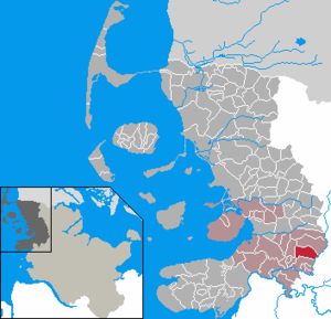
| Location of the municipality of Winnert in the district of North Friesland | ||
  |
||

Winnert ( Danish : Vinnert , formerly also Vinnerød ) is a municipality in the district of North Friesland in Schleswig-Holstein .
geography
Geographical location
The municipal area of Winnert extends on the edge of the Schleswig Geest on the western bank of the Treene about ten kilometers southeast of Husum . The slightly meandering river is just under two kilometers alongside the southeastern municipality border at the same time the office - or county boundary from.
Community structure
In addition to the village of Winnert, the smaller, outlying districts of Autrum (Danish: Agtrum , sønderjysk Awtrum ), Brehmhöft ( Bremhoved ), Osterwinnert and Winnertfeld belong to the municipality.
Neighboring communities
The municipal areas border on Winnert:
| Ostenfeld | ||
| Oldersbek |
.svg)
|
|
| Schwabstedt | Wohlde (Schleswig-Flensburg district) |
landscape
About half of the 631- hectare nature reserve Wildes Moor near Schwabstedt is located in the municipality.

history
On April 1, 1934, the parish land municipality Ostenfeld was dissolved. All of their villages, village communities and farmers became independent communities / rural communities, including Winnert and Wittbek next to the main town of Ostenfeld .
The place name Autrum is probably composed of the Danish agten ( from the back ) and -rum for space, space, the meaning would therefore be behind the space .
politics
Community representation
Since the local elections in 2008, the WGW electoral community has had all eleven seats in the municipal council. Due to the reduction in the number of inhabitants, only nine seats were left in the local elections on May 26, 2013. With a turnout of 55.7 percent, these fell back to the WGW.
coat of arms
Blazon : "Above a blue-gold wave shield foot in green, a golden tip offset to the right, inside two angled red half-timbered houses."
economy
The community is predominantly agricultural.
Sons and daughters of the church
- Detlef Thomsen (1880–1954), German politician ( SHBLD ), member of the Weimar National Assembly
Web links
Individual evidence
- ↑ North Statistics Office - Population of the municipalities in Schleswig-Holstein 4th quarter 2019 (XLSX file) (update based on the 2011 census) ( help on this ).
- ↑ Gerret Liebing Schlaber: Administrative tilhørsforhold mellem Ejderen og Kongeåen indtil 2007 , Flensburg / Flensborg 2007, p. 282
- ↑ Schleswig-Holstein topography. Vol. 10: Timmaspe - Ziethen . 1st edition Flying-Kiwi-Verl. Junge, Flensburg 2008, ISBN 978-3-926055-92-7 , p. 311 ( dnb.de [accessed on August 9, 2020]).
- ↑ Relation: Winnert (1404153) at OpenStreetMap. Retrieved August 10, 2020 .
- ↑ State Statistical Office Schleswig-Holstein (Ed.): The population of the communities in Schleswig-Holstein 1867-1970 . State Statistical Office Schleswig-Holstein, Kiel 1972, p. 251 .
- ↑ Wolfgang Laur: Historisches Ortsnamelexikon von Schleswig-Holstein , 2nd edition, Neumünster 1992, p. 134
- ↑ www.amt-nordsee-treene ( page no longer available , search in web archives ) Info: The link was automatically marked as defective. Please check the link according to the instructions and then remove this notice. : Election announcement, accessed June 12, 2013
- ↑ Schleswig-Holstein's municipal coat of arms
Achtrup | Ahrenshöft | Ahrenviöl | Ahrenviölfeld | Alkersum | Almdorf | Arlewatt | Aventoft | Bargum | Behrendorf | Bohmstedt | Bondelum | Bordelum | Borgsum | Bosbull | Braderup | Bramstedtlund | Bredstedt | Breklum | Dagebüll | Drage | Drelsdorf | Dunsum | Elisabeth-Sophien-Koog | Ellhöft | Emmelsbüll-Horsbüll | Narrow Sands | Fresendelf | Friedrich-Wilhelm-Lübke-Koog | Friedrichstadt | Galmsbüll | Garding | Garding, parish | Goldebek | Goldelund | Gröde | Grothusenkoog | Haselund | Hattstedt | Hattstedtermarsch | Högel | Spar | Hooge | Hörnum (Sylt) | Horstedt | Hude | Humptrup | Husum | Immenstedt | Joldelund | Kampen (Sylt) | Karlum | Katharinenheerd | Klanxbüll | Klixbull | Koldenbüttel | Kolkerheide | Kotzenbüll | Ladelund | Langeneß | Langenhorn | Leak | Lexgaard | List on Sylt | Löwenstedt | Lütjenholm | Midlum | Mildstedt | Fog | Neukirchen | Nieblum | Niebüll | Norddorf on Amrum | Norderfriedrichskoog | North beach | Norstedt | Ockholm | Oevenum | Oldenswort | Oldersbek | Olderup | Oldsum | Ostenfeld (Husum) | Oster-Ohrstedt | Osterhever | Pellworm | Poppenbüll | Ramstedt | Rantrum | Reußenköge | Risum-Lindholm | Rodenäs | Sankt Peter-Ording | Schwabstedt | Schwesing | Seeth | Simonsberg | Sollwitt | Sönnebüll | Sprakebull | Stadum | Stedesand | Struckum | South end | Süderhöft | Süderlügum | South March | Sylt | Tating | Tetenbull | Tinningstedt | Tönning | Tümlauer-Koog | Uelvesbüll | Uphusum | Utersum | Viöl | Vollerwiek | Vollstedt | World | Wenningstedt-Braderup (Sylt) | Wester-Ohrstedt | Westerhever | Westre | Winnert | Wipe | Witsum | Wittbek | Wittdün on Amrum | Joke word | Wobbenbüll | Wrixum | Wyk on Föhr